Rome revisited

On our second stay in Rome, we stayed at an Airbnb near the Vatican. [Our first stay was somewhat near the Colosseum in the southern part of the city.] Vatican City is its own country within Rome and has ancient walls surrounding it.

_DSC8450.JPG

This picture was taken from the top of St. Peter’s Basilica, showing the greenness of Vatican City and the walls keeping the green in from the rest of Rome (about 1/4 down from the top of the picture).

We actually began our second Rome adventure by taking a special tour of the Vatican Museums at 0600 called “Opening up the Vatican”. This group of 18 tourists followed around the “key keepers” of the Vatican Museums as they unlocked doors and gates and turned on the lights. [Steve dropped the ball and didn’t get a picture of me opening one of the doors.]

_DSC8406.JPG

Just one of the many doors we opened:

_DSC8348.JPG

When the lights came on in the “Map Room”, it took your breath away (be patient for the first 10 sec of the video).

This room was just amazing, and almost more mesmerizing than the Sistine Chapel.

_DSC8422.JPG

Speaking of which - we had 20 minutes, just the 18 of us, alone in the Sistine Chapel, and were allowed to take all the pictures we wanted. This is just not granted when the masses come streaming in. You are forbidden to take pictures here, and the staff even have people delete pictures off their phones and cameras, if they catch you doing it (but everyone still does, surreptitiously). This ceiling is so busy that it’s nearly impossible to take in all of what’s going on, in one sitting.

This is “just” the 5 center panels:

_DSC8388.JPG

You can enlarge the picture to see more details. I was almost more enamored of the Sibyls along the sides because of their vivid colors and flowing robes.

_DSC8396.JPG

Even though the Creation of Adam is probably the best known panel, I liked the “Downfall of Adam and Eve” better (because of the snake lady around the tree).

_DSC8389.JPG

Probably the crowning glory is The Last Judgment on the altar wall. We had our guide take our picture in front of it (since everybody else was too).

IMG_20181123_073202.jpg

My favorite part was the side where the damned were being pulled down to Hell. The poor guy with his head in his hand looks to be thinking “why did I …?” The skin hanging near the top left is said to be Michelangelo’s self portrait. The skin is held by St. Bartholomew, who usually is depicted with a knife and a human skin, showing how he was killed.

_DSC8394.JPG

In reviewing all my pictures, I found that I didn’t get a full picture of this fresco. The best way to see it in all its gory glory and busyness is enlarging the one taken of us by our guide.

It was pretty cool to see the city coming to life as we passed various windows and doors.

_DSC8374.JPG

After the private tour, we went back through the Vatican Museums with the throngs of tourists (and this was low season) to spend more time trying to take in just a fraction of the collection of paintings, sculptures and artifacts that have been amassed by the Church over the past two millennia.

We were also able to enter St. Peter’s Basilica through a “secret” door, bypassing the lines at security out in the Square. Wow. The sheer size and height of the interior was truly jaw dropping.

_DSC8430.JPG

The baldachin (66 ft high) over the altar is supposed to mediate between the height of the dome directly over it and the human scale of those saying Mass.

_DSC8436.JPG

Of course we took the opportunity to climb up the dome. By this point, we had already been on our feet for 6 hours, so we took the elevator part way up, saving about 300 steps, but we came down the entire 551 on the way out. The first picture in this post was taken from the dome. It was too bad that the weather didn’t cooperate, but the views over the city were still pretty awe inspiring.

_DSC8454.JPG

[We thought it quite ironic (and humorous) that a (pagan) Christmas tree was being erected near the Egyptian obelisk in the center of St. Peter’s Square.]

_DSC8551.JPG

The sun finally came back on our last morning in Rome:

_DSC8560.JPG

I’ll close with one last Michelangelo sculpture, the Pieta. Even though it’s not “of this season”, the quiet beauty is very thought provoking. Here’s wishing you and yours a blessed Christmas.

_DSC8441.JPG

Florence...some more

We hit the ground running, every morning we were in Florence, to make the most of the time we had, as well as to get the most out of our 72 hour museum pass!

Early morning rowers on the Arno

Early morning rowers on the Arno

The Duomo in Florence reminded me of the one in Siena because of the similar white, green and pink stones used to build it, as well as the bell tower, but this one was SO much larger and more ornate.

_DSC8198.JPG

Duomo in Italian means cathedral. The one in Florence has a very impressive dome and bell tower, as well as a Baptistery. This latter building is famous for a set of bronze doors completed by Ghiberti in 1452 named the “Gates of Paradise”, after Michelangelo apparently stated they were beautiful enough for that. The 3 dimensionality was unique and revolutionized the way Renaissance people saw the world.

_DSC8311.JPG

I’m sorry I don’t have a picture of a person next to the door, to show how massive they are. Each door has 5 panels in it, and when someone was standing next to the doors, their head only started to come up into the second panel. The panels were made of bronze with a layer of gold on top.

Of course we climbed the bell tower - all 414 steps…

_DSC8307.JPG

… and got great views of the city.

IMG_20181121_112346.jpg

Next up was the Medici Chapels. It was one enormous building with tombs of the Medici family. The best part was Michelangelo’s New Sacristy which contained 4 of his statues on two tombs. My favorite was “Dawn”:

_DSC8218.JPG

Our favorite museum was a little known “gem” called Museo dell’Opificio delle Pietre Dure, or Museum of the Workshop of Semi-Precious Stones. The Opificio Delle Pietre Dure is an Italian government agency devoted to art conservation and is a direct descendant of the workshop established in 1588 by Fernando I de’Medici to create the elaborate, inlaid precious and semi-precious stoneworks. (Pietre dure is the art of cutting and fitting highly polished colored stones to create mosaic images.) We wandered awestruck through the little museum with our mouths agape at the artistry, contemplating the time necessary to create such beauty.

_DSC8232.JPG

I’m sorry for the lighting, but it was lit from above, and I couldn’t get any better angle. This is not a painting. Expand the picture so you can see the intricacy of the cut pieces of marble and stones and how closely they fit. I loved the use of the dark stones to create shadows and give a look of depth.

The Ponte Vecchio at dusk:

_DSC8239.JPG

So, the place where Michelangelo’s David lives is the Accademia. He had stood for over 350 years outside of the Palazzo Vecchio when it was decided to move him inside in 1874. The building was essentially built for him, and it’s a marvelous showcase. Lining the hall leading up to David are 4 more Michelangelo sculptures, The Prisoners, that are all unfinished. It was really cool to see the chisel marks and the suggestion of shapes coming out of the marble blocks.

_DSC8241.JPG

I was dreading the crowds, but they really ebbed and flowed, so that I was able to wander all around him and appreciate the beauty and complexity of the work.

_DSC8257.JPG

Different angles of viewing brought out seemingly different looks to his expression -

_DSC8248.JPG

(it’s hard to believe that sling is made of marble, like the rest of him)

_DSC8253.JPG

When Michelangelo died (at age 89!), he was working on the Pieta for his own tomb (the hooded man holding Jesus is a self portrait of the artist). Again, the unfinished state was fascinating to see how he worked with the marble.

_DSC8315.JPG

Closing the door on this chapter of Florence, leads us back to Rome…

_DSC8225.JPG

Scenes from Tuscany, then on to Florence

I still had some neat pictures from the towns in Tuscany that we visited, that I wanted to share, but didn’t fit my story line in the previous post.

Several days in the villa near Cortona were very foggy. We went ahead and hiked up into the town of Cortona, and literally on the top of the hill that the town is built on, we got above the clouds and fog, and had some really neat views.

_DSC7592.JPG

Once the fog lifted we could see the views we had been missing:

_DSC7597.JPG

In Siena (and most other Tuscan towns) they have gorgeous painted ceramics -

_DSC7394.JPG

… as well as interesting door decorations:

_DSC7393.JPG

Even the smallest towns will have a church, with some having three (or 5 or 10!).

_DSC7433.JPG

Also, I thought it was interesting that so many towns are walled, and the walls are still intact.

Montepulciano

Montepulciano

We have loved the first hand education on Italian wine, being able to taste ones from different locations, and having a mental image of the town or the area they come from. Also tasting the different levels of quality, and being able to put names to the tastes we prefer (will be very helpful in the future in restaurants!).

grapevines in the foreground and olive trees behind

grapevines in the foreground and olive trees behind

Florence is a much bigger city than any we visited in Tuscany. It too has a wall:

_DSC8226.JPG

We went to so many museums that our heads and eyes were spinning trying to take in all the beauty around. Michelangelo was primarily a sculptor, and completed this Bacchus when he was only 22! (1497)

_DSC8175.JPG

This “Holy Family” is his only completed easel painting:

_DSC8164.JPG

The Uffizi Gallery (where we saw so many famous paintings by Botticelli, Lippi, Michelangelo, Donatello, Leonardo da Vinci, Raphael, Titian) has the largest collection of Italian art in the world. It was huge, and we almost literally ran through it, just to make it to all the main pieces. Steve was disappointed at all the art (and plaques to read) that we had to miss. We need to go back to Florence, just to spend another 2 days at the Uffizi alone! I was truly surprised at how much I enjoyed seeing all these Old Masters’ works of art (such gorgeous colors and neat perspectives up close) and being educated on the progression of painting technique through the Renaissance.

Caravaggio painted this head of Medusa on a shield:

_DSC8173.JPG

Enough paintings already! As we advanced through the museums, I kept wanting to take pictures of all the masterpieces, then rightly concluded that I’d probably never look at them again. Sculptures on the other hand, were mesmerizing, and I usually took multiple pictures of a piece from all angles. In Rome, we had our breath taken away by the entire first floor of sculptures in the Borghese Museum, and the Bargello in Florence did likewise. (hint: these are strong recommendations for sculpture museums in these cities). Even though this post is on Florence, I wanted to include a favorite from the Borghese:

IMG_20181109_100332_1.jpg

This is a sculpture by Bernini of “Apollo and Daphne” as she is being turned into a tree. Check out the fineness of the carving of the leaves between the two figures. This is marble!

Now back to Florence - here’s an interesting version of David in bronze by Donatello (over 50 years before Michelangelo’s David):

_DSC8180.JPG

Enough art (for now)! We got a great view of the Ponte Vecchio (literal translation is “old bridge”) from the Uffizi Gallery:

_DSC8163.JPG

The current version of this bridge was built in 1345, and it’s the only one of the many bridges over the Arno River to have shops actually built on it. The Vasari Corridor runs along above the shops and was a secret passage for the Medici to pass unseen from Palazzo Vecchio and the Uffizi Gallery over to the Pitti Palace (4 blocks from the bridge!).

I’ve just looked ahead and found that I have WAY too many more pictures from Florence to include (bore you with) in a single post, so I’ll end this one with a sneak peek at what’s to come:

_DSC8246.JPG

Tuscany and a wedding

We fell in love with small Tuscan towns such as Cortona, Siena, and Montepulciano. First, seeing them up on the hills from afar…

_DSC7381.JPG

…and then exploring their narrow, curving streets.

_DSC7528.JPG
_DSC7567.JPG

We went truffle hunting -

_DSC7464.JPG
_DSC7459.JPG

We tramped up and down hills and through woods after the hunter and his dogs for about an hour or two, and he had a very successful day.

_DSC7471.JPG

That’s 335 grams of both black and white truffles. The white ones are much more valuable, as they are much less common and usually grow deeper than the black ones. At a restaurant, we were able to add very thinly shaved truffles to a dish for 9 euros a gram! (there are 28 grams to an ounce)

_DSC7476.JPG

We then learned how to make homemade pasta…

_DSC7479.JPG

… and got to enjoy the fruits of our labor.

shaved truffles on our hand made noodles

shaved truffles on our hand made noodles

We visited Siena where there was a beautiful cathedral and bell tower.

_DSC7397.JPG

We got to climb up into the dome and had fabulous views of the town -

_DSC7403.JPG

and surrounding countryside.

_DSC7406.JPG

We spent a week in a villa near Cortona, where our son got married, and had a marvelous time with family and friends, eating, drinking, and again making hand made pasta - this time, spaghetti:

_DSC7702.JPG

During this trip we also learned the “correct” way to make tiramisu and biscotti…

_DSC7873.JPG

…as well as saltimbocca (thin steak wrapped around a sage leaf and prosciutto).

_DSC7845.JPG

The wedding was fun, festive, fancy and enjoyed by all!

(bride and groom in the middle on the right)

(bride and groom in the middle on the right)

Roma!

Our Italian vacation started with three days in Rome. Amazingly, jet lag didn’t hit us too bad, and after a nice dinner of fresh pasta at a local trattoria with a bottle of wine, we crashed deeply. Our first full day started with a guided tour of the Colosseum, Palatine Hill and the Roman Forum.

_DSC7289.JPG

You can tell where a later restoration was added to the right, to help stabilize it. Apparently, half of the Colosseum collapsed during an earthquake, as it was built on sand, while the half that remains was built on stone. The multiple pock marks or holes are where bronze bolts were holding the stones together, and were dug out by later rulers to melt down for munitions.

_DSC7265.JPG

Our modern day stadiums resemble this lay out. There were three levels of seating for 60,000+ spectators. The pit in the center was where the gladiators waited and where the animals were kept. They have partially covered the far end, to recreate the look of the floor that spectators would have seen.

A small section of seating for nobles

A small section of seating for nobles

It took only 8 years for construction of the outer structure (and 100,000 Jewish slaves). It was just amazing that something of that size and complexity is still standing 2000 years later!

_DSC7250.JPG

Two other sites that were included in our tour with the Colosseum were Palatine Hill and the Forum. Both weren’t very exciting or photogenic, and the Forum seemed to be random ruins scattered over an area in the center of the city, surrounded by newer buildings.

_DSC7324.JPG

Moving on to the Pantheon was a Wow! for us. This building is about the same age as the Colosseum and is beautifully preserved.

IMG_20181108_134722.jpg

It has the largest non-reinforced brick dome in the world. In the center of the dome is the oculus, which is open to the sky, allowing the only light into the building. The rain that falls in, drains through holes drilled in the marble floors into the still functioning Roman pipes underneath.

IMG_20181108_134554.jpg

The Trevi Fountain was one of those “must see” things while in Rome, and we were going to be walking right near it on our way back to our apartment…so, why not? I was only expecting big crowds taking selfies and throwing coins, so I was really surprised by how beautiful it was. It is an enormous facade on a building that is carved in travertine.

_DSC7351.JPG

The coolest part was that the edges were left rough and unfinished, making it look like the statues were rising up out of the stone.

_DSC7354.JPG

And it’s pretty at night too!

IMG_20181108_182620.jpg

It was fun wandering the streets, people watching, and eating gelato, of course! My favorite square was Piazza del Popolo (“People’s Square”) because it was so open and had neat terracing on one end leading several stories up to a garden area.

_DSC7368.JPG

Like this young one, we’re now off to Tuscany to catch some dreams.

_DSC7365.JPG

Big Bend National Park and some random comments

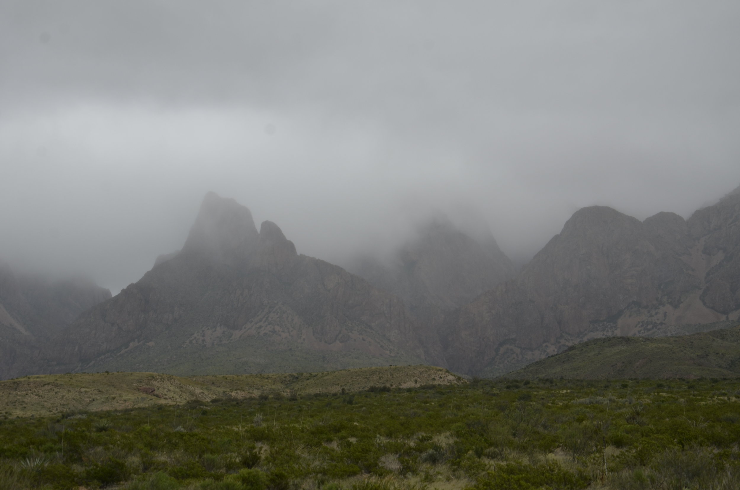
As we headed into TX, our weather luck changed. We stayed in little Marathon, TX as the closest town to Big Bend National Park, and that was 1 1/2 hours away. When we checked in, it was 80 degrees. The wind howled all night, and when we got up in the morning, the skies were overcast and it was 40 degrees!

_DSC7127.JPG

This was the atmosphere we encountered as we entered the park. This place was huge, and the terrain was quite varied. It was neat to see the various geologic strata…

_DSC7129.JPG
_DSC7132.JPG

…as well as the variety of plant life. (For a desert, there sure was a lot of grass!)

_DSC7148.JPG

It took 30 miles of driving on curvy roads at 40 mph to get to the southern border - the Rio Grande, and its towering cliffs on the Mexico side.

_DSC7158.JPG

The Santa Elena Canyon allowed us to get down to river level.

_DSC7162.JPG

I don’t know what I was expecting, but I was underwhelmed by the river at that point (I still loved the cliffs!).

_DSC7167.JPG

On our way back out, we continued to see interesting formations…

_DSC7173.JPG

…and color combinations.

The rock layer above the reddish one was actually a blue-green.

The rock layer above the reddish one was actually a blue-green.

The bit of road curve in the lower center gives some sense of scale:

_DSC7181.JPG

After leaving Big Bend (and vowing to return in the spring, to see it in a better light), we drove across the entire state of TX under cover of rain the whole time. You may have heard about “a little” flooding there? We saw the rivers and creeks super full, and normally dry washes nearly overflowing.

So, not a very pretty end to our 6600 mile sojourn through the Southwest. But don’t forget our gorgeous weather and timing for the aspens!

_DSC6097.JPG

Random comments:

If you’re ever in Pueblo, CO, check out the Rosemount Mansion. It was built in 1893 and has 37 rooms, all still with period furnishings. Gorgeous! But then, we’re partial to big ol’ piles of bricks. ;)

We tried to take mostly scenic drives between national or state parks, but in central CO, we ran out of time, and had to finish a (apparently) gorgeous stretch in the dark. We did see a lot of mule deer right beside the road, thus slowing our progress considerably, but as our lights flashed over them, we could see tons of really nice antler sets.

Before I headed to the Southwest, I spent a quick few days in our nation’s capital and got some cool shots just with my cell phone.

20180928_140920.jpg
20180928_142834.jpg

This is the last of our US ramblings for this year. We’re off to Italy soon, for a wedding, and to explore Rome, Florence and Tuscany in between.

Last NM post

We headed to Carlsbad Caverns Nat’l Park, after leaving Albuquerque. We were able to explore the Big Room in the Cavern and make it back out to catch the nightly Bat Flight. Within 5 minutes of the ranger beginning his speech about the flight, the tornado of bats started leaving the cave (and he quit speaking) and was still pouring out when we left 45 minutes later! They estimate that about 500,000 roost in the cave between May and October. We’re not allowed to film them or take pictures, as electronic devices are very disrupting to them. So, sorry, no blurry twilight pictures of black blobs. It was really cool to see the constant stream whirling out from the cave in a 360 and then flying off in a dark ribbon to the horizon, while hearing wingtips clicking. What was not so cool was the guano odor accompanying them (wind shifts would make it better or worse).

The Big Room is just that - it is the largest single cave chamber by volume in North America. Stats: 4,000 ft long and up to 350 ft high. The space is a little over 8 acres, or over 6 football fields!

_DSC6994.JPG

First, we walked down into the cavern along this trail that was 1.25 miles long and very steep.

_DSC6996.JPG

The first 1/3 or so was really stinky until we got down past the opening of the “bat cave”. There were beautiful formations along the way, but Steve kept commenting every time I stopped for a picture, “just wait ‘til you see the Big Room”.

_DSC7006.JPG

This was a reflecting pool at the base of the columns above:

_DSC7008.JPG

Hopefully you can see the railing at the bottom center of the next picture, to give you the scale of the formations, and the depth of the trail:

_DSC7030.JPG

Water was dripping throughout the cave, continually making new formations or adding to those already present. Can you appreciate the wetness of this one?

_DSC7027.JPG

The little warty growths are called “popcorn”. They are another type of formation (speleothem) besides the basic stalactites and stalagmites.

_DSC7036.JPG

My favorite types of formations are curtains:

_DSC7021.JPG

and soda straws:

_DSC7045.JPG

“Fairy Cave”:

_DSC7064.JPG

We treated the hike back out (up 750 ft in about 1 mile) (signs said it compared to a 75 story building) as our exercise for the day (besides the miles of walking on the trail throughout the cavern), and we did it in 30 minutes! As I said in a previous post, “one foot in front of the other”… Of all the other people we saw in the cavern, only 3 other couples attempted the climb that afternoon.

_DSC7069.JPG

Now on to White Sands National Monument. This Bleached Earless Lizard is found only in White Sands, with its protective coloration. He’s only about the size of your pinky.

This is how you study the little guy with binoculars:

_DSC7070.JPG

We walked along the trail for about a mile, following the line of footprints, and heeding the warning to not proceed from one pole, unless you could see the next.

_DSC7085.JPG

The line of mountains along one border gave a neat contrast to the dunes,

_DSC7073.JPG

… while in the other direction you saw only sand and sky.

_DSC7097.JPG

As unlikely as it was, there were large puddles of standing water in the parking areas (in a desert!).

_DSC7113.JPG

This is what the dunes looked like up close:

_DSC7090.JPG

One last shot before we’re on to TX.

_DSC7106a.jpg

Albuquerque International Balloon Fiesta, part 2

So, we left even earlier the second morning, to try to beat a little of the traffic, but it’s amazing what a lil’ ‘ol balloon festival will bring out of the woodwork at 0500! We did get cheaper parking, but walked farther (kept us warm in the low 40’s of a morning). The skies were really cloudy, so the colors in the pictures aren’t as bright, but there was absolutely no wind! That meant that the Dawn Patrol was lifting off as we entered the gates.

_DSC6546.JPG

I looked up some facts about the Fiesta. About 1 million people come to this over the 9 days, along with over 500 balloons.

It was fabulous this day to see hundreds of balloons all getting ready at the same time. It was amazing how closely they were packed.

_DSC6592.JPG
_DSC6649.JPG

Every time a balloon lifted off, the crowd around it would send up a cheer.

_DSC6619.JPG

There were big gondolas like those above that you could ride in for about $500 a person, but most were family operations with 1-3 people aboard.

_DSC6663.JPG

This day also saw the “Special Shape Rodeo”.

Jesus was rising above Darth Vader

Jesus was rising above Darth Vader

_DSC6778.JPG

Darth Vader and Yoda were taking off together. Both were flying German flags. (I never could find out how many different countries were participating this year)

_DSC6755.JPG

Some other interesting shapes:

_DSC6789.JPG
_DSC6727.JPG
_DSC6735.JPG

This was our personal favorite:

_DSC6798.JPG

A whole collection of different ones:

_DSC6831.JPG

,,,and even more!

_DSC6849.JPG

After 2 hours of taking innumerable pictures, I finally decided that I’d had enough, and we could go. I took this last picture as we walked away from the field:

_DSC6962.JPG

As we were walking toward the exit, I noticed some of the balloons were dropping lower, and actually sailing right towards us!

_DSC6987.JPG

We happened to be standing on the landing field (unbeknownst to us), so we quickly backed up!).

_DSC6986.JPG

I love balloons!

_DSC6877.JPG

So many balloons, so little time...

…to take all their pictures! I felt like a little kid, oohing and aahing over all the pretty colors and interesting shapes. We went out 2 mornings (at 0-dark-hundred) and were treated to two totally different experiences. The first morning was almost called off due to winds, but eventually the green flag went up, to a roar of applause and cheers, and inflations began.

_DSC6332.JPG
_DSC6333.JPG

It was super cool to be on the field right next to balloons and their crew, and see just what goes into getting a balloon off the ground (and back safely).

_DSC6339.JPG

While they’re giving the last bursts of flame to keep it full and upright, there are holders stationed around leaning their weight into the lines keeping the basket on the ground (as well as numerous crew standing on the outside of the basket doing the same thing).

_DSC6359.JPG

It was also really neat to have multiple balloons inflating all around you and filling the sky with color. That day, once the balloons started to rise, they were quickly swept away by the winds.

_DSC6369.JPG

We had gorgeous clear skies, against which to take pictures:

_DSC6377.JPG

I just couldn’t stop taking pictures of all the “pretties”.

_DSC6443.JPG
_DSC6450.JPG

Even with the brisk winds, there were still at least 100 balloons that ascended (compared to the multitude we saw the next day).

I counted close to 50 balloons in this one shot!

I counted close to 50 balloons in this one shot!

I also liked it when they passed directly overhead:

_DSC6471.JPG

I’ll close with a series of single balloons that caught my fancy.

_DSC6392.JPG
_DSC6453.JPG

I can’t take just one (picture or balloon)!

_DSC6470.JPG

Mesa Verde (CO) and Rio Grande Gorge (del Norte)(NM)

We continued west across southern CO, driving more scenic byways, heading to Mesa Verde. I got yet more beautiful mountain and aspen shots, that I just have to share with you.

_DSC6128.JPG
_DSC6093.JPG
_DSC6121.JPG

As we got closer to Mesa Verde, the environment definitely dried out, but there were still aspens anywhere there was some water.

_DSC6137.JPG

Mesa Verde is in the arid SW corner of CO and has several well preserved Ancestral Puebloan cliff dwellings.

_DSC6139.JPG

We hiked along a trail to a wall with petroglyphs, and the journey was a little challenging, but beautiful.

_DSC6143.JPG

The petroglyphs are about 800 years old.

_DSC6155.JPG

We took a tour through one of the dwellings, Balcony House, and it was quite the adventure, with climbing up very tall ladders -

_DSC6171.JPG

…and crawling through tunnels on our hands and knees.

IMG_20181006_161031.jpg

We enjoyed seeing the craftsmanship up close, as well as the views across the gorge.

_DSC6185.JPG

One last look back:

_DSC6190.JPG

As we drove back into NM, we were still happy to see some mountains before diving back into arid sagebrush country.

_DSC6225.JPG

We stayed in Taos for a couple of days, killing time until the Balloon Fiesta. We went hiking in the Rio Grande del Norte National Monument. It sure is a small river at that point, but a pretty deep gorge.

_DSC6227.JPG

Along the windswept rim, pinon pines are stunted and have neat spiral trunks:

_DSC6226.JPG

We hiked down into the canyon, to the Rio Grande, and the trip was pretty easy as well as scenic.

_DSC6236.JPG
_DSC6237.JPG

The water in the river here was a pretty green (when we saw it further downstream near Santa Fe, it was a muddy brown). It was just a gentle stream.

_DSC6249.JPG

Now, the hike back up was a different story.

_DSC6265.JPG

That sign says “Little Arsenic Rim 0,8 mi” straight up. Not really, but at times, it felt like it. We ascended 700 ft in less than a mile - at 7500 ft elevation. Boy were we panting! We did it in 30 minutes and felt really good at the top. When we’ve been hiking in TN, most elevation gains are in the realm of about 300 ft, over several miles.

_DSC6268.JPG

As we drove to Albuquerque, our weather luck changed. Rain dogged us most of the day, although we thought we might get lucky for a time, so headed to Bandelier National Monument for more hiking. The geology there is pretty cool (we never did find a good explanation as to why the rocks in this area eroded the way they did).

_DSC6277.JPG

We hiked down through this canyon, in the rain, to the top of a nonexistent waterfall. Sounds reasonable, doesn’t it? Or just like something that Lisa and Steve would do.

_DSC6278.JPG

The canyon was very pretty, even in poor light, and we really enjoyed seeing how it changed over a short distance, depending on altitude and geography.

That’s a dry creek at the bottom.

That’s a dry creek at the bottom.

The shiny black in the next picture is the lava over which the waterfall flows (in the spring?).

_DSC6287.JPG

Now… Balloon Fiesta here we come!

The Black Canyon of the Gunnison

Steve and our boys had discovered this gem in SW CO when they went on a 5000+ mile “round the West” RV tour about 15 years ago. Steve had talked this up so much since then, that it was a must stop on this trip for us. Man, am I glad we did!

_DSC5950.JPG

The views were just jaw dropping-ly beautiful, and I just couldn’t do it justice with two dimensional pictures, but I’ll try!

_DSC5952.JPG

There are areas of the canyon that get only 30 minutes of sunlight a day (due to the depth and steepness of the walls), hence the name.

_DSC5954.JPG

There were beautiful knife edges of the canyon wall, that hopefully you can appreciate in the picture above. The sharp edges are the lighter vertical stripes in the right third of the picture.

_DSC5964.JPG

We went hiking on a trail that took us down into the canyon aways, and were thrilled to be treated to this aspen grove. We also got some really unique views:

_DSC5971.JPG

At another overlook (that we drove to), we got yet a different perspective:

_DSC5986.JPG

Shot throughout many of the walls were lighter bands of “pegmatite” (igneous rock with large crystals in it) that looked like enormous modern art murals.

_DSC6033.JPG

Painted Wall is a gigantic version of this. It is “the tallest sheer cliff in CO, at 2,250 ft” (thanks again, Wiki). Note the full size trees on the top of the wall:

_DSC6043.JPG

We drove down to the Gunnison River, along a road with a 16% grade and numerous hairpin turns. Next time you’re driving on a road with a steep grade, note the percent - bet it won’t be more than 5 or 10%.

_DSC6070.JPG
_DSC6061.JPG

We then just drove numerous scenic byways in central and western CO, and got lucky with breaks in the clouds, or coming up on some ranges that had just had the first snow the day before.

_DSC6095.JPG

I just kept saying, “O.M.G.” or “It’s just so beautiful!”, and Steve would patiently pull over, so I could take yet another picture.

_DSC6103.JPG

We continued to marvel at our luck in hitting the turning aspen season so perfectly.

_DSC6125.JPG

All aboard!

Almost on a whim, we decided that neither of us had been on a passenger train in so many years (since the train in “wine country” Hermann, MO) that it was time to do it again. We initially looked at the Durango - Silverton narrow gauge train in SW CO, but it was all sold out for the time we’d be there. We were going to be going to Royal Gorge anyway, so we booked tickets for lunch in a Vista Dome car.

The Vista Dome is the second car to the right

The Vista Dome is the second car to the right

We lucked out and got a table to ourselves (instead of sharing it with another couple, like everybody else did). Super comfortable seats, white tablecloths, salad served as you sat down - oo la la! The view out the windows and glass ceiling was phenomenal, but didn’t begin to compare to the flat, open car behind our dome car, that we were also welcome to walk out on, to be outside, as we meandered through the Gorge.

_DSC5826.JPG

Steve checked our speed on the speedometer app on his phone, and we leisurely proceeded at 11-12 mph. The tracks were right against the rock wall most of the time, and the Arkansas River close on the other side.

_DSC5820.JPG

This was such an awesome way to view the Gorge, and we were thrilled to have been able to take the train through.

_DSC5827.1.jpg

Besides the gorgeous canyon walls, we got to see the Royal Gorge Bridge from a unique vantage point.

_DSC5833.JPG

This next one maybe gives a better sense of scale:

_DSC5835.JPG

The canyon walls were so much prettier from this vantage point -

_DSC5856.JPG

… compared to when we hiked along the rim on top (before boarding the train) -

_DSC5799.JPG

I just loved the closeness of the rock walls and the colors they had:

_DSC5834.JPG
_DSC5857.JPG

We then headed across south central CO to Great Sand Dunes National Park. The view from afar wasn’t very exciting…

_DSC5862.JPG

… but as we got closer, it began to look like a painting.

_DSC5866.JPG

When given scope, the sheer size was just amazing (those are full size aspen trees in the foreground).

_DSC5874.JPG

In the two hours that we were there, the light and shadows changed so much and seemed to make the dunes have black highlighting.

_DSC5912.JPG

In the next post, we’ll be heading across central CO.

_DSC5926.JPG

First NM post (with a little southern CO)

I’m nearly positive that I’ll have at least one more post from NM later in this trip, as we go to Albuquerque for the Balloon Fiesta, thus, the title for this post.

It’s REALLY dry. Like sand and rocks and cactus dry. There really wasn’t much to take pictures of around Santa Fe (where we spent a couple of days in a really nice, secluded B&B reading and sitting), until we went hiking in Kasha-Katuwe Tent Rocks National Monument. That was really cool!

_DSC5717.JPG

I just love striations of different colors in the rocks, and can’t stop taking pictures (I’ll refrain from overloading you, or at least I’ll try).

The tent rocks are made of soft pumice and tuff (volcanic ash that has been compacted) and have a cap of harder stone.

_DSC5731.JPG

There was a slot canyon that we got to hike through, and this was a first for us.

_DSC5721.JPG

Hopefully we’ll get to see many more in the future, as I was just mesmerized by the colors and shapes.

_DSC5726.JPG

It got really narrow at times:

_DSC5727.JPG

After the slot canyon, we saw some more tent rocks,

_DSC5744.JPG

…on our way up to see the surrounding mesas.

_DSC5738.JPG

Again with the tent rocks and color striations -

_DSC5742.JPG

We then hiked back down through the slot canyon again

_DSC5746.JPG

…before bidding adieu to the pretty rocks.

_DSC5747.JPG

Entering southern CO, we immediately began seeing mountains and gorgeous swaths of aspens.

_DSC5758.JPG
_DSC5765.JPG

As with the striated rocks in NM, I couldn’t stop taking pictures of the aspens in CO.

_DSC5774.JPG

Steve LOVED driving this scenic route on the way to Pueblo, CO.

_DSC5778.JPG

We’ll be in south central CO for the next week, so stay tuned!

_DSC5782.JPG

Beartooth Highway

Oh… wow! Charles Kuralt (of CBS’ “On the Road” segments for the Nightly News with Walter Cronkite) dubbed this “the most scenic highway in the USA”. At first we were very underwhelmed, then the road began climbing through numerous switchbacks, and boy did our tune change!

If you are driving to Yellowstone, an absolutely awesome route would be to take this highway from Red Lodge, MT to the NE entrance of the park (we actually did it the opposite way).

_DSC5648.JPG

As we left Yellowstone, we came across the beautifully reflective Beartooth Lake, where I got some awesome shots, after I picked my jaw up off the ground. We were thrilled that the aspens were turning as we were driving through the upper West.

_DSC5685.JPG

The road is 68 miles along US Route 212 in MT and WY. The highest point is Beartooth Pass, which is well above treeline.

_DSC5656.JPG

It was fascinating to watch the trees become more stunted and then disappear altogether as we would round a corner and find ourselves in alpine tundra.

_DSC5651.JPG

The myriad alpine lakes were a neat surprise. We had no idea that an area that dry and barren would have deep pockets of blue.

_DSC5661.JPG

After numerous twists and turns, Steve showed me the map on his phone:

Screenshot_20180912-101145.png
_DSC5667.JPG

I was also loving the pink granite everywhere -

_DSC5655.JPG

My pictures don’t really do the drive and scope justice. You really need to drive it yourself to experience the awesome beauty of this corner of the country.

As we drove back into WY, we descended into red rocks and sagebrush.

_DSC5673.JPG

Wind River Canyon in the Indian reservation of the same name was a really cool drive, but unfortunately we were in shade through it all, so no good pics. Interestingly, there were numerous signs along the highway informing us about the type of rock layers we were passing through and their ages (i.e. Triassic 115-225 million yrs).

_DSC5674.JPG

Another interesting thing we noticed as we drove back through WY was how many pronghorn were scattered about.

_DSC5626.JPG

Then in CO, we got to see lots more aspens…

_DSC5680.JPG

…and were surprised to see not only yellow, but even some red.

_DSC5682.JPG

We went hiking all around a couple of small lakes that were purported to be great spots to see moose, with nary a one in sight. We were heading out of a scenic canyon drive, settling in for the long haul to NE, when a cow decided to trot alongside the road in a field.

_DSC5689.JPG

After we stopped to let her cross the road, she disappeared into the surrounding forest.

_DSC5699.JPG

Some final (random) thoughts on this 6000 mile road trip -

  • miles and acres of sunflowers in SD

  • we paced a several mile-long train in ID going 68 mph! (imagine what it takes to stop that??)

  • we repeatedly saw signs and barriers on highways (and even the Interstate) for closing them (how much snow DO they get?)

  • how did Hiland, WY (population 10) warrant an official road sign stating that?

  • as we crossed NE, it was freaky and very noticeable that about halfway across the state, there was suddenly mugginess in the air and green grass everywhere

_DSC5707.JPG

That was our last look at CO, in contrast to “back home” in MO:

_DSC5712.JPG

For those who might not know, both Steve and I were raised in MO (he near St. Louis, and me in SW MO - Springfield), and whenever we see country like this, it brings up waves of nostalgia.

So… we’re off tomorrow on our next road trip to explore part of the Southwest - NM, southern CO and TX.

Yellowstone part 3

On our last day in Yellowstone, we got up well before dawn since we were heading to Mammoth Hot Springs near the North entrance, and we figured at least 90 minutes for the drive, even without any “critter” traffic. Super glad we did!

_DSC5540.JPG

In the dawn’s early light, we saw him; he was just lounging on a rise right off the road. Throughout the park, I remained on the lookout for bull elk and moose - the 2 large mammals I hadn’t “shot” yet (I had no hopes for wolves, so they weren’t even on my list). Our first night in Yellowstone, a cow greeted us on the road to our lodge.

_DSC5177.JPG

Both elk and bison had no fear of roads, cars or even people, and sauntered wherever they wanted. Well, after 4 or 5 cars stopped and pulled over for pictures and just to admire, this big guy got up and wandered over the rise to graze in peace.

_DSC5549.JPG

On the drive to Mammoth, we continued to be in awe of the extent of thermal activity in the park.

_DSC5552.JPG

Our first glimpse of Mammoth Hot Springs:

_DSC5559.JPG

We opted to skip the hour’s worth of walking on boardwalks around these springs, as we felt “geysered out” from our first day. We wanted to go on a 5+ mile hike up in the hills surrounding this area. The view of the beautiful travertine (limestone deposits) terraces started us off just right.

_DSC5574.JPG

The name of the trail was “Beaver Ponds” but the namesake was not to be seen, nor were any moose. We got some great exercise and views.

_DSC5584.JPG

Steve is my favorite pack animal (just takes some beef jerky and a few scratches behind the ears to keep following me happily up and down trails, carrying water, extra clothes and telephoto lens), so I included him in this shot with the hills of Montana in the background.

_DSC5591.JPG

As we headed out of the park by the NE entrance, we passed through the Lamar Valley which is known as “the Serengeti of Yellowstone”. Apparently, wolves can be seen here because of the herds of bison and pronghorn that favor this area for grazing. No wolves for us, but plenty of the hoofed ones mixing it up.

_DSC5634.JPG

Even a baby!

_DSC5622.JPG

With a lingering last look, as we leave the park…

_DSC5606.JPG

The Grand Canyon of the Yellowstone

This is the first large canyon on the Yellowstone River downstream from Yellowstone Falls. We had aspirations of hiking along the South Rim. Unfortunately, the whole rim was closed for repairs to the overlooks and parking areas. We were able to get to Artist Point (where Thomas Moran sketched his famous picture of the falls and the canyon) and take some neat pictures.

_DSC5446.JPG

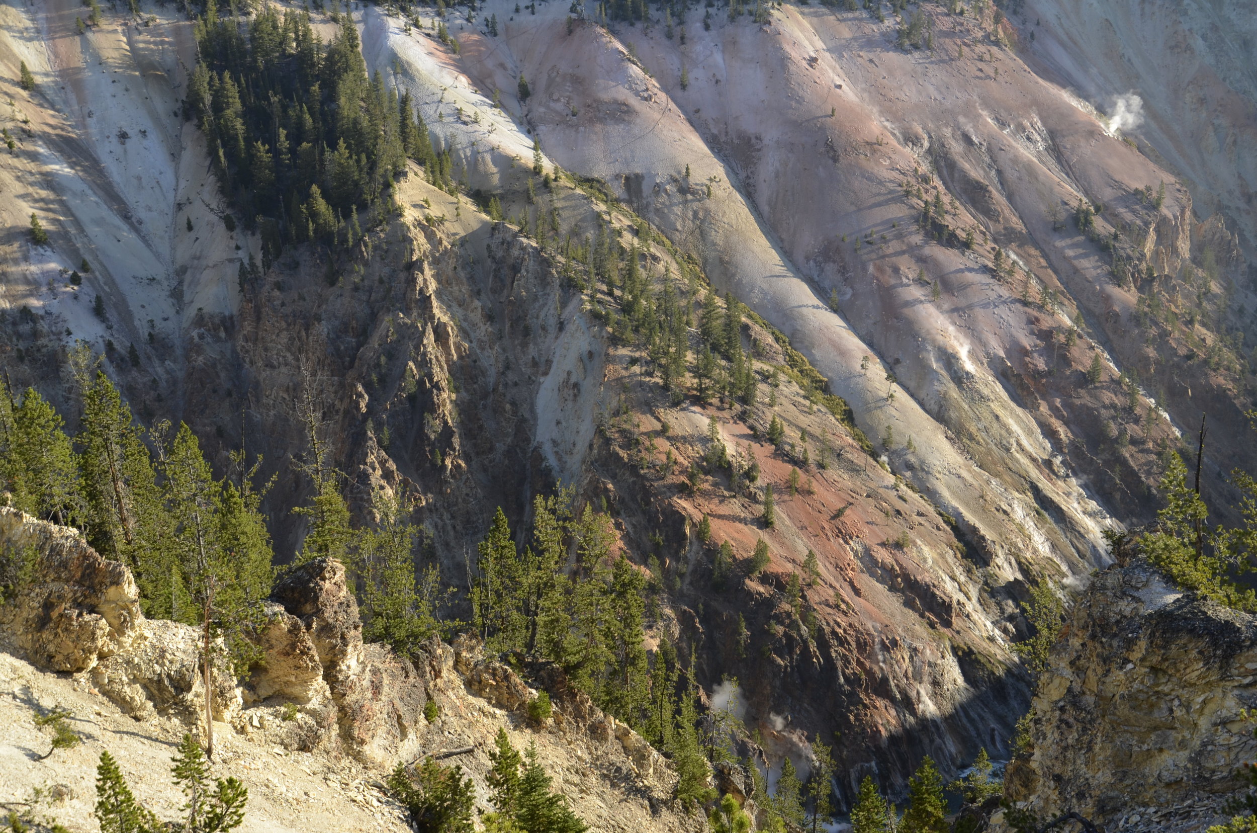
The walls of the canyon are very colorful…

_DSC5436.JPG

…and still have active thermal vents:

_DSC5444.JPG

On the north rim, we were able to drive to several different points where we could hike down 600-800 ft into the canyon, to get some really neat perspectives on it and the falls. The Lower Falls of the Yellowstone drop over 300 feet, about twice as far as Niagra.

The green notch is an area of deeper, less turbulent water:

_DSC5440.JPG

Seen from the edge of the falls:

_DSC5464.JPG

Standing on the observation deck at the top of the falls was mind blowing.

In the next picture you can see one of the staircases we took to get a different view of the falls. On the right side of the falls, you can spy the observation ledge where we had been on the edge.

_DSC5469.JPG

The canyon walls were so multi-colored, and covered in green at the bottom (from the constant mist of the falls):

_DSC5474.JPG

Another gorgeous section of canyon wall…

_DSC5479.JPG

…and many of the steps it took to get there.

_DSC5482.JPG

As we drove away from the canyon, we passed open areas with large buffalo herds that never failed to attract numerous cars (including ours, sometimes) pulled off the sides of the road for pictures.

_DSC5495.JPG

Next post will conclude our Yellowstone visit.

_DSC5499.JPG

Geyser Karma

On our first full day in Yellowstone, we decided to explore Geyser Country.  We got an early start, to try and beat some of the crowds.  The signage in the parking lots around Old Faithful wasn't the greatest, but we managed to find our way in ok.  My morning coffee was speaking to me, so I had to visit the restroom before starting our tour.  I wasn't even finished, when I hear Steve yelling outside, "Hurry up Lisa!"  I raced outside to find Old Faithful had just started its every 90 minute (or so) show.

Steve’s early bird shot

Steve’s early bird shot

_DSC5183.JPG

Because I was "late out of the gate", I caught only the tail end of that spouting.  We went on to walk all along the boardwalks around the myriad geysers and hot springs, taking way too many pictures.  We were so early that there was ice in places on the walkways where the spray had frozen overnight!

The next major geyser we approached was "Castle" for the formation around its spout, and as we just walked up to it, the geyser show started.  This one only had an eruption twice a day, within a window of about an hour's prediction.  We sure were feeling pretty lucky. 

_DSC5227.JPG

About an hour later, we were pondering whether we should wait around for the Grand Geyser to blow (we were in the middle of the predicted 2 hour window), and... you guessed it - it decided to show off for us.

We were really amazed at the extent of “Geyser Country”. It just seemed to go on forever.

_DSC5202.JPG
_DSC5220.JPG

The various hot springs were so gorgeous with their clarity and vivid colors.

_DSC5204.JPG
_DSC5315.JPG

The various concretions around the springs were endlessly different and fascinating.

_DSC5211.JPG
_DSC5212.JPG

Morning Glory Pool was in a class of its own:

_DSC5241.JPG

This guy was grazing calmly about 50 ft off the boardwalk:

_DSC5259.JPG

So on we drove to Grand Prismatic Spring. As we were approaching, the steam that was rising from it was multicolored, but alas, photos don’t let you appreciate that. We were so glad that we had read in Lonely Planet (plug here for awesome guide books for anywhere in the world!), that there was a hike where you could get a bird’s eye view of the spring. Otherwise, on the ground, you just can’t appreciate its extent and colors.

_DSC5329.JPG
_DSC5335.JPG

We were glad that we went down and explored around it, as there were other beautiful spots to see nearby. Grand Prismatic Spring drains into Excelsior Pool, which discharges 4000 gallons per minute of boiling water into Firehole River.

_DSC5400.JPG
Excelsior Pool

Excelsior Pool

This was Grand Prismatic Spring from the ground:

_DSC5410.JPG

I’ll close with the soothing sounds of an anonymous roadside geyser.

On the way to Yellowstone

I had to write a note to remind myself. I kept forgetting because I didn’t have a picture of it. While we were on the Salmon, a young black bear(!) trotted along a ledge above the river bank for a minute or two, giving everybody a good look (but alas, too short for me to get my camera).

After leaving the river, we drove across Idaho the next day, staying in a town on the eastern side, so we could get an early start towards Yellowstone. We first wanted to see Mesa Falls, which had both upper and lower sections.

_DSC5104.JPG

You could only see those Lower Mesa Falls from a lookout quite a distance away, but the Upper Falls, you could see right at the edge.

The Upper Falls are 114 ft. high and 200 ft across. It was gorgeous and thundering to stand right near the top.

_DSC5122.JPG

Seeing the river below the falls brought back happy memories of our time spent on the Salmon.

_DSC5123.JPG

Any time there was a shock of color in otherwise grey/brown landscape, I tried to get a picture:

_DSC5121.JPG

We then dipped back south a bit, to take a scenic byway to the Tetons. For a lot of this trip (except across SD, NE and MO), I found scenic byways to travel along. We continually said “wow!” and “gorgeous!”. What a huge and beautiful country we’re blessed to live in!!

our first view of Jackson Hole, WY

our first view of Jackson Hole, WY

At a waterway just outside of Jackson, there were trumpeter swans. I’ve always thought these were beautiful birds in the books, but never thought I’d get to see them up close. This parent and cygnet made a photogenic pair:

_DSC5139.JPG

The Tetons are absolutely breathtaking. Even in fall with little snow, they were so majestic. Capped with white, I’m sure they’re stunning.

_DSC5150.JPG

The naming of the mountains is attributed to early 19th-century French-speaking trappers—les trois tétons (the three breasts) was later anglicized and shortened to Tetons. (thanks, Wiki!)

_DSC5157.JPG

Driving north through Grand Teton National Park was a neat entryway to Yellowstone, and offered stupendous scenic views.

_DSC5167.JPG

Next post will be the first of three on Yellowstone. Bye!

_DSC5143.JPG

Rafting the Main Salmon River

So, I wanted to test whether I'd like river rafting and camping, before we embarked on our reserved two week trip through the Grand Canyon next fall.  Using the same company, OARS, we took a 6 day/5 night trip down the main portion of the Salmon in Idaho.  I chose this one for several reasons - length seemed just about perfect; time of year was similar; and probably most importantly (for Steve) we could choose each day what craft we wanted to float down the river on.  There was a dory (~20 ft long wooden boat similar to the craft that John Wesley Powell used to first explore the Colorado River); paddle boat (the typical rubber raft to run whitewater rapids, which the guests get to paddle in); oar boats (that the guides do all the paddling using super long oars resting in metal oarlocks, and the boat is loaded down with lots of gear); and even inflatable kayaks and a standup paddleboard.

_DSC4921.JPG

That picture was taken from the paddle boat, with a kayak just in front of us, and an oar boat in front of that.  The dory was always in the front, and you may be able to barely make it out in this picture.  There are several other pictures I'll share, which have the dory much closer.

_DSC4955.JPG

The canyons we floated through were so awe inspiring, and could sure make you feel small.  Apparently, we were in some of the remotest country in the lower 48, and were warned to always be mindful of safety, as an evacuation could be monumental.

_DSC4954.JPG

The granite walls were so beautiful in their asymmetric geometry, and the contrast of the sky, canyon walls, river and trees never ceased to raise "ahhh's".  

_DSC4930.JPG

This was the scene when we would make camp each night.  We'd pull up to a large sandbank camping area with enough room for 21 (16 guests and 5 guides), and unload the boats.  Everyone would pick out a flat spot for their tent, and proceed to set up their home for the evening.

_DSC4929.JPG

I took this picture of one of our tent sites because it was so picturesque:

_DSC5053.JPG

... and yes, I handled the camping well and LOVED the rafting!

_DSC5066.JPG

Even though I had purchased an inflatable mattress (that even had some down in it!), and an especially cozy down sleeping bag (thinking ahead to the Grand Canyon in Oct. next year), I still woke up with sore shoulders and hips from pressure points.  I was happily never cold at all, and in fact, even woke up sweating several times.  The days were so gorgeous, both in scenery and weather, that interrupted sleeping just didn't bother me. 

_DSC4967.JPG

That picture is the closest I got to getting a good image of rapids.  I had to get my camera out of the dry bag, that was latched into the boat, take the picture, and get it back (staying dry) into the bag and latched, before we hit whitewater where I either was paddling, or holding on.  I did take my underwater camera along, but it doesn't have any zoom, and the few pictures I took with it were disappointing.

One day we saw a male bighorn sheep at the edge of the river, which stayed kneeling as we floated by.  As you can see, it was very emaciated.  We were afraid it was near death, but after we went by, it stood up and walked off.

_DSC5014.JPG

Our last camp had a great show for us to watch.  A bald eagle directly across the river was initially perched in a dead tree.  He swooped down to the river, but he came up empty.  He tried again, but still no success.  After sitting on a large rock and studying the river, he launched once more and came up with a fish in his talons, and then flew off to enjoy his dinner.  Sadly, I didn't have my camera with me.  I did get this very long distance shot later:

_DSC5082.JPG

Steve tried his hand at kayaking on our last day (despite never being in one before) and loved it!  That's him on the left (with the blue floppy hat under his helmet):

_DSC5096.JPG

We thoroughly enjoyed ourselves, and reveled in the peace and quiet of the absolute solitude, as well as whooped and hollered our way through every rapid.

_DSC5056.JPG

Ah, Idaho

As we entered Idaho (in its SE corner), we drove along the edge of Bear Lake, which straddles the border of Utah and Idaho.

_DSC4847.JPG

Our first major stop in the state for sightseeing was Twin Falls.  As the Snake River crosses the state, it can cut really deep canyons, or spill over ever changing waterfalls.

_DSC4853.JPG

This is actually Shoshone Falls, and there was only 1/6 of the water flowing over it compared to the spring.  We learned that you don't pronounce the final "e" in Shoshone (as I had mistakenly done since grade school) - 

_DSC4856.JPG

As we drove across the state, we were amazed at the enormous number of acres given to grass/hay, as well as the huge stacks of hay bales everywhere.  

_DSC4870.JPG

The hills in the background of the picture above are the foothills of the Sawtooth Mountains.  We were to be rafting through those soon.

_DSC4877.JPG

These are the headwaters of the Salmon River, that just a few days later we were to be whooping and hollering down the rapids:

_DSC4885.JPG
You can see why they're called the Sawtooth Mountains.

You can see why they're called the Sawtooth Mountains.

Before hitting the Salmon River for our rafting week, we took a detour up along the Idaho - Oregon border to see Hell's Canyon.  It's North America's deepest river gorge, with the Snake doing the honors of carving it.  Unfortunately, you can only get good views of it, if you boat along it through some pretty remote wilderness.  So, I don't have pictures of that, but the dammed portion of the river before that, was gorgeous.

_DSC4910.JPG

After Hell's Canyon, we made it to McCall, Idaho in time for the whitewater orientation session; it sounded intriguing--and it turned out to be even better!  Details in the next post...