Big Bend National Park and some random comments

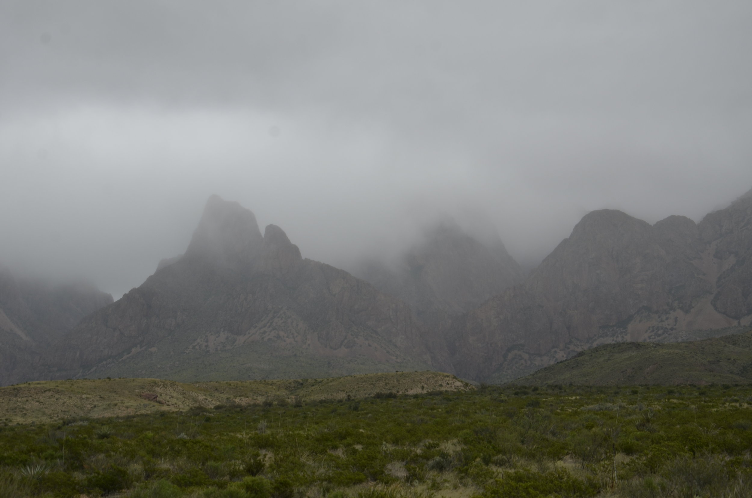
As we headed into TX, our weather luck changed. We stayed in little Marathon, TX as the closest town to Big Bend National Park, and that was 1 1/2 hours away. When we checked in, it was 80 degrees. The wind howled all night, and when we got up in the morning, the skies were overcast and it was 40 degrees!

_DSC7127.JPG

This was the atmosphere we encountered as we entered the park. This place was huge, and the terrain was quite varied. It was neat to see the various geologic strata…

_DSC7129.JPG
_DSC7132.JPG

…as well as the variety of plant life. (For a desert, there sure was a lot of grass!)

_DSC7148.JPG

It took 30 miles of driving on curvy roads at 40 mph to get to the southern border - the Rio Grande, and its towering cliffs on the Mexico side.

_DSC7158.JPG

The Santa Elena Canyon allowed us to get down to river level.

_DSC7162.JPG

I don’t know what I was expecting, but I was underwhelmed by the river at that point (I still loved the cliffs!).

_DSC7167.JPG

On our way back out, we continued to see interesting formations…

_DSC7173.JPG

…and color combinations.

The rock layer above the reddish one was actually a blue-green.

The rock layer above the reddish one was actually a blue-green.

The bit of road curve in the lower center gives some sense of scale:

_DSC7181.JPG

After leaving Big Bend (and vowing to return in the spring, to see it in a better light), we drove across the entire state of TX under cover of rain the whole time. You may have heard about “a little” flooding there? We saw the rivers and creeks super full, and normally dry washes nearly overflowing.

So, not a very pretty end to our 6600 mile sojourn through the Southwest. But don’t forget our gorgeous weather and timing for the aspens!

_DSC6097.JPG

Random comments:

If you’re ever in Pueblo, CO, check out the Rosemount Mansion. It was built in 1893 and has 37 rooms, all still with period furnishings. Gorgeous! But then, we’re partial to big ol’ piles of bricks. ;)

We tried to take mostly scenic drives between national or state parks, but in central CO, we ran out of time, and had to finish a (apparently) gorgeous stretch in the dark. We did see a lot of mule deer right beside the road, thus slowing our progress considerably, but as our lights flashed over them, we could see tons of really nice antler sets.

Before I headed to the Southwest, I spent a quick few days in our nation’s capital and got some cool shots just with my cell phone.

20180928_140920.jpg
20180928_142834.jpg

This is the last of our US ramblings for this year. We’re off to Italy soon, for a wedding, and to explore Rome, Florence and Tuscany in between.
Last NM post

We headed to Carlsbad Caverns Nat’l Park, after leaving Albuquerque. We were able to explore the Big Room in the Cavern and make it back out to catch the nightly Bat Flight. Within 5 minutes of the ranger beginning his speech about the flight, the tornado of bats started leaving the cave (and he quit speaking) and was still pouring out when we left 45 minutes later! They estimate that about 500,000 roost in the cave between May and October. We’re not allowed to film them or take pictures, as electronic devices are very disrupting to them. So, sorry, no blurry twilight pictures of black blobs. It was really cool to see the constant stream whirling out from the cave in a 360 and then flying off in a dark ribbon to the horizon, while hearing wingtips clicking. What was not so cool was the guano odor accompanying them (wind shifts would make it better or worse).

The Big Room is just that - it is the largest single cave chamber by volume in North America. Stats: 4,000 ft long and up to 350 ft high. The space is a little over 8 acres, or over 6 football fields!

_DSC6994.JPG

First, we walked down into the cavern along this trail that was 1.25 miles long and very steep.

_DSC6996.JPG

The first 1/3 or so was really stinky until we got down past the opening of the “bat cave”. There were beautiful formations along the way, but Steve kept commenting every time I stopped for a picture, “just wait ‘til you see the Big Room”.

_DSC7006.JPG

This was a reflecting pool at the base of the columns above:

_DSC7008.JPG

Hopefully you can see the railing at the bottom center of the next picture, to give you the scale of the formations, and the depth of the trail:

_DSC7030.JPG

Water was dripping throughout the cave, continually making new formations or adding to those already present. Can you appreciate the wetness of this one?

_DSC7027.JPG

The little warty growths are called “popcorn”. They are another type of formation (speleothem) besides the basic stalactites and stalagmites.

_DSC7036.JPG

My favorite types of formations are curtains:

_DSC7021.JPG

and soda straws:

_DSC7045.JPG

“Fairy Cave”:

_DSC7064.JPG

We treated the hike back out (up 750 ft in about 1 mile) (signs said it compared to a 75 story building) as our exercise for the day (besides the miles of walking on the trail throughout the cavern), and we did it in 30 minutes! As I said in a previous post, “one foot in front of the other”… Of all the other people we saw in the cavern, only 3 other couples attempted the climb that afternoon.

_DSC7069.JPG

Now on to White Sands National Monument. This Bleached Earless Lizard is found only in White Sands, with its protective coloration. He’s only about the size of your pinky.

This is how you study the little guy with binoculars:

_DSC7070.JPG

We walked along the trail for about a mile, following the line of footprints, and heeding the warning to not proceed from one pole, unless you could see the next.

_DSC7085.JPG

The line of mountains along one border gave a neat contrast to the dunes,

_DSC7073.JPG

… while in the other direction you saw only sand and sky.

_DSC7097.JPG

As unlikely as it was, there were large puddles of standing water in the parking areas (in a desert!).

_DSC7113.JPG

This is what the dunes looked like up close:

_DSC7090.JPG

One last shot before we’re on to TX.

_DSC7106a.jpg

Albuquerque International Balloon Fiesta, part 2

So, we left even earlier the second morning, to try to beat a little of the traffic, but it’s amazing what a lil’ ‘ol balloon festival will bring out of the woodwork at 0500! We did get cheaper parking, but walked farther (kept us warm in the low 40’s of a morning). The skies were really cloudy, so the colors in the pictures aren’t as bright, but there was absolutely no wind! That meant that the Dawn Patrol was lifting off as we entered the gates.

_DSC6546.JPG

I looked up some facts about the Fiesta. About 1 million people come to this over the 9 days, along with over 500 balloons.

It was fabulous this day to see hundreds of balloons all getting ready at the same time. It was amazing how closely they were packed.

_DSC6592.JPG
_DSC6649.JPG

Every time a balloon lifted off, the crowd around it would send up a cheer.

_DSC6619.JPG

There were big gondolas like those above that you could ride in for about $500 a person, but most were family operations with 1-3 people aboard.

_DSC6663.JPG

This day also saw the “Special Shape Rodeo”.

Jesus was rising above Darth Vader

Jesus was rising above Darth Vader

_DSC6778.JPG

Darth Vader and Yoda were taking off together. Both were flying German flags. (I never could find out how many different countries were participating this year)

_DSC6755.JPG

Some other interesting shapes:

_DSC6789.JPG
_DSC6727.JPG
_DSC6735.JPG

This was our personal favorite:

_DSC6798.JPG

A whole collection of different ones:

_DSC6831.JPG

,,,and even more!

_DSC6849.JPG

After 2 hours of taking innumerable pictures, I finally decided that I’d had enough, and we could go. I took this last picture as we walked away from the field:

_DSC6962.JPG

As we were walking toward the exit, I noticed some of the balloons were dropping lower, and actually sailing right towards us!

_DSC6987.JPG

We happened to be standing on the landing field (unbeknownst to us), so we quickly backed up!).

_DSC6986.JPG

I love balloons!

_DSC6877.JPG

So many balloons, so little time...

…to take all their pictures! I felt like a little kid, oohing and aahing over all the pretty colors and interesting shapes. We went out 2 mornings (at 0-dark-hundred) and were treated to two totally different experiences. The first morning was almost called off due to winds, but eventually the green flag went up, to a roar of applause and cheers, and inflations began.

_DSC6332.JPG
_DSC6333.JPG

It was super cool to be on the field right next to balloons and their crew, and see just what goes into getting a balloon off the ground (and back safely).

_DSC6339.JPG

While they’re giving the last bursts of flame to keep it full and upright, there are holders stationed around leaning their weight into the lines keeping the basket on the ground (as well as numerous crew standing on the outside of the basket doing the same thing).

_DSC6359.JPG

It was also really neat to have multiple balloons inflating all around you and filling the sky with color. That day, once the balloons started to rise, they were quickly swept away by the winds.

_DSC6369.JPG

We had gorgeous clear skies, against which to take pictures:

_DSC6377.JPG

I just couldn’t stop taking pictures of all the “pretties”.

_DSC6443.JPG
_DSC6450.JPG

Even with the brisk winds, there were still at least 100 balloons that ascended (compared to the multitude we saw the next day).

I counted close to 50 balloons in this one shot!

I counted close to 50 balloons in this one shot!

I also liked it when they passed directly overhead:

_DSC6471.JPG

I’ll close with a series of single balloons that caught my fancy.

_DSC6392.JPG
_DSC6453.JPG

I can’t take just one (picture or balloon)!

_DSC6470.JPG

Mesa Verde (CO) and Rio Grande Gorge (del Norte)(NM)

We continued west across southern CO, driving more scenic byways, heading to Mesa Verde. I got yet more beautiful mountain and aspen shots, that I just have to share with you.

_DSC6128.JPG
_DSC6093.JPG
_DSC6121.JPG

As we got closer to Mesa Verde, the environment definitely dried out, but there were still aspens anywhere there was some water.

_DSC6137.JPG

Mesa Verde is in the arid SW corner of CO and has several well preserved Ancestral Puebloan cliff dwellings.

_DSC6139.JPG

We hiked along a trail to a wall with petroglyphs, and the journey was a little challenging, but beautiful.

_DSC6143.JPG

The petroglyphs are about 800 years old.

_DSC6155.JPG

We took a tour through one of the dwellings, Balcony House, and it was quite the adventure, with climbing up very tall ladders -

_DSC6171.JPG

…and crawling through tunnels on our hands and knees.

IMG_20181006_161031.jpg

We enjoyed seeing the craftsmanship up close, as well as the views across the gorge.

_DSC6185.JPG

One last look back:

_DSC6190.JPG

As we drove back into NM, we were still happy to see some mountains before diving back into arid sagebrush country.

_DSC6225.JPG

We stayed in Taos for a couple of days, killing time until the Balloon Fiesta. We went hiking in the Rio Grande del Norte National Monument. It sure is a small river at that point, but a pretty deep gorge.

_DSC6227.JPG

Along the windswept rim, pinon pines are stunted and have neat spiral trunks:

_DSC6226.JPG

We hiked down into the canyon, to the Rio Grande, and the trip was pretty easy as well as scenic.

_DSC6236.JPG
_DSC6237.JPG

The water in the river here was a pretty green (when we saw it further downstream near Santa Fe, it was a muddy brown). It was just a gentle stream.

_DSC6249.JPG

Now, the hike back up was a different story.

_DSC6265.JPG

That sign says “Little Arsenic Rim 0,8 mi” straight up. Not really, but at times, it felt like it. We ascended 700 ft in less than a mile - at 7500 ft elevation. Boy were we panting! We did it in 30 minutes and felt really good at the top. When we’ve been hiking in TN, most elevation gains are in the realm of about 300 ft, over several miles.

_DSC6268.JPG

As we drove to Albuquerque, our weather luck changed. Rain dogged us most of the day, although we thought we might get lucky for a time, so headed to Bandelier National Monument for more hiking. The geology there is pretty cool (we never did find a good explanation as to why the rocks in this area eroded the way they did).

_DSC6277.JPG

We hiked down through this canyon, in the rain, to the top of a nonexistent waterfall. Sounds reasonable, doesn’t it? Or just like something that Lisa and Steve would do.

_DSC6278.JPG

The canyon was very pretty, even in poor light, and we really enjoyed seeing how it changed over a short distance, depending on altitude and geography.

That’s a dry creek at the bottom.

That’s a dry creek at the bottom.

The shiny black in the next picture is the lava over which the waterfall flows (in the spring?).

_DSC6287.JPG

Now… Balloon Fiesta here we come!

The Black Canyon of the Gunnison

Steve and our boys had discovered this gem in SW CO when they went on a 5000+ mile “round the West” RV tour about 15 years ago. Steve had talked this up so much since then, that it was a must stop on this trip for us. Man, am I glad we did!

_DSC5950.JPG

The views were just jaw dropping-ly beautiful, and I just couldn’t do it justice with two dimensional pictures, but I’ll try!

_DSC5952.JPG

There are areas of the canyon that get only 30 minutes of sunlight a day (due to the depth and steepness of the walls), hence the name.

_DSC5954.JPG

There were beautiful knife edges of the canyon wall, that hopefully you can appreciate in the picture above. The sharp edges are the lighter vertical stripes in the right third of the picture.

_DSC5964.JPG

We went hiking on a trail that took us down into the canyon aways, and were thrilled to be treated to this aspen grove. We also got some really unique views:

_DSC5971.JPG

At another overlook (that we drove to), we got yet a different perspective:

_DSC5986.JPG

Shot throughout many of the walls were lighter bands of “pegmatite” (igneous rock with large crystals in it) that looked like enormous modern art murals.

_DSC6033.JPG

Painted Wall is a gigantic version of this. It is “the tallest sheer cliff in CO, at 2,250 ft” (thanks again, Wiki). Note the full size trees on the top of the wall:

_DSC6043.JPG

We drove down to the Gunnison River, along a road with a 16% grade and numerous hairpin turns. Next time you’re driving on a road with a steep grade, note the percent - bet it won’t be more than 5 or 10%.

_DSC6070.JPG
_DSC6061.JPG

We then just drove numerous scenic byways in central and western CO, and got lucky with breaks in the clouds, or coming up on some ranges that had just had the first snow the day before.

_DSC6095.JPG

I just kept saying, “O.M.G.” or “It’s just so beautiful!”, and Steve would patiently pull over, so I could take yet another picture.

_DSC6103.JPG

We continued to marvel at our luck in hitting the turning aspen season so perfectly.

_DSC6125.JPG

All aboard!

Almost on a whim, we decided that neither of us had been on a passenger train in so many years (since the train in “wine country” Hermann, MO) that it was time to do it again. We initially looked at the Durango - Silverton narrow gauge train in SW CO, but it was all sold out for the time we’d be there. We were going to be going to Royal Gorge anyway, so we booked tickets for lunch in a Vista Dome car.

The Vista Dome is the second car to the right

The Vista Dome is the second car to the right

We lucked out and got a table to ourselves (instead of sharing it with another couple, like everybody else did). Super comfortable seats, white tablecloths, salad served as you sat down - oo la la! The view out the windows and glass ceiling was phenomenal, but didn’t begin to compare to the flat, open car behind our dome car, that we were also welcome to walk out on, to be outside, as we meandered through the Gorge.

_DSC5826.JPG

Steve checked our speed on the speedometer app on his phone, and we leisurely proceeded at 11-12 mph. The tracks were right against the rock wall most of the time, and the Arkansas River close on the other side.

_DSC5820.JPG

This was such an awesome way to view the Gorge, and we were thrilled to have been able to take the train through.

_DSC5827.1.jpg

Besides the gorgeous canyon walls, we got to see the Royal Gorge Bridge from a unique vantage point.

_DSC5833.JPG

This next one maybe gives a better sense of scale:

_DSC5835.JPG

The canyon walls were so much prettier from this vantage point -

_DSC5856.JPG

… compared to when we hiked along the rim on top (before boarding the train) -

_DSC5799.JPG

I just loved the closeness of the rock walls and the colors they had:

_DSC5834.JPG
_DSC5857.JPG

We then headed across south central CO to Great Sand Dunes National Park. The view from afar wasn’t very exciting…

_DSC5862.JPG

… but as we got closer, it began to look like a painting.

_DSC5866.JPG

When given scope, the sheer size was just amazing (those are full size aspen trees in the foreground).

_DSC5874.JPG

In the two hours that we were there, the light and shadows changed so much and seemed to make the dunes have black highlighting.

_DSC5912.JPG

In the next post, we’ll be heading across central CO.

_DSC5926.JPG

First NM post (with a little southern CO)

I’m nearly positive that I’ll have at least one more post from NM later in this trip, as we go to Albuquerque for the Balloon Fiesta, thus, the title for this post.

It’s REALLY dry. Like sand and rocks and cactus dry. There really wasn’t much to take pictures of around Santa Fe (where we spent a couple of days in a really nice, secluded B&B reading and sitting), until we went hiking in Kasha-Katuwe Tent Rocks National Monument. That was really cool!

_DSC5717.JPG

I just love striations of different colors in the rocks, and can’t stop taking pictures (I’ll refrain from overloading you, or at least I’ll try).

The tent rocks are made of soft pumice and tuff (volcanic ash that has been compacted) and have a cap of harder stone.

_DSC5731.JPG

There was a slot canyon that we got to hike through, and this was a first for us.

_DSC5721.JPG

Hopefully we’ll get to see many more in the future, as I was just mesmerized by the colors and shapes.

_DSC5726.JPG

It got really narrow at times:

_DSC5727.JPG

After the slot canyon, we saw some more tent rocks,

_DSC5744.JPG

…on our way up to see the surrounding mesas.

_DSC5738.JPG

Again with the tent rocks and color striations -

_DSC5742.JPG

We then hiked back down through the slot canyon again

_DSC5746.JPG

…before bidding adieu to the pretty rocks.

_DSC5747.JPG

Entering southern CO, we immediately began seeing mountains and gorgeous swaths of aspens.

_DSC5758.JPG
_DSC5765.JPG

As with the striated rocks in NM, I couldn’t stop taking pictures of the aspens in CO.

_DSC5774.JPG

Steve LOVED driving this scenic route on the way to Pueblo, CO.

_DSC5778.JPG

We’ll be in south central CO for the next week, so stay tuned!

_DSC5782.JPG

Beartooth Highway

Oh… wow! Charles Kuralt (of CBS’ “On the Road” segments for the Nightly News with Walter Cronkite) dubbed this “the most scenic highway in the USA”. At first we were very underwhelmed, then the road began climbing through numerous switchbacks, and boy did our tune change!

If you are driving to Yellowstone, an absolutely awesome route would be to take this highway from Red Lodge, MT to the NE entrance of the park (we actually did it the opposite way).

_DSC5648.JPG

As we left Yellowstone, we came across the beautifully reflective Beartooth Lake, where I got some awesome shots, after I picked my jaw up off the ground. We were thrilled that the aspens were turning as we were driving through the upper West.

_DSC5685.JPG

The road is 68 miles along US Route 212 in MT and WY. The highest point is Beartooth Pass, which is well above treeline.

_DSC5656.JPG

It was fascinating to watch the trees become more stunted and then disappear altogether as we would round a corner and find ourselves in alpine tundra.

_DSC5651.JPG

The myriad alpine lakes were a neat surprise. We had no idea that an area that dry and barren would have deep pockets of blue.

_DSC5661.JPG

After numerous twists and turns, Steve showed me the map on his phone:

Screenshot_20180912-101145.png
_DSC5667.JPG

I was also loving the pink granite everywhere -

_DSC5655.JPG

My pictures don’t really do the drive and scope justice. You really need to drive it yourself to experience the awesome beauty of this corner of the country.

As we drove back into WY, we descended into red rocks and sagebrush.

_DSC5673.JPG

Wind River Canyon in the Indian reservation of the same name was a really cool drive, but unfortunately we were in shade through it all, so no good pics. Interestingly, there were numerous signs along the highway informing us about the type of rock layers we were passing through and their ages (i.e. Triassic 115-225 million yrs).

_DSC5674.JPG

Another interesting thing we noticed as we drove back through WY was how many pronghorn were scattered about.

_DSC5626.JPG

Then in CO, we got to see lots more aspens…

_DSC5680.JPG

…and were surprised to see not only yellow, but even some red.

_DSC5682.JPG

We went hiking all around a couple of small lakes that were purported to be great spots to see moose, with nary a one in sight. We were heading out of a scenic canyon drive, settling in for the long haul to NE, when a cow decided to trot alongside the road in a field.

_DSC5689.JPG

After we stopped to let her cross the road, she disappeared into the surrounding forest.

_DSC5699.JPG

Some final (random) thoughts on this 6000 mile road trip -

  • miles and acres of sunflowers in SD

  • we paced a several mile-long train in ID going 68 mph! (imagine what it takes to stop that??)

  • we repeatedly saw signs and barriers on highways (and even the Interstate) for closing them (how much snow DO they get?)

  • how did Hiland, WY (population 10) warrant an official road sign stating that?

  • as we crossed NE, it was freaky and very noticeable that about halfway across the state, there was suddenly mugginess in the air and green grass everywhere

_DSC5707.JPG

That was our last look at CO, in contrast to “back home” in MO:

_DSC5712.JPG

For those who might not know, both Steve and I were raised in MO (he near St. Louis, and me in SW MO - Springfield), and whenever we see country like this, it brings up waves of nostalgia.

So… we’re off tomorrow on our next road trip to explore part of the Southwest - NM, southern CO and TX.

Yellowstone part 3

On our last day in Yellowstone, we got up well before dawn since we were heading to Mammoth Hot Springs near the North entrance, and we figured at least 90 minutes for the drive, even without any “critter” traffic. Super glad we did!

_DSC5540.JPG

In the dawn’s early light, we saw him; he was just lounging on a rise right off the road. Throughout the park, I remained on the lookout for bull elk and moose - the 2 large mammals I hadn’t “shot” yet (I had no hopes for wolves, so they weren’t even on my list). Our first night in Yellowstone, a cow greeted us on the road to our lodge.

_DSC5177.JPG

Both elk and bison had no fear of roads, cars or even people, and sauntered wherever they wanted. Well, after 4 or 5 cars stopped and pulled over for pictures and just to admire, this big guy got up and wandered over the rise to graze in peace.

_DSC5549.JPG

On the drive to Mammoth, we continued to be in awe of the extent of thermal activity in the park.

_DSC5552.JPG

Our first glimpse of Mammoth Hot Springs:

_DSC5559.JPG

We opted to skip the hour’s worth of walking on boardwalks around these springs, as we felt “geysered out” from our first day. We wanted to go on a 5+ mile hike up in the hills surrounding this area. The view of the beautiful travertine (limestone deposits) terraces started us off just right.

_DSC5574.JPG

The name of the trail was “Beaver Ponds” but the namesake was not to be seen, nor were any moose. We got some great exercise and views.

_DSC5584.JPG

Steve is my favorite pack animal (just takes some beef jerky and a few scratches behind the ears to keep following me happily up and down trails, carrying water, extra clothes and telephoto lens), so I included him in this shot with the hills of Montana in the background.

_DSC5591.JPG

As we headed out of the park by the NE entrance, we passed through the Lamar Valley which is known as “the Serengeti of Yellowstone”. Apparently, wolves can be seen here because of the herds of bison and pronghorn that favor this area for grazing. No wolves for us, but plenty of the hoofed ones mixing it up.

_DSC5634.JPG

Even a baby!

_DSC5622.JPG

With a lingering last look, as we leave the park…

_DSC5606.JPG

The Grand Canyon of the Yellowstone

This is the first large canyon on the Yellowstone River downstream from Yellowstone Falls. We had aspirations of hiking along the South Rim. Unfortunately, the whole rim was closed for repairs to the overlooks and parking areas. We were able to get to Artist Point (where Thomas Moran sketched his famous picture of the falls and the canyon) and take some neat pictures.

_DSC5446.JPG

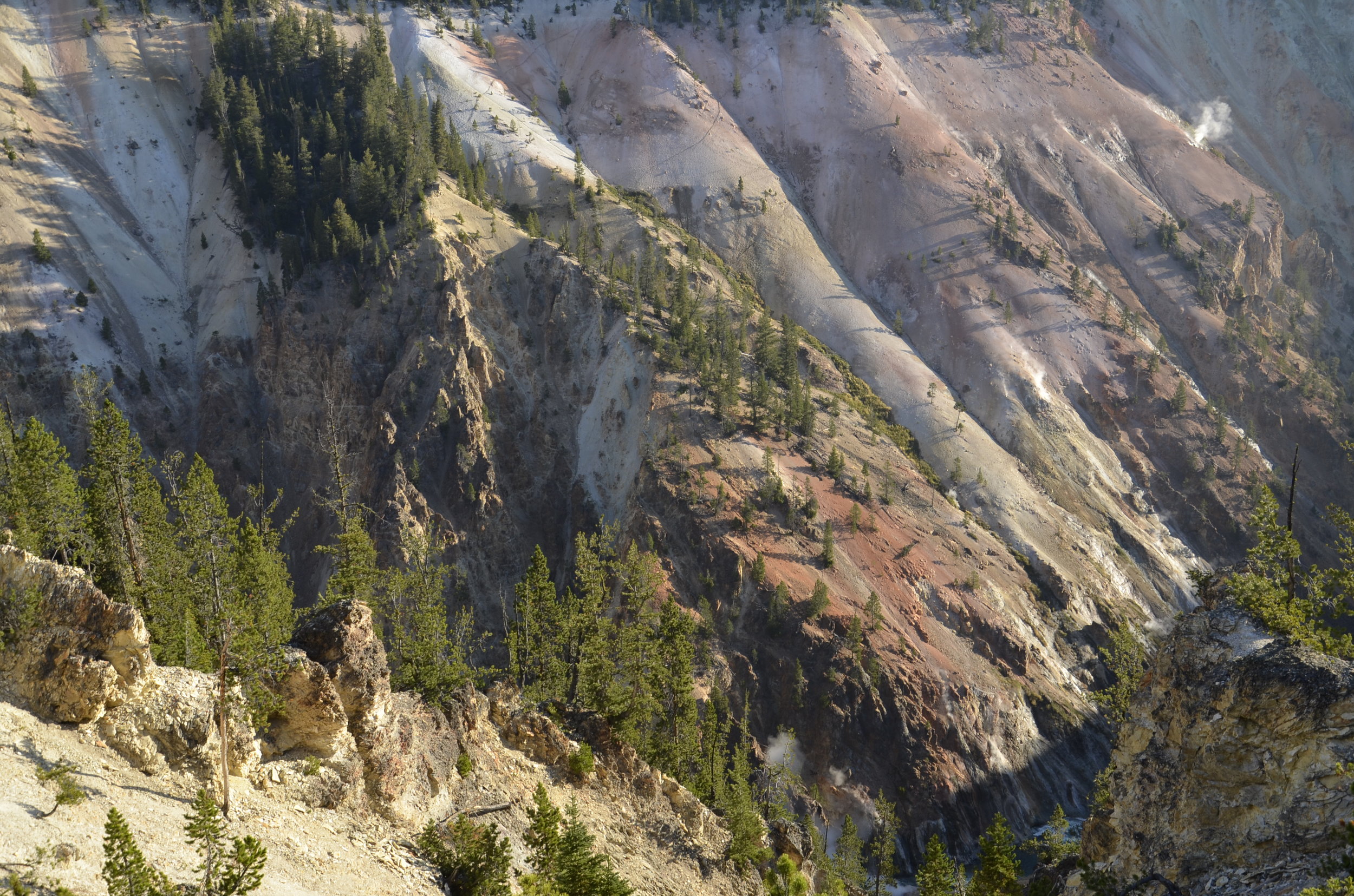
The walls of the canyon are very colorful…

_DSC5436.JPG

…and still have active thermal vents:

_DSC5444.JPG

On the north rim, we were able to drive to several different points where we could hike down 600-800 ft into the canyon, to get some really neat perspectives on it and the falls. The Lower Falls of the Yellowstone drop over 300 feet, about twice as far as Niagra.

The green notch is an area of deeper, less turbulent water:

_DSC5440.JPG

Seen from the edge of the falls:

_DSC5464.JPG

Standing on the observation deck at the top of the falls was mind blowing.

In the next picture you can see one of the staircases we took to get a different view of the falls. On the right side of the falls, you can spy the observation ledge where we had been on the edge.

_DSC5469.JPG

The canyon walls were so multi-colored, and covered in green at the bottom (from the constant mist of the falls):

_DSC5474.JPG

Another gorgeous section of canyon wall…

_DSC5479.JPG

…and many of the steps it took to get there.

_DSC5482.JPG

As we drove away from the canyon, we passed open areas with large buffalo herds that never failed to attract numerous cars (including ours, sometimes) pulled off the sides of the road for pictures.

_DSC5495.JPG

Next post will conclude our Yellowstone visit.

_DSC5499.JPG

Geyser Karma

On our first full day in Yellowstone, we decided to explore Geyser Country.  We got an early start, to try and beat some of the crowds.  The signage in the parking lots around Old Faithful wasn't the greatest, but we managed to find our way in ok.  My morning coffee was speaking to me, so I had to visit the restroom before starting our tour.  I wasn't even finished, when I hear Steve yelling outside, "Hurry up Lisa!"  I raced outside to find Old Faithful had just started its every 90 minute (or so) show.

Steve’s early bird shot

Steve’s early bird shot

_DSC5183.JPG

Because I was "late out of the gate", I caught only the tail end of that spouting.  We went on to walk all along the boardwalks around the myriad geysers and hot springs, taking way too many pictures.  We were so early that there was ice in places on the walkways where the spray had frozen overnight!

The next major geyser we approached was "Castle" for the formation around its spout, and as we just walked up to it, the geyser show started.  This one only had an eruption twice a day, within a window of about an hour's prediction.  We sure were feeling pretty lucky. 

_DSC5227.JPG

About an hour later, we were pondering whether we should wait around for the Grand Geyser to blow (we were in the middle of the predicted 2 hour window), and... you guessed it - it decided to show off for us.

We were really amazed at the extent of “Geyser Country”. It just seemed to go on forever.

_DSC5202.JPG
_DSC5220.JPG

The various hot springs were so gorgeous with their clarity and vivid colors.

_DSC5204.JPG
_DSC5315.JPG

The various concretions around the springs were endlessly different and fascinating.

_DSC5211.JPG
_DSC5212.JPG

Morning Glory Pool was in a class of its own:

_DSC5241.JPG

This guy was grazing calmly about 50 ft off the boardwalk:

_DSC5259.JPG

So on we drove to Grand Prismatic Spring. As we were approaching, the steam that was rising from it was multicolored, but alas, photos don’t let you appreciate that. We were so glad that we had read in Lonely Planet (plug here for awesome guide books for anywhere in the world!), that there was a hike where you could get a bird’s eye view of the spring. Otherwise, on the ground, you just can’t appreciate its extent and colors.

_DSC5329.JPG
_DSC5335.JPG

We were glad that we went down and explored around it, as there were other beautiful spots to see nearby. Grand Prismatic Spring drains into Excelsior Pool, which discharges 4000 gallons per minute of boiling water into Firehole River.

_DSC5400.JPG
Excelsior Pool

Excelsior Pool

This was Grand Prismatic Spring from the ground:

_DSC5410.JPG

I’ll close with the soothing sounds of an anonymous roadside geyser.

On the way to Yellowstone

I had to write a note to remind myself. I kept forgetting because I didn’t have a picture of it. While we were on the Salmon, a young black bear(!) trotted along a ledge above the river bank for a minute or two, giving everybody a good look (but alas, too short for me to get my camera).

After leaving the river, we drove across Idaho the next day, staying in a town on the eastern side, so we could get an early start towards Yellowstone. We first wanted to see Mesa Falls, which had both upper and lower sections.

_DSC5104.JPG

You could only see those Lower Mesa Falls from a lookout quite a distance away, but the Upper Falls, you could see right at the edge.

The Upper Falls are 114 ft. high and 200 ft across. It was gorgeous and thundering to stand right near the top.

_DSC5122.JPG

Seeing the river below the falls brought back happy memories of our time spent on the Salmon.

_DSC5123.JPG

Any time there was a shock of color in otherwise grey/brown landscape, I tried to get a picture:

_DSC5121.JPG

We then dipped back south a bit, to take a scenic byway to the Tetons. For a lot of this trip (except across SD, NE and MO), I found scenic byways to travel along. We continually said “wow!” and “gorgeous!”. What a huge and beautiful country we’re blessed to live in!!

our first view of Jackson Hole, WY

our first view of Jackson Hole, WY

At a waterway just outside of Jackson, there were trumpeter swans. I’ve always thought these were beautiful birds in the books, but never thought I’d get to see them up close. This parent and cygnet made a photogenic pair:

_DSC5139.JPG

The Tetons are absolutely breathtaking. Even in fall with little snow, they were so majestic. Capped with white, I’m sure they’re stunning.

_DSC5150.JPG

The naming of the mountains is attributed to early 19th-century French-speaking trappers—les trois tétons (the three breasts) was later anglicized and shortened to Tetons. (thanks, Wiki!)

_DSC5157.JPG

Driving north through Grand Teton National Park was a neat entryway to Yellowstone, and offered stupendous scenic views.

_DSC5167.JPG

Next post will be the first of three on Yellowstone. Bye!

_DSC5143.JPG

Rafting the Main Salmon River

So, I wanted to test whether I'd like river rafting and camping, before we embarked on our reserved two week trip through the Grand Canyon next fall.  Using the same company, OARS, we took a 6 day/5 night trip down the main portion of the Salmon in Idaho.  I chose this one for several reasons - length seemed just about perfect; time of year was similar; and probably most importantly (for Steve) we could choose each day what craft we wanted to float down the river on.  There was a dory (~20 ft long wooden boat similar to the craft that John Wesley Powell used to first explore the Colorado River); paddle boat (the typical rubber raft to run whitewater rapids, which the guests get to paddle in); oar boats (that the guides do all the paddling using super long oars resting in metal oarlocks, and the boat is loaded down with lots of gear); and even inflatable kayaks and a standup paddleboard.

_DSC4921.JPG

That picture was taken from the paddle boat, with a kayak just in front of us, and an oar boat in front of that.  The dory was always in the front, and you may be able to barely make it out in this picture.  There are several other pictures I'll share, which have the dory much closer.

_DSC4955.JPG

The canyons we floated through were so awe inspiring, and could sure make you feel small.  Apparently, we were in some of the remotest country in the lower 48, and were warned to always be mindful of safety, as an evacuation could be monumental.

_DSC4954.JPG

The granite walls were so beautiful in their asymmetric geometry, and the contrast of the sky, canyon walls, river and trees never ceased to raise "ahhh's".  

_DSC4930.JPG

This was the scene when we would make camp each night.  We'd pull up to a large sandbank camping area with enough room for 21 (16 guests and 5 guides), and unload the boats.  Everyone would pick out a flat spot for their tent, and proceed to set up their home for the evening.

_DSC4929.JPG

I took this picture of one of our tent sites because it was so picturesque:

_DSC5053.JPG

... and yes, I handled the camping well and LOVED the rafting!

_DSC5066.JPG

Even though I had purchased an inflatable mattress (that even had some down in it!), and an especially cozy down sleeping bag (thinking ahead to the Grand Canyon in Oct. next year), I still woke up with sore shoulders and hips from pressure points.  I was happily never cold at all, and in fact, even woke up sweating several times.  The days were so gorgeous, both in scenery and weather, that interrupted sleeping just didn't bother me. 

_DSC4967.JPG

That picture is the closest I got to getting a good image of rapids.  I had to get my camera out of the dry bag, that was latched into the boat, take the picture, and get it back (staying dry) into the bag and latched, before we hit whitewater where I either was paddling, or holding on.  I did take my underwater camera along, but it doesn't have any zoom, and the few pictures I took with it were disappointing.

One day we saw a male bighorn sheep at the edge of the river, which stayed kneeling as we floated by.  As you can see, it was very emaciated.  We were afraid it was near death, but after we went by, it stood up and walked off.

_DSC5014.JPG

Our last camp had a great show for us to watch.  A bald eagle directly across the river was initially perched in a dead tree.  He swooped down to the river, but he came up empty.  He tried again, but still no success.  After sitting on a large rock and studying the river, he launched once more and came up with a fish in his talons, and then flew off to enjoy his dinner.  Sadly, I didn't have my camera with me.  I did get this very long distance shot later:

_DSC5082.JPG

Steve tried his hand at kayaking on our last day (despite never being in one before) and loved it!  That's him on the left (with the blue floppy hat under his helmet):

_DSC5096.JPG

We thoroughly enjoyed ourselves, and reveled in the peace and quiet of the absolute solitude, as well as whooped and hollered our way through every rapid.

_DSC5056.JPG

Ah, Idaho

As we entered Idaho (in its SE corner), we drove along the edge of Bear Lake, which straddles the border of Utah and Idaho.

_DSC4847.JPG

Our first major stop in the state for sightseeing was Twin Falls.  As the Snake River crosses the state, it can cut really deep canyons, or spill over ever changing waterfalls.

_DSC4853.JPG

This is actually Shoshone Falls, and there was only 1/6 of the water flowing over it compared to the spring.  We learned that you don't pronounce the final "e" in Shoshone (as I had mistakenly done since grade school) - 

_DSC4856.JPG

As we drove across the state, we were amazed at the enormous number of acres given to grass/hay, as well as the huge stacks of hay bales everywhere.  

_DSC4870.JPG

The hills in the background of the picture above are the foothills of the Sawtooth Mountains.  We were to be rafting through those soon.

_DSC4877.JPG

These are the headwaters of the Salmon River, that just a few days later we were to be whooping and hollering down the rapids:

_DSC4885.JPG
You can see why they're called the Sawtooth Mountains.

You can see why they're called the Sawtooth Mountains.

Before hitting the Salmon River for our rafting week, we took a detour up along the Idaho - Oregon border to see Hell's Canyon.  It's North America's deepest river gorge, with the Snake doing the honors of carving it.  Unfortunately, you can only get good views of it, if you boat along it through some pretty remote wilderness.  So, I don't have pictures of that, but the dammed portion of the river before that, was gorgeous.

_DSC4910.JPG

After Hell's Canyon, we made it to McCall, Idaho in time for the whitewater orientation session; it sounded intriguing--and it turned out to be even better!  Details in the next post...

Now, Wyoming

Devil's Tower was something we weren't initially going to drive by, but when it popped up out of nowhere in the NE corner of WY, we had to investigate.  The wildfires out West made our first views very hazy:

_DSC4685.JPG

Scientists aren't exactly sure how it was formed, but in general, they think there was an enormous up-welling of magma, followed by millions of years of erosion of the land around it.  For those old enough to remember, this monument played a central role in the movie, "Close Encounters of the Third Kind".

_DSC4693.JPG

It was super cool to see up close, as well as from different angles as we hiked all the way around it.

_DSC4692.JPG
_DSC4698.JPG

As we left, the red sandstone bluffs provided a nice contrast:

_DSC4712.JPG

We drove across northern WY, passing some majestic cuts against a big sky.

_DSC4725.JPG

We were headed for the appropriately named town of Thermopolis.  Hot Springs State Park was nearby.  Ten acres of land surrounding the spring was bought from the Wind River Indian Reservation in 1896.  The tribal contract stipulated that locals could always soak free, and that still holds true today.  Anyone can soak (with a 20 minute time limit) in the sulfuric smelling waters, so of course, we had to try them.  Quite soothing, and you quickly got used to the stink.  The soaking was done in the bath house, at 104 degrees, while the water emanating from the spring is at 135 degrees!

There were mats of bacteria growing in the mineral rich waters, that mimicked underwater grasses.  The large bubble in the lower corner of the picture was the spring releasing sulfur dioxide:

_DSC4730.JPG

As the water spilled out of the spring and over the landscape, it formed travertine terraces that were quite extensive:

_DSC4738.JPG

FINALLY!  Big sky country!

_DSC4742.JPG

At the SW corner of the state, where it meets Utah, is the Flaming Gorge National Recreation Area.

_DSC4746.JPG

The dam across the Green River created this gorgeous lake.

_DSC4780.JPG

Next up is Idaho, where we met a herd of these gals (bighorn sheep) in a campground, and they seemed to like to have their pictures taken.

_DSC4802.JPG
_DSC4792.JPG

A sheep-butt goodbye!

South Dakota - there's more there than you think!

We're starting to explore our huge country, by driving out to Idaho, where we're going to spend 6 days on the Salmon River, rafting rapids and camping.  Yes, Lisa is going to try camping.  You see, we're booked on a two week trip down the Colorado River through the entire length of the Grand Canyon next year, and I wanted to see if this is really something I can handle.  

We left Nashville kind of on a whim for timing.  We were initially going to leave in the morning and drive all the way to Kansas City, staying with my cousin, but we decided to break that first drive up.  So we left in the afternoon, calling Steve's mom on the way, asking if we could stay at her place (in St. Charles, MO) that evening.  She and her husband very graciously accepted our offer to pay for dinner that night, in exchange for a bed and bath.  The next morning, we went out and walked for an hour before driving on to Overland Park, KS (KC suburb).  The walking bit has been an activity that we've tried to engage in on a daily basis, keeping up our fitness, to a degree, as well as combating butt spread!  Our walk in Wall, SD was neat to watch the sun rise, and see the widespread and desolate plains all around.  Wall is "famous" for Wall Drug that is touted literally all across S. Dakota by billboards along the highway.  We were underwhelmed.

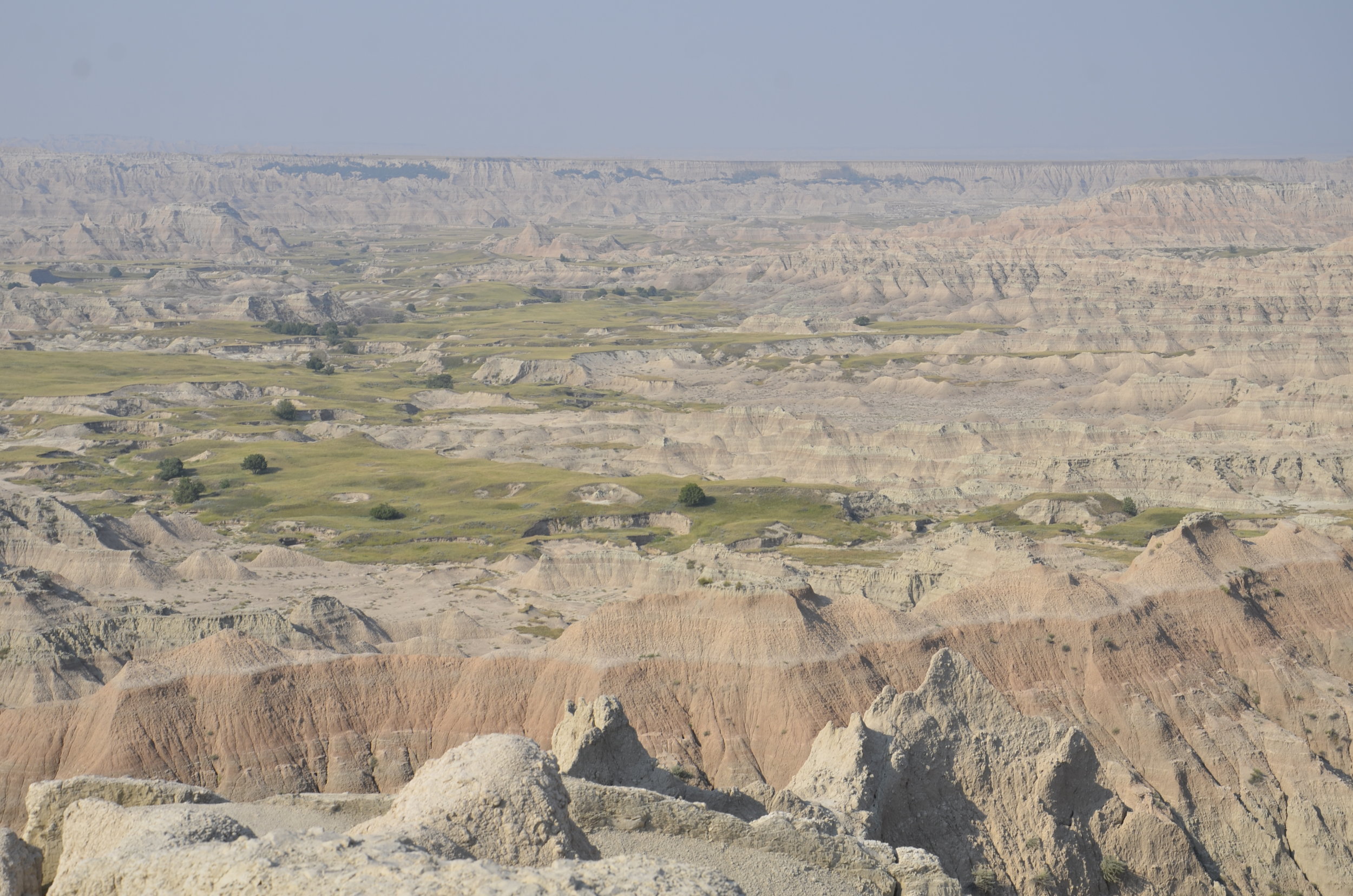
The Badlands, however, were awesome!  They are on the western border of the state, but you have to drive through a whole lot of empty land stretching to the horizon, to get to them (when you're coming from KC).  This was our first glimpse as we entered the National Park:

_DSC4508.JPG

As we were driving, I just kept thinking about the settlers trying to get through this very inhospitable terrain (on foot and with covered wagons) to go on to Oregon and the coast.

_DSC4497.JPG

This fella was part of a large prairie dog town just before the entrance of the park, and we were to see many more of these towns during our next several days of driving.  It was fun to stop and watch them right off the road, running from burrow to burrow, feeding, and calling/squeaking to each other.

_DSC4520.JPG

As we drove further into the park, we were treated to gorgeous displays of wind and water carving that left the spires on the peaks above, as well as the color striations.

the aptly named Yellow Mounds

the aptly named Yellow Mounds

_DSC4530.JPG

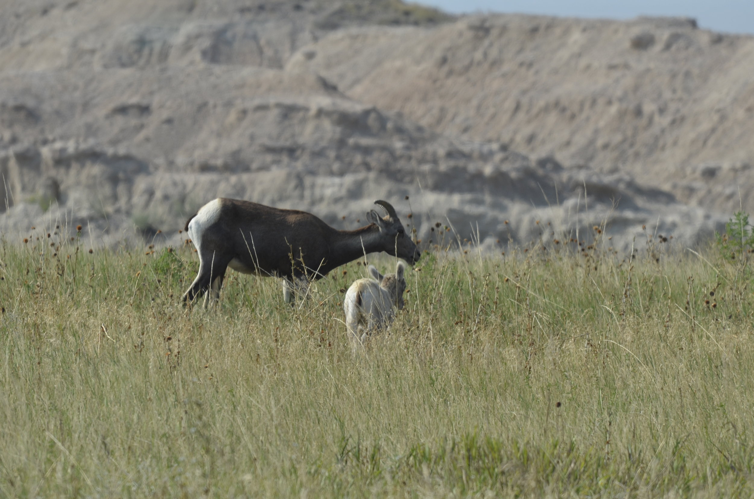
I initially thought these were pronghorn antelopes, given their white rumps, but they are actually bighorn sheep (females)!  Several days later, we were to come upon a herd of about 15 females and youngsters, who didn't seem to be afraid of us at all (to be covered in a later post).

Momma and baby

Momma and baby

This coyote was hanging out over a prairie dog town, hoping to get lucky

This coyote was hanging out over a prairie dog town, hoping to get lucky

Wonder why they call it a mule deer?

Wonder why they call it a mule deer?

_DSC4569.JPG

Now, THAT'S a pronghorn.  As you can guess by the pretty grassland, we've moved on to a different park.  This was later that afternoon in Custer State Park, that we specifically went to for the wildlife along the scenic drive.

This big guy was right beside the road,

_DSC4579.JPG

and he was following her:

_DSC4580.JPG

As I looked back, he had broken into a trot ("objects in the picture are closer than they appear")

_DSC4581.JPG

We made it safely down the road, and then stopped to eat lunch, while watching Romeo continue to pursue his Juliet.  They later joined the herd grazing in a field.

_DSC4587.JPG

I'll close this post with a shot from Needles Highway, on the way to Mount Rushmore (we packed all of this in one day!).  A storm rolled in during the late afternoon, and we sat out the rain in the car, happily reading. 

_DSC4609.JPG

Oregon Coast

We were SO lucky not to have the typical Pacific Northwest weather of rain and gray skies for most of our trip.  This allowed me to get some great pictures (and share them with you!), but also let us see so much more of the coastline than we probably would have otherwise.

Southern Oregon was quite craggy, with numerous small and large rocks and "seastacks" offshore.

Very few actually had trees on them

Very few actually had trees on them

_DSC2665.JPG

One of our favorites was Coquille Point at Bandon, Oregon.  The tide was out, so there was a huge expanse of beach, that was enjoyed by numerous people and dogs.

The people on the left side show the scale.  I also loved the purple-blue of the hills in the back.

The people on the left side show the scale.  I also loved the purple-blue of the hills in the back.

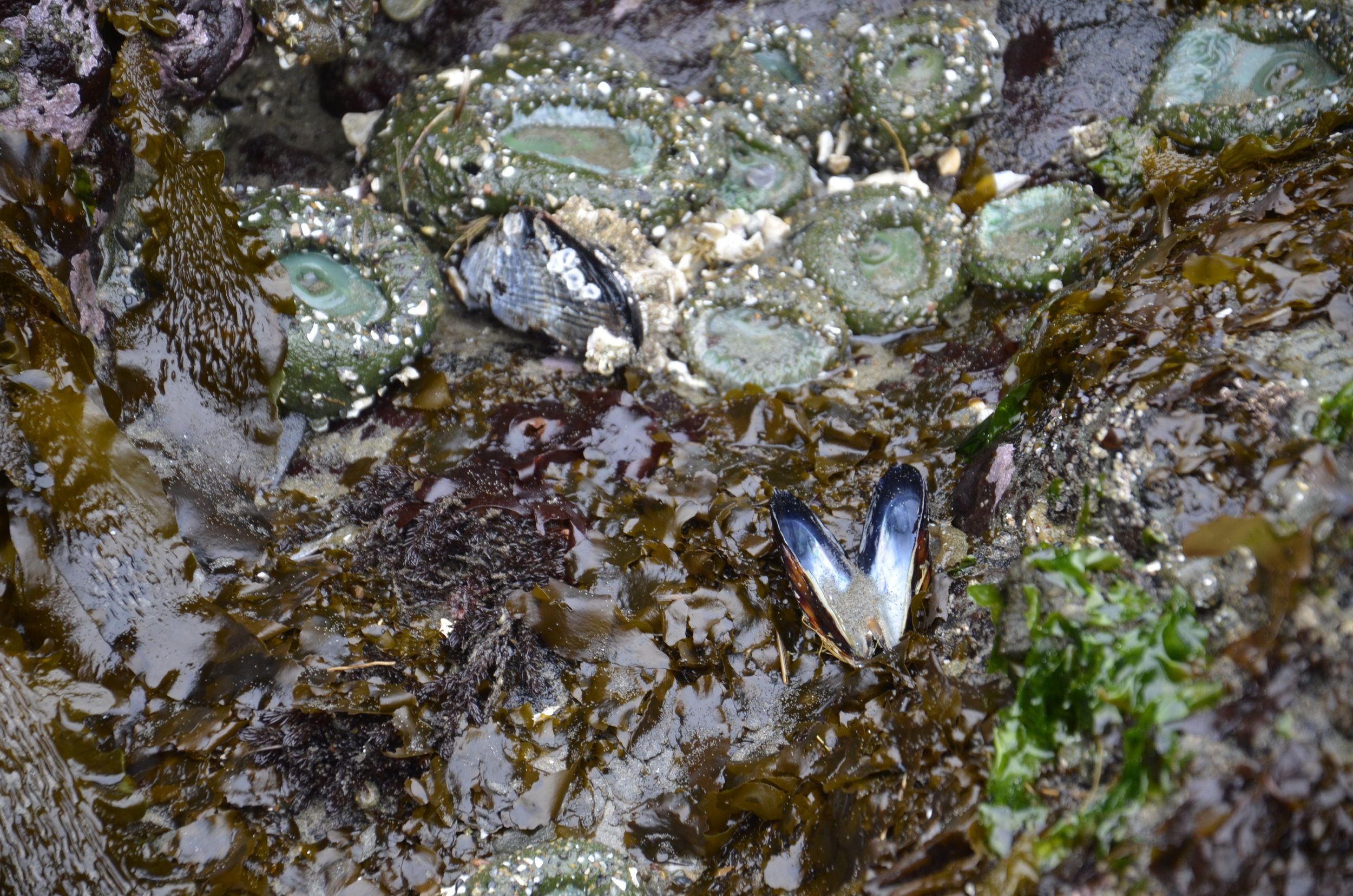
Exploring the tide pools was fascinating, since I'd never dive in these cold waters!

A bivalve shell among various types of seaweed and anemones

A bivalve shell among various types of seaweed and anemones

The open anemone in the water, with closed ones above it

The open anemone in the water, with closed ones above it

The rocks and seastacks are havens for seabirds and seals.  These black guillemots are in the family of puffins, but we didn't see any of the latter.  The guillemots (or murres) were all over the rocks and floating on the water in large groups:

They reminded me of penguins in their coloring and how they stood upright.

They reminded me of penguins in their coloring and how they stood upright.

_DSC2713.JPG

At one beautiful overlook we heard what we thought were seals barking, but didn't see any.  Luckily Steve reads all the signs (and I mean all!) and found that if we drove just a mile back the way we had come, there was a popular haul out point for several types of seals.  The volume of their calls was amazing.  The California sea lions (smaller and dark) and the Stellar sea lions (larger and tan) covered the closer beaches and rocks, but they were still at least 100 yards out.

_DSC2782.JPG

Harbor seals are more timid, and so stay further out from shore.  They are the smaller white and gray ones on the second tier of rocks, and there's even a youngster looking at the camera, just left of center:

_DSC2789.JPG

We stopped briefly at Oregon Dunes National Recreation Area, to take advantage of the gorgeous sunny weather, but unfortunately we couldn't stay and play, since we had miles to go before we could sleep. (apologies to Robert Frost)

_DSC2816.JPG

You can see the tectonic action at this site, along with evidence of water erosion on the rock surface:

_DSC2752.JPG

The coast interestingly became less sheer and rocky as we traveled north.  I didn't take any photos, because it was less picturesque.

On our last day, we actually backtracked about 30 min. to get to Haystack Rock south of Astoria, because we had to "rush" to get to our B&B the previous night for check-in.  We finally had the usual rain of Oregon, so we literally stopped just to get a picture, and then drove on to Portland to meet friends.

_DSC2839.JPG

Interesting tidbits:  In the town of Tillamook, the sports teams are named the Cheesemakers (won't that strike fear in the hearts of opponents?).

Several small towns reminded us of Myrtle Beach, SC (with too many tourist/kitschy shops and attractions) but with cannabis outlets.

Our next post will be from Fiji in just about a month.

Here's looking at you, kid.

_DSC2820.JPG

California redwoods & Oregon elk

Unbelievable! and Wow!  Those were my mantras throughout our drives and hikes amidst the redwoods.  Avenue of the Giants is a meandering parallel to Highway 101 that extends 31 miles through the heart of Humboldt Redwoods State Park.

Steve shows scale of both width and height of these trees

Steve shows scale of both width and height of these trees

These giants have been here for anywhere from 600 - 1000 years.  As you can see in the next picture, the trunk is starting to encroach on the road (at the left side of the turn).  We drove through a number of narrow spots, that sometime in the future might need to be made into short one way lanes.

_DSC2555.JPG

The forest floor is covered with ferns, because that's the only thing that survives in the deep shade and high moisture.

_DSC2574.JPG

If a redwood splits or undergoes some major stress, another can grow up from the base of the original, and they've been tested to have the same DNA.

_DSC2572.JPG

Steve got the money shot of the trip:

IMG_20180402_153039.jpg

And now, on to the elk.  We stopped at various state parks in both California and Oregon, with sites named Elk Meadow and Elk Valley, always on the lookout, but repeatedly disappointed.  On one hike we saw:

_DSC2591.JPG

...but alas, no elk.  I was reading ahead on our map and itinerary, and found one of the last spots to mention elk, so we decided to try one last time. 

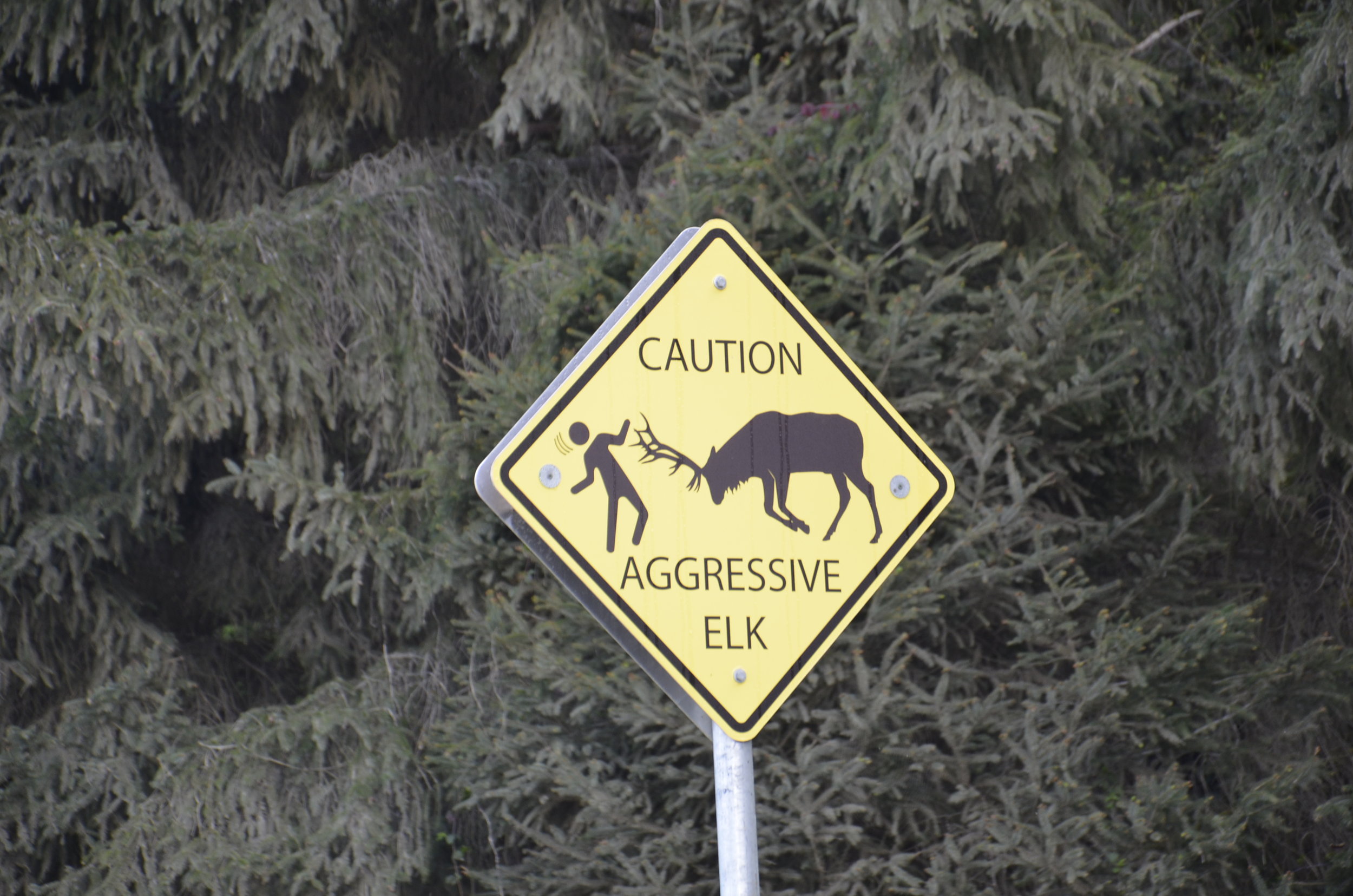
With a permanent sign and concrete benches along a paved walkway, I figured this was a safe bet.

With a permanent sign and concrete benches along a paved walkway, I figured this was a safe bet.

_DSC2804.JPG

The picture above is without any magnification at all.  It was like taking pictures of cows in a field, for all they were bothered by the people standing in the parking lot 50 feet away!

_DSC2798.JPG

The velvet on the emerging antlers was cool to see, and the birds sitting on the rumps made me smile.

We tried to hike in Fern Valley, right near the border of California and Oregon, but the creek running through it was too high.  To illustrate the dampness all around, the trees were covered in hanging moss:

_DSC2585.JPG

Next post is going to focus on the coast:

_DSC2610.JPG