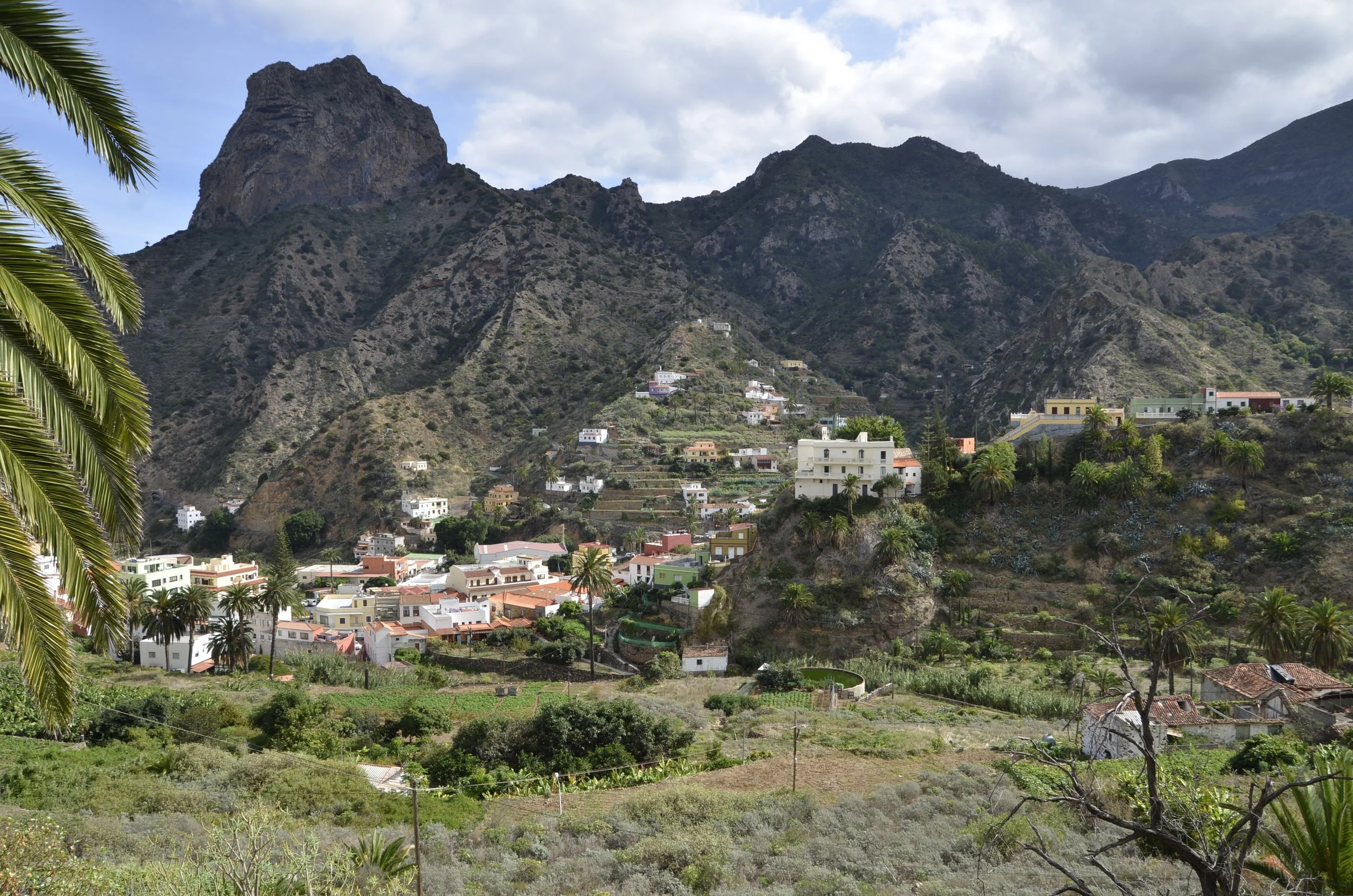
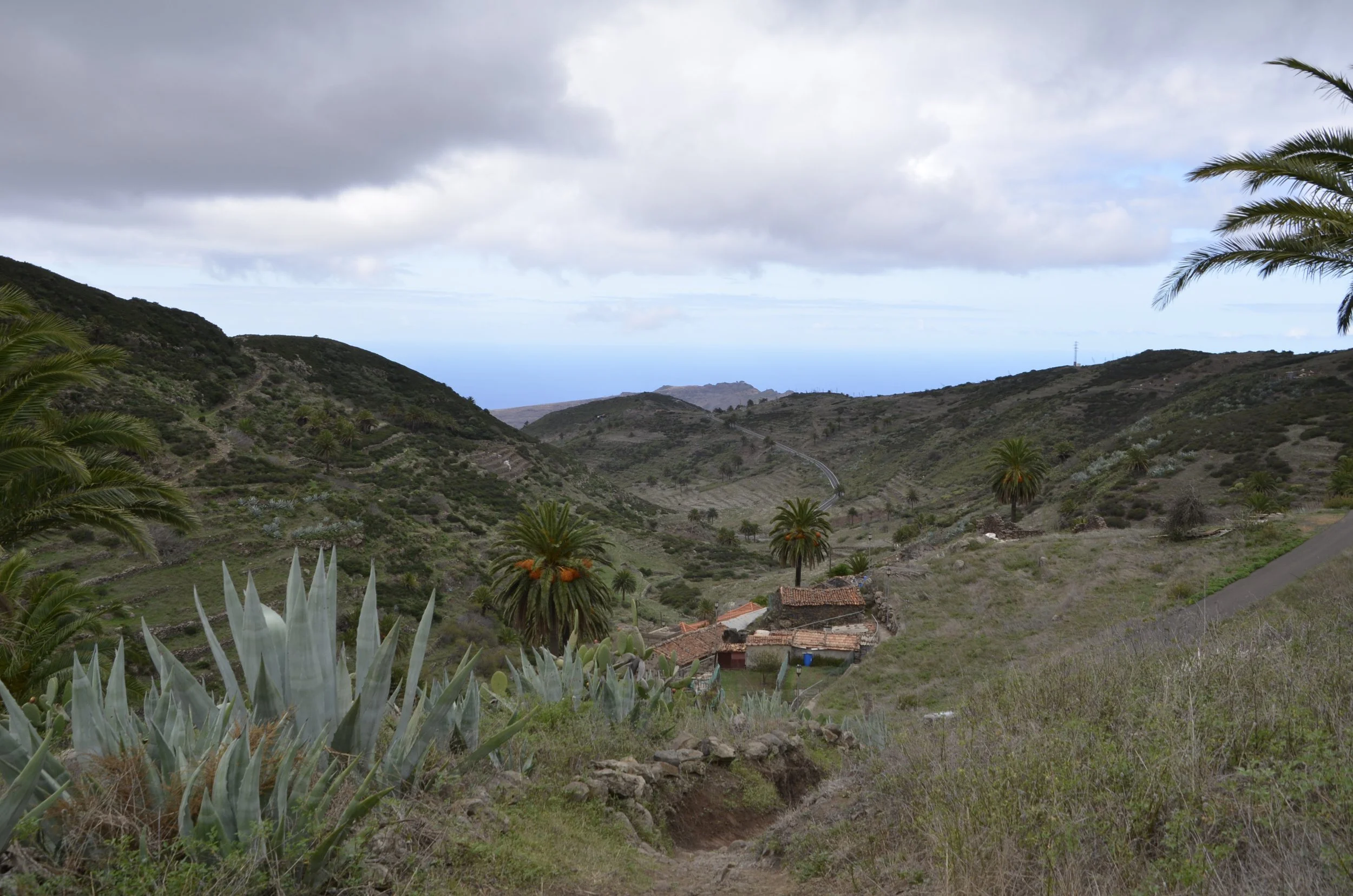
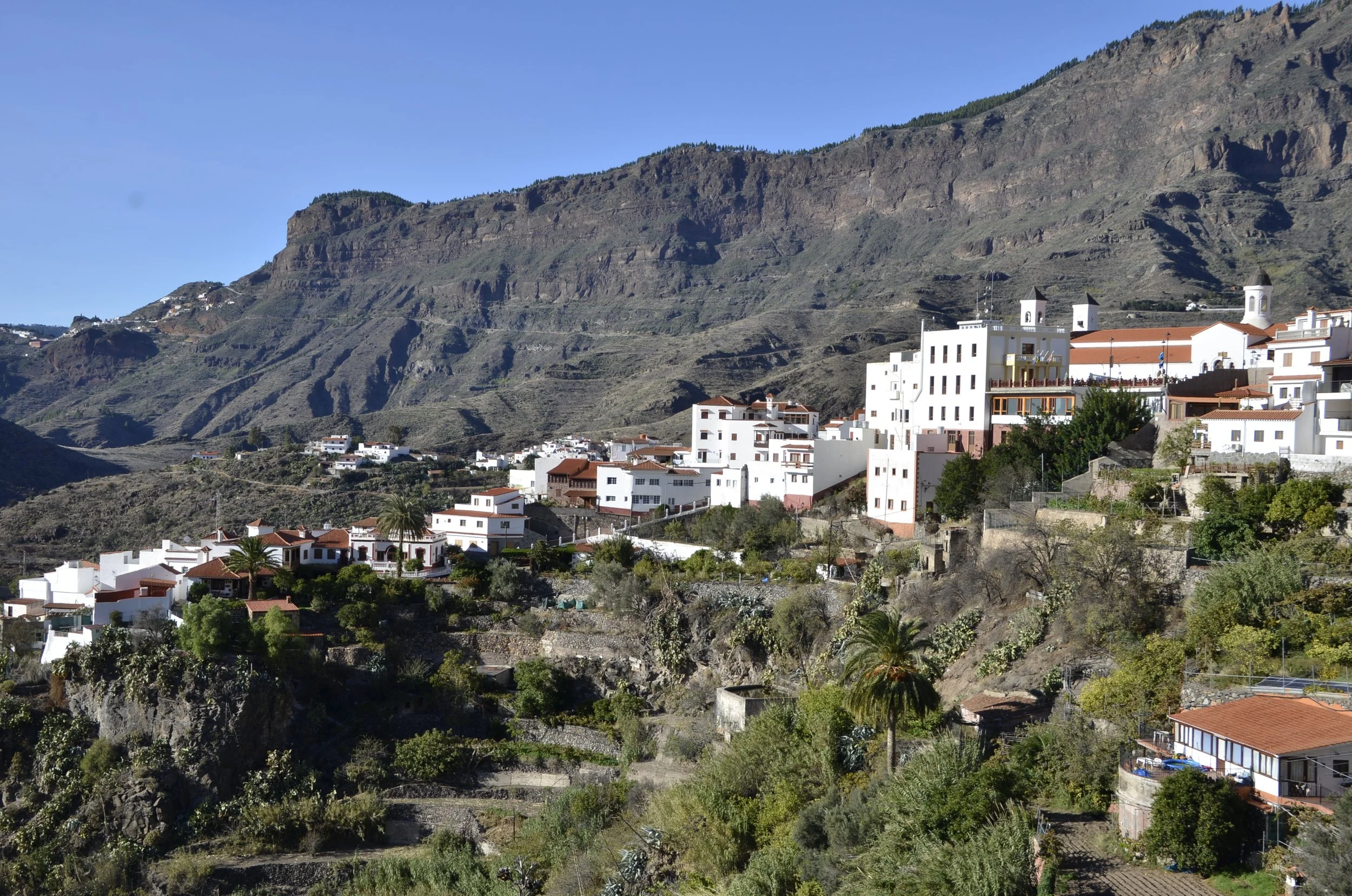
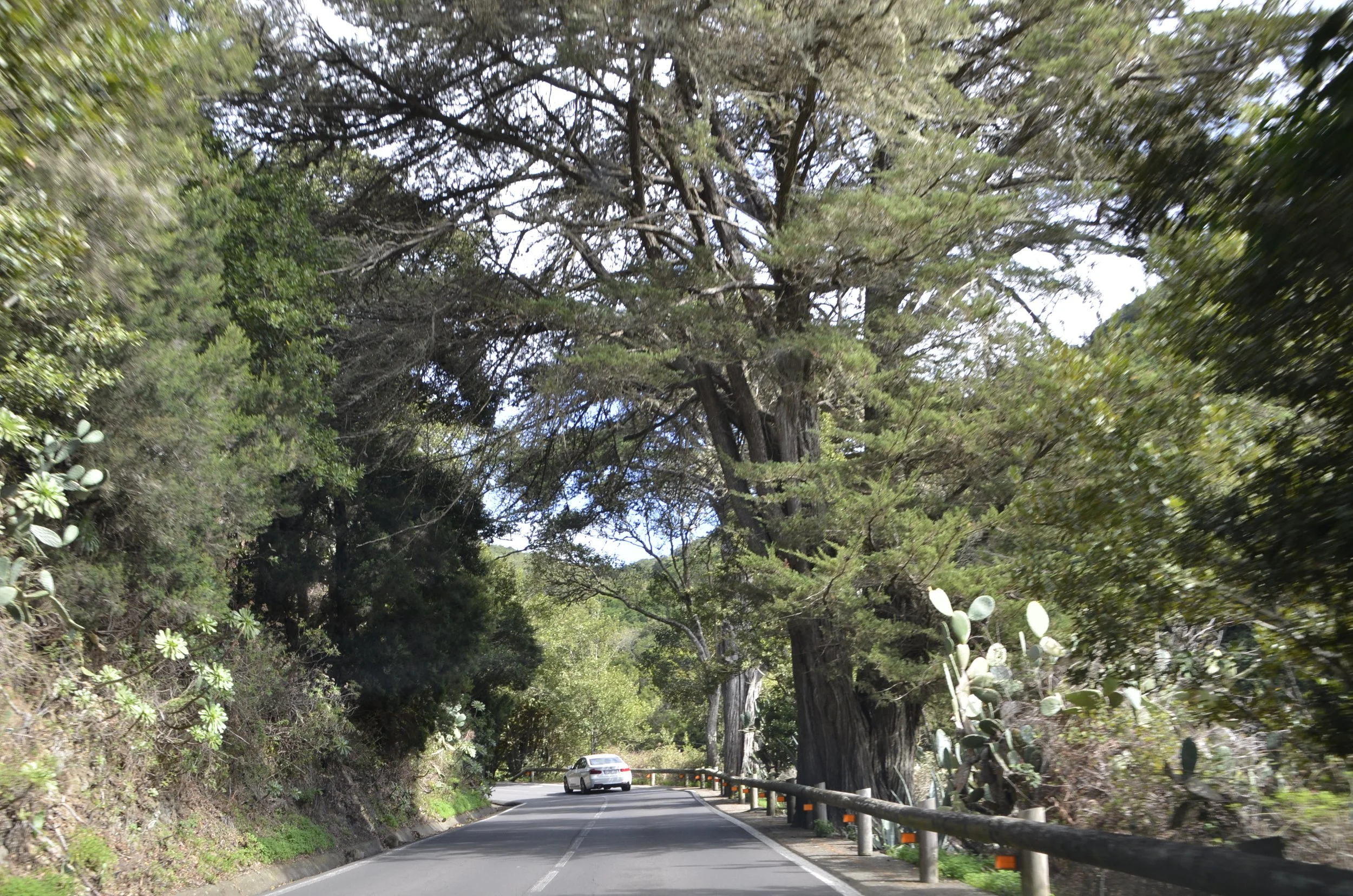
Tenerife Return

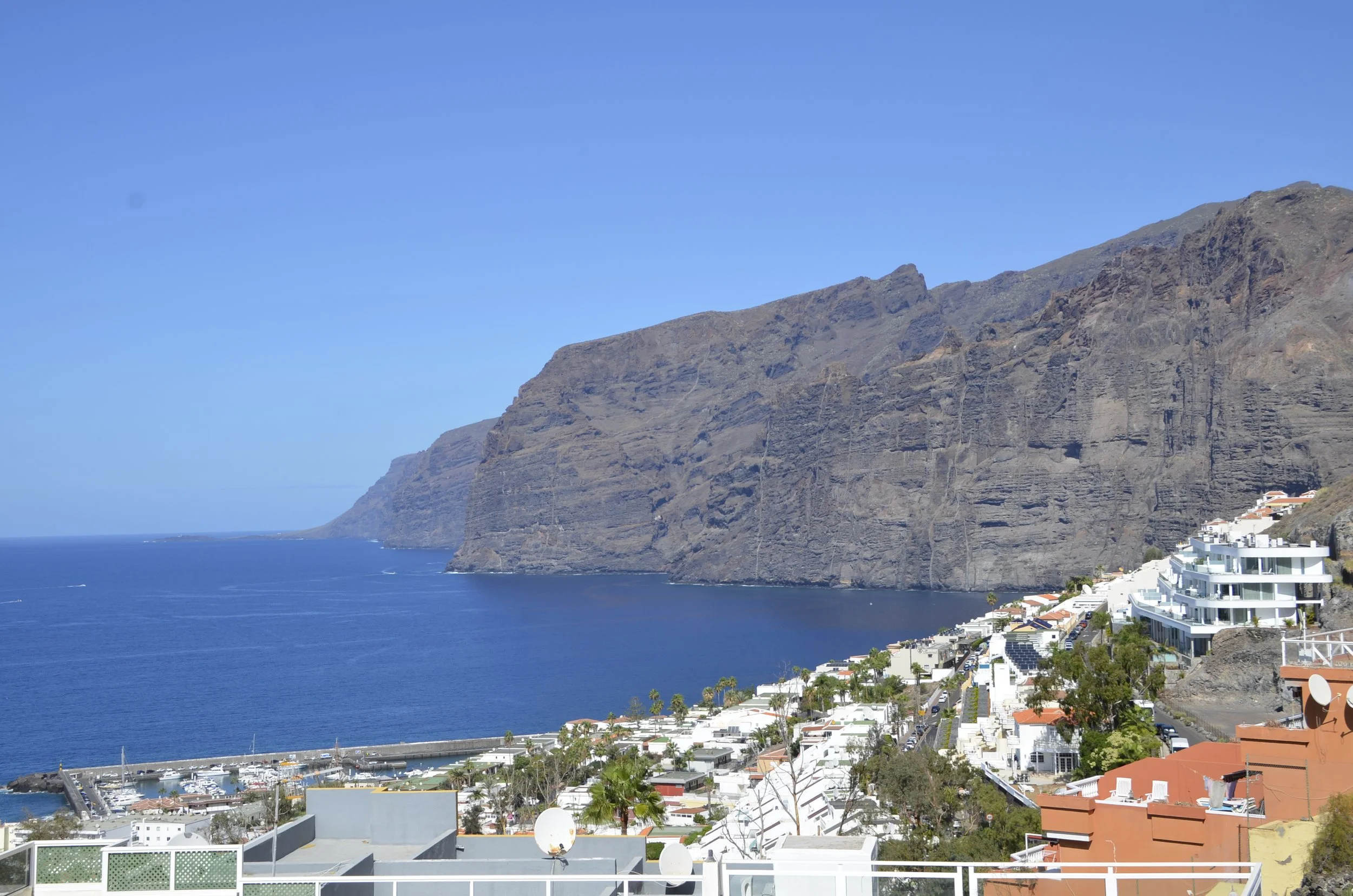
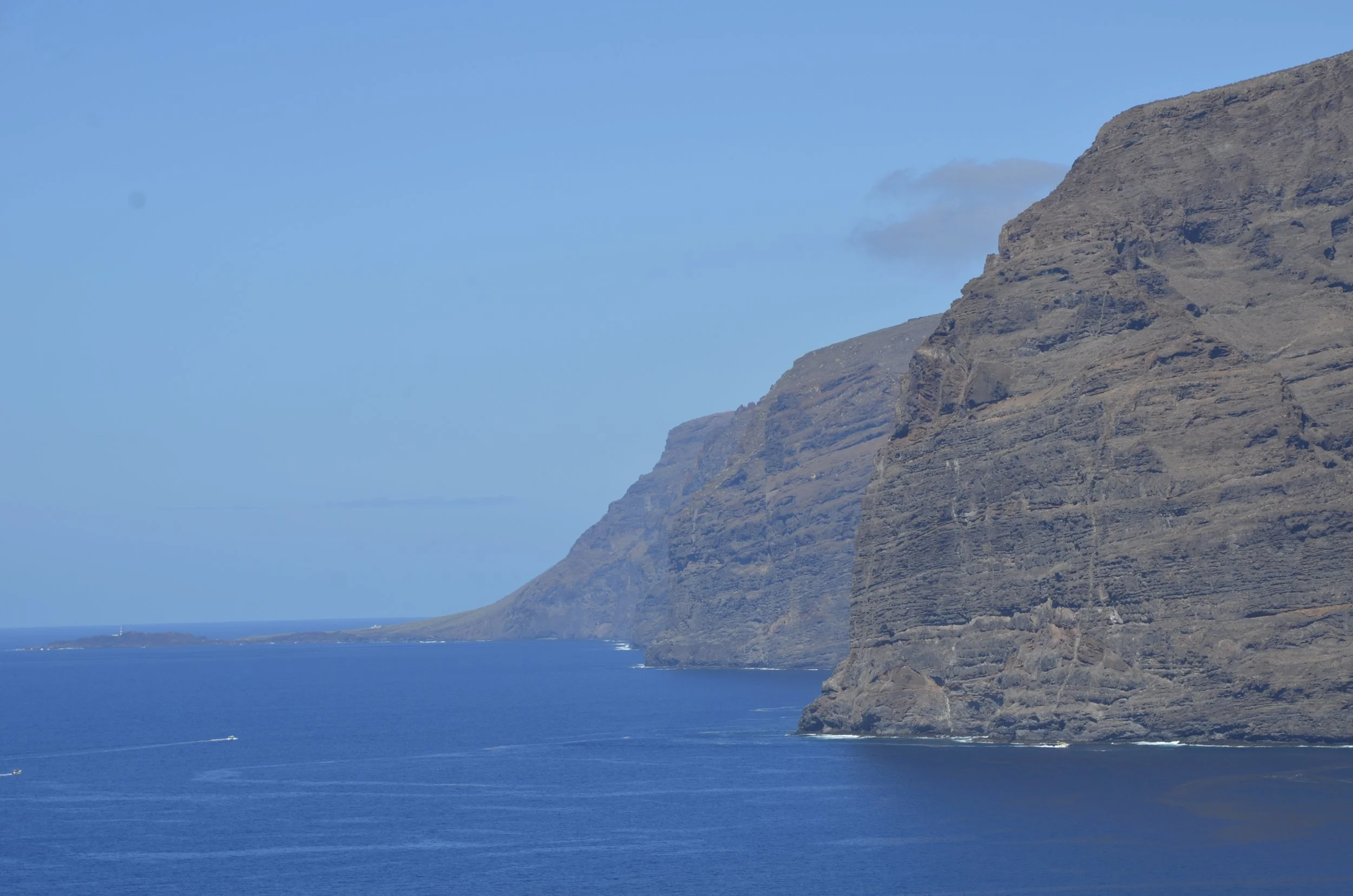
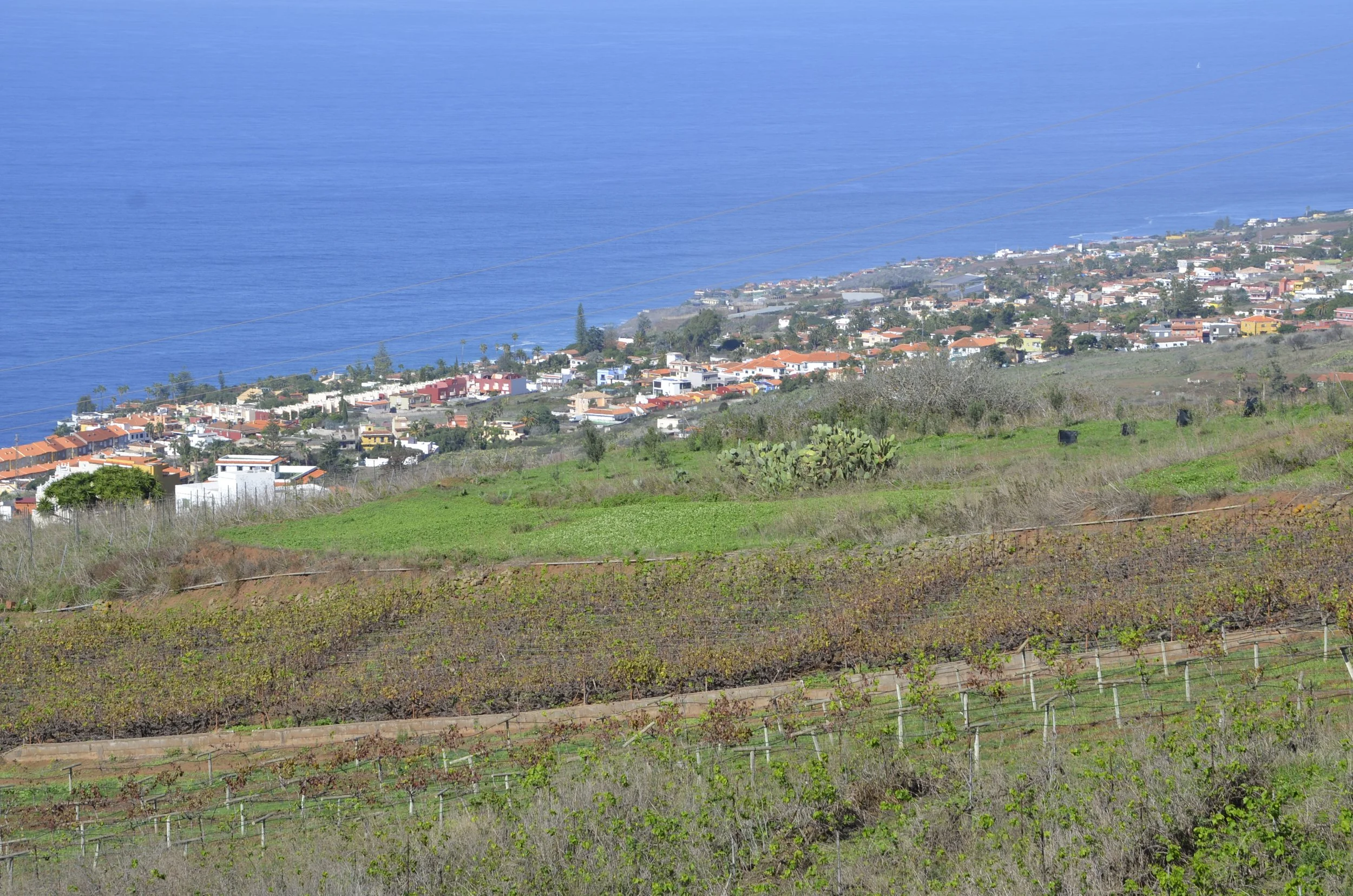
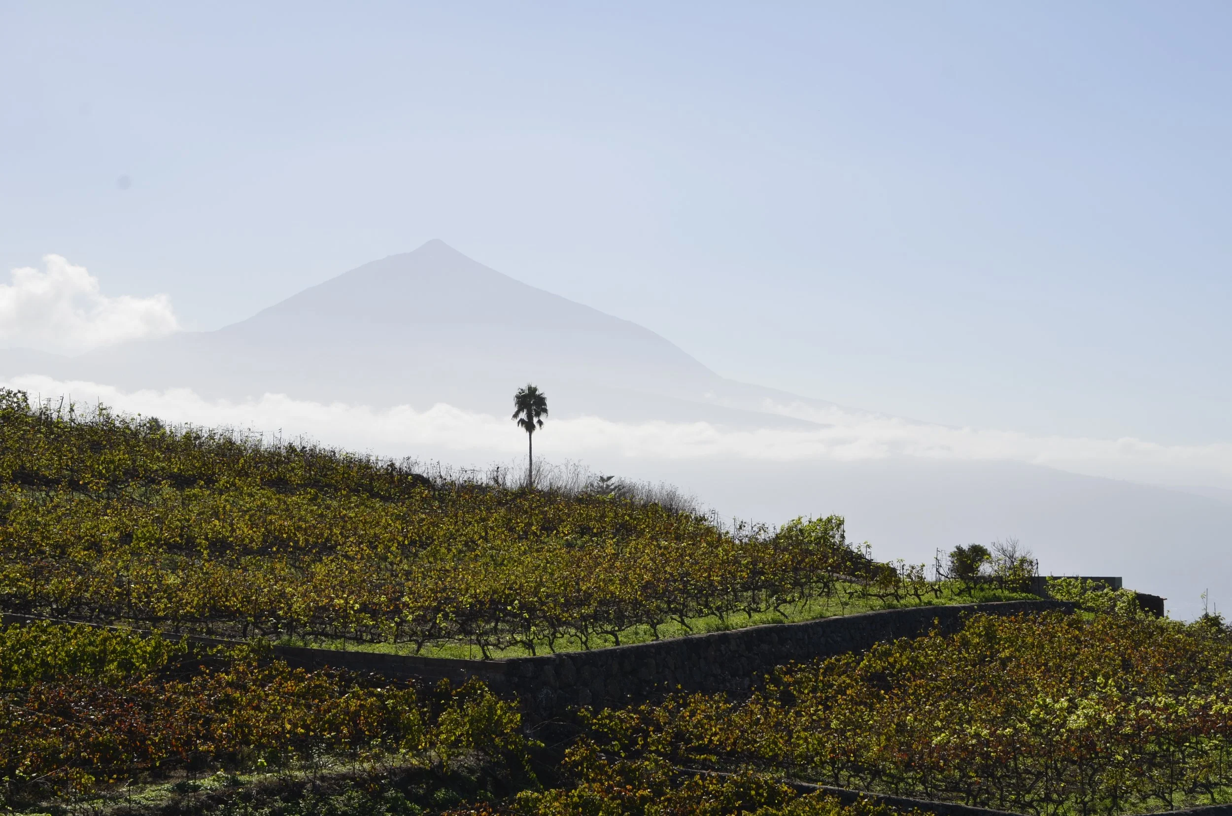
Since we were flying home from Tenerife, we came back and chose to stay on the south end of the island, both for proximity to the airport, as well as to hike in Teide National Park. Mount Teide is the conical peak of a volcano that is visible from some of the other Canary Islands, like Gran Canaria…

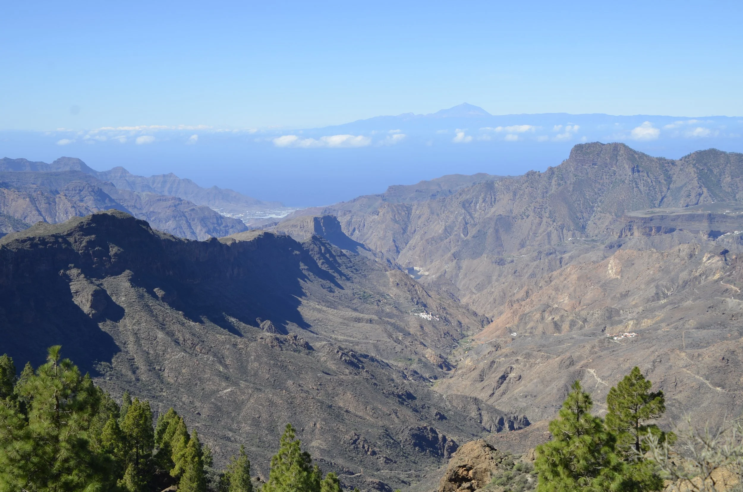
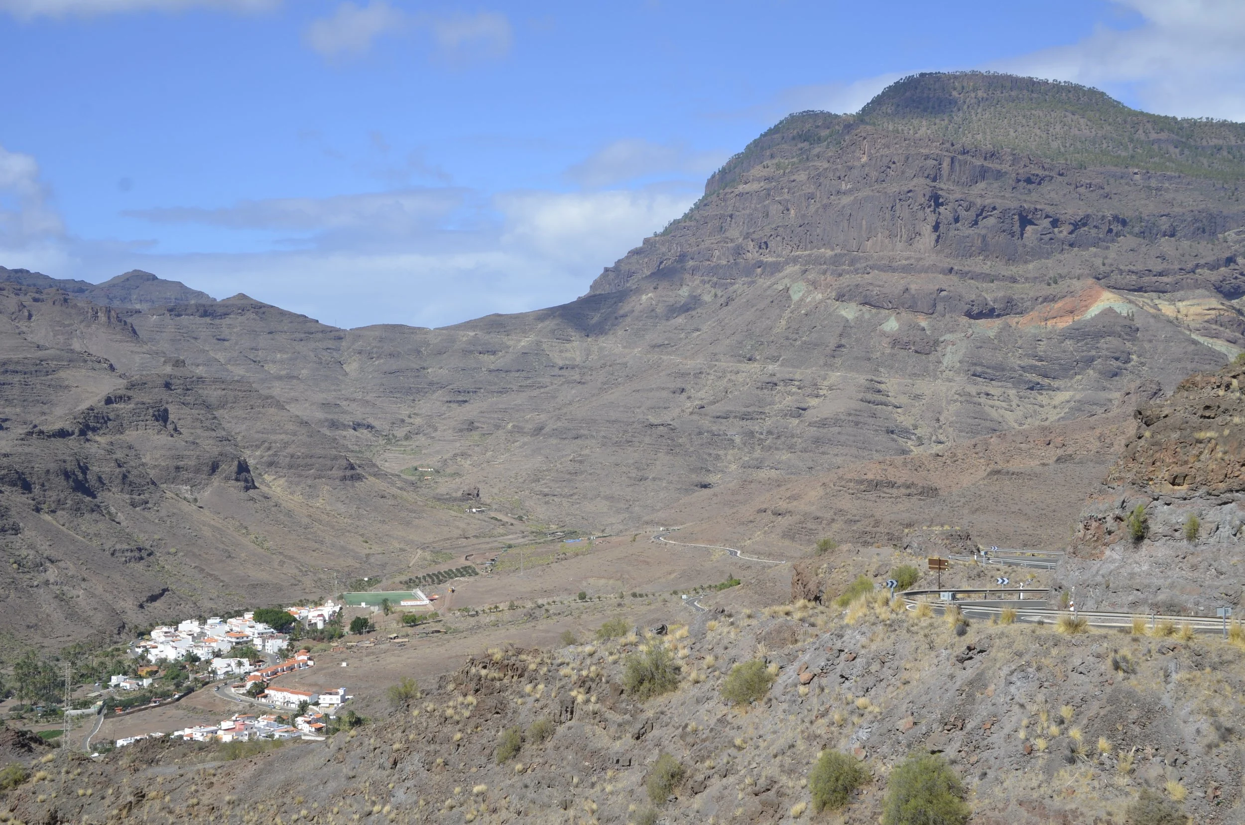
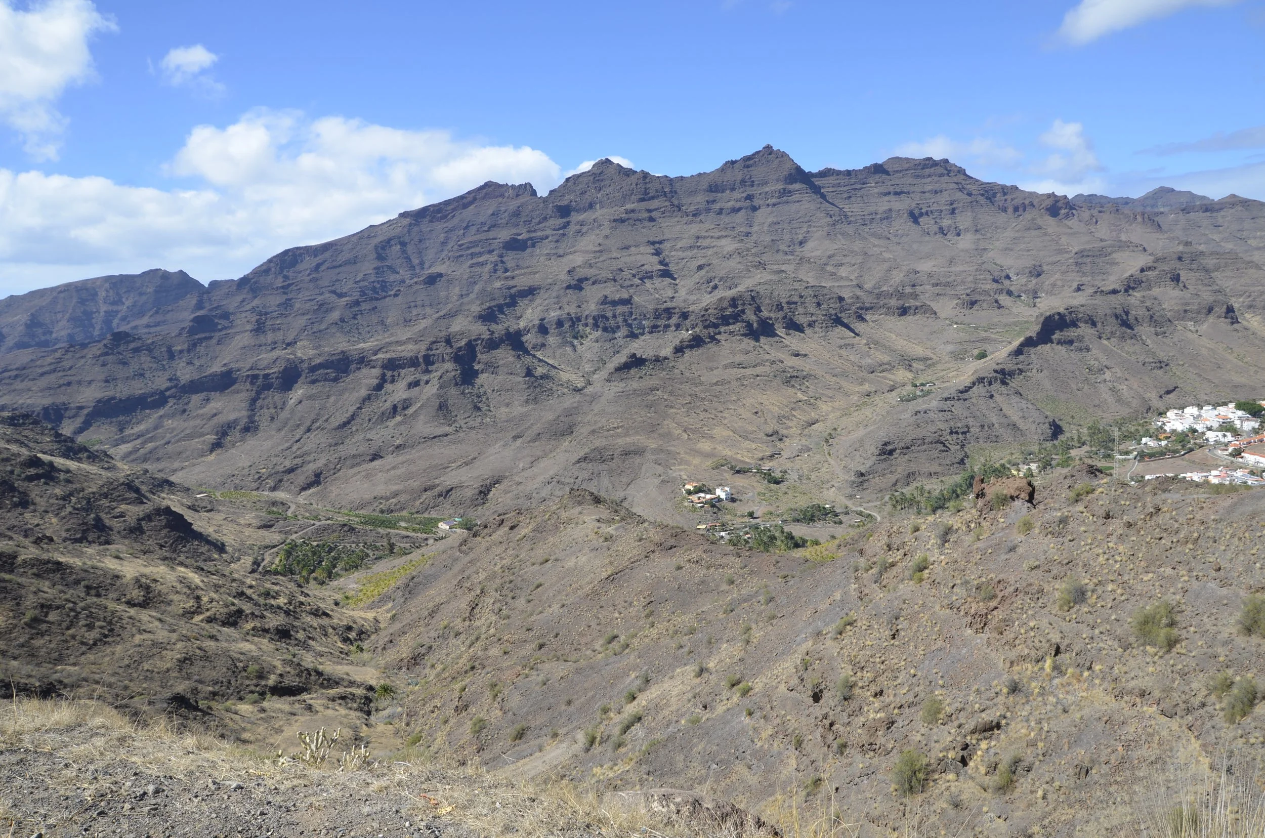
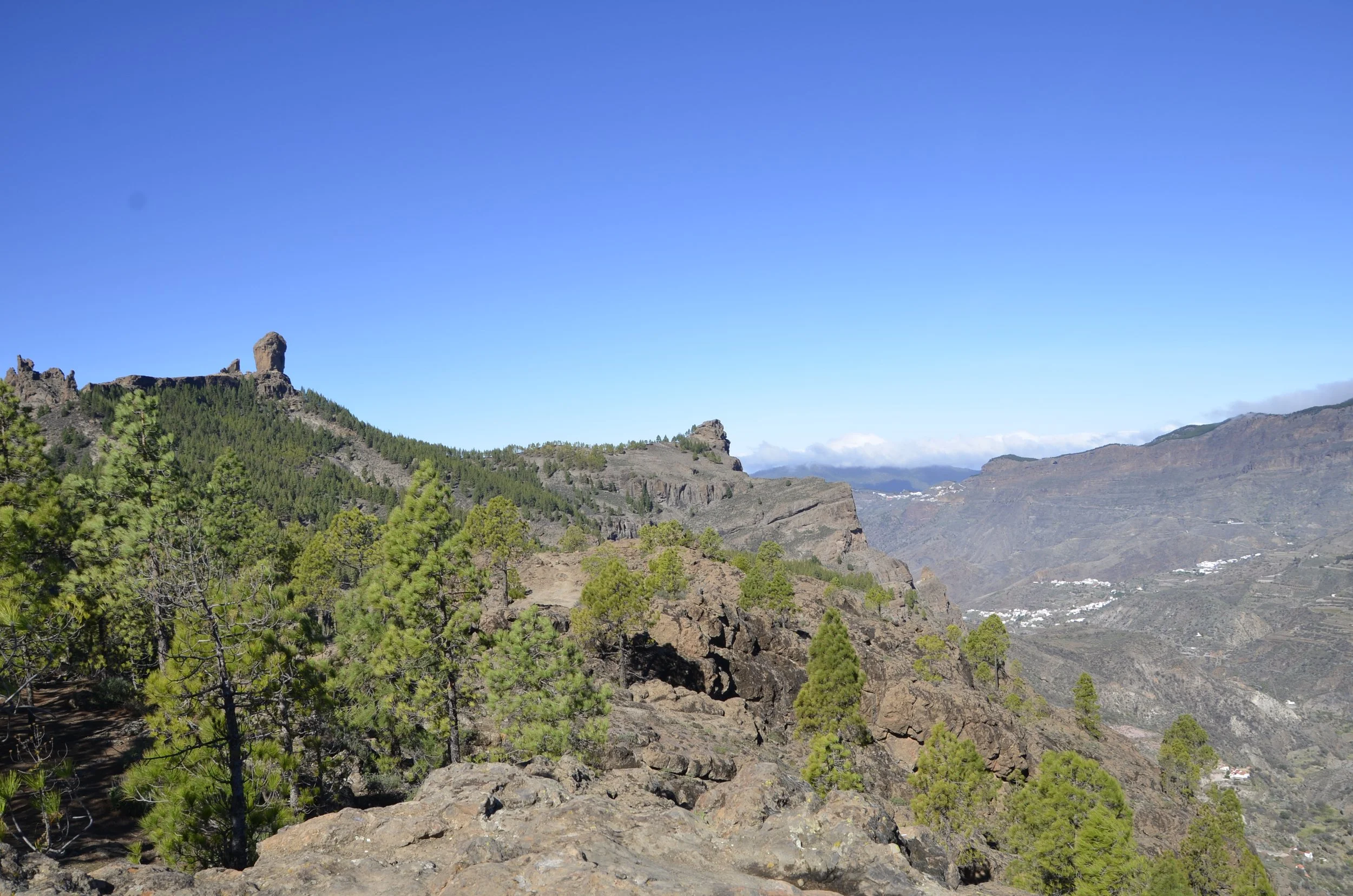
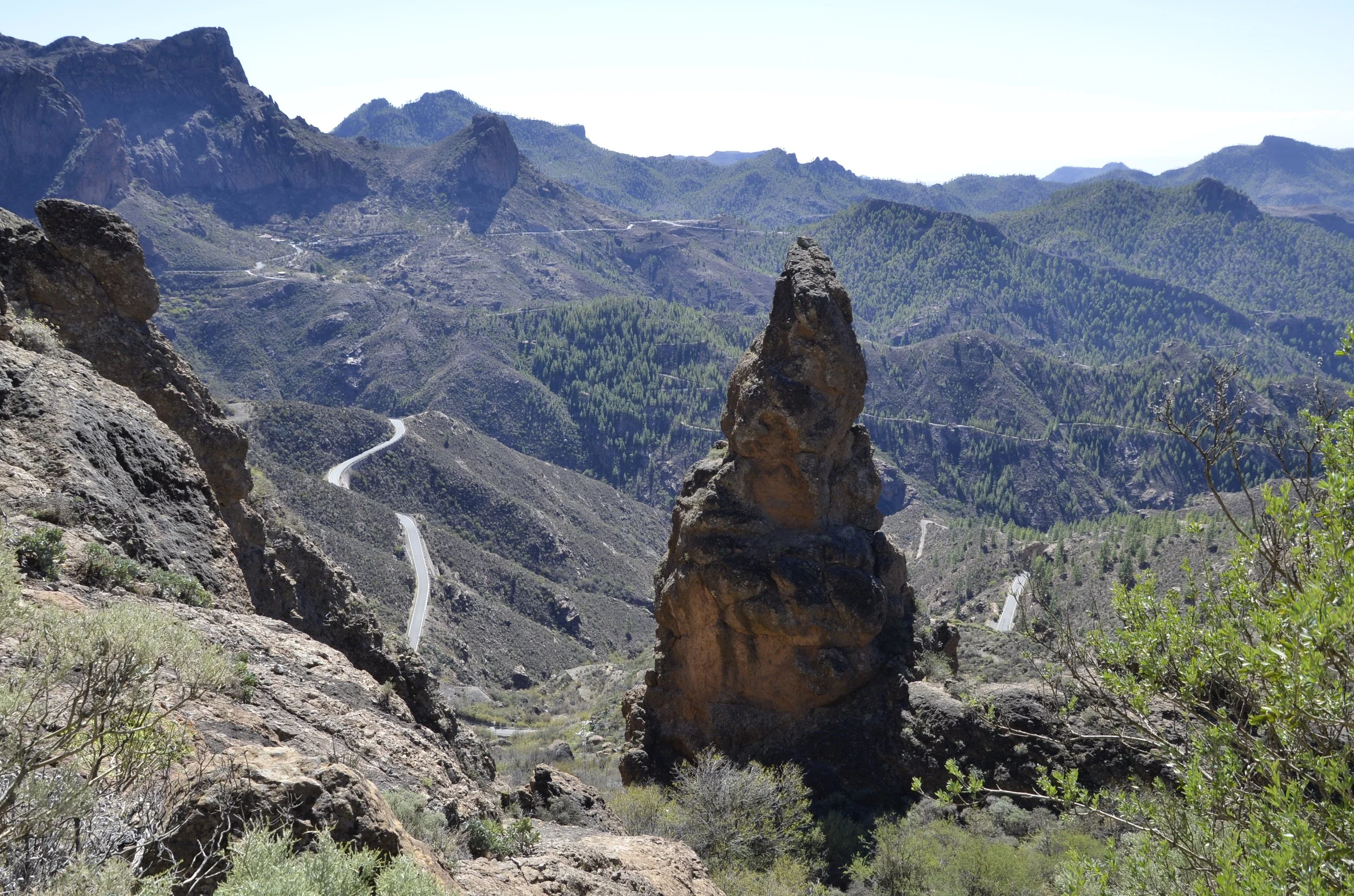
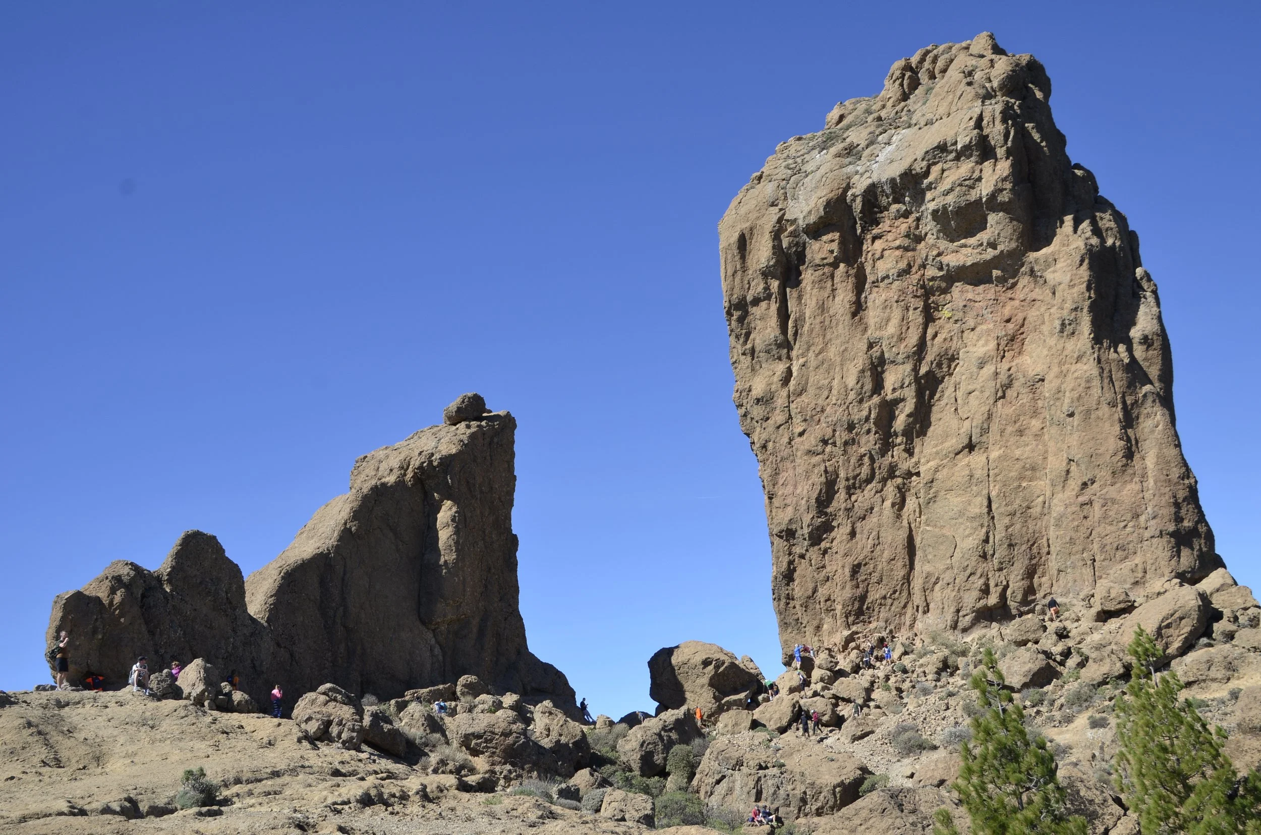
we saw it on the horizon when we hiked up to Roque Nublo

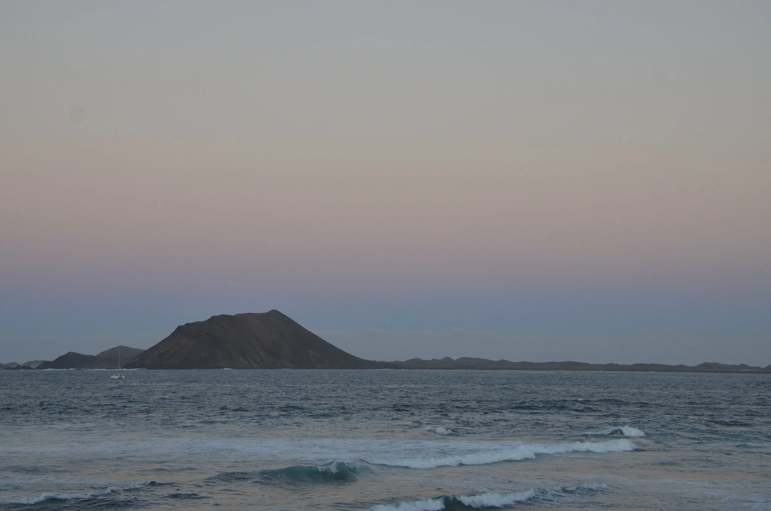
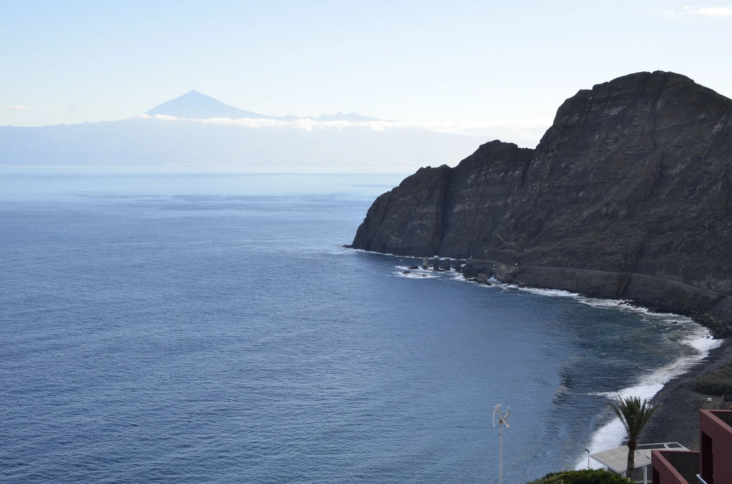
… and very easily from La Gomera (the last island we just came from) -

The peak is at 12,188 ft and is the highest point in Spain, as well as all the Canaries. We had not planned on hiking that mountain, but one near it, for some awesome views. I had read reviews that sunrise light on Mount Teide is beautiful, so I dragged Steve’s butt out of bed, and we drove up very curvy roads in the dark. As we got near, the horizon was lighting up -

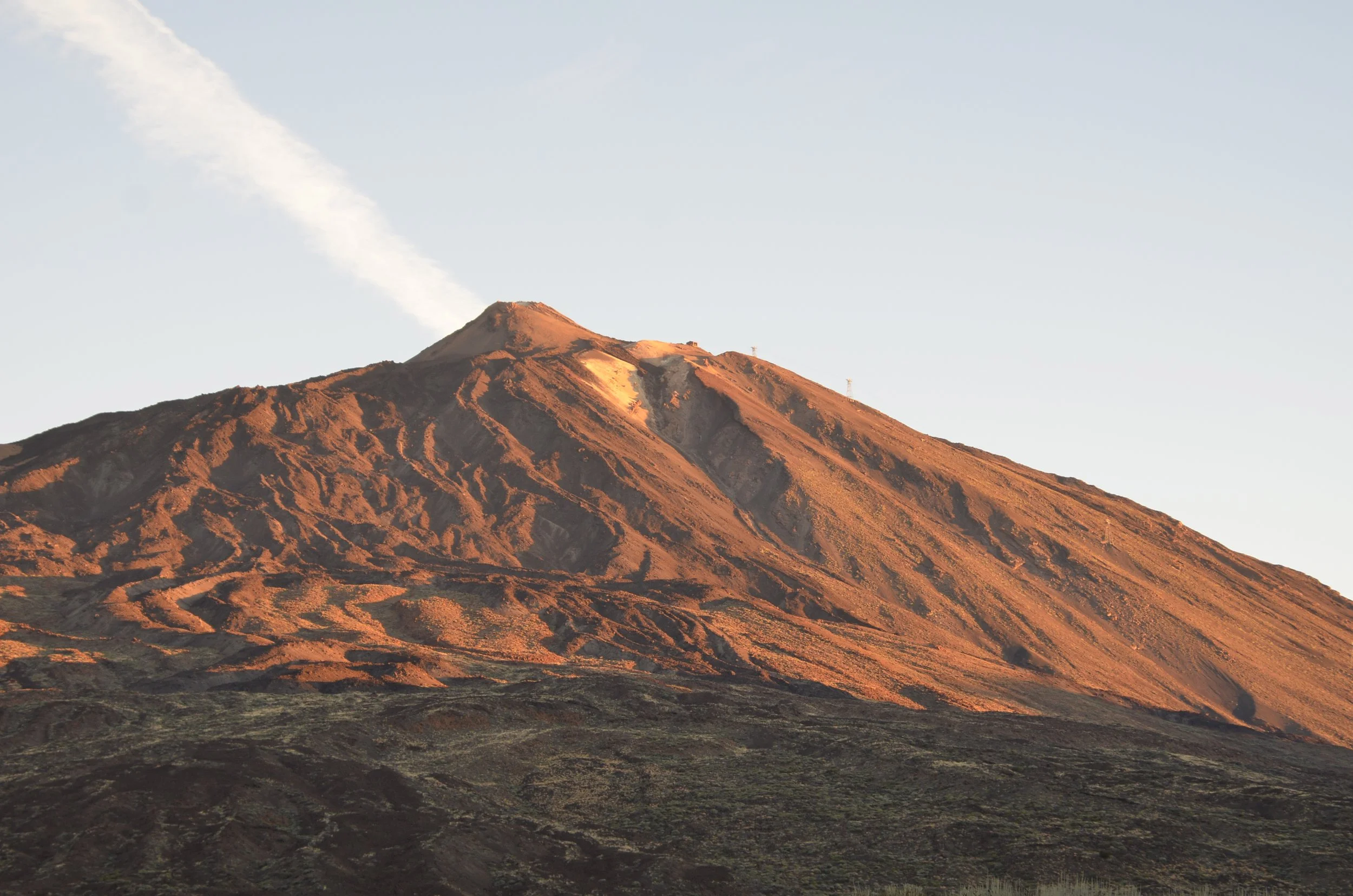
As we came around the corner and saw the volcano for the first time, we found that we had timed it perfectly -

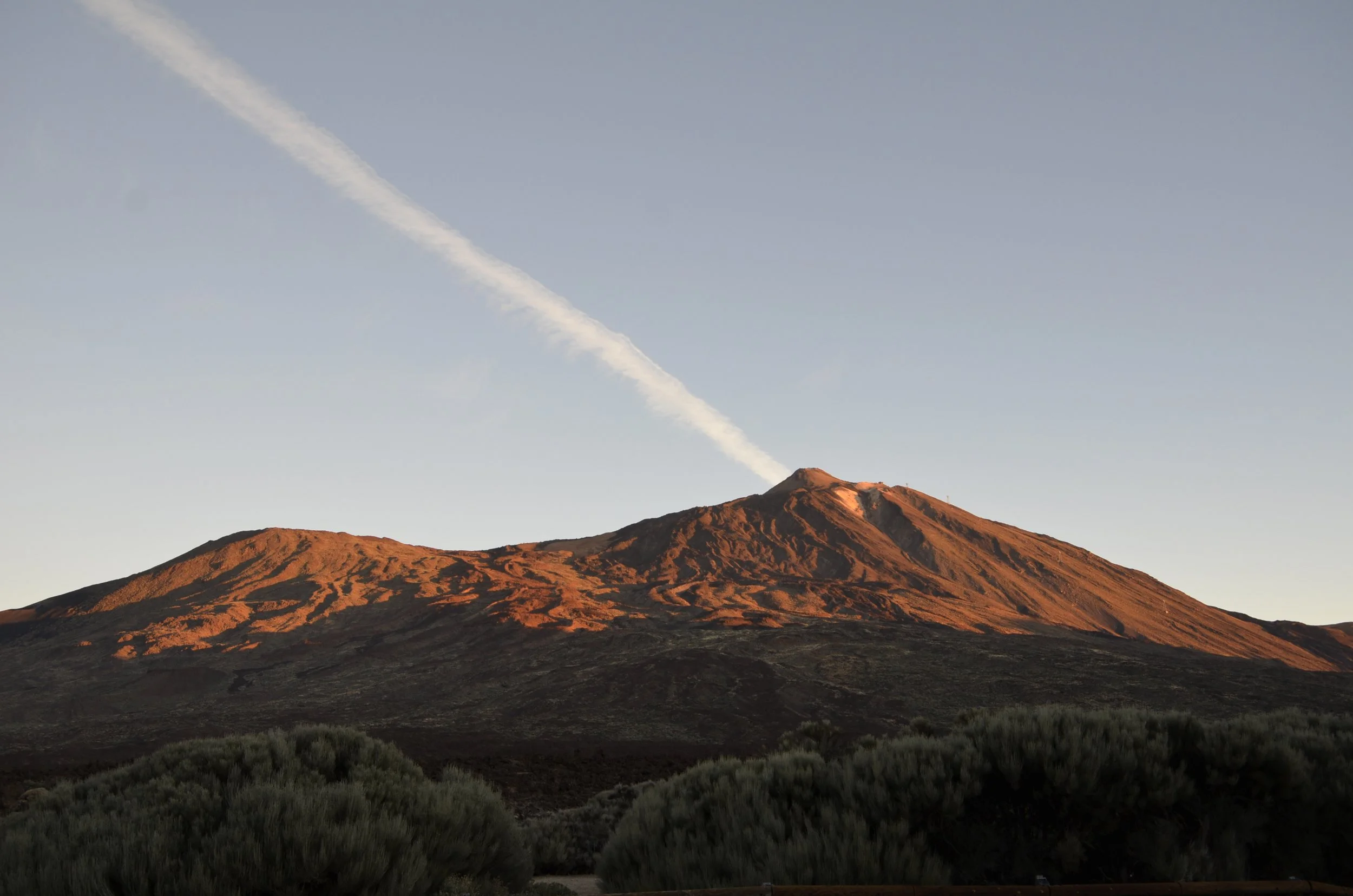
It was really cold (35 degrees), and we sure weren’t used to that on this sunny island trip!

We got to our trailhead and found a sign saying it was closed on Mon/Wed/Fri because they were hunting/culling wild sheep. Yep, we were there on Wed.

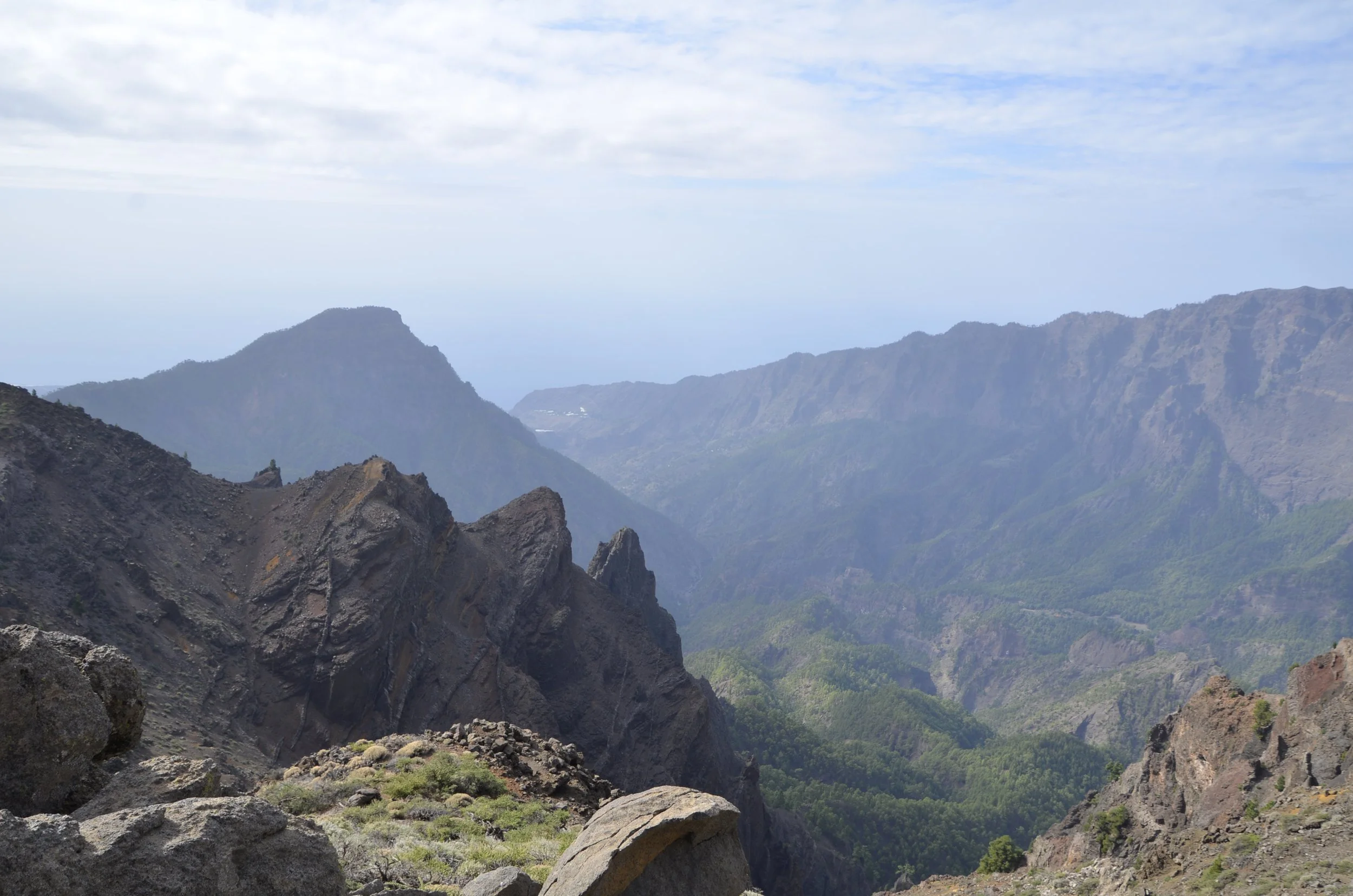
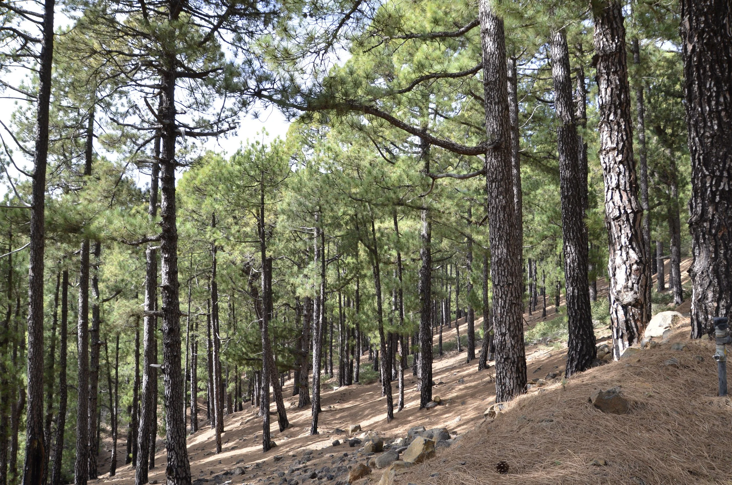
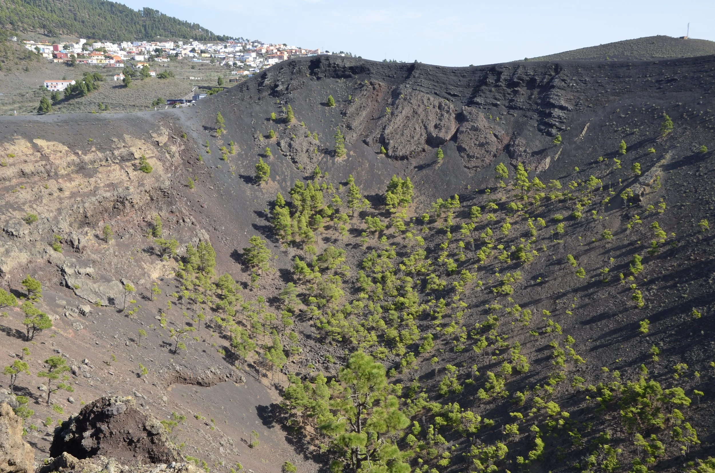
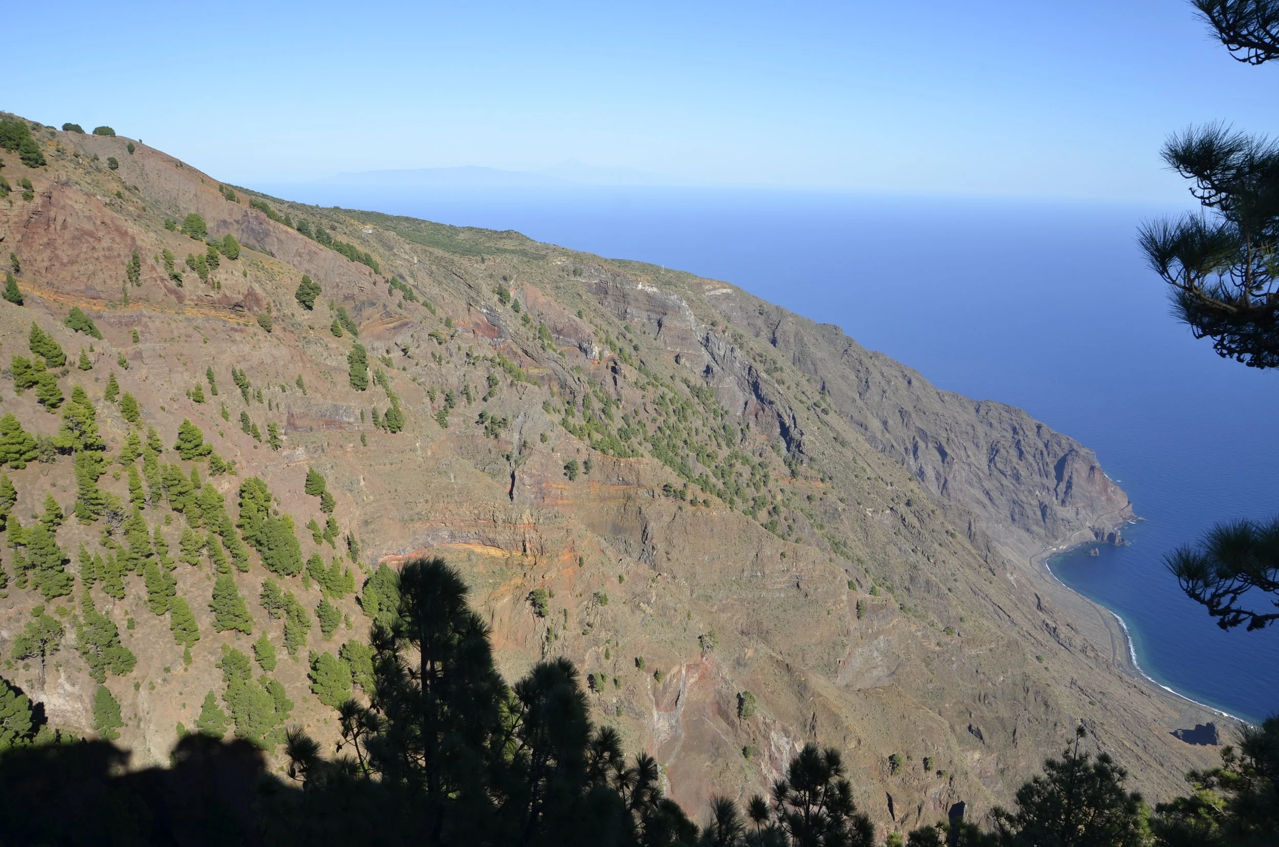
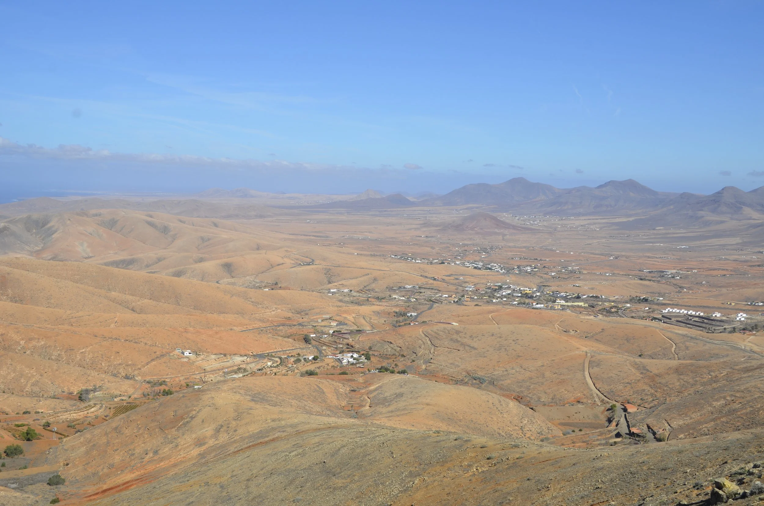
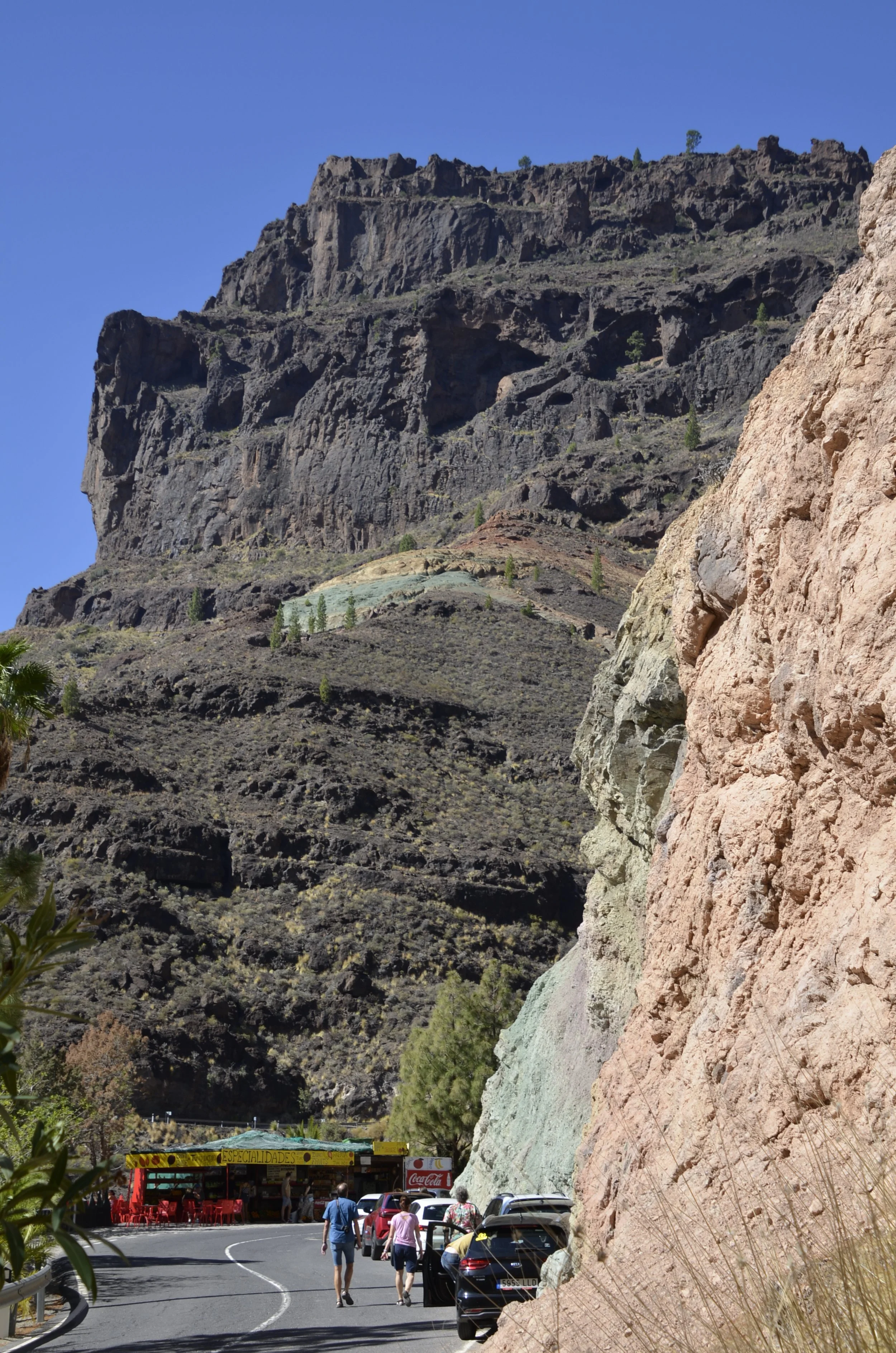
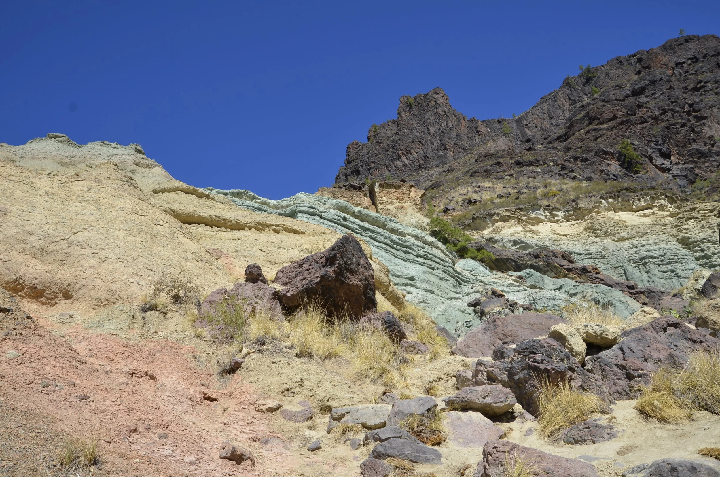
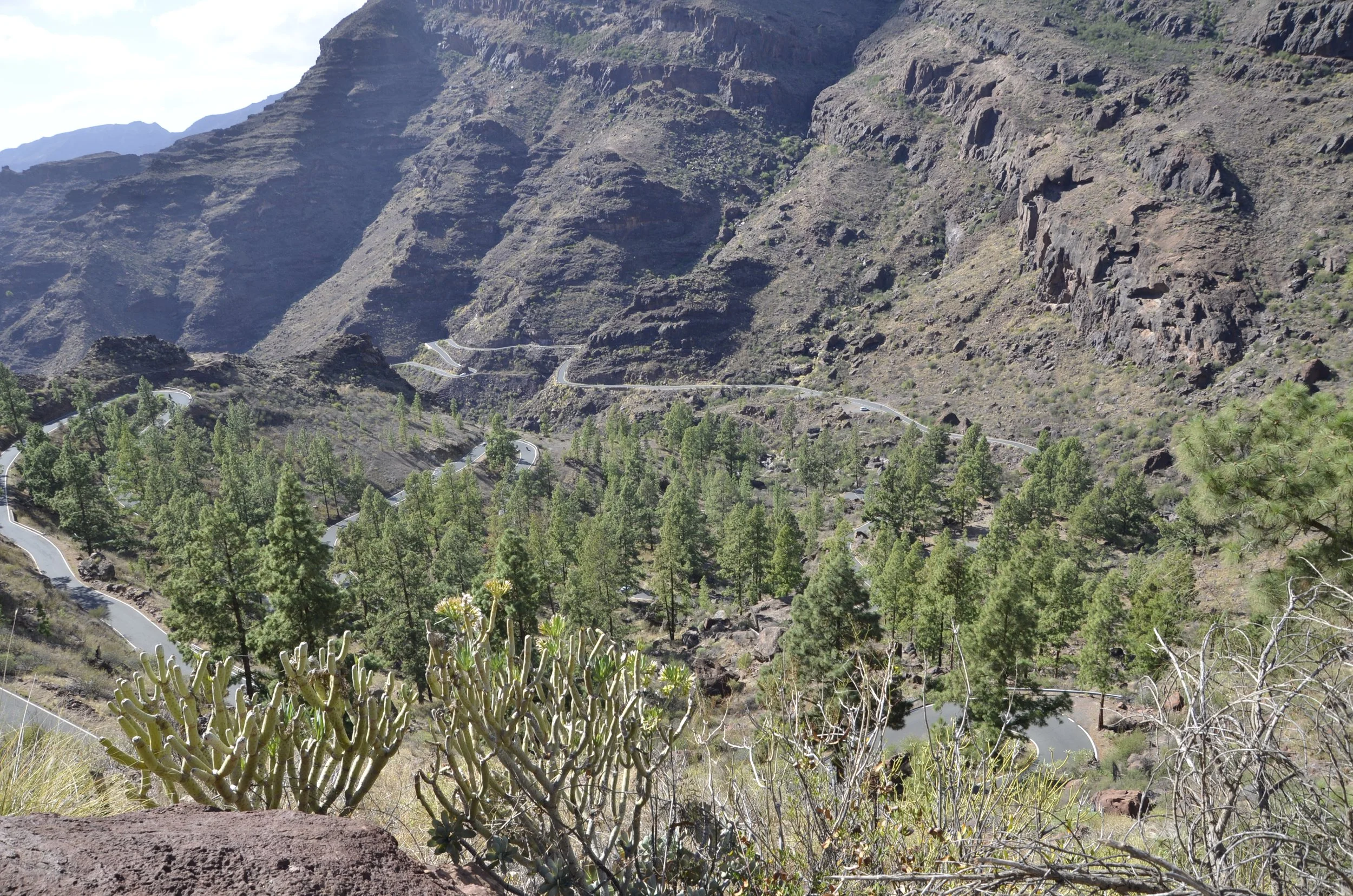
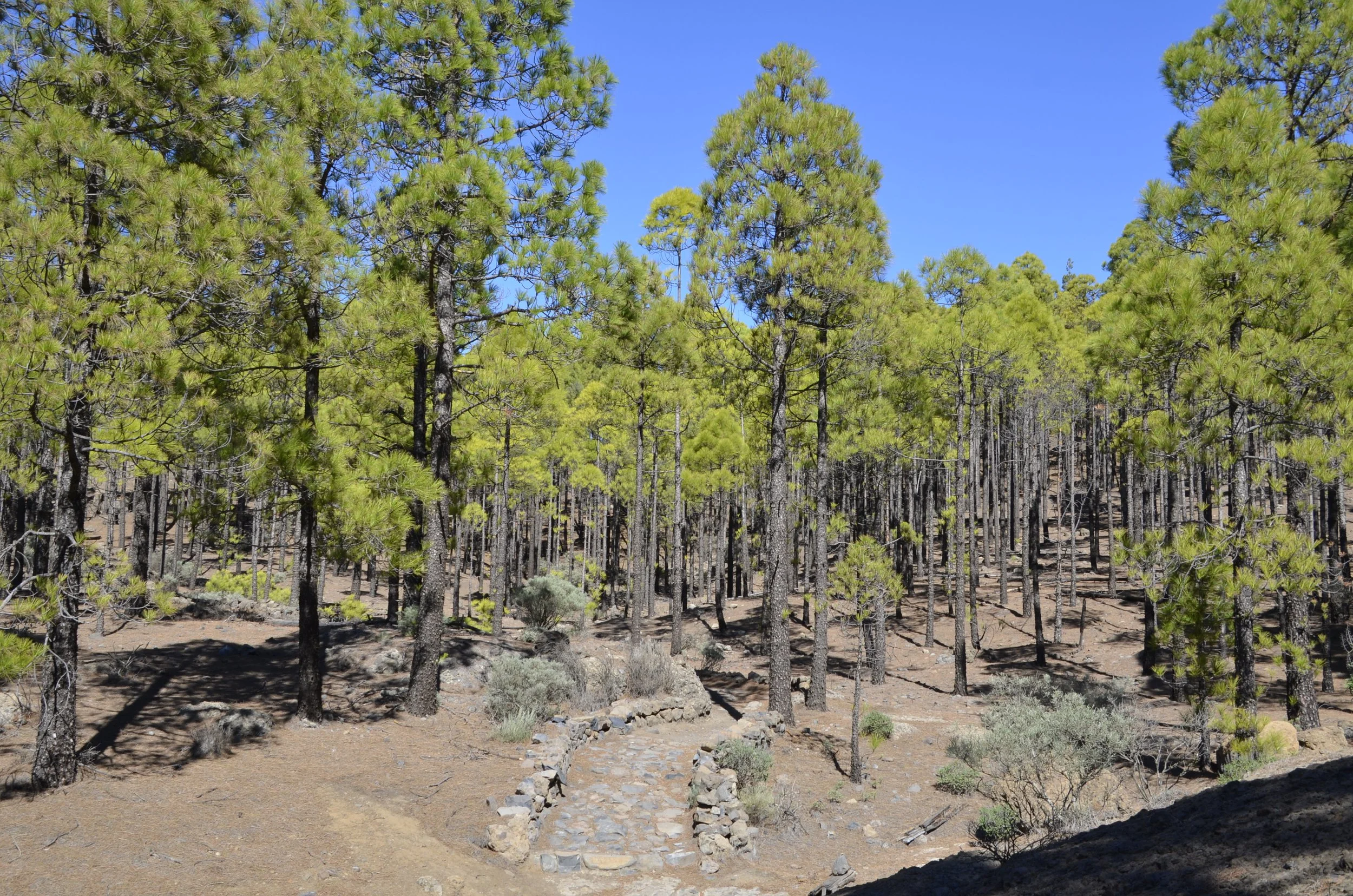
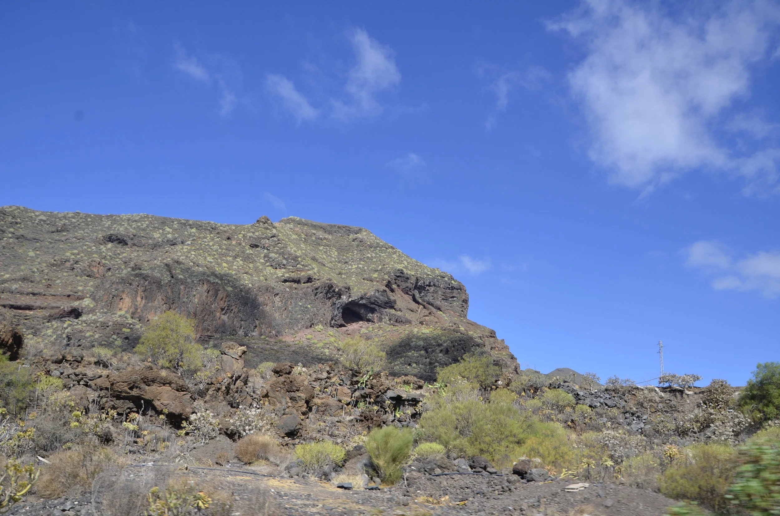
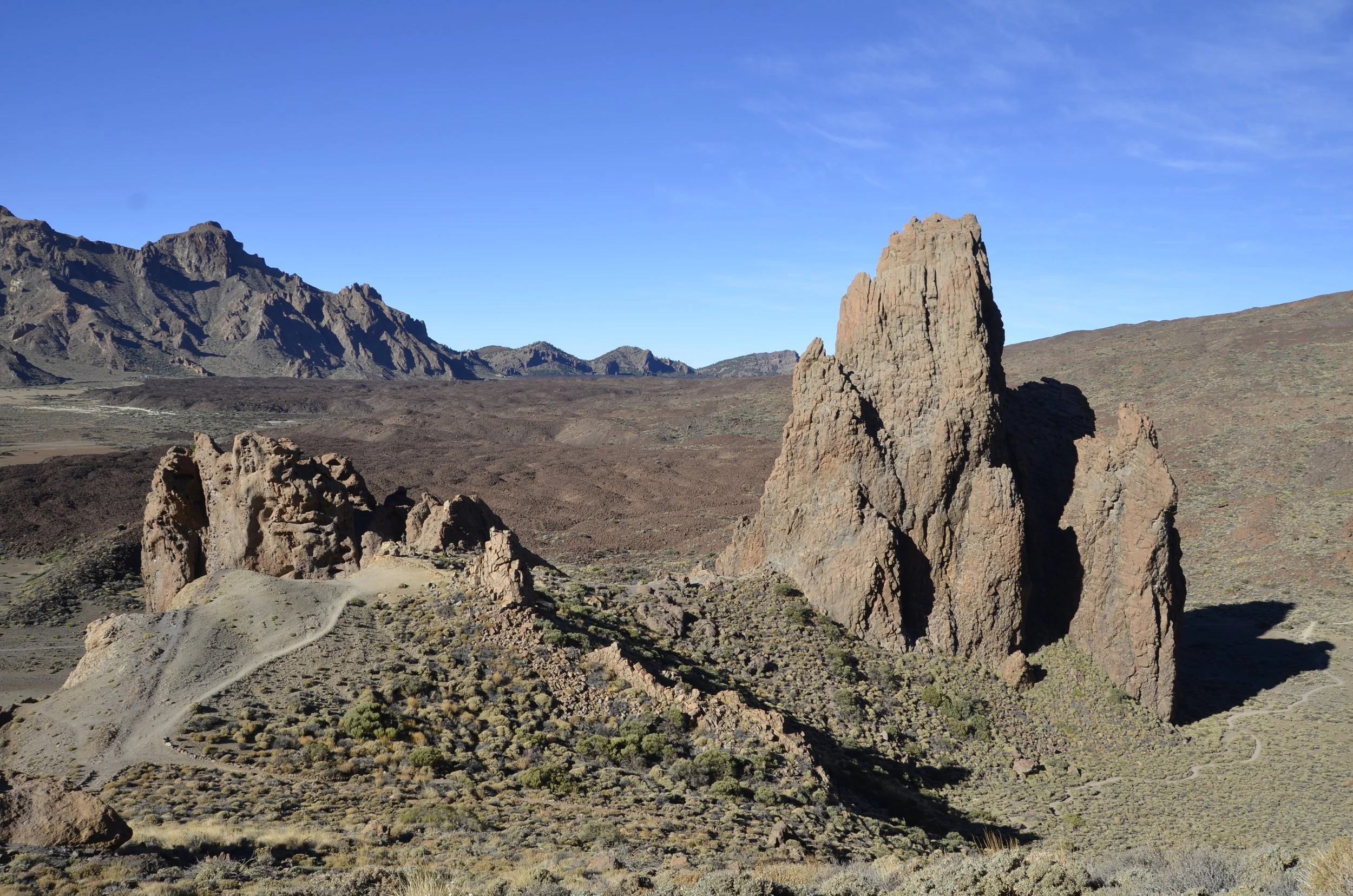
We scouted around for another trail and found a 3 mile hike around Roques de Garcia. I hadn’t read anything about it, so it was to be a novel exploration for us.

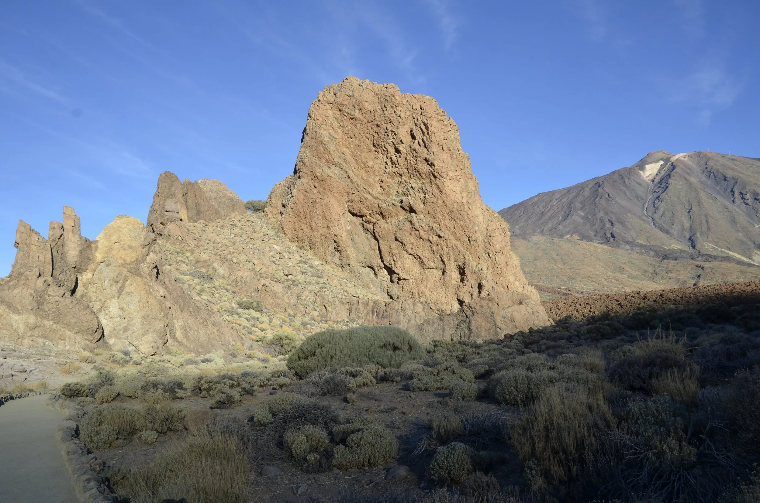
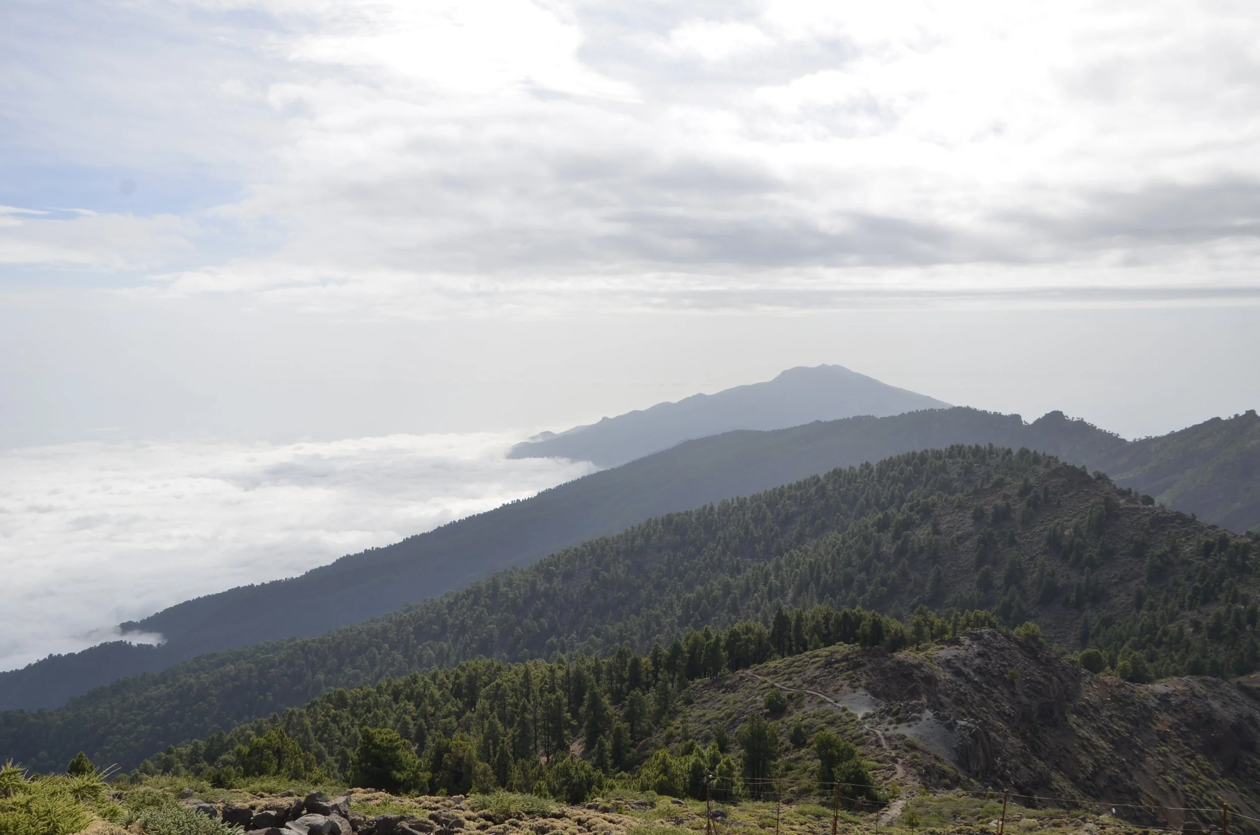
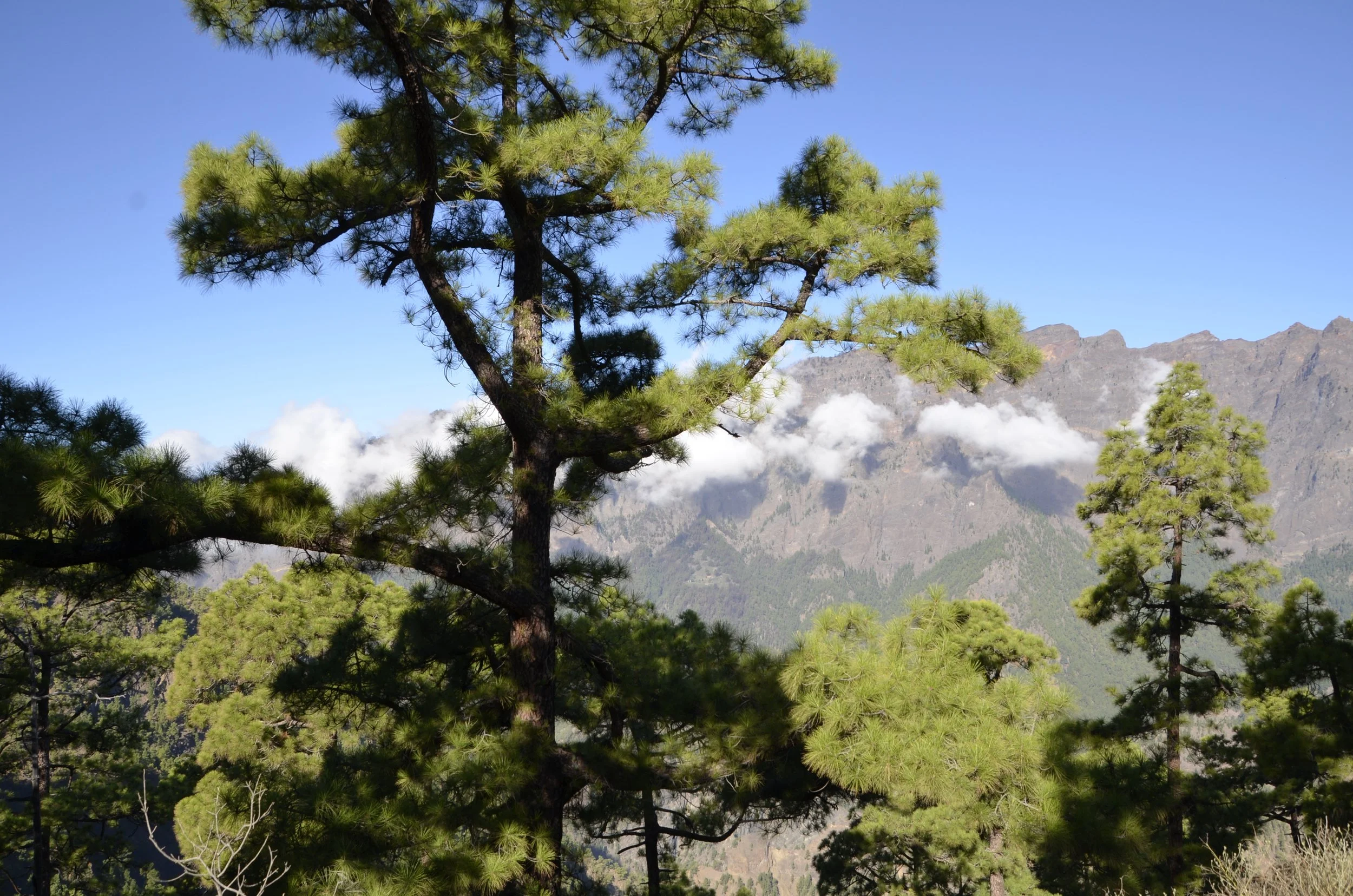
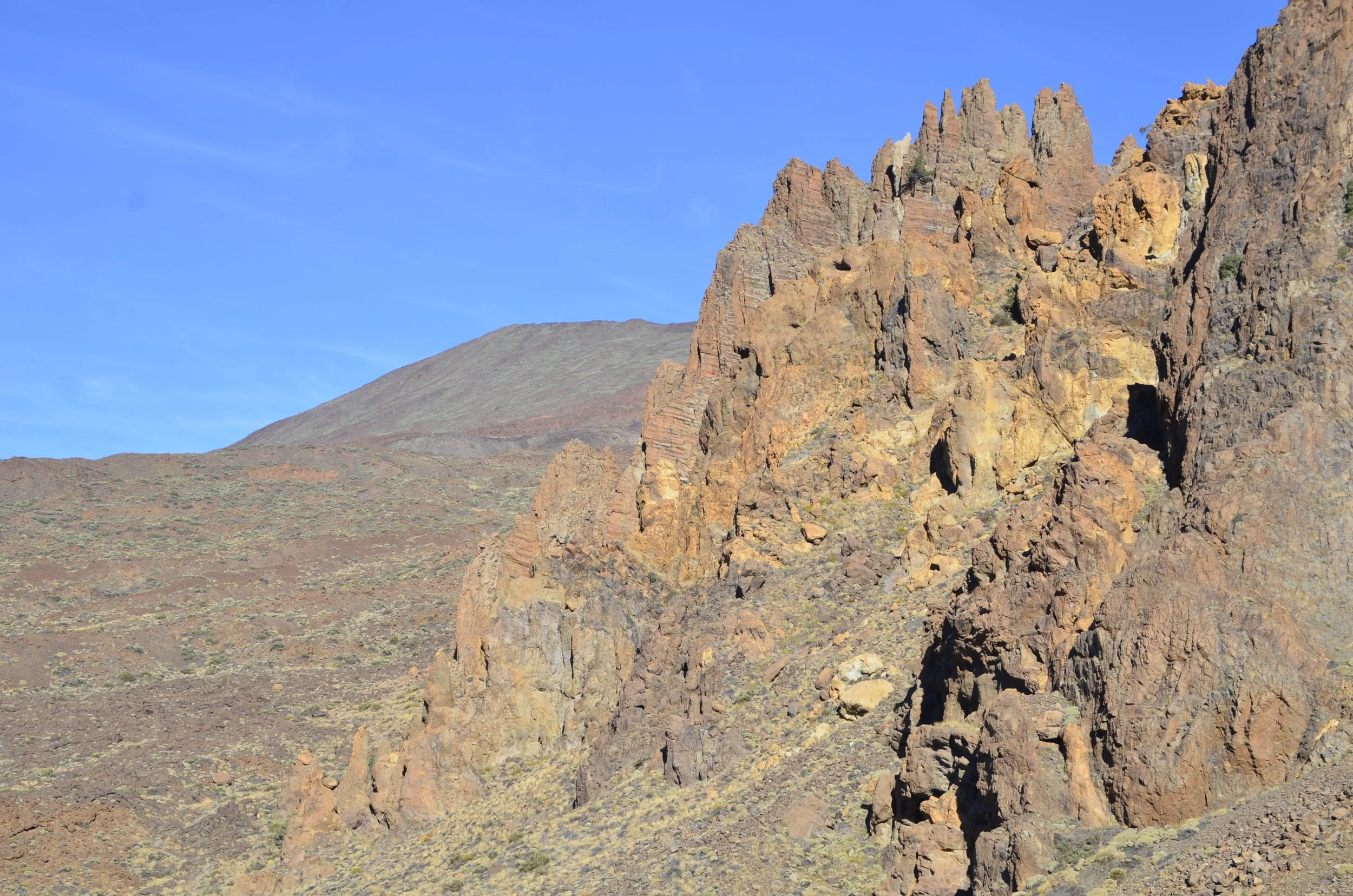
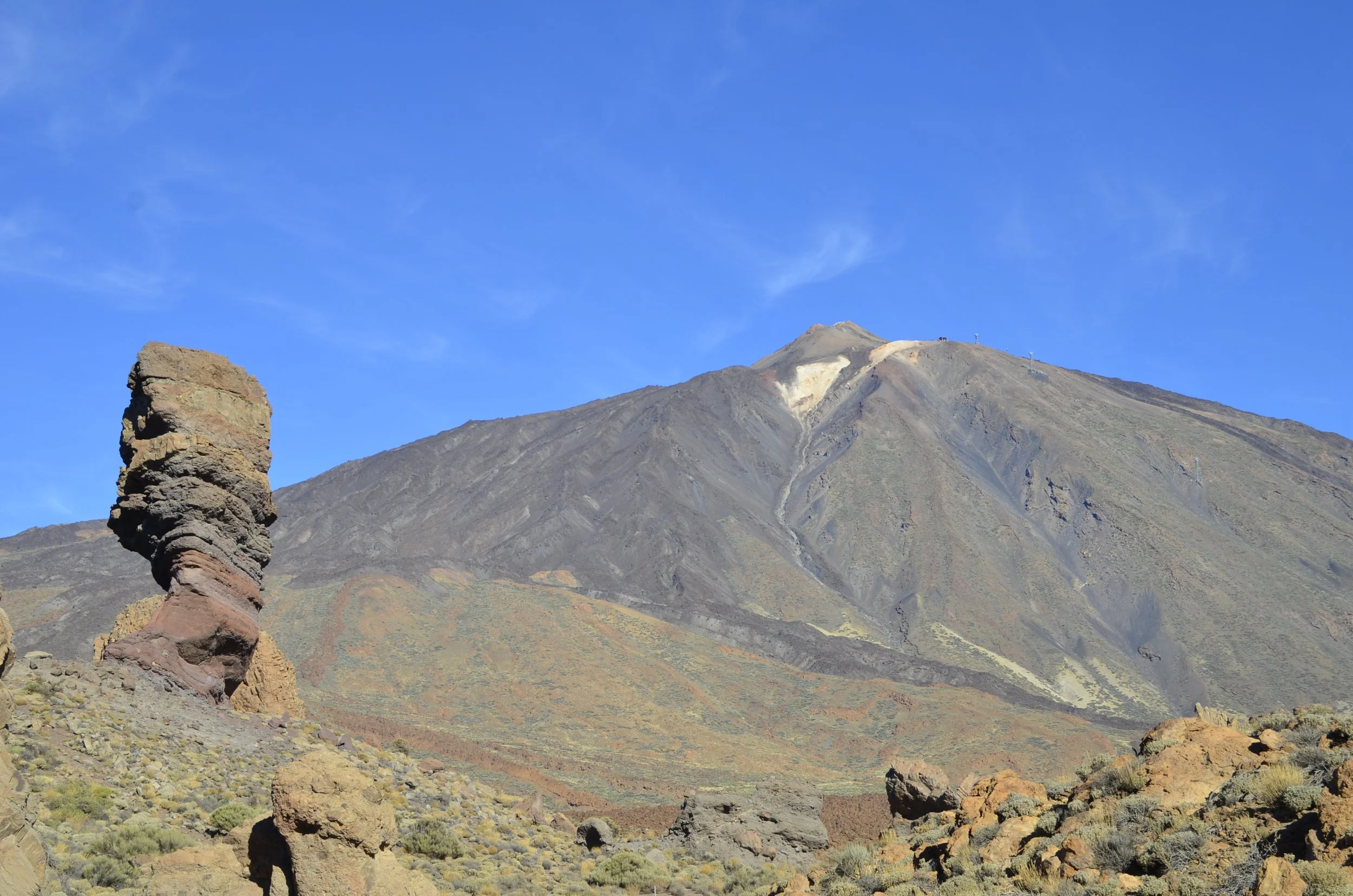
This turned out to be a fantastic consolation prize. Mount Teide was always in the background…

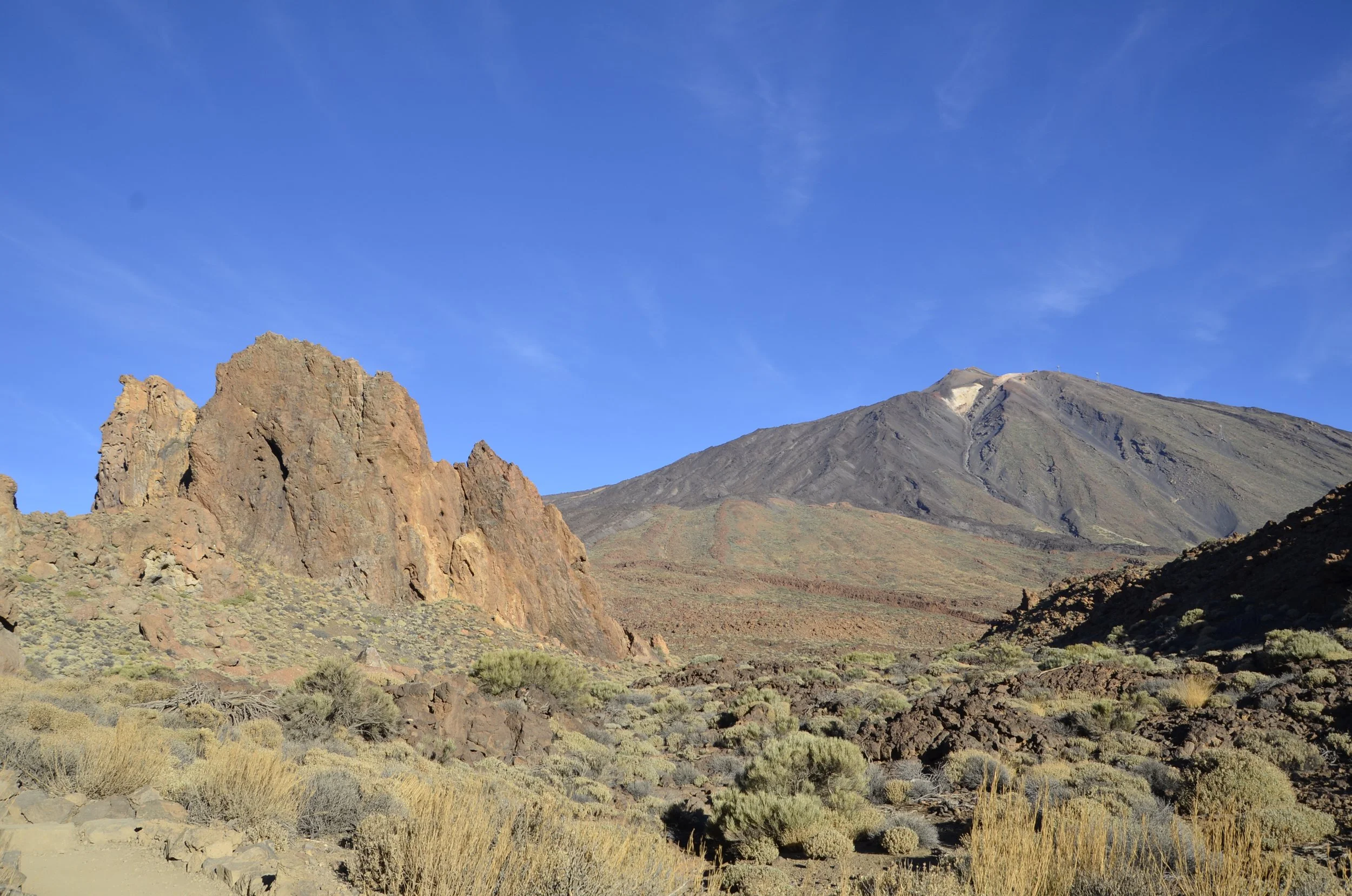
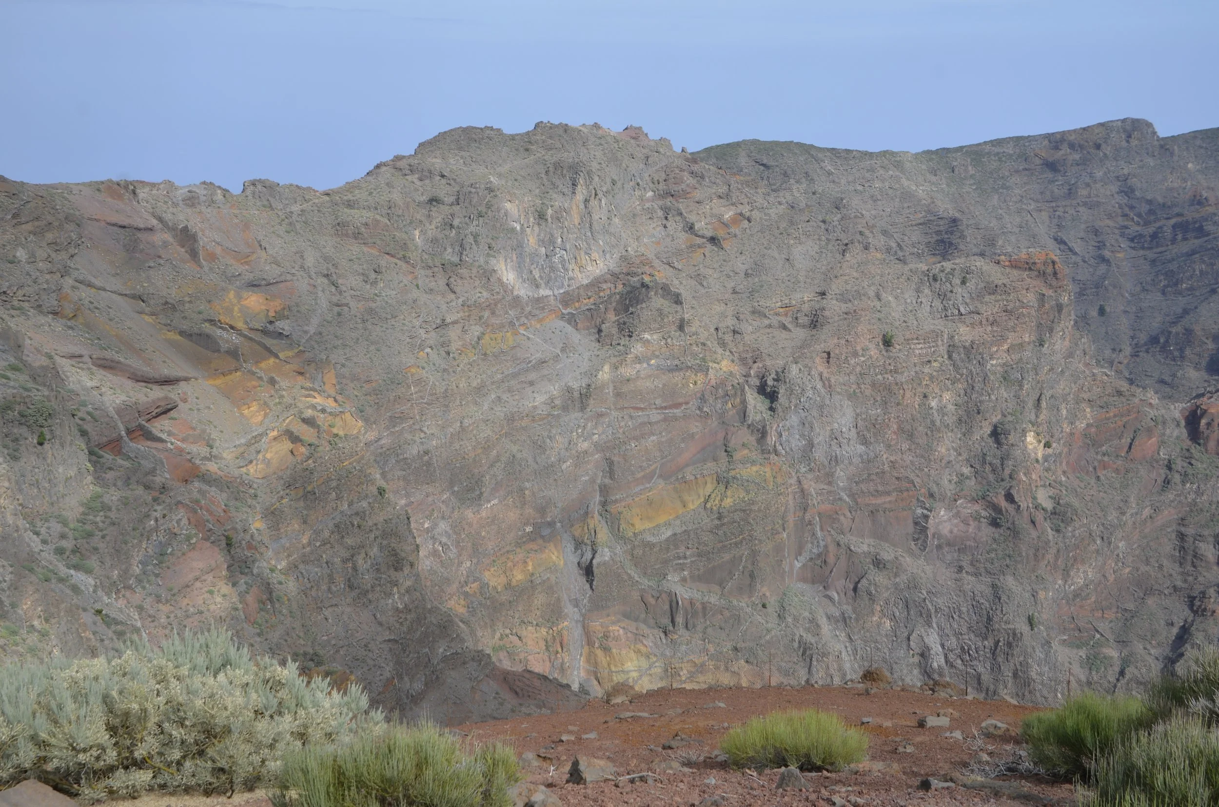
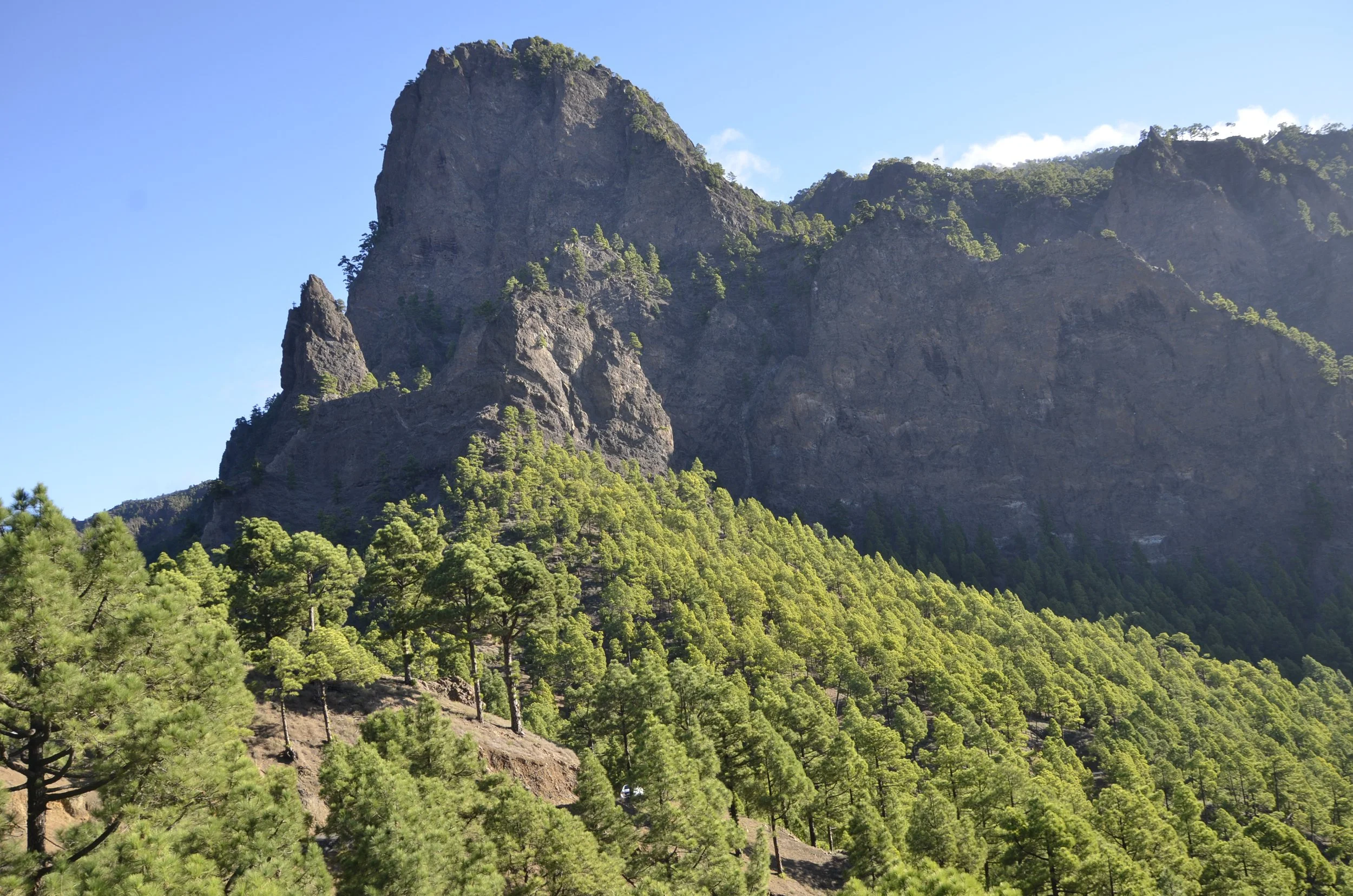
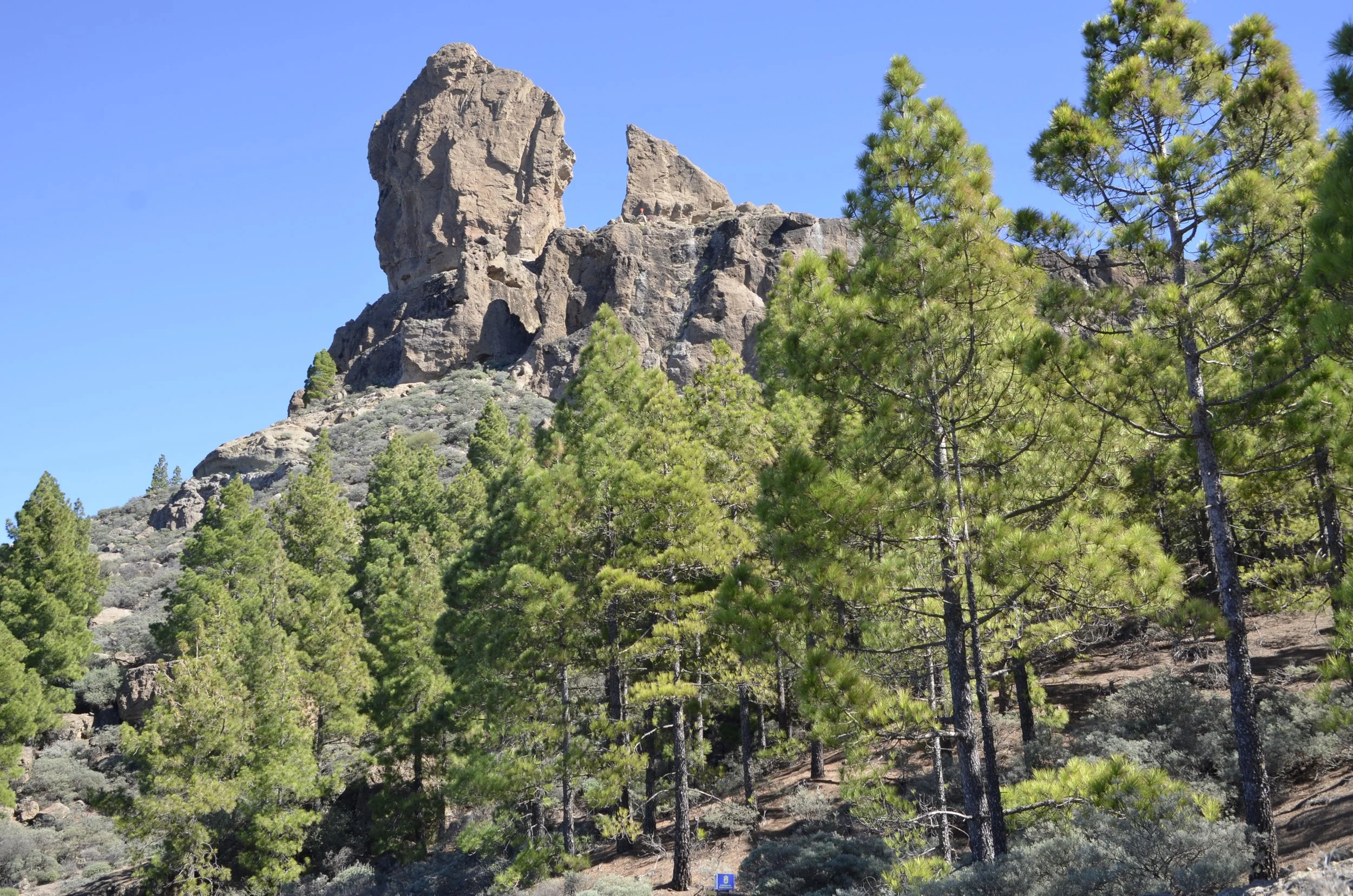
… and the roques themselves were gorgeous…

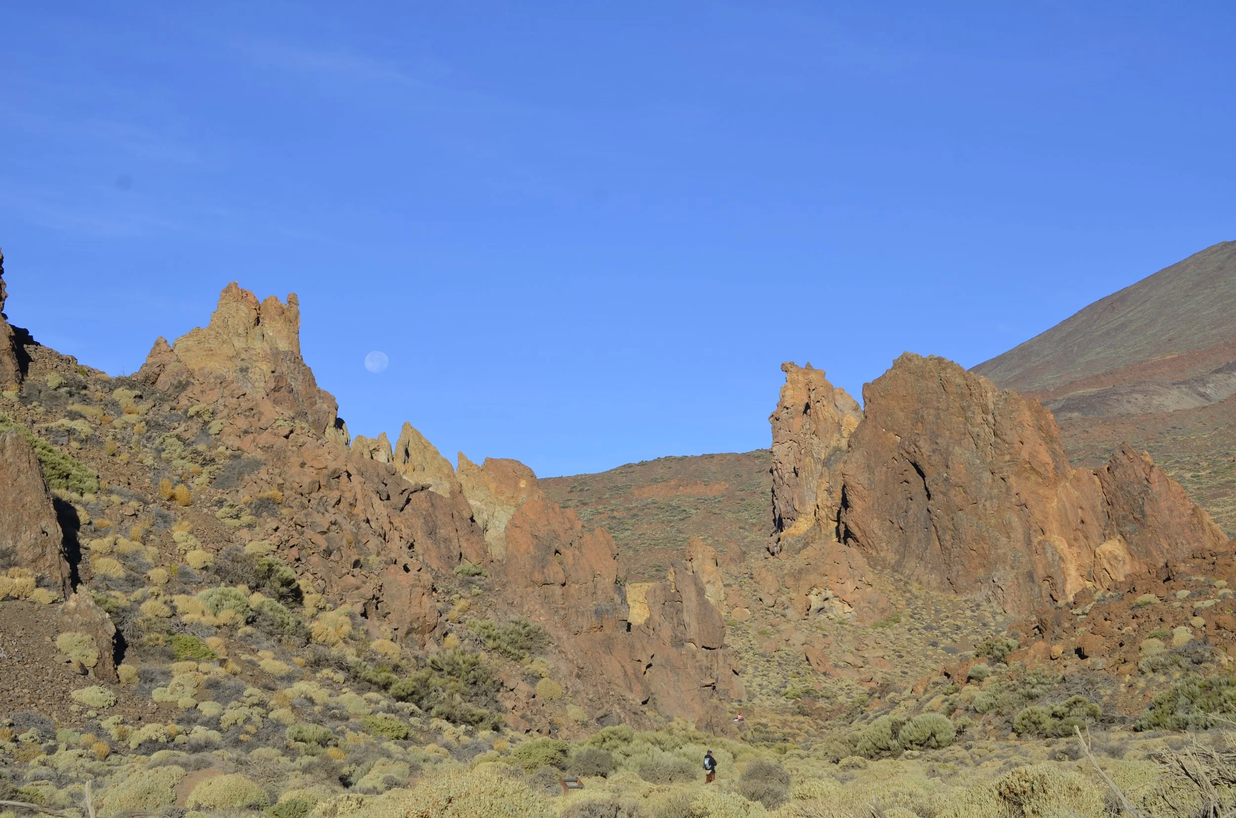
… especially in the early morning light -

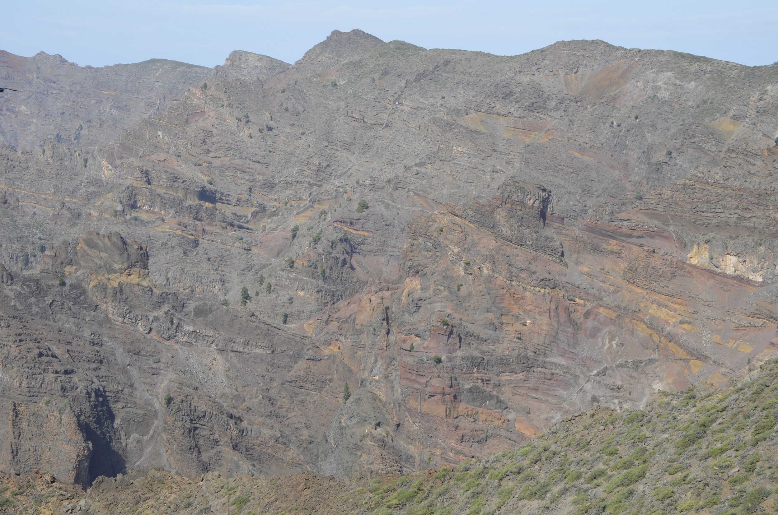
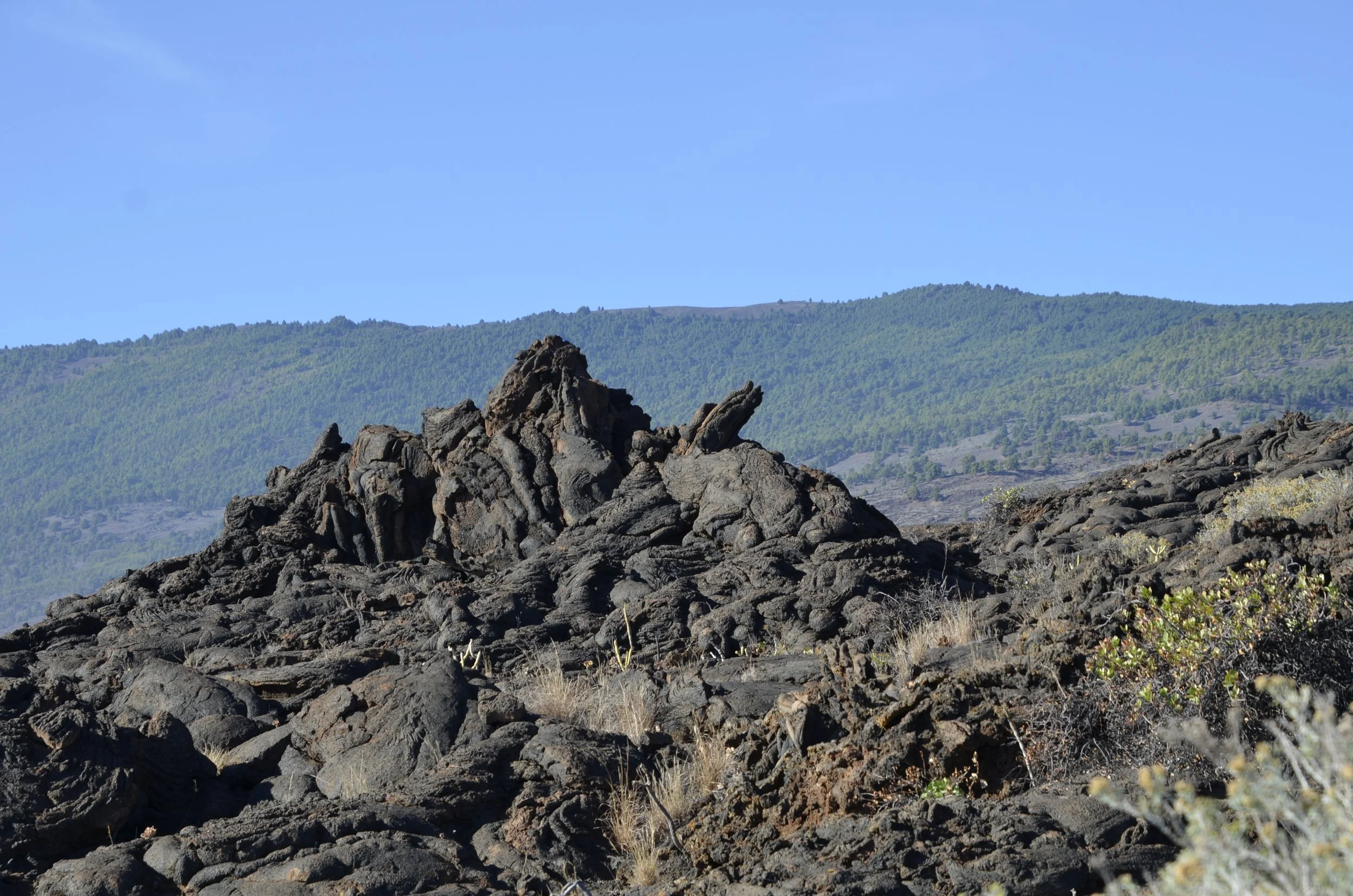
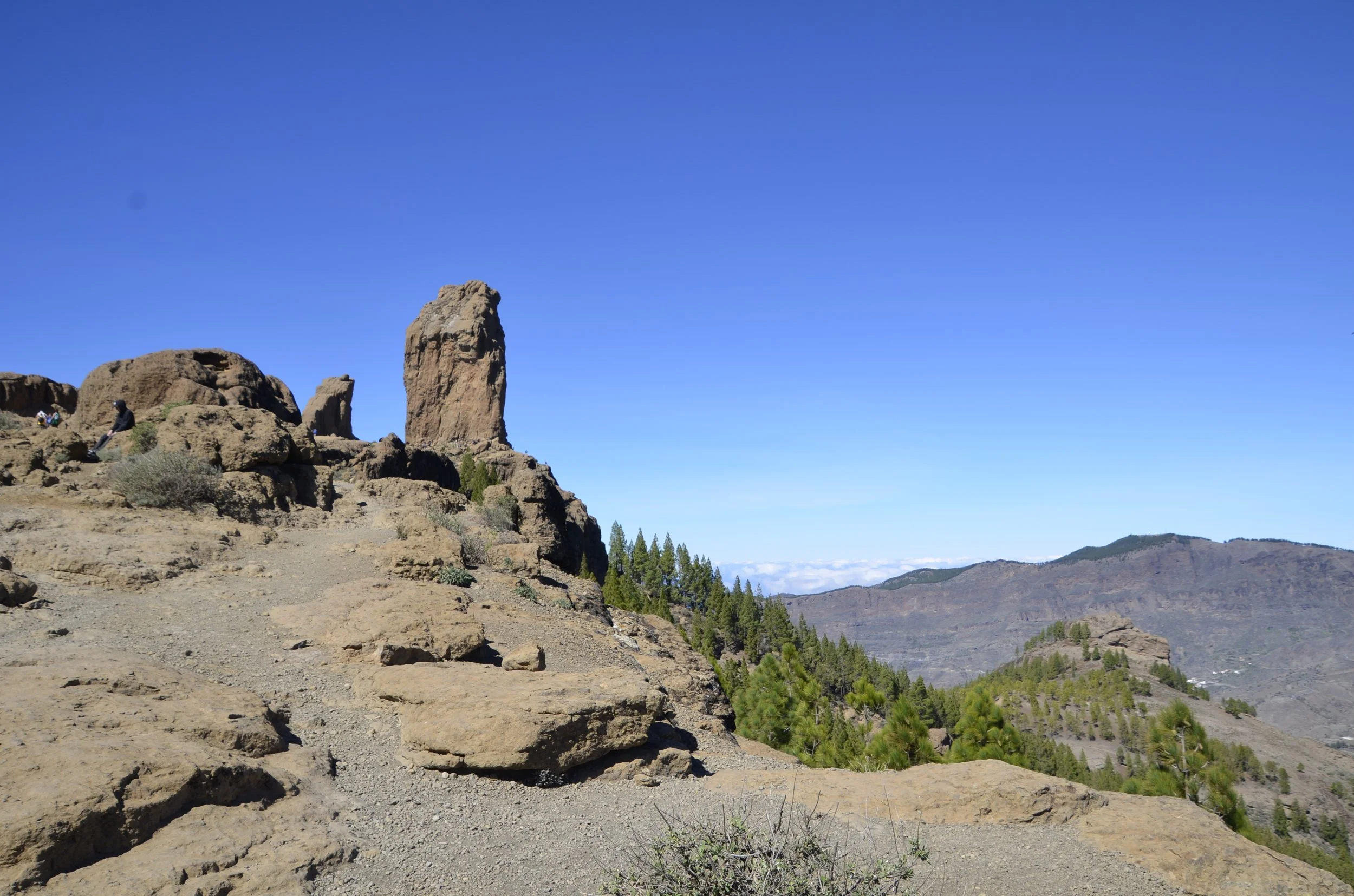
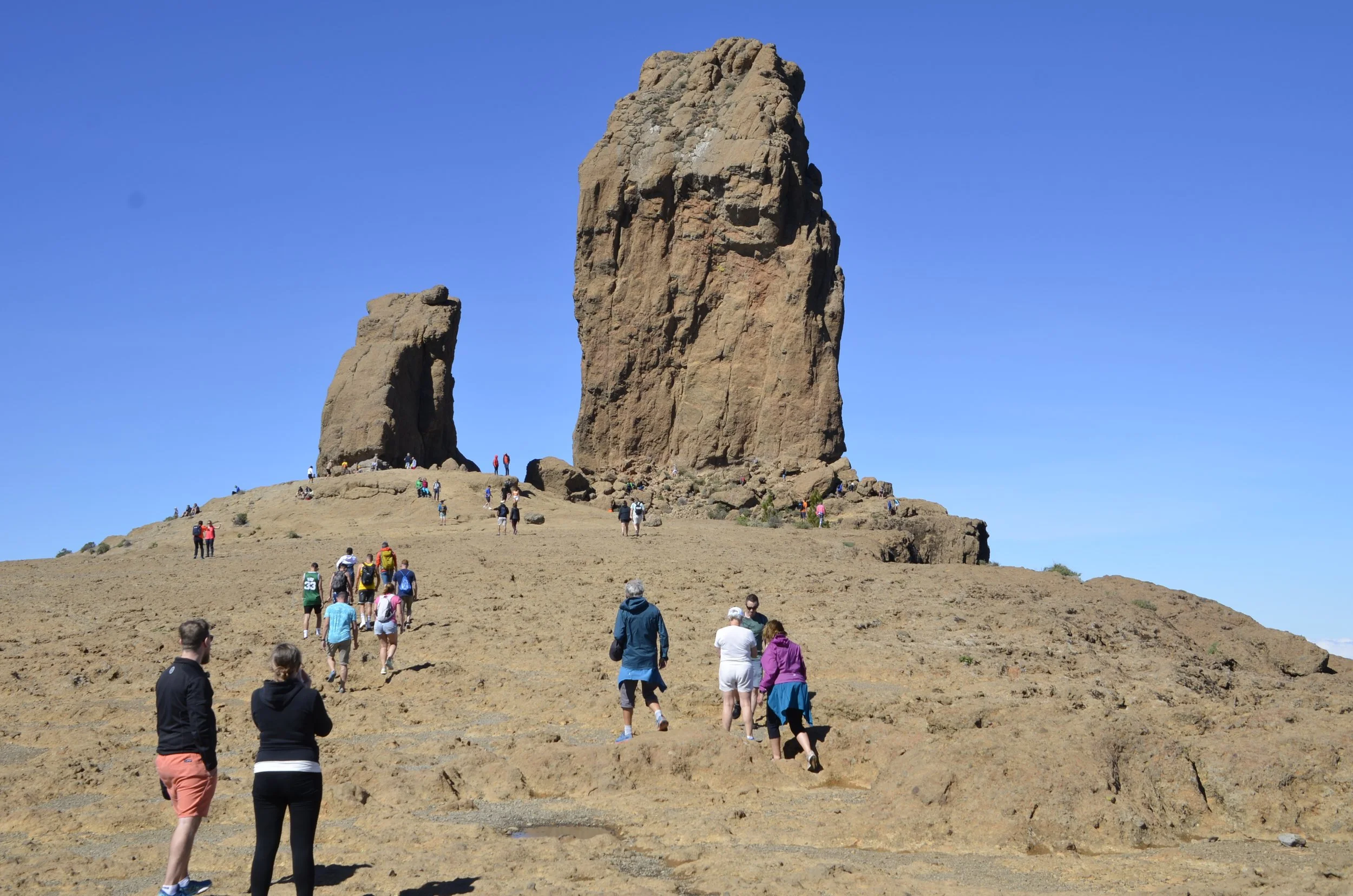
Initially, we thought they were fairly small formations in a compact space, but then we got to walking around them. Wow!

can you find Steve for scale?

I just loved how Teide would peek in from time to time -

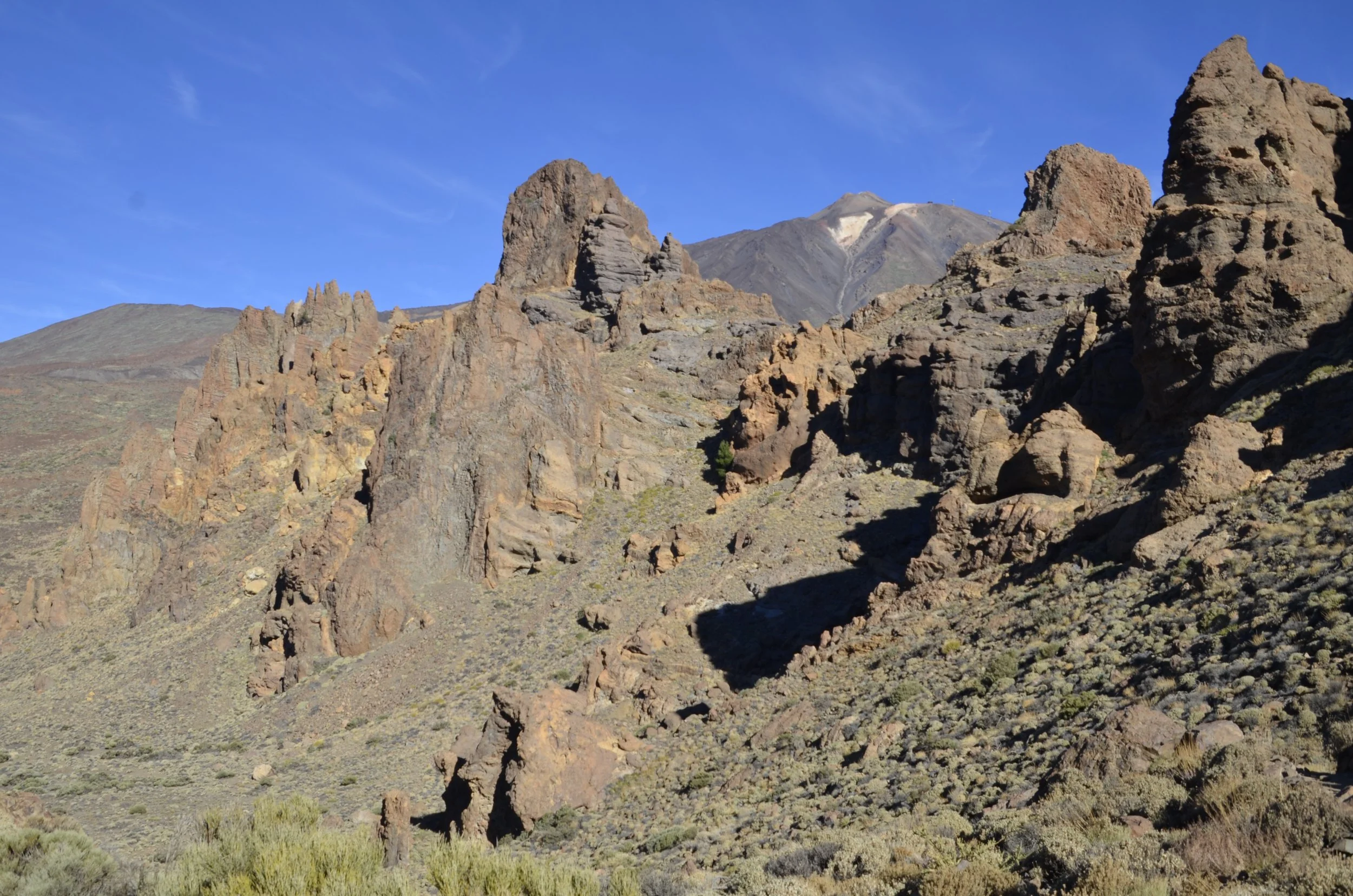
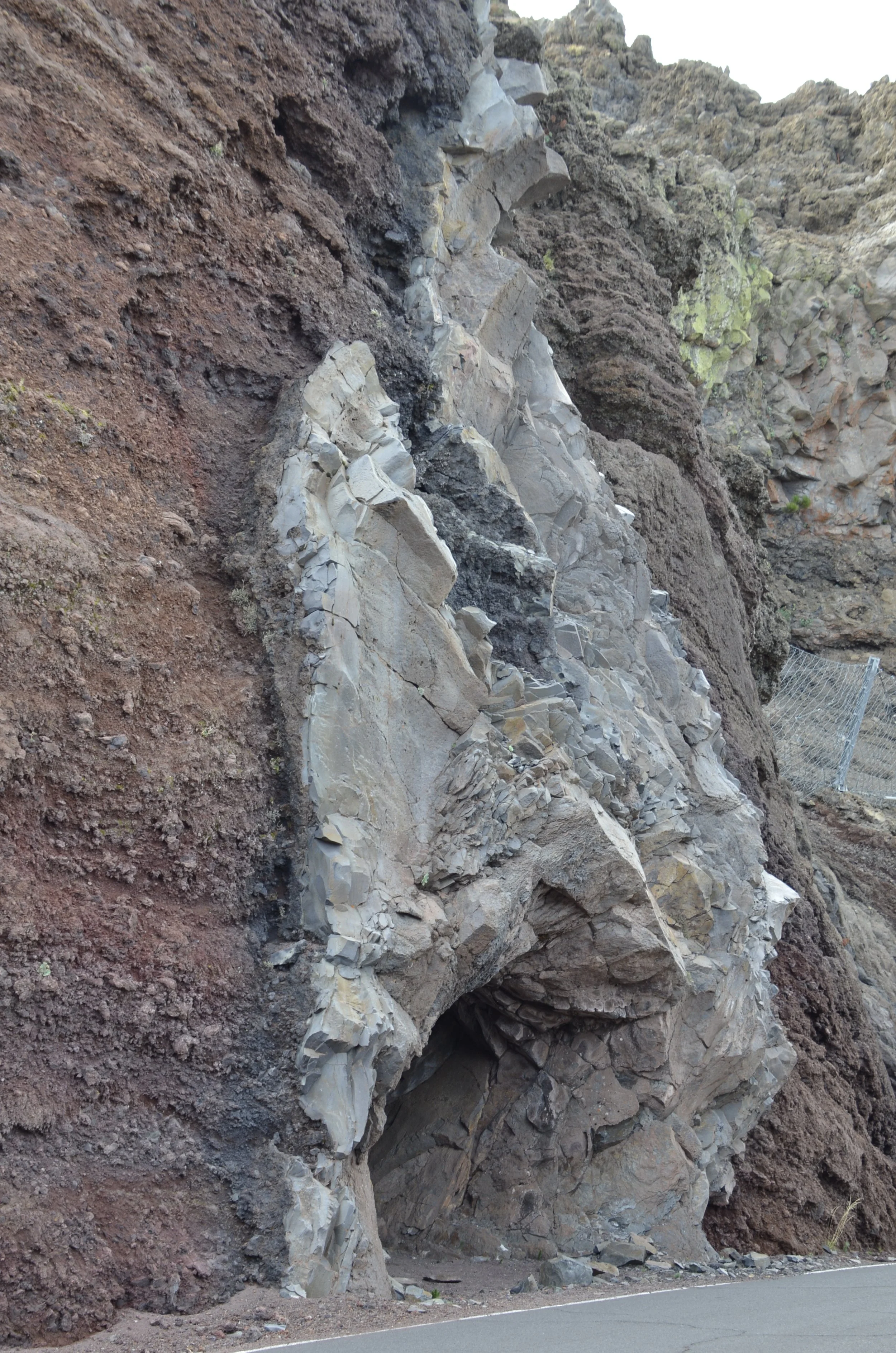
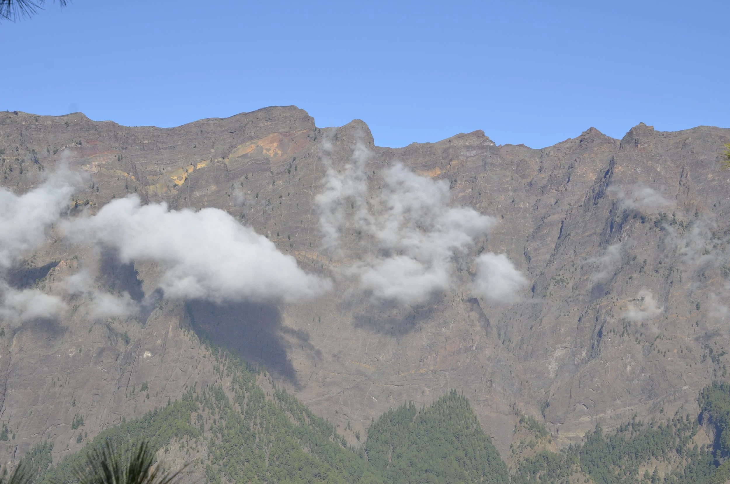
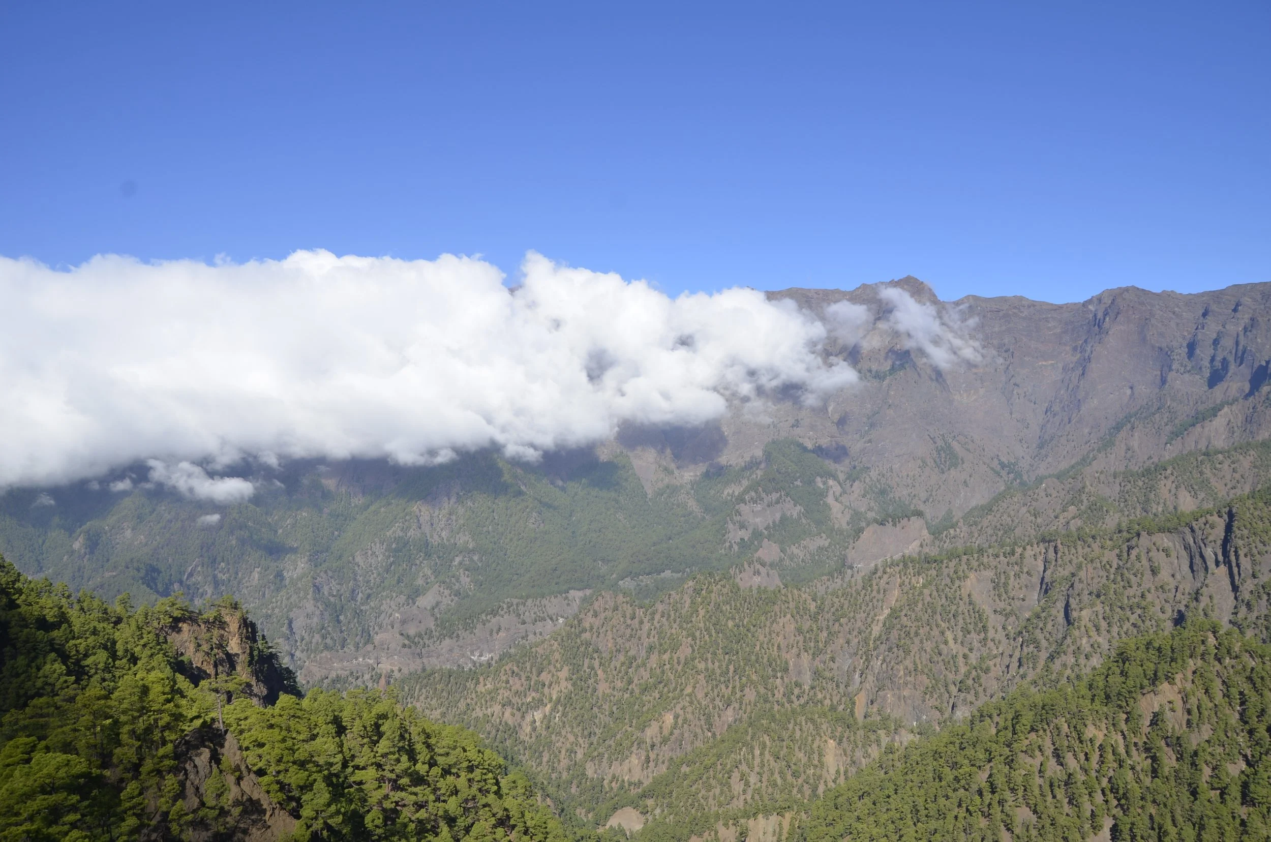
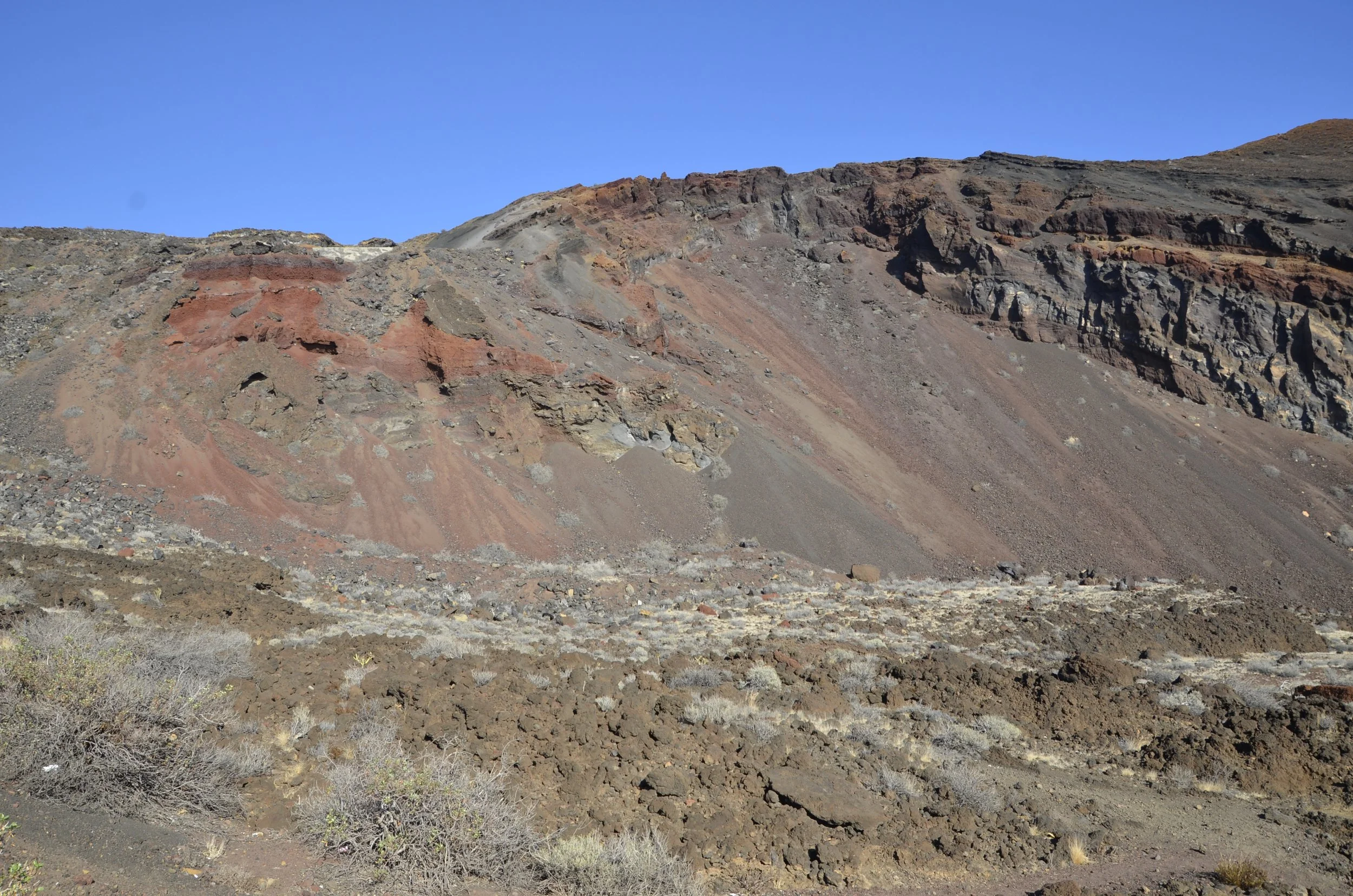
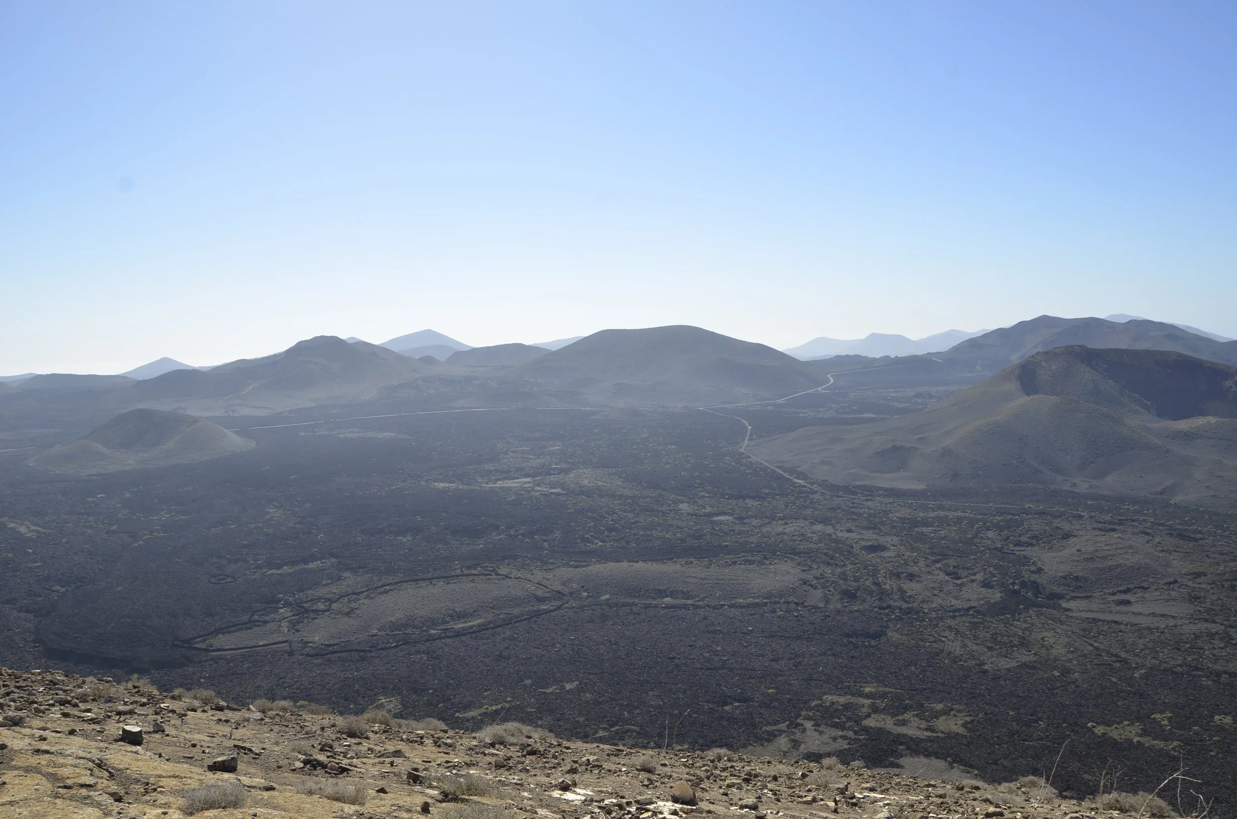
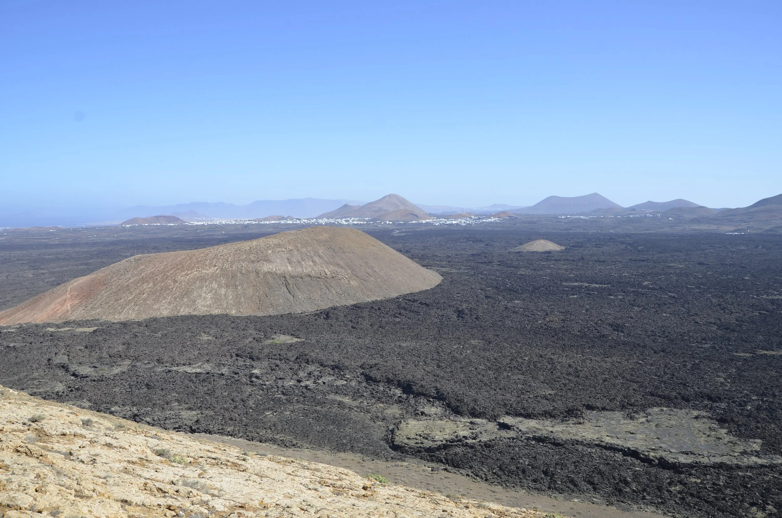
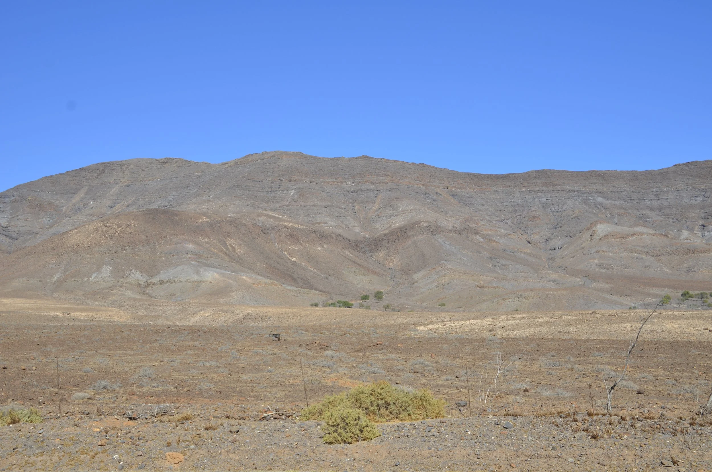
This was an amazingly varied landscape -

(the trail in the bottom right was where Steve was standing when I used him for scale)

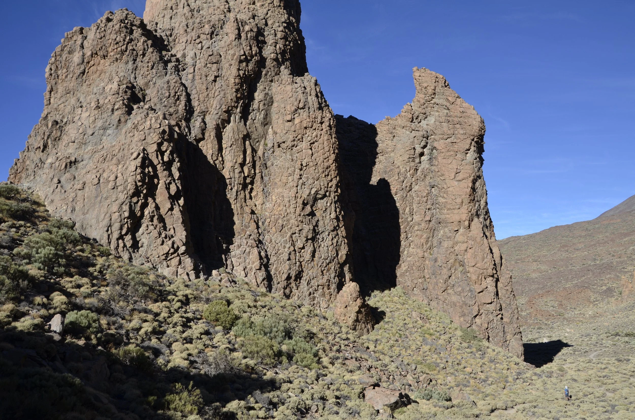
When we started our walk, the rocks were in shadow, and there were very few people around.

As we finished, the sun was warming us nicely and lighting up the rocks as well -

Here’s a brief video to show the extent of the volcano (and just a hint of the crowds swarming the park) -

As always, use the link at the end of this post to open it in your browser, so you can watch.

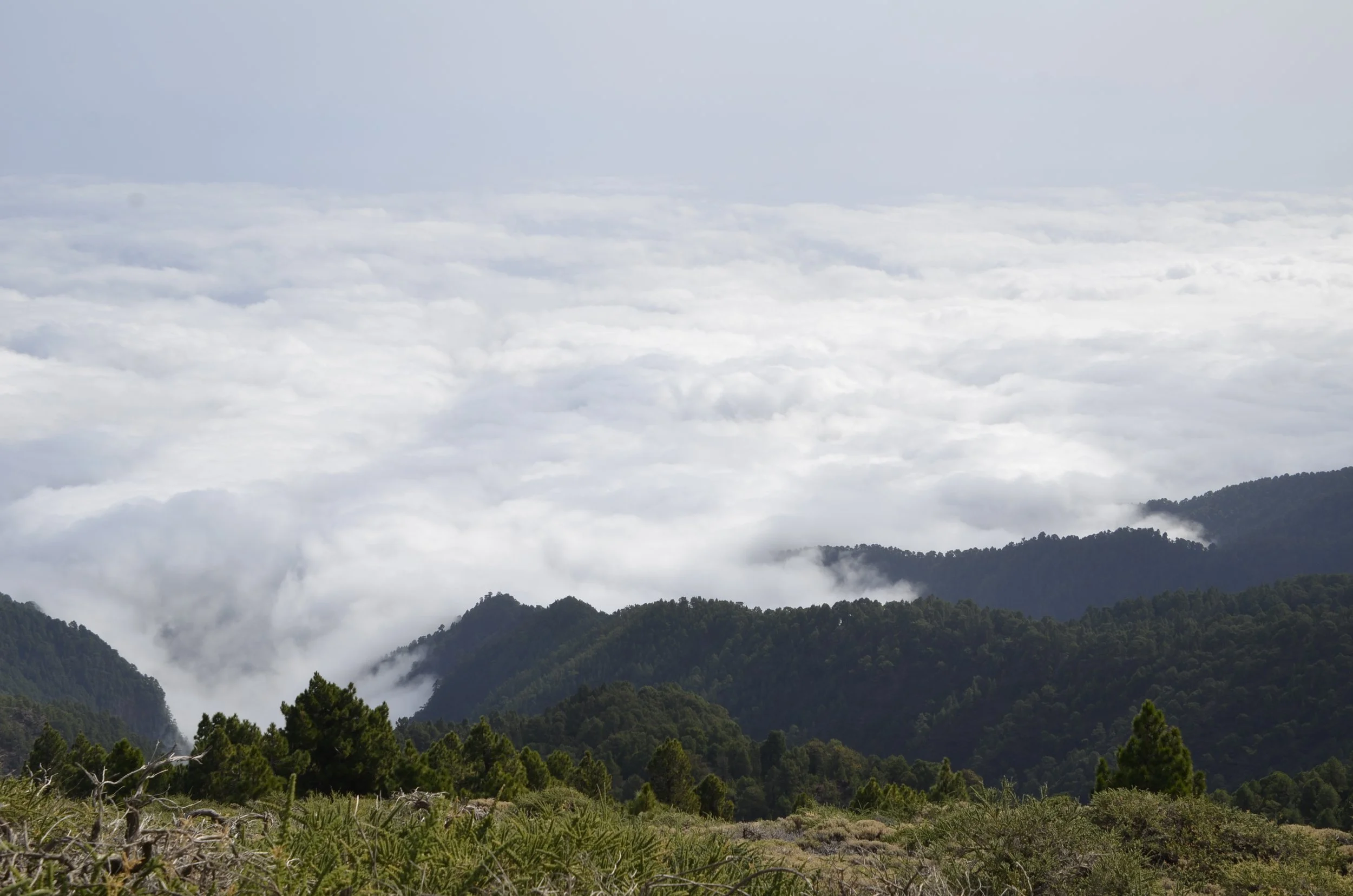
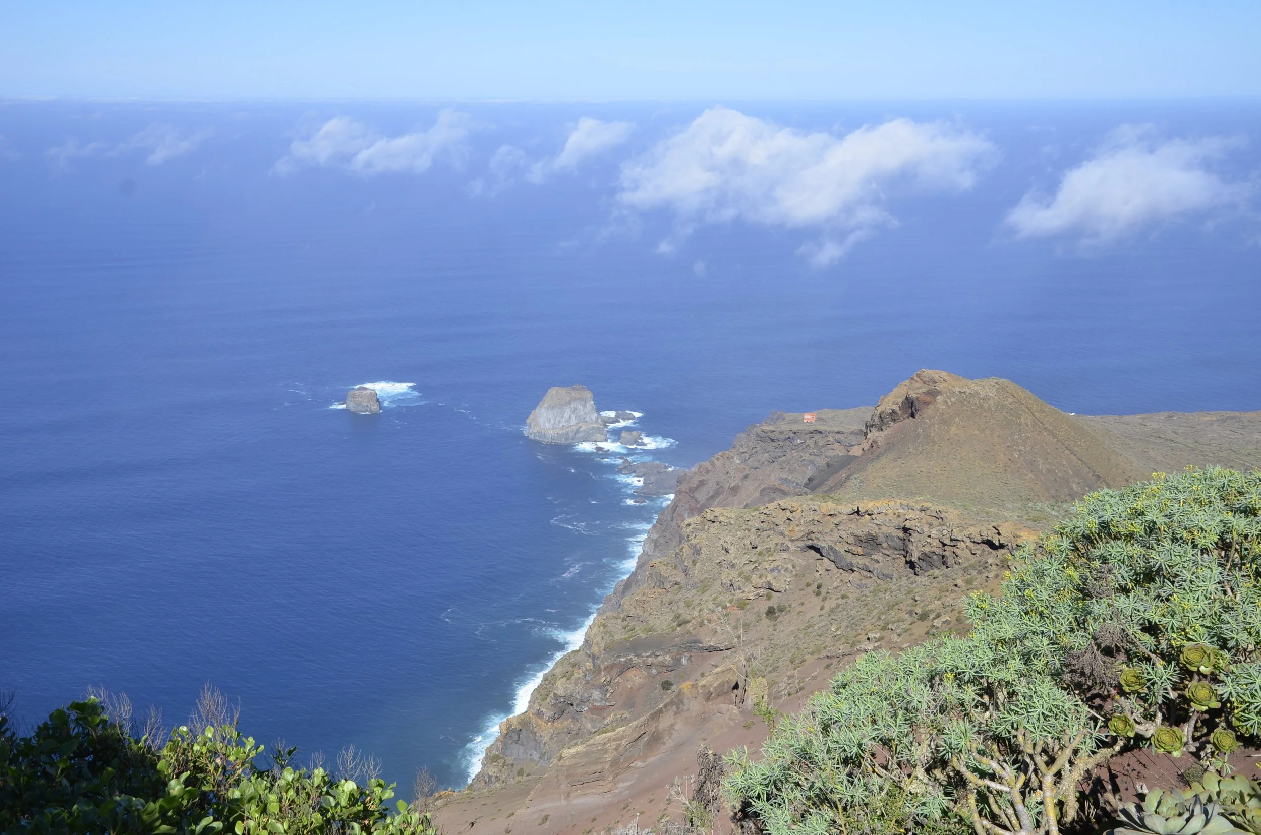
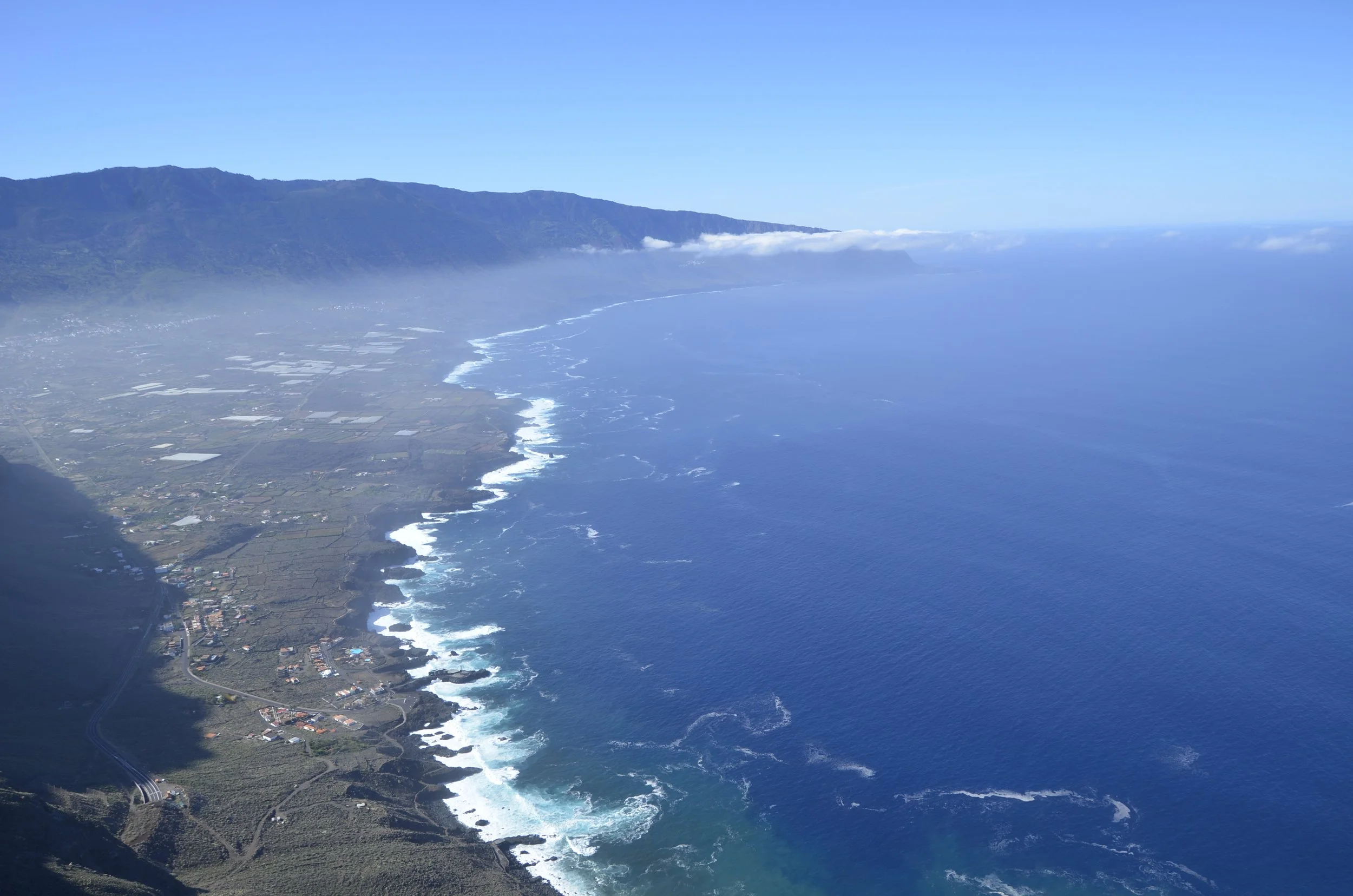
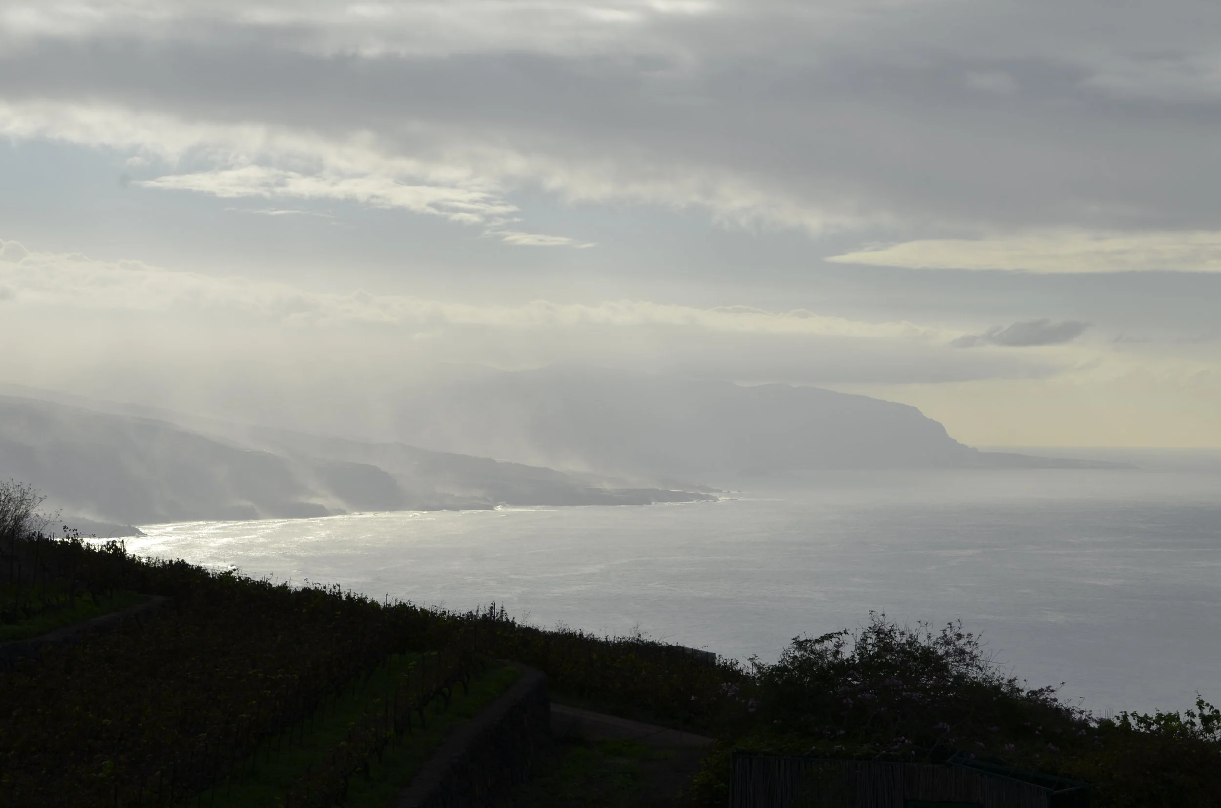
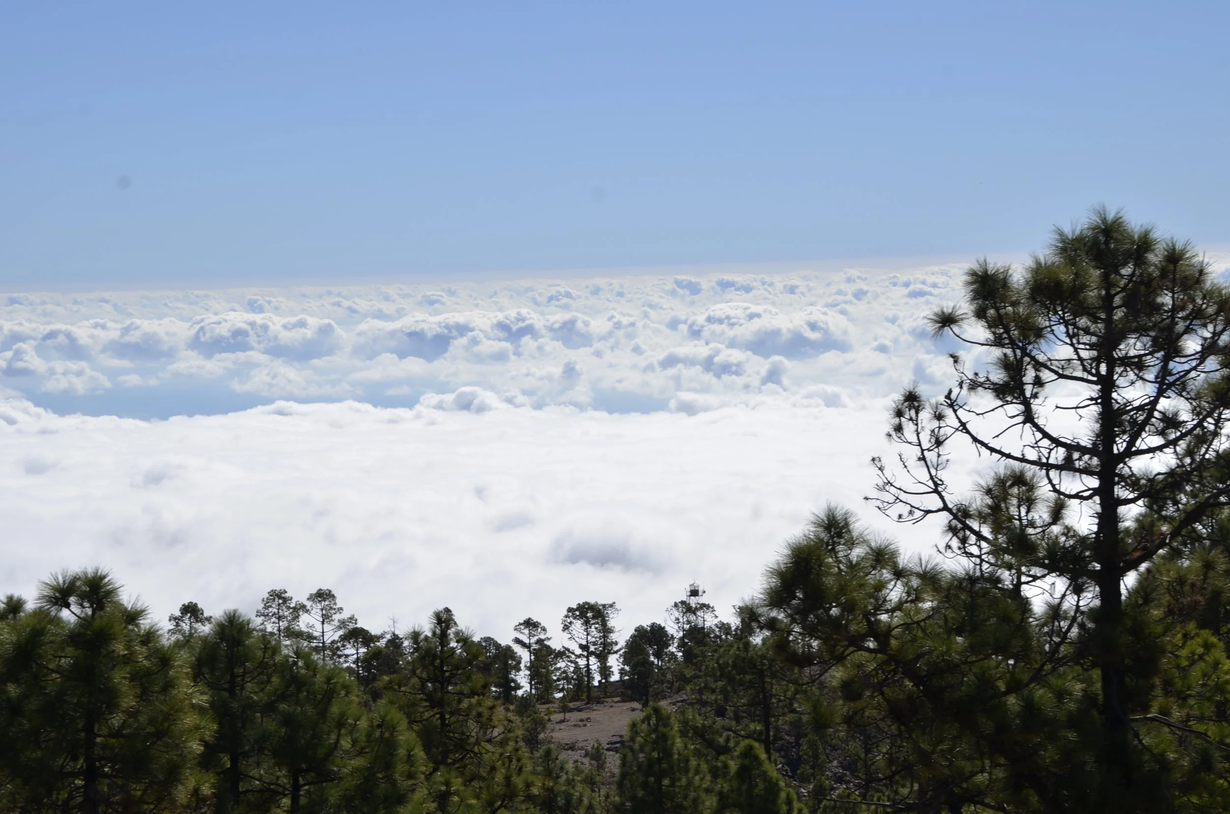
As we drove back down to the coast, we found a veritable sea of clouds -

And thus, another one of our adventures comes to a close. Hope you all have happy and peaceful holidays!

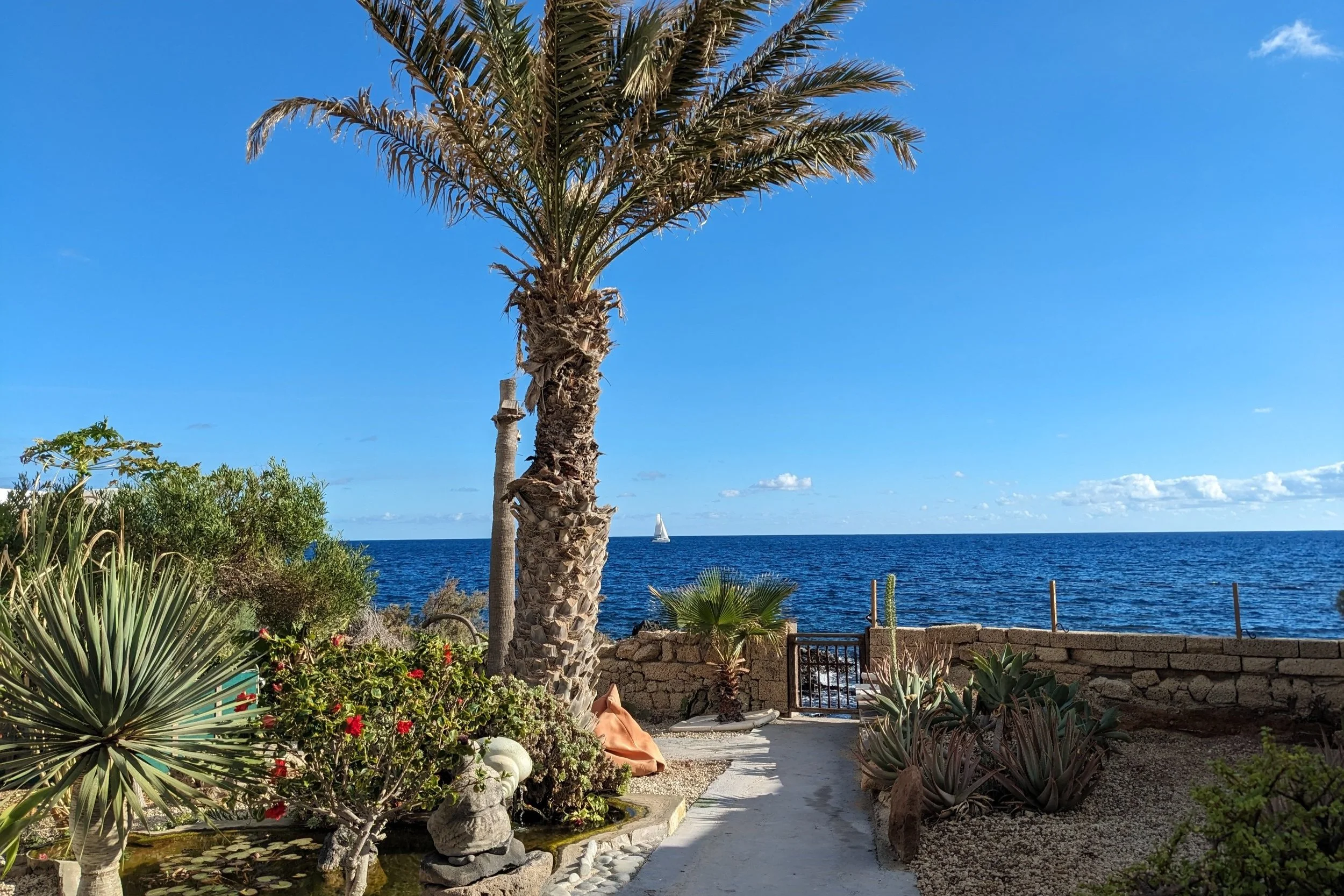
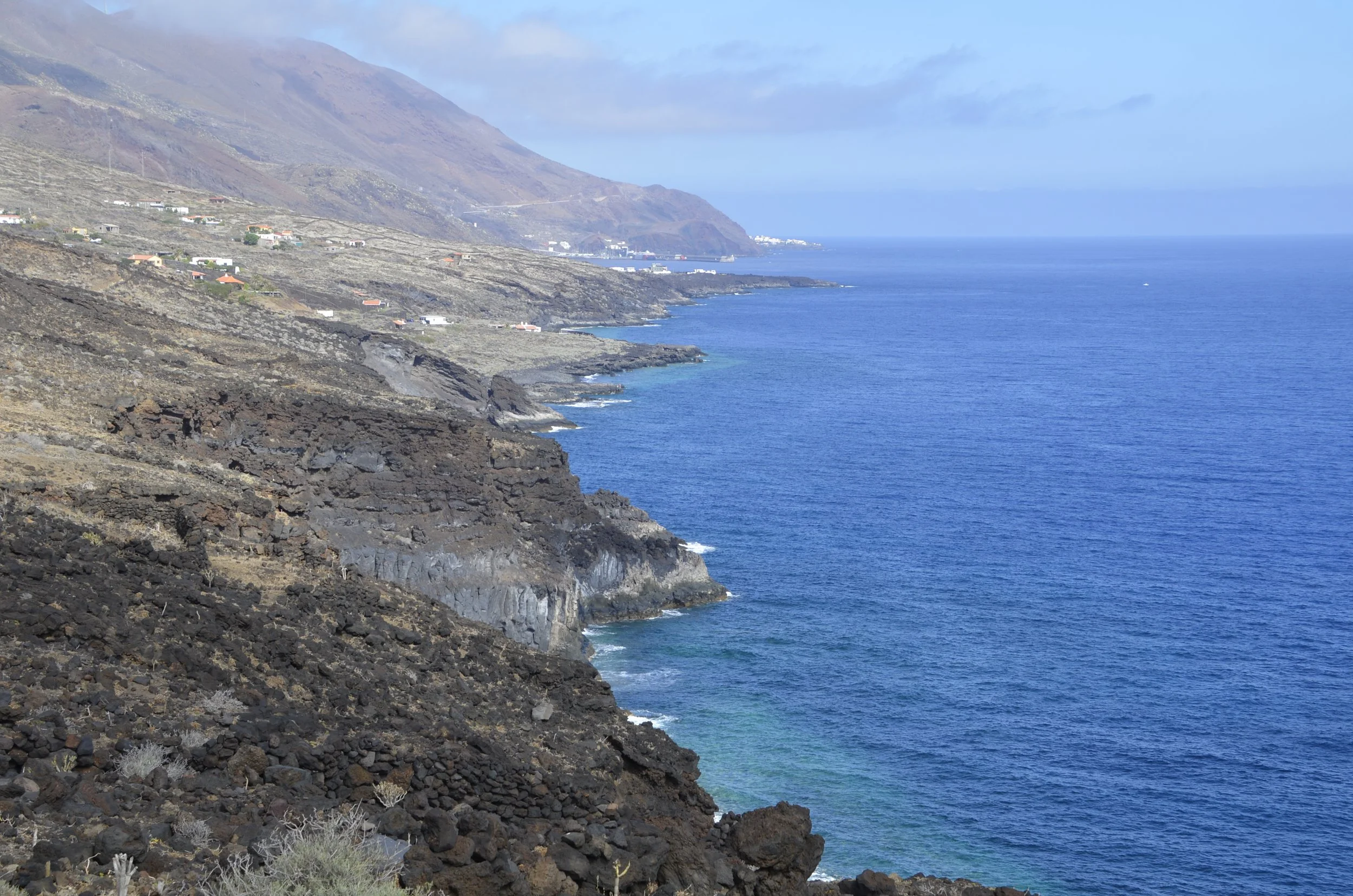
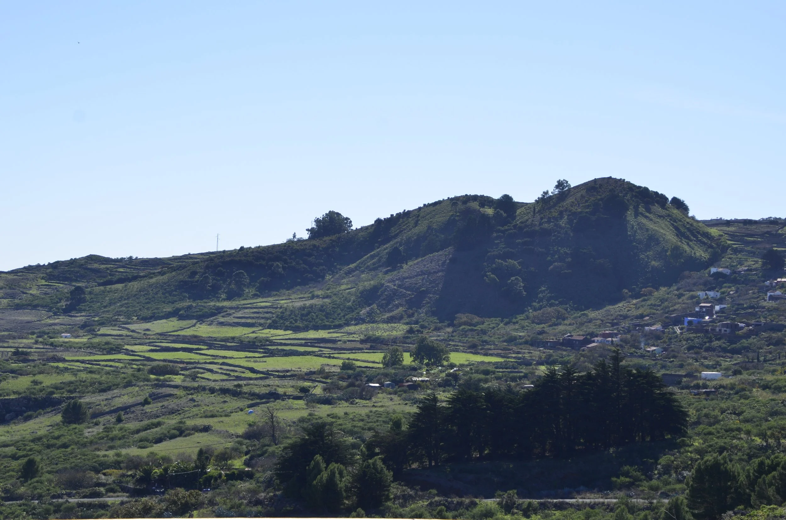
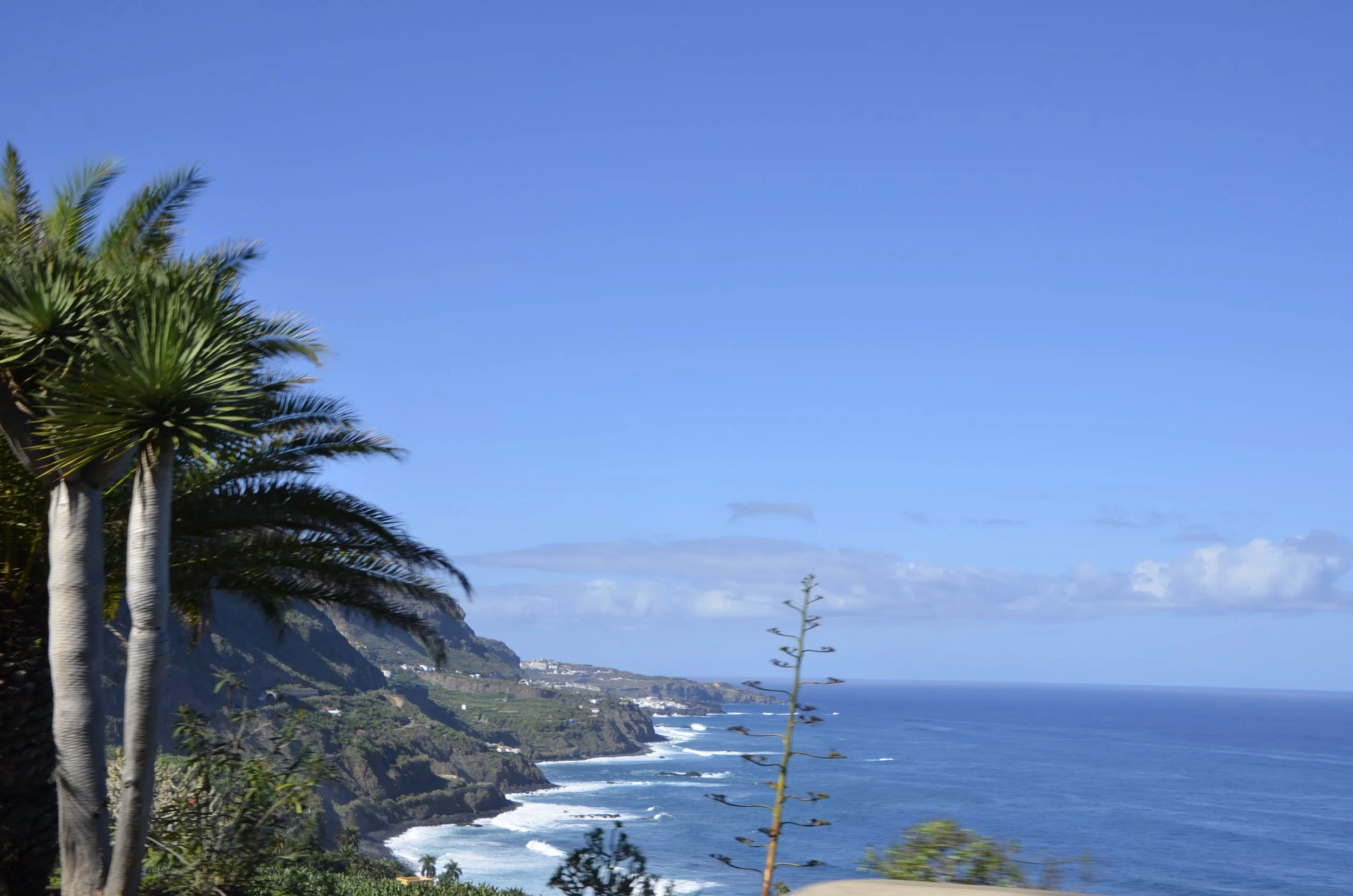
from our lodgings on the coast

La Gomera

This was our seventh Canary Island. Boy is it vertical! It took a long time to get anywhere since you had to drive up and down ravines through numerous switchbacks. Hermigua is the town we stayed in -

As we drove to various hikes and destinations, we’d pass many “roques”, like Roque de Agondo…

(note the road in the pic for scale)

… Roque Cano…

… that stands guard over the town of Villahermosa -

And then there are “rocks” that you have to take a boat to see. We went for a “3 hour tour” to see Los Organos…

… so named for the pipe organ they resemble -

This was the back side -

Now to talk about hiking… which of course we did. The center of the island is criss-crossed with innumerable trails. Many Europeans come here specifically for a hiking holiday.

Our first hike was quite the undertaking - over 8 1/2 miles with 2300+ feet of elevation gained. I really wasn’t sure what all we were going to see, but the terrain was quite varied. We passed by abandoned farms…

… and through small villages…

… before reaching the literal pinnacle of the hike -

La Fortaleza

The name means “fortress”…

… and the only way to the top is a narrow, steep path…

… that made even me a little nervous…

… and reminded me of Angel’s Landing in Zion National Park.

That staircase part was made even more hairy by the presence of our two mascots who decided to follow us, and be right underfoot at times -

The views from the top were epic!

As always, to view that video, click the link at the end of the post to open in your browser.

Our second hike on this island was much more sedate…

… but no less gorgeous, in a dripping greenery kind of way -

My parting shot today was taken from the ferry as we left La Gomera, for our last stop before heading home -

La Palma

… the beautiful isle. That’s its nickname and it certainly fits. This is Santa Cruz de La Palma, the capital, and where we stayed -

The historic area of the city had some beautiful homes and balconies…

(sorry it’s tilted; there was construction along the street in front of them)

… while the island as a whole is mostly lush and green, and very mountainous -

That picture was from our hike to the top of La Nieve. We started in a pine forest…

… and ended above the clouds -

Before you go being too impressed, know that clouds seemed to come in every day over the coast, and are pretty low. The peak tops out at 7,325 ft, and we started about 1,000 ft lower. I liked looking at the “sea” of clouds -

There was a nice wall of different colors (that we could see at the top of our hike) across the Caldera de Taburiente…

… which is a massive volcanic crater in the center of the island, ringed by peaks and fabulous viewpoints.

We continued driving around the crater, near the top of the ridge, and stopping frequently to admire the colorful rock formations -

This was quite interesting, but we couldn’t go inside -

Around the next “corner” we found multiple observatories and the MAGIC telescopes

… near the high point of the island, and this beautiful wall -

Now, shifting gears, we headed south to check out the Volcan San Antonio…

… and then headed up the west coast to survey the damage caused by the eruption of the Tajogaite volcano in 2021 -

They are still moving literal tons of rocks and ash from roadways and fields -

And the volcano is still smoking -

The next day we did an easy hike within the Caldera de Taburiente, luckily getting there early enough before the daily clouds poured in (as shown at the end of the video) -

(as before, click the link at the end of the post to open this in your browser to see the video)

Can you tell the direction of the prevailing winds from the angle of the trees? -

As soon as we started walking, we could see the first clouds sneaking in -

… so I grabbed a shot of the far wall…

… before it was gone. Thirty minutes later, this is all we would have seen -

We definitely enjoyed this pine forest stroll -

For my parting shot, I got a close up of the bark of a Canarian pine, showing its resilience against fire -

El Hierro

The next island we visited is the smallest of the seven, and the farthest south and west. The population of the whole island is about 11,000. It was really rural and laid back, and we thoroughly enjoyed exploring the topography.

That picture above was taken from a viewpoint near the NE corner of the island, and when you turned and looked down the north coast you saw:

The village we stayed in, La Frontera, was tucked in against the base of the ridge near the upper left edge of the above picture.

After we left that viewpoint, we checked in on Pozo de Las Calcoses -

Pozo means “well”, and this area was used by fisherman during the summer, and the houses had volcanic stone walls and thatched roofs. The natural pool has been reinforced with concrete, and has steps leading down to the water. (we didn’t get in)

Natural pools are a big deal in these islands, but I think even in summer the water temp is chilly. [I just looked it up - Aug. water temp is 75 and air temp is 86.]

I loved this coast -

We rounded the north end of the island and drove down the east coast about as far as the road will take you. Our goal was Roque de La Bonanza -

At first I was a little underwhelmed, but then as we walked up the abandoned road, we marveled at the geology -

Talk about secluded beaches!

We then headed back up into the interior of the island…

(this reminded me of Ireland!)

… to the Mirador de Las Playas, overlooking where we had been at the Roque. Do you see it down near the point on the right?

I just loved the colorful layers in the rock wall.

Down near the southern end of the island, we drove past a lava field with cool formations…

… on our way to Tacoron…

… and its very rustic “pool” -

The colors in the rock walls were spectacular, especially in contrast to the water and pine covered hills in the distance -

The next day we headed across the north coast, passing through Sabinosa…

… along roads that were fun for Steve to drive (no comment from the passenger) -

La Laja natural pool…

… was another unique iteration of a “swimming hole”…

… with interesting denizens -

Continuing further to the NW end of the island…

… we visited Arco de La Tosca…

… on our way to Playa del Verodal -

I was mesmerized by the designs formed by the water and the black sand -

We ended that day looking for examples of the windblown junipers that El Hierro is known for…

… and the best one I found by scrambling up a hillside. :)

The morning we left, we hiked in La Llania, which is a nature reserve “just up the hill” from La Frontera. We started in a moist laurel forest…

… with shaggy trees…

… before passing by a mini-caldera…

… and ending in a pine forest!

That single 3 mile walk had nearly all the types of flora we had seen over the entire island.

I want to close with one of my favorite pictures from this island -

Lanzarote

Lanzarote is a fascinating mix of agriculture and volcanoes.

The valley in the middle of the island was a very rich agricultural region until devastated by the Timanfaya volcano that erupted for 6 years between 1730 and 1736. After the people dug back out from under the “ash”…

… (which actually looks like tiny pebbles), they found that in places, the still rich dirt was only slightly covered by ash…

… but in others, they had to dig deep to find dirt -

There are 3 main ways that grape vines are grown and protected here. The walls are hand built of native stone that provide a wind break, but also have spaces between the rocks to allow some air flow. Both the large rocks and ash have tiny holes that collect dew overnight, that then runs down to the plant, providing the only moisture. There is no irrigation of the vines on the entire island.

The straight walls are used in the valley where the ash wasn’t so deep, and the semicircular “terraces” are needed where the dirt was found deeper. The third area where a small amount of grapes are grown, usually Muscat for sweeter wines, are natural ravines surrounded by large blocks of broken lava -

Harvest is July - Aug., so there were no grapes for us to see on our tour. The white wines made with Malvasia Volcanica grapes are only fermented for 15-20 days in steel tanks and then bottled. They are meant to be drunk the year they’re produced, and they are quite tasty!

The yield in the vineyards are low due to having to space the vines at least 3 feet apart, so that they don’t compete for the precious moisture. We were told that one vine produces only enough grapes for one bottle of wine!

Now, moving on from wine to hiking - our next favorite topic. :)

The first hike we did on this island was quite the challenge. The viewpoint at the top was killer -

That panorama showed everything very well, but the tint was off. This is what it really looked like -

The water was really that blue. It kept me going as we hiked down over a thousand feet in just about a mile (and remember, we had to repeat that back up at the end!).

That island is La Graciosa, and it was declared the “eighth” Canary Island in 2018, but it has no paved roads, only 2 small towns and a few hundred residents.

I liked this colorful end of it -

Once down at the shore, we walked along Playa del Risco…

… but the pictures don’t really do it justice, both in the length of beach and in the color of the sand. Because it was such a daunting task to get to, it was as empty as you can see.

The next day, we gave ourselves a break and did an easy walk. On our way, we continued to pass sights that were super unique to us, but everyday for the residents here -

We headed to the land of volcanoes -

When we reached the trailhead, we concluded that we were definitely going to have an easier day :) -

We learned tons of info from signboards while walking around Montaña Colorada…

… like the fact that lichens are the first life form to colonize an area after an eruption, but they can only grow on the sides of rocks that face the trade winds that bring moisture -

There are such things as “lava bombs”, which are huge projectiles hurled during an explosion, that can cool and solidify before they land. This one was roped off, so I couldn’t get anything next to it to show scale, but just know that it was quite large -

As we walked around the volcano cone, I was admiring the varying hues…

… as well as the strings of cones in the distance…

… and just the amazing number of cones all around us -

… Now for a bird’s-eye view -

This was from our hike on our last day on the island - to the top of Caldera Blanca (because, why not?!) -

diameter is 1200 meters (almost 4,000 feet across!)

From here we could see the Timanfaya volcano complex that wreaked so much havoc on the island in the 18th century -

It was really interesting to see how the older, paler volcanoes stood out from the black lava that flowed from Timanfaya -

See you on the next island!

Fuerteventura

This island is the second largest of the Canaries (behind Tenerife), and is only 100 km from the coast of Africa. It is much drier than Gran Canaria, as we quickly noticed when driving down to the SW end of the island -

On the way to Punta Jandia, the blue of the ocean was captivating -

The contrast was gorgeous…

… and I don’t think I’d seen waves coming in from so many different directions. Enjoy the next video of this wild point out in the “middle” of the Atlantic by being sure to open this email in your browser -

As we headed back up the island…

… we passed numerous secluded beaches…

… and beautiful colors in the hills -

Our accommodations on the NE end of the island, in Corralejo, were right on the water, and granted us beautiful views of Isla de Lobos (named for the monk seals that were found there)…

… as well as our next destination, Lanzarote -

We drove up into the interior…

… and did only one hike, but boy was it a doozy! It started out innocently enough, with a variety of plant life…

… then skirted a ravine…

… with a few little buddies…

… before culminating in a rocky scramble trying to follow a trail -

Around the large rock in the picture above, we found…

… Arco las Pinitas!

As we headed back “home”, we visited Betancuria…

… which, as you can see from the plaque on the building, was founded in 1404 -

The next day we took it easier and had a beach day.

However, the first beach, La Escalera (“the staircase”) took a bit of work to get to (135 steps, to be exact) -

But to have a beach this gorgeous with only a few other people was fantastic.

The other beach we checked out was Playa La Concha, and it was full of Brits and Germans…

… with sugar-fine sand and clear blue water that was freezing! Needless to say, I just waded for a short while.

On our last night on the island, we had a waterside table at a great fresh fish restaurant, and thoroughly enjoyed the sunset -

Adios!

Gran Canaria

This island is amazing with its variety of microclimates. On the south end are the dunes of Maspalomas -

It was so windy when we were there, we opted not to walk out on the dunes, as the windblown sand really stung!

We headed up into the interior hills, and found “Rainbow Rocks” (Los Azulejos de Veneguera)…

… and a fantastic lookout -

These were just beautiful…

… and we could walk right up to them -

Heading further into the hills, we reached Canarian pine forests…

… mixed with palms!

It was a gorgeous, albeit curvy drive -

Near the center of the island, we watched a bank of clouds pour over a ridge, and dissipate quickly. (I tried to capture it on video, but it didn’t really show it well).

We stayed in the historic center of Las Palmas de Gran Canaria…

… and of course we had to go up in the bell tower of the Catedral de Santa Ana -

We walked by, but didn’t have time to visit, the museum of Christopher Columbus (still decorated for Halloween!). Columbus was reported to have stayed here during his stop on the island in 1492 -

Another day we drove through a very lush area in the center of the island…

… and through Llanos de Ana Lopez (the plains of Ana Lopez), a cool breezy recreation and picnic area…

… on our way to our hike to Roque Nublo.

Rather than just walking 30 minutes from the parking lot with tons of other tourists, we chose to walk about 4 miles roundtrip to it…

…. having the trail nearly to ourselves, along with gorgeous vistas -

As we got closer, we started hiking through pines…

… and then found our quarry -

(can you see the person at the base of the rock on the R in the red shirt? nice scale!)

The expansive view to our west even included Mt. Teide on Tenerife!

As we neared the top…

… people became much more frequent.

Roque Nublo is pretty spectacular, rising 250 ft from the surrounding landscape…

… and the surrounding panoramic view was pretty impressive -

On our way back to Las Palmas, we stopped by a few towns, like Tejeda…

… and Teror…

… after passing through yet another microclime of moist eucalyptus forest -

I’ll close with this imposing neo-Gothic church in Arucas - Iglesia de San Juan Bautista -

It definitely reminded me of La Sagrada Familia in Barcelona.

We’ll leave the beauty of this relatively lush island for the arid volcanic one of Fuerteventura. See you there!

Tenerife

Yes, we did have a much better day on our second day on the island. For most of it we had clear blue skies. We started by exploring La Orotava, the town on the north coast where we stayed. There were some beautiful gardens in town…

… and I was mesmerized by these church towers -

There was a Dragon tree in a nearby garden…

… and I just loved its gnarly trunk and roots -

These are native to the Canary Islands, and when the bark or leaves are cut, they secrete a reddish resin - “dragon’s blood”.

I liked the bright colors on the houses in the old town -

We then drove along the north coast -

That picture may look a little odd, but I wanted to share it, to show the different types of palm trees here, as well as the stalk and bloom of the “century” plant (agave) that we saw all over the island. I took that picture above as we turned a corner along the road heading west.

It was very interesting to see how dry and volcanic most of the island was -

Our goal for our drive that day was Los Gigantes - rock cliffs that are 1600-2600 ft high -

The boat gives scale -

On the opposite end of the island (in the NE), Anaga laurel forest stands as a unique area. After climbing out of a very dry area, we rounded a corner and found this…

(please forgive the windshield sticker in the corner - cropping it out would have ruined the composition)

… and as we climbed, the air became cooler and noticeably moister. After the cacti disappeared…

… the laurels took over -

As you probably know by now, we love to visit wineries wherever we travel. The siting of this one was quite stunning…

… and I loved the cacti at the edge of the vineyard!

That’s Mount Teide, and we plan to hike around it when we return to Tenerife at the end of this adventure.

See you on the next island!

Canary Islands

Hi everyone! Yes, it’s been a minute since we were out and abroad. We’ve spent the last 4+ months traveling domestically, to visit family and friends. We chose the Canary Islands because it’s usually warm and sunny here year round, and November in TN is pretty dreary.

I just wanted to send out a quick post so you can go to your favorite place to look at a map, to find out just where in the world we are. Any of the maps I found on the Internet didn’t translate well to a small picture, so I decided to let you look us up yourselves.

Of the 7 main islands, the closest one to Africa (Fuertaventura) is only 100 km from the western coast of Morocco.

(until I posted this, I didn’t realize I got a shadow picture of us!)

The first island we’re exploring is Tenerife, and it’s the largest of the lot. It’s in the middle of the archipelago. I don’t have a lot of pictures, but I do have a story to tell…

This turned out to be another one of those trips with an inauspicious start. On our first morning, we were walking back from breakfast, and Steve lost his wallet to pickpockets! Thinking about it, we’re quite lucky it’s never happened before, given some of our choices in itineraries. :) We were cleverly distracted by a driver in a car blocking our way across a street, as a young couple passed us by. We were just a few doors away from our accommodations, and as we got inside, Steve noticed his wallet was gone. Soon after, we started getting notified that his card(s) were being used to try and get cash withdrawals but were denied. So, we then spent a good portion of that first day on the phone and computer getting cards cancelled, and ensuring that we still had access to cash from ATMs with a card that I had. Nice way to start a vacation, huh?

Some of the buildings in La Orotava were built in the 1600’s! And the streets are pretty steep -

I hope to post again about Tenerife… after we have a better day tomorrow.

Malacca, Malaysia & Singapore

Malacca (also spelled Melaka) is a city on the southwest coast of Malaysia, and I had always heard of it in reference to the Malacca Straits. Once we started exploring and heading into museums, we found that it was first established in 1400 by Parameswara, a Sumatran prince. It remained the Malacca Sultanate until overthrown by the Portuguese in 1511. They built a fort to protect the highest point, and this is all that remains -

St. Paul’s Church was built on top of the hill in 1521, and visited by St. Frances Xavier numerous times, as he was propagating Christianity in the area.

It is the oldest church building in SE Asia.

The Dutch captured Malacca in 1641, because of wanting a foothold in the spice trade. The Dutch East India Company was prominent in shipping throughout the 17th and 18th centuries. Stadthuys was built in the 1650’s as a town hall, and later became an administrative center.

Buildings were painted red in the 1820’s, and the area became known as Red Square (also, Dutch Square) -

The British took over control of Malacca in 1824, until Malaysia achieved its independence in 1957. We didn’t find a whole lot of British influence as we wandered around, other than they drive on the left! Speaking of transportation, a very interesting mode is the tri-shaw. Be sure to have your audio on for this video:

The speakers on front of the carriage would be blasting the music choice of the passengers. (and no, we didn’t ride in one)

As we wandered around town, we found numerous temples…

… which were predominantly Chinese Buddhist.

The ornate decorations along the top are made from pieces of clay pottery -

We did make a special trip outside the city to see the Melaka Straits Mosque at sunset -

I had to clamber quite a ways along a rocky shore to get this, not-so-great picture, after I had seen some beautiful ones online. Those must have been taken years ago before all the construction built up around here. So, if you’re headed to Malacca, and want to see the mosque bathed in beautiful sunset colors…don’t bother. [you’re welcome] :)

I loved all the tile roofs and greenery throughout the old town -

We specifically styed in Malacca over a weekend, so we could go to the Jonker Street Night Market. We expected lots of street food like in Penang, but we were disappointed.

It was more of a flea market, with some stalls selling sweets -

We did enjoy watching the river traffic…

… and the lights after dark -

Shifting gears — we’re going to head to Singapore for our last night in SE Asia. Here’s a reminder of what the Marina Bay Sands hotel looks like -

Well… I wanted to go to the top and have a cocktail! On the 57th floor, they have an infinity pool (for those who paid $500 and up for a room)…

… where you could watch the sun set, and lights come on over the city. Where we were sitting at the bar, we also had access to the other side of the building, to see the harbor…

… and the light show put on in the Gardens by the Bay -

I’ll close with this silent video, and say Bye for now… until our next big adventure!

My mistake...Penang redux

I’m sorry. I did not mean for that partial Penang post to come out. It was supposed to have been saved, for me to continue to work on it. So, anyway… the monkey that reminded me of Don King, really did so when he was talking to us (sorry it’s a little out of focus) -

Penang is a true melting pot of Asian cultures, and has many temples, from Chinese Buddhist…

… to Indian Hindu…

… to Muslim mosques.

These were all on the same street - Harmony. :)

So besides checking out the local temples and nature, I enjoyed tracking down some street art. A Lithuanian artist, Ernest Zacharevic, painted the most interesting ones to me. Little Children on a Bicycle…

… Children on a Swing…

… that I just had to join (this is the closest I’ll ever get to Instagram)…

… and Boy on a Motorbike -

For all you cat lovers out there -

I thought this was a fantastic 3-D piece, complete with shadows -

We also toured two mansions of rich Chinese merchants from the 19th century. The Green Mansion wasn’t much to see from the outside, but had a gorgeous courtyard within the family temple…

… while the Blue Mansion offered some great pics…

… including this courtyard just past the front receiving room -

So, here are some street scenes that caught my eye -

… most buildings were no more than 2 stories…

… and pedal rickshaws were occasionally used by tourists -

Now finally, the food. Night markets begin setting up and selling food at 6 pm every night. You just walk down the street and get a plate of something that’s appealing to you -

… and the cost is about $1. You grab a table on the side of the road, sit on plastic stools, and direct the food vendor to deliver the food you want to your table, or just take it with you. A quick video on one of my favorite fried noodle dishes (egg, bean sprouts, noodles, pork cracklin’s and shrimp) -

Here’s a stand where you choose the foods you want to cook in the boiling broth, and you’re charged by how many skewers you take -

You share the road with pedestrians, food stands and even cars -

We loved the street food, but did have Dim Sum…

… at a beautiful tea house -

Well, I’ve reached the end of my photo folder for this city, so “see ya!”

Penang

This was our next stop on our tour of Malaysia. It is an island off the NW coast (very near the Thailand border) that is known around the world for its street food. Besides eating, though, we found plenty of sights to explore.

The Kek Lok Si temple is the largest Buddhist temple in Malaysia. It is a large complex with many prayer halls…

… with multiple statues of Buddha…

… amid colorful decorations -

At the top of the hill is the 120 ft tall bronze statue of Guanyin, Goddess of Mercy -

The doors in the picture above are “human size”, as is the staircase you can just see at her feet in the next one -

Again, besides food, one of my favorite places was The Habitat Penang Hill. This is a nature preserve to protect rainforest, right at the edge of bustling Georgetown. There were some beautiful flowers…

Ginger

Bromeliad

… Fern Trees…

… and beautiful mammals, such as the Giant Black Squirrel (size of a housecat)…

… and the Dusky Leaf Monkey…

… also known as the Spectacled Langur -

That one reminded me of Don King. :)

Cameron Highlands

This area of Malaysia is about 120 miles north of Kuala Lumpur, and at 3-4,000 ft of elevation. It was SO much cooler than at sea level (where we’d been sweltering for the last 6 weeks). Daily temps in the rest of Malaysia were usually around 90, while here they were in the low 70’s. Besides tourism, the main business here is growing tea…

… and strawberries.

The latter are grown in large “greenhouses” covering acres of hillsides…

Another view, showing tea in the foreground and strawberries in the distance on the right (under the white plastic coverings) -

We did a tour of the largest tea plantation in the area (BOH Tea). Besides being very photogenic…

… it was also quite informative. BOH is not a surname, but stands for “best of highlands”. Tea bushes are not harvested for the first four years (then produce for 100 years!), but are kept trimmed to about waist-high:

The new shoots of the topmost leaves are then hand plucked (for the finest teas), or sheared by two people on either side of the bushes moving a large set of scissors over the tops. Our driver for the morning told us that tea leaves can be harvested every 21 days from the same bush.

After harvest, the leaves are “withered” for 20 hours to reduce moisture content and remove the “leafy” taste. They are then rolled and compressed to “liberate the enzymes and juices”. Fermentation (oxidization) is done by spreading them out on trays for varying lengths of time. Green tea is not fermented at all. Drying (quickly, over 10 minutes) stops the fermentation process and reduces moisture content from 60% to 3%. Sorting is done by passing them through a series of vibrating sieves, separating out stalks and fibers. I found it interesting that tea bags are filled with “Tea Bag Dust”, one of the lowest categories.

All of that information above came from a series of posters outside the factory. We were told not to take pictures inside the factory. Hopefully, this panorama will translate well here -

We then went to a place called Mossy Forest. It sits at an elevation of nearly 6700 ft, and is commonly shrouded in clouds and mist.

We had a beautifully clear morning for our walk…

… and enjoyed the flowers and ferns.

The name was quite appropriate…

… as mosses and other plants covered branches quite thickly -

I don’t know what this flower is, but it made a pretty wall on the outside of a strawberry greenhouse. And this is where I leave you for today.

photo courtesy of Steve :)

Kuala Lumpur

After the sweaty wilds of Borneo, we welcomed the civilization of Kuala Lumpur. We spent several days seeing the sights and sampling local food. Our first day was checking out the heights of this very (to us) vertical city -

That is the KL Tower, where we got great views of the city…

the Petronas Towers are on the right side of the picture

… and the surrounding highlands…

… and we really enjoyed the experience of stepping into the Skybox -

One of our best pictures of this trip was taken by the security guard (!) -

We learned that the Merdeka 118 tower is the second tallest building in the world right now (behind the Burj Khalifa in Dubai)…

I think you can figure out which building is the Merdeka

… and it was just completed this month.

I thought this was a fun pic -

I hadn’t even realized that the shadow of the tower we were in was in the picture, until I was picking the photos for the blog. :)

We then walked over to get some pictures of the Petronas Towers…

… because for me they are synonymous with KL. I thought they were near the top of tallest buildings in the world, but actually they are “only” the 21st tallest building in the world. We opted not to go up, so this seemed to be a bit of a let down after seeing the city from the KL Tower.

That night, and nearly every night we were in KL, we went to Jalan Alor for the street food Night Market -

There are stalls of food where you can order food, and then eat it at tables right on the street, sitting on plastic stools -

We had these fantastic charcoal-grilled chicken wings, that still make my mouth water.

On the next day, we headed out to Batu Caves, just a few km north of the city proper, but 30 minutes by Grab (the Malaysian version of Uber/Lyft) -

This is a Hindu temple dedicated to Murugan, who is commonly referred to as “the god of the Tamil “ people of south India. At 140 ft high, it is the second tallest Murugan statue in the world. There are 272 steps to reach the first (and largest) cave, and these were painted the ‘Instagram’ colors in 2018.

The caves are limestone, and had neat formations…

… formed by water dripping through over the centuries. There were a series of caves…

… within which a number of temples were built. The cave furthest back was open on top -

As we headed back out, you can see the edges of the city…

… as well as the bright colors that we found on most every Hindu temple -

Did you see the monkeys? There are at least 4 Long-tailed Macaques in the picture above.

Now, after still sweltering in KL (highs around 90, humidity at 75-85%), we’re looking forward to cooler temps up in the Highlands, which is the next post.

Last of Borneo

On our last full day in the jungle lodge, our guide said we were going to hike to see the Great Argus dance for his ladies. In case you’re puzzled by that sentence, this is a Great Argus -

It is one of the largest pheasants, and they have a dancing ground (like birds of paradise or grouse) where the males put on a show to attract a mate. The first dancing ground was empty, so we walked another km through the jungle (managing to avoid leeches this time!), and quietly walked up to this fella who was all alone.

We had been hearing his call as we were approaching, but unfortunately there were no females. Thus, no dancing. However, we did get this video so you might see him better, and especially his tail plumage (maybe when they dance, he would resemble a peacock?) They are only found on Borneo, Sumatra, and the Malay Peninsula.

As usual, open the email in your browser by clicking the link at the bottom of the post, to see this video -

But… I’m getting ahead of myself. We started out early that morning, like usual, watching the mist rise…

… when we caught sight of a Monitor Lizard coming down a tree -

Anyway, then we went off, getting more and more sweaty, and being as quiet as possible approaching the Great Argus.

Now, fast forward to later in the afternoon. We drove over an hour away from the lodge, to visit the Danum Valley Research Station (deeper into the primary forest of the Conservation Area), hoping to see more or different animals.

We were lucky and saw Red Leaf Monkeys -

That was about it.

Now I’ll share some of the insects and other creepy-crawlies we saw. This caterpillar’s hairs are apparently very painful to touch -

We saw a few different centipedes…

… but this one…

… was the same kind that crawled out of the shoulder belt holder in the car and stung Steve on the neck!

He said it really stung for a few hours, but then went away, leaving no trace.

I thought this was a very interesting entrance to a hive for these Stingless Bees -

The ambient humidity in the jungle (and it had not recently rained) -

A Forest Cockroach -

be sure to enlarge to see the babies

Steve, for scale, against one of the many giants we walked around…

… and his finger for scale by the millipede -

We really enjoyed the colorful collections of fungi -

I’ll close with some brightly colored pics…

… before we head back to civilization in Kuala Lumpur.

Blue-throated Bee-eater

Welcome to the Jungle

Leech socks are a thing…

… but you don’t need them up on a canopy walk, just down on the forest floor trails -

I always assumed leeches were in water (from Hollywood, I guess), but in actuality, they hang onto leaves in the undergrowth…

That Tiger Leech has a sucker at one end that holds onto things, but it’s the other end that bites and sucks blood. Steve got a video of one moving along the undergrowth - (as always, to see the video, open this post in your browser by clicking on the link at the bottom of the post) -

We were both christened on our very first hike, despite wearing leech socks. I had one near my armpit, and Steve had a few around his waist. Apparently, they get on your clothes and climb up until they find bare skin. We didn’t feel them bite, but man, do the spots bleed after you pull them off. They have anticoagulant in their saliva, and despite firm pressure, the areas continued to bleed for over 30 minutes. Luckily, they don’t hurt or itch - it’s just the persistent bleeding that’s a pain.

We were now in primary forest, meaning the land had never been cleared by man (except for the lodge we stayed in and the gravel/dirt road we bounced in on, over 2 1/2 hrs to get there).

It is very dense jungle and very hot and humid. Even when we would go out walking with our guide early in the morning, we’d be literally sopping in sweat by the first 15 minutes (think 90+ degrees and 90% humidity). It was tough.

The day we walked up to this viewpoint over our lodge, it took us a little over an hour, but we saw nothing except lots of leaves and the muddy trail in front of us. I had been really looking forward to seeing more primates here, but we had a few really hot and fruitless days of walking in the jungle. Ah well, you can’t win ‘em all. We did see an ebony tree...

… and a massive pillbug (tennis ball size) -

This is one that was undisturbed -

Hands down, the best time we had in 3 days was on the night hike on our 2nd evening. We saw loads of things, from Forest Crabs (a couple of inches wide in total)…

… to a Huntsman Spider (size of your palm)…

… to this teeny Black-spotted Rock Frog (thumbnail size).

We walked by a pond that was loaded with treefrogs.

Dark-eared Treefrog

I had always been envious of pictures that I saw of treefrogs, and wondered how the photographers found them (usually they’re very small) as well as got their photos. Well, I learned that they sit motionless…

Harlequin Treefrog

… despite bright lights shined right at them. All of these pictured here were no bigger than 3-4 inches.

Cinnamon Treefrog

The crowning glory of the evening was seeing a Western Tarsier. This is a primate that is only found on Borneo and Sumatra. It is completely nocturnal and its body is only 6 inches long.

if you enlarge the photo, you can see the long hairless tail and maybe make out one of the fingers near the head

Despite the bright lights shone on him from several angles, and lots of photographers madly clicking away, he remained motionless.

So, here’s lookin’ at you kid. G’night.

Orangutans, Elephants and more

Our days on the river were very busy and long. We’d join our guide in the boat by 0600, and motor up or down the river looking for different wildlife for a couple of hours before returning to the lodge for breakfast. This will give you a taste of a morning boat ride (to see the video, be sure to open the email in your browser by clicking the link at the bottom of the post) -

There’s no audio on that because the wind noise was just too much.

early morning colors on another day

Down smaller tributaries of the Kinabatangan River were “Orangutan bridges”; these great apes cannot swim. Normally, these were empty ropes strung across, but one morning we watched a Pig-tail Macaque crossing…

…and he took a couple of breaks along the way.

Our fullest day had us heading back out to the river at 1400 (the sun is really hot and bright then) to motor upstream for nearly 2 hours (62 km) in search of Pygmy Elephants. Along the way, we finally saw some orangutans…

…enjoying a fruiting fig tree -

We realized how close the encounters we had had at the rehabilitation center were, and how lucky I was to have gotten those great close-ups. This is the best I could get at the extent of my long lens -

Sure makes you think of Bigfoot, doesn’t it? :)

(you can see the face if you zoom in)

Well, we did find elephants…

do you see it?

… and boy, did they look small (even with my zoom lens) -

When I looked up stats, I found that Pygmy or Borneo elephants are under 8 ft tall, while African elephants can be 10 - 12 ft tall. This adult and youngster looked much less than 8 ft, but we had to stay across the river so we didn’t bother them.

I loved the different coloration…

… and their lively tails -

With watching this little guy clamber out of the river, I felt like this showed his true size (the grasses at the water’s edge aren’t that tall) -

With this shot of the end of her trunk…

… I was reminded of this alpha male Proboscis -

check out those nostrils!

This juvenile Proboscis monkey…

… seemed fascinated by us, and even called out -

So, a few more pics before I end this series. I caught a neat glimpse of a nursing Proboscis…

… while nearby was this massive guy -

On our way to lunch at the lodge one day, we met this gorgeous Paradise Snake -

Much of the time the water was very still…

… and every morning with the mist rising…

… it was magical.

The End.

Kinabatangan River

Before we left the Sandakan area (where the rehabilitation centers are), we were treated to one last wild Orangutan encounter -

(be sure and enlarge it for detail)

We stayed 4 nights at the Sakau Rainforest Lodge on the above named river, and can highly recommend Borneo Eco Tours as an operator. For those of you who have been following me for a long time, you know I ‘never’ highlight accommodations or tours we’ve done, because that’s not what this blog is about. I’m making an exception here, because that operator was top notch, and the wildlife spotting was really good. If you can afford it, get a private guide, so you don’t have to share a boat with 6 or 8 other people.

It was a 2 1/2 hr boat ride to the lodge, and on the way, we saw two more of the “Big 5” of Borneo -

That is a young male Proboscis monkey. The Alpha male has a much larger nose, but he wasn’t out and posing as well -

(I did like his apparent grin)

They looked like they were wearing long fuzzy opera gloves.

This Estuarine Crocodile was posing nicely…

… but didn’t move a muscle for so long, that we joked with the boat crew that it was a plastic model that they planted there for tourists. So the croc obliged us -

Obviously, we had seen Orangutans, as members of the Big 5, and later in our visit, we were to see the remainder - Rhinoceros Hornbill and Pygmy Elephants.

Many times I was glad I had my long lens, as the wildlife was fairly far away and hidden in trees. We were only to see this Silvered Langur twice in our whole time in Borneo -

(you’ll want to enlarge this picture to see more detail)

They are often referred to as the “golden monkey”, because babies have bright orange fur for several months after birth. Sadly, we didn’t get to see a baby.

We were to see sunrise every morning on the river…

… because it’s cooler, and the animals and birds are more active. I’ll try not to bore you with too many birds, but I definitely want to share the hornbills that we saw…

Asian Black Hornbill

… and the more colorful ones, like these Black-and-red Broadbills at their nest -

We had a close encounter with some Long-tailed Macaques…

… that our guide called ‘cheeky monkeys’.

Another Hornbill is the Oriental Pied, and hopefully you can see the difference between a female (L) and male (R) -

Now, the grandest of them all, the Rhinoceros Hornbill, is the national bird of Malaysia -

That one flew right over us one morning, and you can tell it’s a female because of the red ring around the eye.

Even though it’s not the best pose for the camera, hopefully you can see the dark line on the horn of the male on the left, and the red eye ring on the female -

And this guy was rightly proud to pose -

I’m finding it hard to tell a story, when I look through my picture folders and find tons of bird pictures (that I think are beautiful, and I know how hard it was to photograph some of them), but I can almost feel you shudder at the thought of more birds.

I captured that Blue-eared Kingfisher on a night boat ride. The “captain” steering the outboard motor also had a strong spotlight, and when he spied something along the riverbank, we’d pull up for a closer look. The birds at night were essentially frozen on their perches, so I was easily able to photograph them in their full-color glory.

This Palm Civet was much more active and elusive -

(you’ll want to enlarge the pic for more detail - I didn’t want to crop it because it’s a little fuzzy)

This Stork-billed Kingfisher just wanted to be left alone, probably like you by now, so bye-bye!

Borneo

Borneo is the third largest island in the world, and the largest in Asia. We explored only a small part of the state of Sabah (Malaysian), on the northern end of the island, The island is shared by Indonesia, Malaysia and Brunei.

Our first visit was to the Rainforest Discovery Center where we quickly spied some neat inhabitants -

That Giant Squirrel had a tail much longer than its body -

Steve wanted to show just how big this Pitcher Plant was -

The Borneo Sun Bear Rehabilitation Center had some endearing members -

These are the smallest bears in the world, and there are less than 500 left in Malaysia. Our guide told us that each bear has unique chest markings…

… and I noticed as they walked, their large curved claws caused them to shuffle along with their paws turned inward.

As we left the center, a large wild Orangutan was moving away right in front of us!

Steve captured this video (open the email in your browser by clicking the link at the bottom of the post)…

… and I got some neat closeups…

… including before he started “walking” away -

Later that same day, we visited the Sepilock Orangutan Rehabilitation Center, where we enjoyed watching youngsters in the “nursery”…

… and marveled at the length of their arms, and the size of their hands and feet -

At another feeding station, this guy caught my attention…

… because most of the apes kept one appendage holding onto a rope or vine, but he seemed very comfortable actually walking around on his legs -

Later this same day, we went back to the Rainforest Discovery Center for a night walk, and were treated to Red Giant Flying Squirrels putting on a show -

Our guide said this was really unusual because normally they’re active after dark…

… but the ‘golden hour’ lighting was gorgeous on them…

… and let us see so much more detail than at dusk.

After all that excitement, the night hike was a little anticlimactic, but we still got to see Lantern Bugs…

… and a gorgeous Kheeled Pit Viper -

Next, we’re off to the Kinabatangan River, which is the second longest in Malaysia at about 350 miles.

More Bali

Here are a couple more points of general Balinese culture/life, before I share our explorations into the beautiful nature in central Bali.

In most intersections or roundabouts, there were statues - some more elaborate than others.

You can see in the next video how a totally unmarked intersection actually flows amazingly well (as I’ve said before, please open this email in your browser by clicking the link at the bottom to insure you can watch the video) -

The motorbikes zipped everywhere, and were definitely the most dangerous part of any traffic. They would drive in between lanes of cars, as well as on the shoulders of roads. When your car was turning, you had to be very careful that a motorbike wasn’t zooming up alongside (either right or left) to try and beat your turn.

Enough civilization - on to nature!

I apologize for the commercialized picture above, but it had a great view of the Ceking Rice Terraces. Steve took this out the window as we drove back by at noon, and the light was so much better than when we were there first thing in the morning -

This turned out to be a very Instagram-y place. They definitely marketed it to young people who wanted to have their pictures taken. There were numerous swings that young ladies would swing out over the fields wearing a borrowed long skirted dress -

You could also participate in activities over the fields, like zip-lining or riding “sky bikes”, but only if you were under 50. Steve was incensed at the age cutoff, especially since the youngest allowed to participate was 7 yrs old. Once we realized the intent of this stop, I took a few pictures as we wandered along the terraces…

… and told our driver that we wanted to avoid places with lots of tourists, if possible. Our next stop was a very quiet temple, Gunung Kawi, that featured shrines carved into a rock face, from the 11th century -

This reminded us of the Valley of the Kings in Egypt and Petra in Jordan (but with a lot more moisture). Here is a view of the same shrines from across a stream -

Further back in the hills were more temple areas -

On our way to our last stop for that day, we passed a number of shops along the road featuring unique glass vases…

… and more picturesque rice fields -

Interestingly, our next destination had nearly the same name (Pura Gunung Kawi Sebatu), but it was a water temple.

We were immediately smitten by the peacefulness of the water features…

… the reverence of the few locals praying…

… as well as the very intricate and colorful decorations -

This was such a welcome and quiet change from the first water temple we visited near Amed, earlier in the month -

way too many self-absorbed people waiting to have the perfect picture taken

There were very few people at Pura Gunung Kawi Sebatu, and they were all quiet and contemplative. Because it was an active temple, we were asked to wear sarongs as respect for the local culture -

Steve was not injured; he wears the ankle brace for support of his weak ankle.

Now, our next day of exploration was all about waterfalls. There are tons of them in central Bali, but they are scattered over numerous hillsides and tucked in valleys that are not interconnected at all by roads. Thus, we spent an entire morning visiting only 2 waterfalls, but for us, they were definitely worth the trek. I had read that Tukad Cepung waterfall was best in the early morning (and that would have the added bonus of fewer tourists).

The sunbeams in the early morning moisture were magical -

We arrived at the second waterfall, Tibumana, in the late morning, so it wasn’t too crowded…

and that guy just had to go for a swim right then (eyeroll)

… but it took creative camera placement and cropping to achieve these -

We certainly fell in love with the natural beauty of Bali and the sweet kindness of its people. We’ll be back.