Traveling in Oregon
After leaving Olympic NP, we traveled south to Oregon, so we could follow the Columbia River back eastward. On a previous road trip, we had briefly visited Multnomah Falls and then returned to Portland. On this trip, we undertook a hike that combined several falls with expansive views of the Columbia.
Multnomah Falls (above) is the tallest waterfall in Oregon, with the upper falls dropping 542 feet, then sloping 9 feet before falling another 69 feet in the lower falls. From that footbridge, the upper falls are pretty impressive -
We carried on past the waterfall to hike a trail between this waterfall and Wahkeena Falls, just up the road along I-84.
We had nice expansive views up the Columbia…
… as well as a number of waterfalls along the trail -
(the person at the bottom R of the falls gives a little perspective)
That was Wiesendanger Falls, and here’s the top of another, unnamed falls -
We hiked on, for a total of 5.5 miles with 1,600 ft of elevation gain -
The middle third of the hike was pretty boring, but then we came upon Fairy Falls -
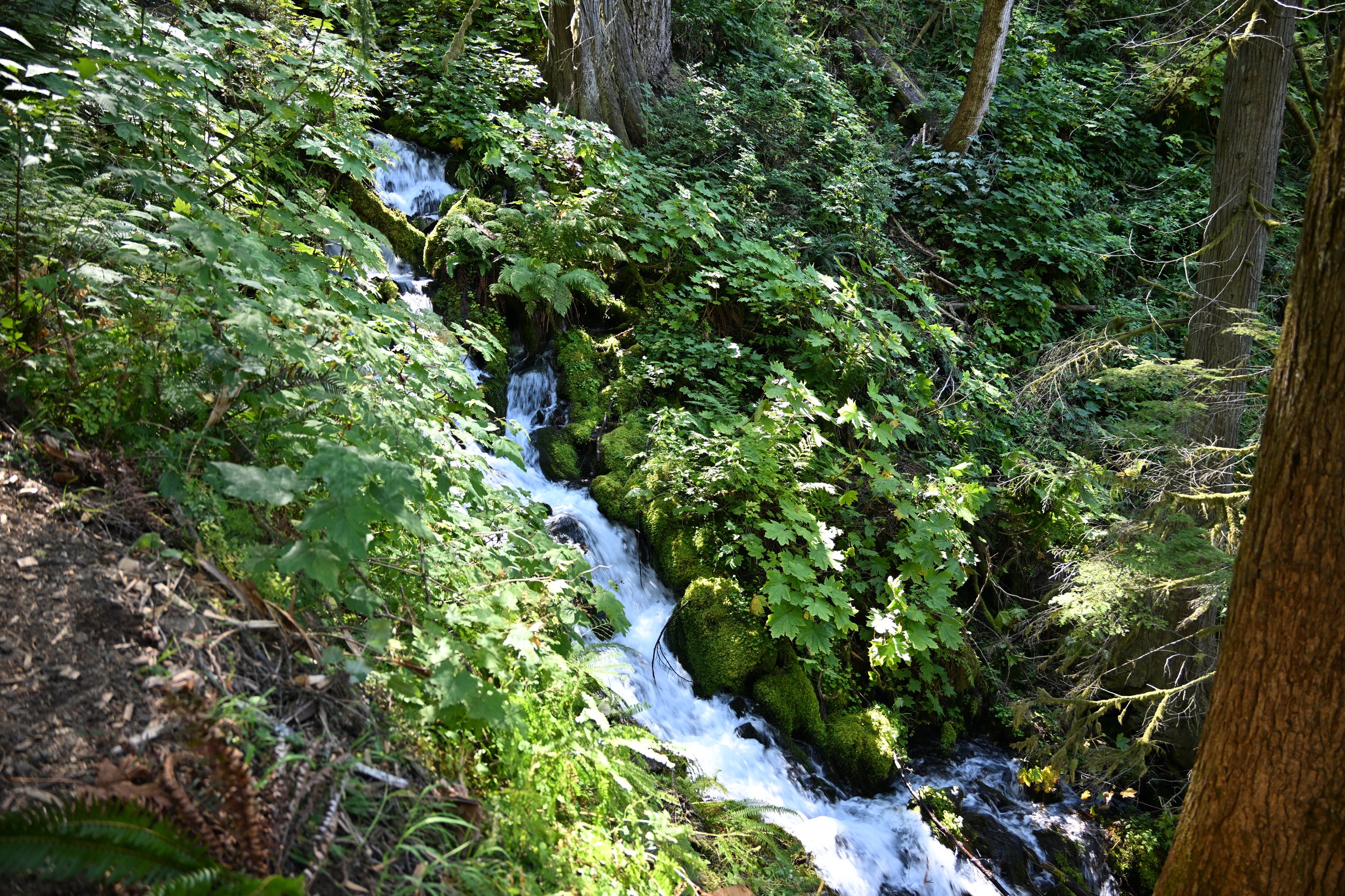
The greenery alongside of it was so lush, and the waterfall just kept stepping down the entire hillside…
… and then another unnamed waterfall jumped out at us as we rounded a corner -
As we continued down the trail on a switchback, we were treated to Fairy Falls again!
By the time we neared the end, Wahkeena Falls was a little anticlimactic -
We stayed in Hood River and thoroughly enjoyed that “little” town. I suggest you check it out the next time you’re rambling along the Columbia River.
We wanted to hike near Mt. Hood…
… so I chose the Tom, Dick and Harry trail. This hikes up the mountain of the same name and gives great views of Mt. Hood. The first part passes by Mirror Lake, but I didn’t get any good reflection shots, so you’ll have to settle for this one, as we walked on boards through a marshy section, surrounded by wildflowers -
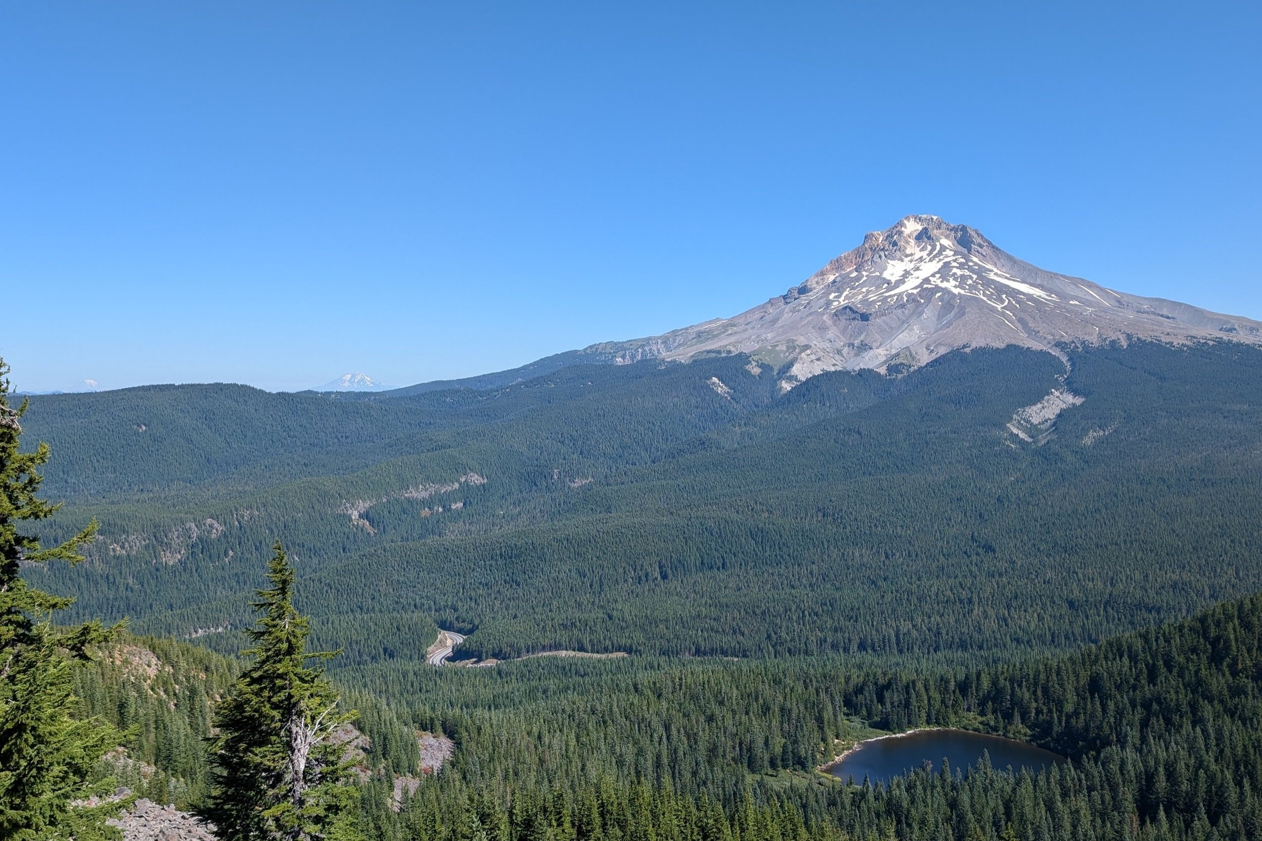
By climbing to the top of ”Tom”, we had some of the best views of surrounding peaks, that we have ever had. As you look at the next picture, see if you can see all the peaks. Mt. Hood is the closest at 7 miles away; Mt. Adams is the next one to the left of Hood, and is 64 miles away, while Mt. Rainier can be seen on the far left of the picture, and it’s 108 miles away! We also saw Mount St. Helens, but it wasn’t very clear, and wouldn’t fit into the line-up picture below.
After we got to this peak, everybody else who was up there, turned around and went back down the same way they came up. I had read about doing the hike as a loop, so we proceeded forward to the “peaks” of Dick and Harry.
(see the bright blue jacket on the guy on the ridge in the center of the picture? That’s the trail along the ridgeline.)
The trail kept disappearing on us as we continued to scramble along the ridge…
… but we are so glad we persevered. The next picture shows where we came from…
… and this was our reward -
Huckleberries!
Once we came down off the rocks, the hillside was covered in huckleberry bushes -
As we walked along, we’d stop every few feet, picking and eating berries until our fingers and lips were stained. Huckleberries taste somewhat like blueberries, but better. They are considered a real treat in the NW because they can’t be cultivated, only grow at high elevations, and have a short season (mid-August to mid-Setember).
After we left Hood River, we followed the Columbia for awhile, loving all the changes in topography of the far bank.
I really liked how this next picture turned out, from the locomotive along the deep blue river, up the smooth foothills to the ridge topped with wind turbines -
We were headed for Walla Walla, WA for wine tasting. This is a region in SE WA that has developed a well deserved reputation for its Syrahs.
There is a small region just across the border in NE OR called “The Rocks” that had quite the unique ‘terroir’ -
I’ll finish with a close-up of Mount Hood -


