Hiking Curacao
The first day we went hiking, we went to Christoffel National Park and followed a trail that was about 5 km total. In the scrub forest that made up the first third of the hike, we had to nearly crawl under some low branches, and dodge our way around overgrown bushes with wicked thorns. It was quite the interesting trail.
You end up on the wild east coast of the island.
The trail
The mountain on the left, in the picture above, is Christoffel Mountain - the highest point on the island at just over 1,000 ft. I had had enough of hiking just to hike, over the last several weeks, so we drove on a loop around it instead. That was actually pretty neat to see the ground bromeliads brightening up the scrub.
You can see the yellow spiky leaves of the bromeliads, along with the different kinds of cacti.
A blooming bromeliad
On the way back to our hotel, we wandered down a road, hoping for a better view of the enormous wind turbines we kept catching glimpses of along the coast.
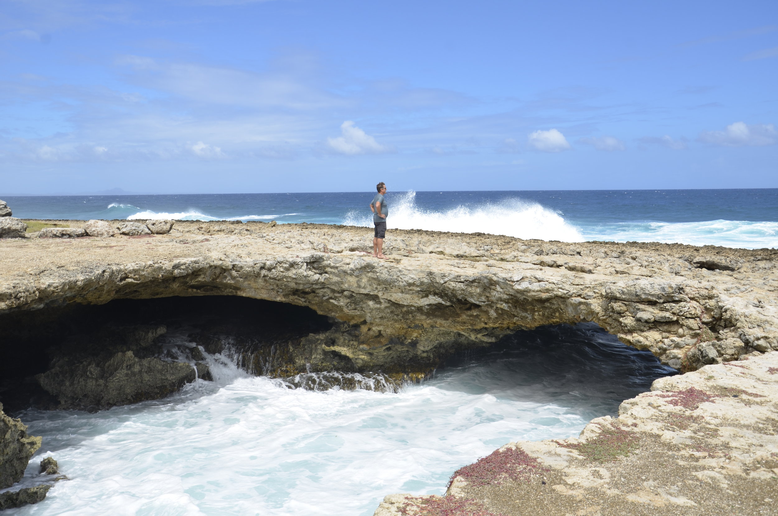
On our second day of hiking, we headed for Westpunt (the western point of the island) to try and find a unique geologic formation that a friend told us about. GPS actually served us well this time, as we wandered down dirt roads to Watamula Hole. There were occasional hand-painted signs that reassured us we were heading in the right direction as the road kept deteriorating. The surf was wild on this edge, and the ground was really sharp pocked limestone.
There was a natural arch that was carved by wave action:
The Watamula Hole is also called the Eye of Curacao - again, cool limestone formation due to water erosion:
The most curious part of the hike was trying to find the Breath of Curacao. This is what our friend had mentioned, but it's not marked on the shore, and the single mention online was vague as to its location. It is a geologic formation caused by water erosion under the shore, that as water rushes back and forth, air is expelled from a rift in the stone, making a sighing sound.
It was anticlimactic, to say the least, after wandering up and down this ironshore, trying to avoid waves crashing, and the wind pushing you towards the edge.
On our last day on the island, we wanted to explore the East End, but there are no roads going there, so we settled for the "northeast end", which was also wild with crashing waves. We again drove on dirt roads to get to this deserted beach, where we found another natural arch.
Oh! Interesting (pallet) fencing seen around the island:
And thus draws to a close, the exploration of the southern Caribbean.


