Last, but definitely not least...bears!

For our last two days in Alaska, we flew to Kodiak Island, hoping to glimpse some of the famed enormous Kodiak bears. They are grizzlies (brown bears) like we’ve seen before, but on that island, have grown much larger due to better diet and isolation from the rest of their species.

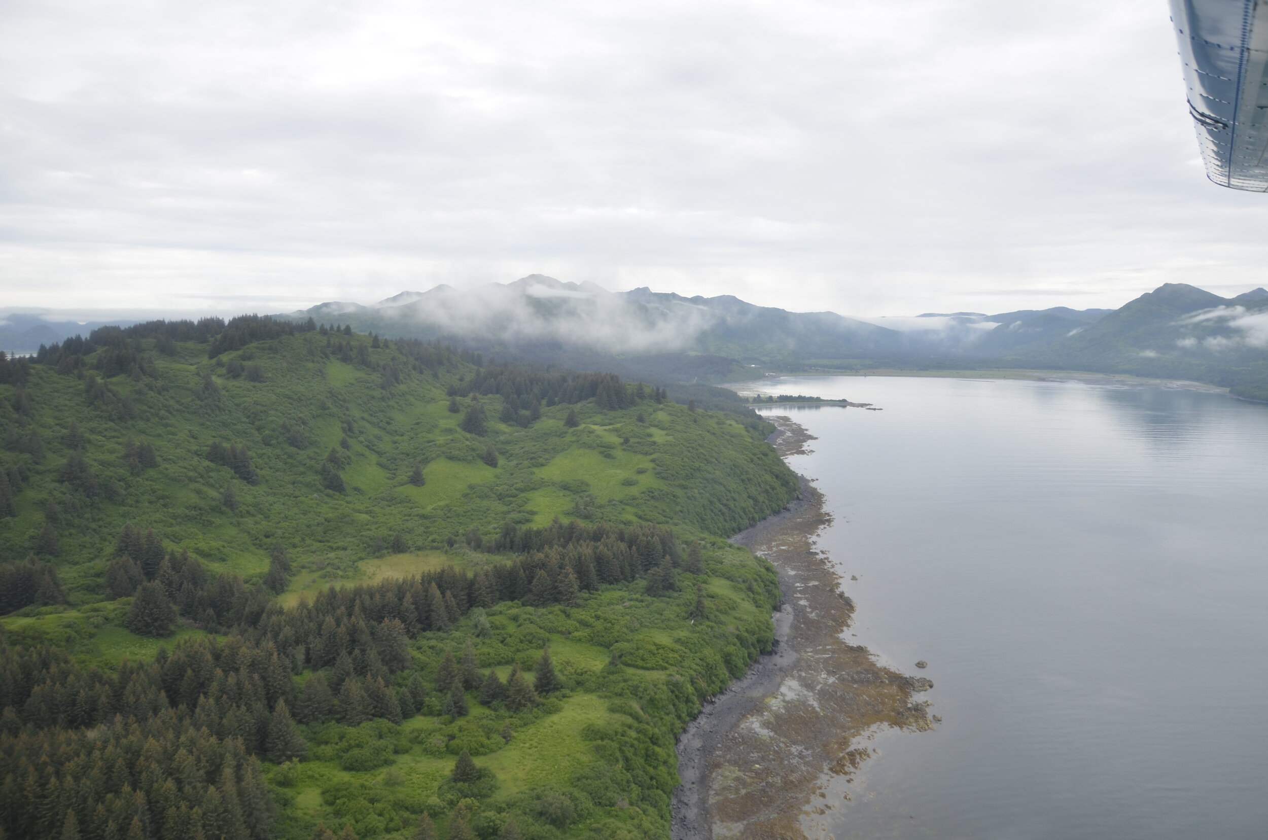
We flew out on a float plane (forgive the early pictures that have the wing in the shot - I figured out later how to take decent shots without the wing in there) and at first it reminded us of the rainy SE of the state, but also Ireland with all the green and hills.

_DSC4306.JPG

I had quickly volunteered to sit in the co-pilot seat…

IMG_20200718_084539 (1).jpg

I didn’t have anything to do with the flying. I just figured I’d have a great view. Everything was so green!

_DSC4315.JPG

The general area where we would hike to, to observe the bears:

_DSC4321.JPG

At the fish ladder, beside the falls in the river, to try and make it a bit easier for the salmon to get upstream (and the rangers to get a count of the fish going by) -

_DSC4338.JPG

We finally got to see bears catching salmon, as well as lots of other activities -

_DSC4414.JPG

At one point, we counted 14 bears in the small area we were sitting back and watching, including numerous different groups.

_DSC4419.JPG

This mam was with her (probably) 2 yr old twins.

We had some awesome shots of intense concentration…

_DSC4429.JPG

…as well as interesting idleness -

_DSC4476.JPG

“Hey bro’, whatchya doin’?” -

_DSC4485.JPG

Interestingly, we saw a number of adult bears fishing this way:

_DSC4532.JPG

…while the youngsters looked on -

_DSC4533.JPG

…and occasionally they were successful…

_DSC4603.JPG

…but usually not.

_DSC4375.JPG

The different groups we saw included a mama with 2 spring cubs -

_DSC4588.JPG

(that were very curious) -

_DSC4592.JPG

There were also a sibling pair that was probably in their 4th year (and first year on their own), checking out a mama and her twins:

_DSC4567.JPG

There was an old sow that wandered out of the brush next to us, surprising us after we’d been there over an hour…

_DSC4551.JPG

…but she just wanted to sit in the cool water of the river.

_DSC4559.JPG

I didn’t see as many standing up as I was hoping to -

_DSC4448.JPG

…but we did get to see several running at shoals of fish (but never successful in catching them that way) -

_DSC4520.JPG

I watched one seemingly just put her paw down, swipe, and come up with a fish -

_DSC4450.JPG

The best were the 2-3 yr triplets. They sat back waiting for mama to catch a fish…

_DSC4465.JPG

…wrestled with each other…

_DSC4377.JPG

…or mobbed mom when they were hungry.

_DSC4596.JPG

I couldn’t believe that cubs this size were still nursing!

_DSC4613.JPG

But that wasn’t all. On our way back, after passing over “Christmas tree heaven” (where all spruces wish they could end up):

_DSC4678.JPG

…I mentioned to our guide that we’d not yet had the luck to see orcas. He said that they would just show up randomly, but you can’t count on them. As we passed by Whale Island (no joke), we spotted them!

_DSC4683.JPG

So he landed on the water (!) and we waited for them to come to us.

_DSC4734.JPG

We were really excited to see them this close…

_DSC4793.JPG

…but as they got closer, I forgot to pull in my lens, so I didn’t get them all in the frame!

_DSC4809.JPG

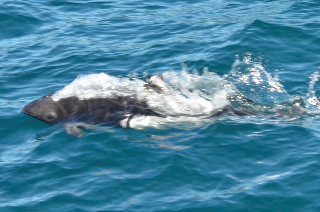
I think we can now safely check off orca on our wildlife checklist!

_DSC4816.JPG

Our trusty steed:

_DSC4826.JPG

That afternoon we went for a hike, and were reminded of how much rain Kodiak must get -

_DSC4849.JPG

We hiked around a lake and loved the yellow pond lilies:

_DSC4866 Yellow Pond Lily.JPG

The night before we flew out of Anchorage, we had dinner at a restaurant overlooking Cook Inlet.

IMG_20200719_201524.jpg

And thus ends our Alaskan saga. Tune in next time for…?
Glacier Hiking!

On our way from Valdez back to Anchorage, to return the RV, we got to see some more beautiful vistas -

this was an enormously wide valley

this was an enormously wide valley

…colorful hills…

_DSC4230.JPG

…vista…

_DSC4232.JPG

…and the glacier we were to be hiking.

_DSC4233 crop.jpg

The Matanuska Glacier is 27 miles long, 4 miles wide and the largest road-accessible glacier in Alaska. I thought it’d be a unique experience to hike on a glacier, so I signed us up.

_DSC4236.JPG

It doesn’t look like much with the mountains looming over it in the distance, but I’ll have a picture later with us in front for scale.

Our guide carried lots of stuff in his backpack - ropes, carabiners, ice drills, reflective thermal blanket (in case we fell in ice water), emergency medical kit, etc., so we felt very safe.

_DSC4240.JPG

That’s actually glacier that he’s on. It looks like a bunch of dirt because it is. That’s all the rocks and dirt that the glacier scraped away years and miles ago, that gets deposited at its terminal end. As we hiked on, it became prettier -

_DSC4244.JPG

We were able to fill a water bottle with pure glacial water (it was surprisingly very “flat” tasting) -

_DSC4245.JPG

He knew that that trickle of water on the right side of the picture arose from deep in the glacier, and had drunk from it frequently before without any issues (and we didn’t develop any issues later, either).

people for scale

people for scale

We had a beautifully clear day for our hike -

_DSC4246.JPG

…and this created lots of streams on the surface that ran into “moulins”, or vertical shafts in the ice:

Crevasses were gorgeous and scary at the same time.

_DSC4254.JPG

My crampons:

really serious spikes

really serious spikes

We got to learn and use specific skills for maneuvering around on icy terrain. This rope was for us to clip on to, as well as hold on, when there’s an open drop off to one side -

_DSC4267.JPG

…that allowed us to reach this crevice:

_DSC4264.JPG

… (and play “Where’s Steve?”) deep in the glacier.

_DSC4270.JPG

Then we got to “walk” down this ice wall:

_DSC4279.JPG

sorry you have to look at Steve’s butt for this, but I couldn’t take any pictures of myself descending -

_DSC4282.JPG

I just loved the clear bright colors -

_DSC4275.JPG

As we came back down the glacier, we stopped at the ice falls (this is a side perspective)…

_DSC4289.JPG

…(in comparison to the straight on) for a last photo -

_DSC4294.JPG

So where we went was up on top on the left:

_DSC4297.JPG

I’ll close with this reflection photo…just because.

_DSC4239.JPG

Valdez and other stuff

So, continuing from Worthington Glacier…

_DSC3713 Worthington Glacier.JPG

…we opted not to hike up to it (since we had done the one near Juneau), and we were glad we skipped it, so we could do this mountain valley hike right off the road:

_DSC3719.JPG

That’s actually a dirt road leading up to the outcropping, then it continued as a trail out to the second prominence you can see there.

_DSC3724.JPG

The hillsides were covered in ferns and wildflowers (mountain harebell, yellow paintbrush, and the large swath of mountain heather in the foreground, if you were interested) 😉.  Because the latitude is 60 degrees North here, alpine tree line is at about 2,500 ft of altitude, compared to over 11,000 ft in CO!

_DSC3736.JPG

Bridal Veil Falls is right beside the highway heading into Valdez…

_DSC3753.JPG

…within Thompson Canyon.

_DSC3757.JPG

Thompson Pass, at the head of this canyon, is the snowiest place in Alaska (averaging 500 inches per year).  It holds the record for the most snow in one season within the entire US – 974 inches in the winter of 1952-53, and the most snow in a single day – 62 inches on 12/29/55.

Before we checked into our campground near the harbor in Valdez, we visited a salmon hatchery across the inlet, where I finally saw salmon.  I had been looking all over the state for salmon in creeks and rivers, with no luck, as we were between spawning seasons of the various species.

_DSC3771.JPG

We had a blast watching sea lions fishing for them at the mouth of the hatchery inlet. We probably spent at least an hour watching them.

As we left the Port of Valdez the next day, for our cruise of Prince William Sound and to see another glacier up close, we were met by a cute farewell committee…

_DSC3949.JPG

…that were pretty laid back.

_DSC3953.JPG

We learned about purse seine fishing for salmon, where the net hangs vertically in the water with its bottom edge held down by weights, until the “purse line” is pulled up into the boat, as the circle is closed:

_DSC3957.JPG

On the way to the glacier, there were huge waterfalls…

_DSC3972.JPG

…gorgeous scenery along the coast…

_DSC4012.JPG

…both Horned and Tufted Puffins (left and right, respectively):

_DSC4040 Horned and Tufted Puffins.JPG

…as well as Dall Porpoises -

_DSC4053.JPG

(very fast and hard to capture in a picture)

_DSC4054 Dall Porppoise.JPG

Well before we could see Columbia Glacier, we encountered large icebergs…

_DSC4061.JPG

…that had beautiful colors and interesting shapes from melting and wind erosion.

_DSC4071.JPG

The captain told us it was pretty rare to see the sea otters out of the water, so we snuck up on this group:

_DSC4109.JPG

…and reveled in seeing this guy walk down the ice floe and pause before slipping into the water.

_DSC4101.JPG

We couldn’t get any closer than this (5 miles) to the main (east) arm of Columbia Glacier, due to all the ice in the water…

_DSC4114.JPG

…but we were able to get within a quarter mile of this west arm –

_DSC4130.JPG

…and watch it calve.

I got really lucky a few times to have my camera trained on the section that let go, because there’s no warning.  Once you hear a crack or splash, it’s almost over.

_DSC4174.JPG

If you blow up the center of the picture above, you can hopefully see the areas falling, with all the little debris around them.  (when I run through the series of stills I got on my computer, it looks like a neat slo-mo movie)

A last look back -

_DSC4192.JPG

On the way back to the harbor:

_DSC4203.JPG

I promised a tanker at the end of the pipeline -

_DSC4211.JPG

Now off to more adventures…

_DSC3836.JPG

Driving in Southcentral Alaska

As we drove from Denali up to Fairbanks, and then down around to Wrangell-St. Elias National Park, we were repeatedly treated to gorgeous vistas of wide rivers -

_DSC3616.JPG

…mountain ranges -

_DSC3627.JPG

(each more beautiful than the last)

_DSC3656.JPG

…glaciers -

_DSC3662.JPG

…and even the Alaska Pipeline.

_DSC3648.JPG

Rather than typing in a bunch of interesting facts, I’ll let you read the info board we did:

_DSC3622.JPG

I cut off its starting location, which is Prudhoe Bay. That first picture showed it coming from underground, then continuing on above ground. The bends are built for expansion joints and flexibility in the event of an earthquake. When we were in Valdez, a few days later, we saw a tanker getting filled at the terminal, which I’ll post later.

Random comment - if you’re ever in Fairbanks and want to kill a couple of hours, we can highly recommend the Fountainhead Antique Auto Museum. They had lots of super early cars, as well as fashion pieces of the comparable eras. Both of us found both facets very interesting.

IMG_20200712_143417 Fairbanks.jpg

As we headed south, we drove along the Wrangell Mountains, and were blown away by their size and beauty.

_DSC3664.JPG

We spent the night in a little town (Glenallen) that lies in the shadow of these gorgeous peaks, and had an even clearer view when we left in the morning (even though the light wasn’t optimal).

_DSC3680.JPG

We stopped at the Wrangell-St. Elias National Park visitor center, took a walk in the woods (swatting mosquitoes the whole way) -

_DSC3687.JPG

…and learned about fish wheels.

_DSC3686.JPG

Hopefully, you can visualize how they work from my description here. In the picture above, current would be flowing left to right, pushing the paddle (that is currently out of sight) and bringing the left basket into the water, scooping up salmon swimming upstream. As the basket rises, the fish fall to the side near the center, that has a slanted floor, and they slide into the holding pen that is the long stacked logs.

They were first used in North Carolina in 1829, but their major deployment was on the Columbia River (Washington) in the 1870’s. They were too successful, and were banned in the late 1920’s. They can still be used for subsistence fishing on the Copper and Yukon Rivers in Alaska, but all salmon caught have to be reported to the Dept. of Fish and Game.

_DSC3689.JPG

Some interesting Wrangell-St. Elias National Park stats: 9 of the 16 highest peaks in the US are here. It is the largest National Park in the US, and is the size of 6 Yellowstones! We barely set foot in it during our hike, but I couldn’t stop taking pictures of the peaks as we drove by.

_DSC3692.JPG

I keep trying…

_DSC3698.JPG

Just about every road we drove down was lined with the fireweed you see above.

There weren’t too many lakes where I could get reflection shots, but I’ll keep trying -

_DSC3702.JPG

All my favorites - mountains, river, fireweed and glacier:

_DSC3712.JPG

Next post will proceed from here, the Worthington Glacier, on into Valdez and out into Prince William Sound.

Denali - weather permitted! (sort of)

On our last morning in the Denali area, we awoke to a gorgeously clear blue sky. I woke up Steve, after I had my French press coffee ;) and we headed out to drive back down south. As we had driven north from Anchorage, there were supposed to be beautiful views of Denali…wait for it…”weather permitting”. We decided it was worth driving 2 hours for a possible clear shot of the mountain, so we raced against the incoming clouds.

_DSC3570.JPG

I made Steve stop briefly for that neat canyon shot of the Nenana River (that runs just outside of Denali park).

Skies are still clear(!) on the way -

_DSC3573.JPG

And then we see IT for the first time:

_DSC3577.JPG

Denali is the all white “lump” in the middle. Not very impressive at that magnification, is it?

As I zoomed in, you could see both the south and north summits (left and right, respectively) -

_DSC3584.JPG

(you’ll need to zoom in also)

This was the clearest/best shot I got. At the above magnification, you can get a sense of how it looms over all the other peaks.

_DSC3586.JPG

Denali is on the right end of that line of peaks above.

Clouds were encroaching…

_DSC3591.JPG

…but I still got a neat shot.

_DSC3590.JPG

By the time we got to the “official” viewpoint, the clouds had really come in, but the colors were gorgeous.

_DSC3597.JPG

This zoomed in shot shows the glaciers below the (now obscured) peak:

_DSC3596.JPG

Just as a recap, the first 5 pictures of Denali in this post were taken by me hanging out the RV window as we sped down the highway (got that mental picture?). I’m really glad i did, because when we could stop to get a “clearer” shot, the clouds were thwarting us.

Oh well, the nearby hills were beautiful anyway, and the skies were blue over us.

_DSC3606 crop.jpg

We decided that our “little” 4 hour trip (down and back) was worth it to see “the high one” (that’s what Denali means in the Athabascan language).

OH! I almost forgot to tell you about another sighting we had on our hike as we left Denali park the day before. We went hiking around Horseshoe Lake near the entrance of the park. As we neared the lake -

_DSC3549 crop.jpg

…we met a hiker coming up the trail who said there had been a moose working its way along the lake edge. So we got down to the lake…

_DSC3514.JPG

…and walked all around it, without finding a moose. Sigh. So we started back up the trail to get back to the RV…

_DSC3516.JPG

…and found this cow grazing on small trees just about 25-30 yds off the trail. We stopped and quietly watched her move slowly off. She walked on up the hill, and crossed the trail that we needed to use to get back. We didn’t want to get any closer, but she stopped just off the trail and was calmly grazing. I took a few close shots -

_DSC3545.JPG

…and we moved on up the trail, hoping we didn’t disturb or provoke her.

One last quick item — we visited a Husky breeding and training center, and learned fascinating things about training Huskies and running in the Iditarod Dog Sled Race (1,000 miles from Anchorage to Nome). Since everybody loves puppies, I’ll close with these 12 day old cuties:

Denali National Park

I don’t think I’ve ever taken a picture of a national park entrance sign, but because Denali is so huge, and because we spent 4 nights camping deep within it, it felt really special.

_DSC3030.JPG

We hardly saw the sun the whole time we were there, but the vistas were still gorgeous…

_DSC3031.JPG

…and the open spaces were immense.

_DSC3037.JPG

I found some buddies…

_DSC3040.JPG

…and some butts.

_DSC3056.JPG

I like the idea of wildflowers in the foreground, trees in the middle and snow capped peaks in the distance, but I’ll keep working on my technique.

_DSC3085.JPG

Fireweed lines all the roadsides with pink, and up close it’s even prettier:

_DSC3012.JPG

This was the view from the riverside just behind our camp –

_DSC3088.JPG

It was a pretty dreary day that we had reservations for the day-long bus ride deeper into the park, but the awe-inspiring views kept us glued to our windows.

_DSC3102.JPG

Animals can’t care about the weather, and we had some great sightings on our trip.  First up, a Hoary Marmot, or “Whistlepig” as it’s also known –

(if you zoom in you can see his teeth)

(if you zoom in you can see his teeth)

A Red Fox posed several minutes for us –

_DSC3143.JPG
_DSC3145.JPG

We saw several small and large herds of caribou…

_DSC3150.JPG

…and they were still shedding their winter coats.

_DSC3156.JPG

When we reached the Eielson Visitor Center, the farthest point that the bus system was running this year (mile 66 into the park), there is said to be a fantastic view of Denali peak (weather permitting).  This was our view:

_DSC3157.JPG

(Actually, that was a view down to a river below the mountains, but you can see how low the clouds were.)

In our travels throughout the state, we were using a very detailed book entitled “The Milepost”.  At numerous times in the description along the Parks Highway (Alaska route 3), points were noted to have great views of Denali “(weather permitting)”.  It became our running joke of the trip.

The clouds/fog lifted enough for us to take a mile loop through the tundra vegetation at the Visitor Center and see some neat things – grasses…

_DSC3167.JPG

…wildflowers…

_DSC3170.JPG

…ground cover…

_DSC3174.JPG

…and an industrious Antelope Ground Squirrel.  He was pushing the dirt he’d excavated from his burrow away with his back feet.

(note the dirt on his nose)

(note the dirt on his nose)

On our way back to our campground, everyone on the bus was treated to a not very common sight here –

_DSC3209.JPG

This was a sow with her (probable) 3 year old offspring (since it was almost her size).

_DSC3218.JPG

I enjoyed the color variations and contrasts.

_DSC3222.JPG

Our last animal sightings were of Dall Sheep.  They are the only white wild sheep in the world.  They are in the same family as bighorn sheep but these are in the group called “narrow horn”.

_DSC3240.JPG

Again, I’ll let you zoom in on the subjects, as they’re not very sharp, due to the distance they were from us (way up on hillsides).

_DSC3244.JPG

You can easily see why these are referred to as “braided” rivers –

_DSC3270.JPG

Now that picture shows the beautiful blue sky and sunshine we were treated to on our 4th day in the park, after spending almost the entire day in the RV on the 3rd day due to rain, cold and overcast.

We were finally able to take advantage of camping deep in the park, by being able to take another bus ride back to Eielson Visitor Center.

_DSC3330.JPG

What I thought were stupendous views before, were even more jaw dropping with color added.

_DSC3342.JPG

This is what we missed as the view from the visitor center 2 days previously:

_DSC3392.JPG

(we couldn’t even see that path down at the bottom of the picture, when we started out on it then)

Even with persistent clouds, I was thrilled to see all the green, as well as snow patches –

_DSC3404.JPG

On this trip we had lots of close encounters with caribou…

_DSC3432.JPG

…and saw some gorgeous racks.

_DSC3435.JPG
_DSC3455.JPG

Caribou are the only members of the deer family in which both sexes have antlers. They also lose those antlers every year and have to grow them back (each one can weigh 18 pounds)!

_DSC3476.JPG

This cow is showing off her pretty white socks, while the old bull keeps his nose in the sand to keep the bot flies from laying their eggs in his nostrils.

I’ll close with this pull back shot, allowing our friend to give a sense of scale to the grandeur that’s Denali.

_DSC3477.JPG

Wandering on the Kenai Peninsula

We left Seward and headed north and then west across the Peninsula. Kenai Lake was a startling turquoise.

_DSC2668 Kenai Lake.JPG

Here is a map of the Kenai Peninsula, so you can see places I’ve referred to:

Kenai-Peninsula-Alaska-Map.jpg

We spent the night in Soldotna at an RV park on Funny River Road (we liked the name). The promised RV picture:

_DSC2674.JPG

The town of Kenai was off the main highway, but we took a side trip to it, to check out the sights. Russians settled there in 1791, building a fort that was an outpost for trading fish and furs. The Russian Orthodox religion took root, and Kenai’s oldest buildings are Orthodox related.

Holy Assumption of the Virgin Mary Russian Orthodox Church (1894)

Holy Assumption of the Virgin Mary Russian Orthodox Church (1894)

The Chapel of St. Nicholas (1906) was built as a tribute to Igumen Nikolai, the first missionary in the Kenai area, who is credited with bringing the smallpox vaccine to the Kenai Peninsula.

_DSC2681.JPG

Across Cook Inlet you can see 3 large volcanoes (I was only able to get 2 in one shot), with the most prominent being Mt. Redoubt.

_DSC2688.JPG

It last erupted in 2009.

_DSC2689.JPG

I don’t know about you, but I had never seen the Alaska state flag. I’ve tried several times to capture it. It shows the Big Dipper and Polaris (the North Star).

_DSC2702.JPG

Before we got to Anchor Point, where we took the bear viewing tour, we took a short detour to another picturesque church - Holy Transfiguration of Our Lord Russian Orthodox Church. It was sitting out on a bluff almost all by itself. It’s still an active church.

_DSC2725.JPG

As we were driving, I was continually scanning for moose, that the roadside warning signs kept hinting of, with nary a one. But…I finally spied them, and it was a cow with her twin calves. Of course, by the time we got turned around and went back to get pictures, they were spooked and headed off into the brush.

_DSC2736.JPG

Anyway, I got more candidates for my butt collection.

_DSC2757.JPG

That beauty above landed in a tree just above us as we were out for one of our evening constitutionals.

After our bear viewing trip, we drove on down to Homer, which is on the southern tip of the Kenai Peninsula, on the west side (maybe look at the map at the beginning of this blog again?). There was a gorgeous approach from the highway…

_DSC2926.JPG

The next picture shows the Homer Spit, which is a 4 mile extension into Kachemak Bay, that was most likely formed by a glacier pushing the land in front of it, then retreating.

_DSC2919.JPG

Steve and I walked along this, marveling at the views across the bay -

_DSC2935.JPG

…while trying to ignore the traffic, shops and too many tourists (even in COVID times!). We decided this reminded us of Myrtle Beach, SC, but with glaciers.

_DSC2938.JPG

This was the view from our RV site. It felt like condo renting on the beach on the Gulf of Mexico…

_DSC2940.JPG

…but with a HUGE beach to wander for miles on, with awesome backdrops.

_DSC2944.JPG

The pictures above and below were taken at low tide. How cool is that? —

_DSC2947.JPG

Those pictures were taken about 7 pm. The “midnight sun” here has really done a number on my internal clock and sleeping. I have to wear a sleep mask, so I can sleep past the sunrise at 0400, and go to sleep by 11 pm, with it still twilight. This was taken at 10 pm:

_DSC2956.JPG

The next morning we went out walking on a trail just off the beach in some wetlands…

_DSC2987.JPG

…and were treated to a Sandhill crane and her chick. They drank in unison from the stream -

_DSC2989.JPG

What cute stubby wings and knobby knees (and crane butt!) -

_DSC3000.JPG

This is the same beach but at incoming tide:

_DSC3010.JPG

We’re now headed for 4 days off the grid in Denali National Park. I’ll close with this neat shot of beach rocks that looked like some kind of painting.

_DSC2953.JPG

Lake Clark National Park (da bears)

_DSC2801.JPG

I wanted to grab your attention and post a picture first, but now I have to backtrack a little…

We left out of Anchor Point launch area on a half day bear viewing tour by boat over to Lake Clark National Park (about 40 miles across Cook Inlet, taking 1 1/2 - 2 [bumpy] hours each way). A fascinating launching method used here is by tractors -

(note the bald eagle watching on the beach)

(note the bald eagle watching on the beach)

Before we left, we donned chest waders and waterproof boots for our landing:

IMG_20200702_092512.jpg

As we approached shore, trying to keep our boots on through the sucking mud, we watched a sow with 2 spring cubs (meaning 6 months old or less) -

_DSC2789.JPG

They looked like they were all legs -

_DSC2805.JPG

Bear butt!

_DSC2812.JPG

As we walked along the beach, we came up on this boar, which was focused on digging for clams, and not at all concerned by us…

_DSC2813.JPG

…and even let us get on his best side for optimal lighting. ;)

_DSC2818.JPG

Out in the meadow…

_DSC2832.JPG

…we watched a sow and her year old triplets graze on the sedge grass (apparently quite nutritious for them) -

_DSC2842.JPG

She then proceeded to walk down to the beach to go clamming. This video was shot by Steve on his cellphone, with little zooming (they really were right in front of us about 15 yds away):

Yes, these are wild grizzlies.

_DSC2856.JPG

We sat and watched these guys tussle for quite awhile -

_DSC2896.JPG

The female in the background wasn’t too impressed -

At one point they looked like they were dancing:

_DSC2910.JPG

All this activity has made me tired. Time to take a nap.

_DSC2864.JPG

Kenai Fjords National Park and other stuff

After we collected our RV (Minnie Winnie!) in Anchorage, and loaded up with groceries, we set off down the Kenai Peninsula and did some exploring. First up was the Turnagain Arm of Cook Inlet.

_DSC2317.JPG

Farther up the arm, this is what it looks like at low tide:

_DSC2319.JPG

This is one of the few places in the world where a “bore tide” occurs. Definition from a an Alaskan website: The "bore" is a tidal phenomenon in which the leading edge of the incoming tide clashes with the flow of the outgoing tide to form a wave that travels up a river or narrow bay. These tides, which can reach 40 feet, come in so quickly that they sometimes produce a bore tide wave that can reach 10 feet high, and locals surf it! Unfortunately, we were at the wrong time of month (best with new and full moons) as we were driving by. However, we did watch the tide coming in and it looked like a river in the bay.

(please ignore the waving person at the bottom left of the video)

Next up was a hike to the Exit Glacier in Kenai Fjords. We did the easy trails first, getting this view:

_DSC2328.JPG
check out the people at the river’s edge (for scale)

check out the people at the river’s edge (for scale)

Since it hadn’t started raining (yet) we decided to try the first 1.3 miles of the strenuous trail up beside the glacier. We climbed 1300 ft, and it took us an hour just for that ~mile.

_DSC2349.JPG

The wildflowers were out like crazy. There were some rain forest-esque areas also:

yes, that’s the trail…(above)

yes, that’s the trail…(above)

_DSC2340.JPG

It was so cool to look down on the glacier.

Steve contributed this awesome panorama

Steve contributed this awesome panorama

The Scottish Bluebells were so dainty and bright -

_DSC2311 Scottish Bluebell.JPG

On our second day in Seward, we took an all day boat tour of Kenai Fjords National Park. We lucked out on a gloriously sunny day.

_DSC2470.JPG

There were tons of glaciers, and lots of wildlife. We saw humpback whales (just spouting), Stellar sea lions:

_DSC2416.JPG

…sea otters, even a black bear (at a distance):

blurry because I was totally zoomed out on the lens and still had to blow up the picture

blurry because I was totally zoomed out on the lens and still had to blow up the picture

…and Harbor Seals -

_DSC2573.JPG

I was loving the reflections -

_DSC2472 crop.jpg

We then hung out in front of Northwestern Glacier…

_DSC2474.JPG

(we were still a mile away at the shot below)

_DSC2485.JPG

…and it cooperated and calved a number of times while we were watching:

The harbor seals on the ice (above) provide scale for the glacier, calving and splashes.

_DSC2533.JPG

This “ice fall” was really neat to watch make its way down the chute after the dam broke at the top (please forgive the poor stabilization; I’m not a great videographer, and the boat was bobbing some) -

Loved the blue! -

_DSC2508.JPG

These were Horned Puffins (so named for the markings on their cheeks) that were interacting up on a cliff -

_DSC2615.JPG

(I’ll let you zoom in on your screens, rather than getting them all fuzzy)

_DSC2618.JPG

Here you can better see the markings:

_DSC2455 Horned Puffin.JPG

As we came back into the harbor, there was an immature bald eagle just landed:

_DSC2659.JPG

The End.

puffin butt

puffin butt

Glacier Bay National Park

We spent an entire day (10 hours) in a small boat with one other customer, along with the captain and his 17 year old granddaughter.

_DSC1838.JPG

Two hundred fifty years ago, Glacier Bay was all glacier and no bay.  Today, the glacier has retreated north, leaving a handful of tidewater glaciers that are still quite impressive.  We saw 5 of them, as we motored up about 55 miles from Bartlett Cove’s dock.

_DSC1950.JPG

We saw only 2 other boats the entire time.  I asked Captain Jim if in a “normal” season the waters are much busier, but he said, actually no.  There’s so much space, that even with cruise ships here, there’s still lots of solitude.

_DSC2144.JPG

Not too long after we started, we were treated to a pair of youngsters that were probably 3 years old and out on their own for their first season.

_DSC1858.JPG

One of them is more skittish than the other, Captain said, and he loped away after just a few minutes.

_DSC1864.JPG

As we kept heading north, brown furry heads would pop up and watch us pass by:

Mom and baby

Mom and baby

It was cool to see the layers left exposed on the rocky shores by low tide.  The black layer is mussels, and the green/brown layer on the bottom is seaweed.

_DSC1872.JPG

We then saw a larger solitary figure, most likely male:

_DSC1887.JPG

…in contrast to the next group of a trio –

baby bear butt!

baby bear butt!

Yes, these are grizzlies.  It was really special to watch them for quite awhile going about their business of turning over rocks, looking for mussels and small fish trying to hide.

_DSC1912.JPG

The claws were very impressive –

on both momma and baby

on both momma and baby

Cute family tableau as we departed -

_DSC1935.JPG

This is the backdrop when I’m not zoomed in:

see the “tiny” bears at the bottom center?

see the “tiny” bears at the bottom center?

The sea otters float effortlessly on the surface, and are quite curious.

_DSC1962.JPG

As we continued north, the waters became more turquoise due to the glacial silt added to the bottom, from the constant scouring.

_DSC2045.JPG

Another fascinating sight was the stranded starfish from the extremely low tide.  We guess they’re so “fat” because everything grows slower and bigger in cold water?

_DSC2062.JPG

Captain Jim said we were really fortunate to see the Tufted Puffins nesting in some holes in the cliff face.  Usually they’re hidden much deeper. (this picture is way blown up):

_DSC2093 Tufted Puffin.JPG

Next up on the critter parade were two nannies and their kids –

check out the teeny tiny horns on the kid

check out the teeny tiny horns on the kid

Momma mountain goat has got some impressive horns –

_DSC2123.JPG

It was so nice that as we approached our first glacier, the water became like a bathtub.

_DSC2153 Reid glacier.JPG

For those who might be interested in names, that was Reid Glacier, while this one is Lamplugh Glacier:

_DSC2155 Lamplugh glacier.JPG

We could only see Johns Hopkins Glacier from a distance, as the area near it was closed to boats for the time being, due to seal pupping.

_DSC2158.JPG

However, I did manage to catch the splash of a piece that calved –

_DSC2171.JPG

…when we were resting on the point we had hiked up.

_DSC2164.JPG

Our trusty conveyance:

_DSC2162.JPG

Now the topper of the trip (and our furthest point north; nearly at the Canadian border!) – Margerie Glacier.

_DSC2182 Margerie glacier.JPG

I included the boat in this shot to “kinda” give a little bit of scale, but you really can’t appreciate its immensity unless you’re right up on it.  Captain said it’s a mile wide!

_DSC2188.JPG

I just loved the gorgeous blues and the wind sculpting –

_DSC2208.JPG

The air temp was pretty cold as we moored out in front of this to eat our lunch.

_DSC2209.JPG

Ahhhh…the whole puffin!

_DSC2226.JPG

After our day on the water, we took the bikes at the lodge to get to a short trail on the other side of town.  Gustavus is not a booming metropolis, with only 446 hardy souls.

_DSC2267.JPG

Remember how I said we had gotten bear bells in Juneau?  Well, they came in handy on this walk.

_DSC2270.JPG

Steve estimated that the sow and her cubs were about 50 yards away.  They were aware we were there, but didn’t seem bothered by our presence.  Since we were at the same level as they were, I wasn’t able to get really clear pictures, but it was way cool to share the meadow with them!

_DSC2284.JPG

This was the beach behind the lodge (where we saw all kinds of wildflowers during our stroll) -

_DSC2297.JPG

Ending with the requisite sunset picture…but this was at 10 pm!

IMG_20200623_220222 10pm.jpg

Mendenhall Glacier and Juneau

After we left Sitka at 0540, and the sun had already been up for 2 hours (!), we had an entire day to kill in Juneau, until our 5:30 pm flight to Gustavus and Glacier Bay.  So, we rented a car at the airport, had a nice breakfast, and got to the Mendenhall Glacier about 0800.  Again, because we had been up for several hours already, we were surprised to be just the second car in the parking lot.  We thought, oh well, COVID strikes again.

_DSC1810.JPG

We proceeded to hike all the trails available in the area (a grand total of 6 miles), taking our time and lots of pictures.

_DSC1811.JPG

Nugget Falls is said to be even more beautiful in the winter, when it’s frozen.

_DSC1795.JPG

We walked out onto the beach alone, for this vantage point:

_DSC1800.JPG

…and when we headed back in, we ran into many people going out.  Thus, we figured that we had just gotten a super early start, but it was sure nice being alone for most of our hiking.  The East Glacier Trail was 3 miles, but took us 2 hours because of all the switchbacks and steps.

IMG_20200622_103231.jpg

It was gorgeous SE Alaskan rain forest, and gave us a different view of the glacier.

_DSC1821.JPG

Because we were flying a lot during this part of our exploration, we didn’t have bear spray with us when hiking.  So Steve kept up a litany as we approached blind corners – “oh bear!  Hello bear!”  Before we left Juneau, we visited an outdoors store and bought a couple of bear bells, for our future hikes.

_DSC1827.JPG

We then drove up the Glacier Highway north of Juneau until the nice pavement gave way to potholes and buckled asphalt.  We opted not to drive to “the end of the road” that it’s literally called, but did enjoy the scenery along the way, of the Chilkat Mountains.

_DSC1834.JPG

Sorry this post is so short. Just watch out - the next one’s a doozy! ;)

Sitka

This is a small, picturesque town on Baranof Island (about halfway up/down the Panhandle) that was first settled by Russians in 1799. Sitka was the site of the transfer ceremony of Alaska from Russia to the US in 1867 - remember “Seward’s Folly” from your US History? Even though it was overcast while we were there, we reveled in the fact that it wasn’t raining!

view from our hotel window

view from our hotel window

Small town Alaska:

_DSC1721.JPG

The Russian Orthodox church, St. Michael’s Cathedral, is a distinctive building in downtown:

_DSC1718.JPG

As we walked along the harbor, I loved the juxtaposition of boats, spruce and mountains.

_DSC1726.JPG

The variety of plants blooming just blew me away. My idea of spring is a gradually changing landscape featuring different flowers blooming in orderly succession.

_DSC1728.JPG

Not surprisingly, with a shorter season here, many different flowers bloom all at once - azaleas, rhododendrons, irises, poppies, lupines, day lilies and columbines, along with many others I couldn’t identify.

_DSC1733.JPG

We spent a long time walking through the Sitka National Historic Park, reveling in the hushed “greenness” all around.

_DSC1736.JPG

Again, it was sure nice to walk through a rain forest and not get soaked.

_DSC1737.JPG

I remember seeing hanging moss like this coating the trees when we were exploring the Oregon coast -

_DSC1738.JPG

It was so interesting to see and hear bald eagles as common as blue jays in our woods.

_DSC1743.JPG

I’m sure that won’t be the last bald eagle picture I’ll bore you with!

Saying goodbye to Sitka -

_DSC1774.JPG

…we’re headed north to Glacier Bay and tiny Gustavus.

_DSC1775.JPG

Ketchikan, Alaska

Before we even left TN, our adventure had begun. To enter Alaska, you must either bring proof of recent negative COVID-19 testing (within 72 hrs of landing in the state), or get tested at your arrival airport and then self quarantine until you get results back (could be 2-3 days). Actually, there’s a third option to self quarantine for 2 weeks upon entering the state, but that requires literally not leaving your hotel room (and no, Airbnb and Rv’s don’t count) for the entire 14 days, receiving your meals by delivery; so that’s not really an option, is it?

Anyway, in the week before we were to leave, we had called around and found only one entity that was offering the rapid test, with results available in 15 minutes rather than an amorphous “2-3 days”. This was a clinic with multiple sites throughout the state, and several near us, but not a single one in the state had any test kits left. Soooo….we ultimately drove 3 hours to Birmingham, AL for our (luckily) negative nasal swab tests (and yes, it does feel like they’re trying to reach your brain when they rummage around in there). This was just 2 days before we were to fly out.

Ketchikan is at the southern end of the Alaskan Panhandle. It is in a temperate rain forest; thus, we should not have been surprised to experience rain. But 2 solid days?? The first day we got soaked just walking to breakfast 1 block away (despite good rain jackets). After spending most of the day holed up in our room, we were getting cabin fever, so we ventured out when it was merely raining, but not blowing much.

_DSC1661.JPG

This was the rushing creek just outside our window that we watched getting more and more flooded and violent as the day progressed.

Downstream from us was the picturesque row of former brothels on Creek Street.

_DSC1660.JPG

As we walked into town, we passed several totem poles. This area of Alaska is known for this unique art form.

_DSC1664.JPG

Interesting little tidbit about the town - the original area of downtown with the wharf, that was settled in the 1890s, soon filled the available land and was butting up against The Knob. Newtown was developing to the north, and until 1954, the two areas were connected by a narrow, wooden, two way viaduct on pilings that skirted Knob Hill. Well, it was decided to build a tunnel through the rock, rather than to blast it down. Residents of Knob Hill were relocated for several months while the tunnel was blasted open.

_DSC1667.JPG

Their claim to fame is that this is the only tunnel in the world that can be driven through, around and over.

This gives a hint of the rain forest around:

_DSC1668.JPG

Unfortunately the weather was so bad that our reserved boat outing to explore Misty Fjords National Monument was cancelled. So, we ventured out again on our second day, happy to find that it was merely lightly raining, to explore Totem Bight State Historical Park. This is an 11 acre park about 10 miles north of Ketchikan, served by the city bus system (with rides being free due to COVID), that allowed us to walk through the rain forest and learn about the heritage of totem poles.

_DSC1674.JPG

There were giant slugs!

_DSC1678.JPG

There was a clan house!

_DSC1686.JPG

And of course, there were totem poles!

_DSC1697.JPG

The door into the clan house was quite small, so you had to crouch down to enter.

_DSC1689.JPG

Totem poles are made from red cedar because it’s most resistant to decay. However, after about 75 years, they do degrade and fall, and are left where they fall to give back to the earth and forest.

_DSC1691.JPG

We learned a lot about the different figures depicted on the totem poles, but this one was unique and caught my eye:

_DSC1695.JPG

Did I mention that it rained a lot?

IMG_20200619_090450.jpg

I was really glad I had gotten a rain cover for my camera, as well as very good rain jacket and pants. There was a sign at the wharf in Ketchikan that said they got 12.5 feet of rain per year! And lots of sunlight right now - 17 1/2 hrs, to be exact. I was awakened the first morning by a bird singing outside our window at 0400 and that was when sunrise was.

MVIMG_20200619_094754.jpg

The trees were covered in moss and fungi, given the near constant moisture.

_DSC1702.JPG

We’ll be moving up the Panhandle now, hoping for even slightly clearer skies.

_DSC1670.JPG