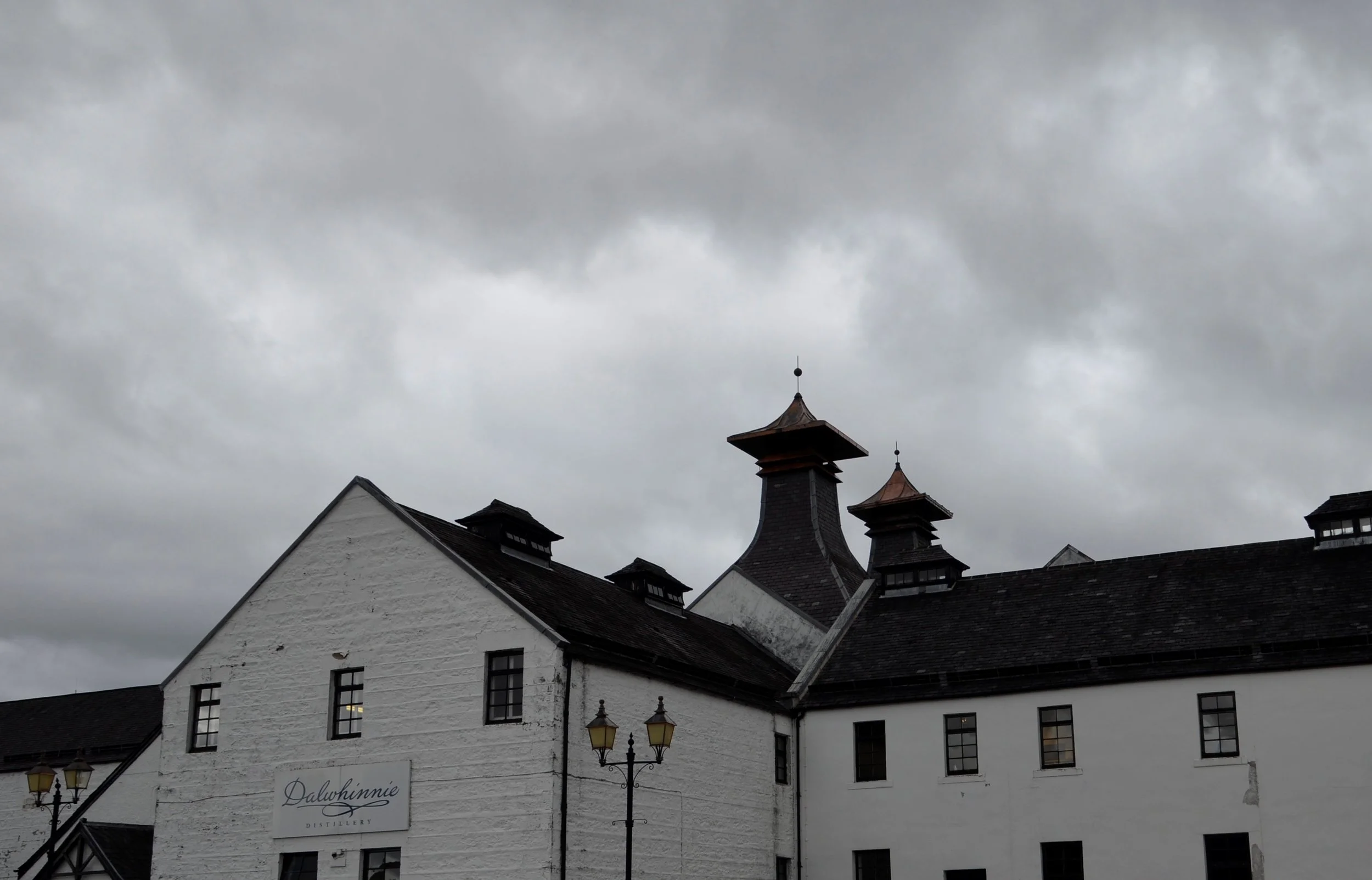
Edinburgh

I’m not sure why, but the city is pronounced by the locals as “Ed-in-burra”. Just so ya know.

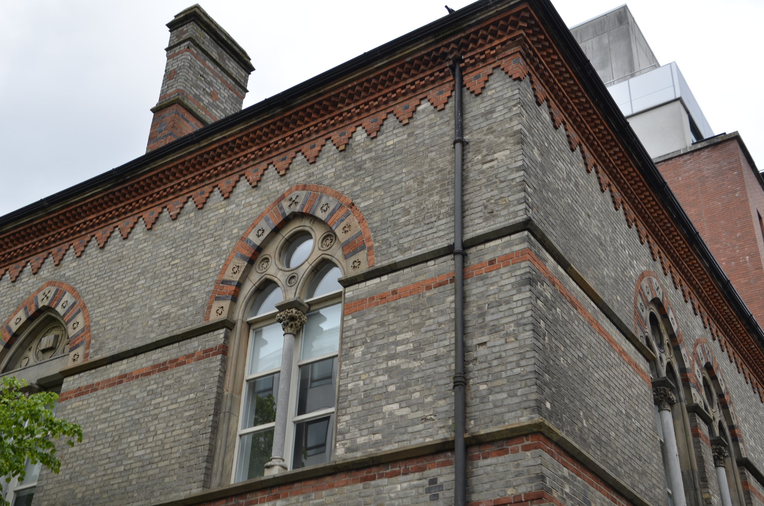
The mixture of stone buildings in Old Town was captivating -

… and Edinburgh Castle would pop up at the end of streets…

… and tower over you when you’re nearby -

We spent our first day in the city touring the castle. This was one that actually had a portcullis in place (the heavy metal gate with wicked looking spikes). We had seen many castle gates that had the groove/space in the opening where it would be, but very few actual gates.

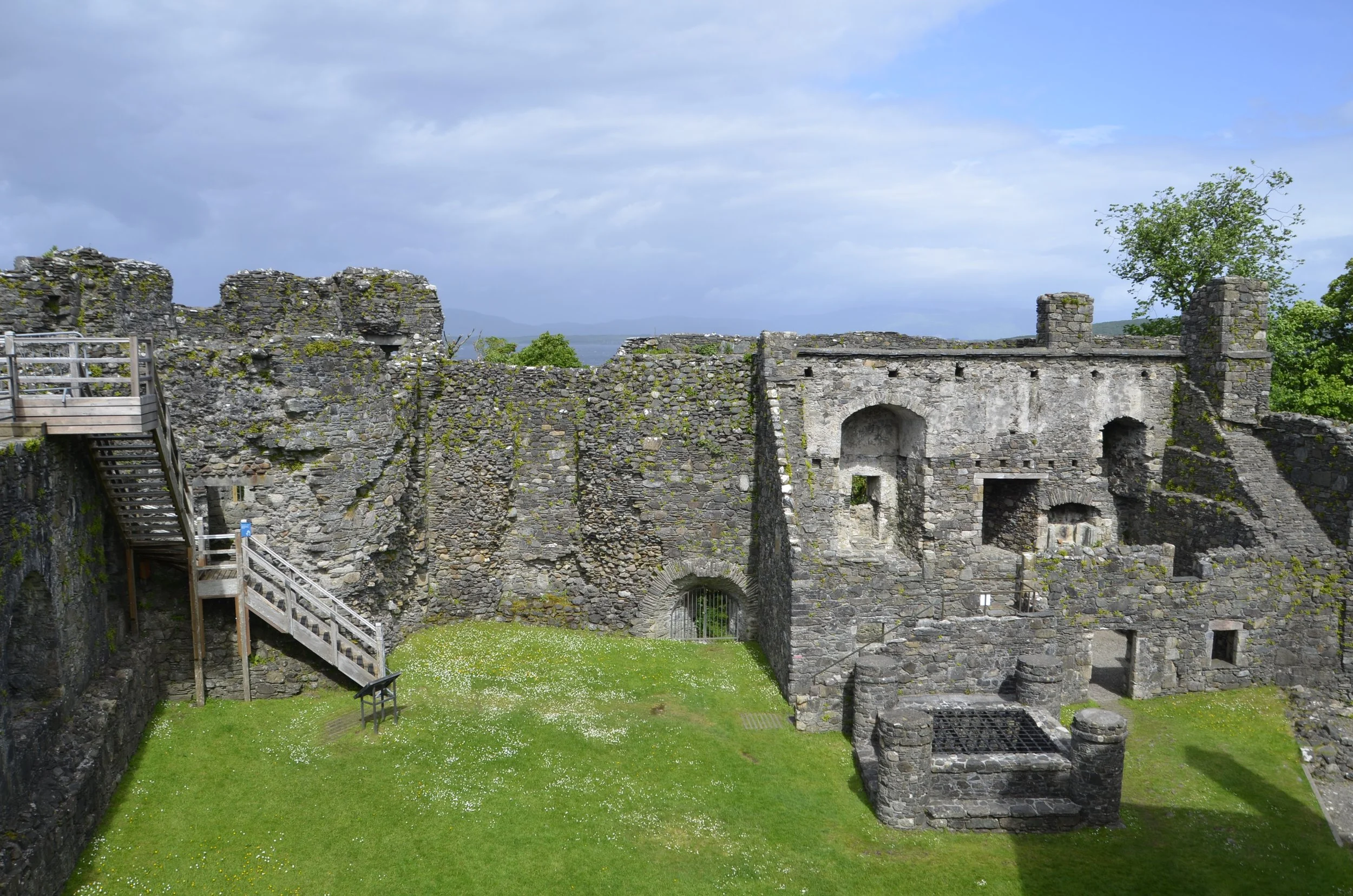
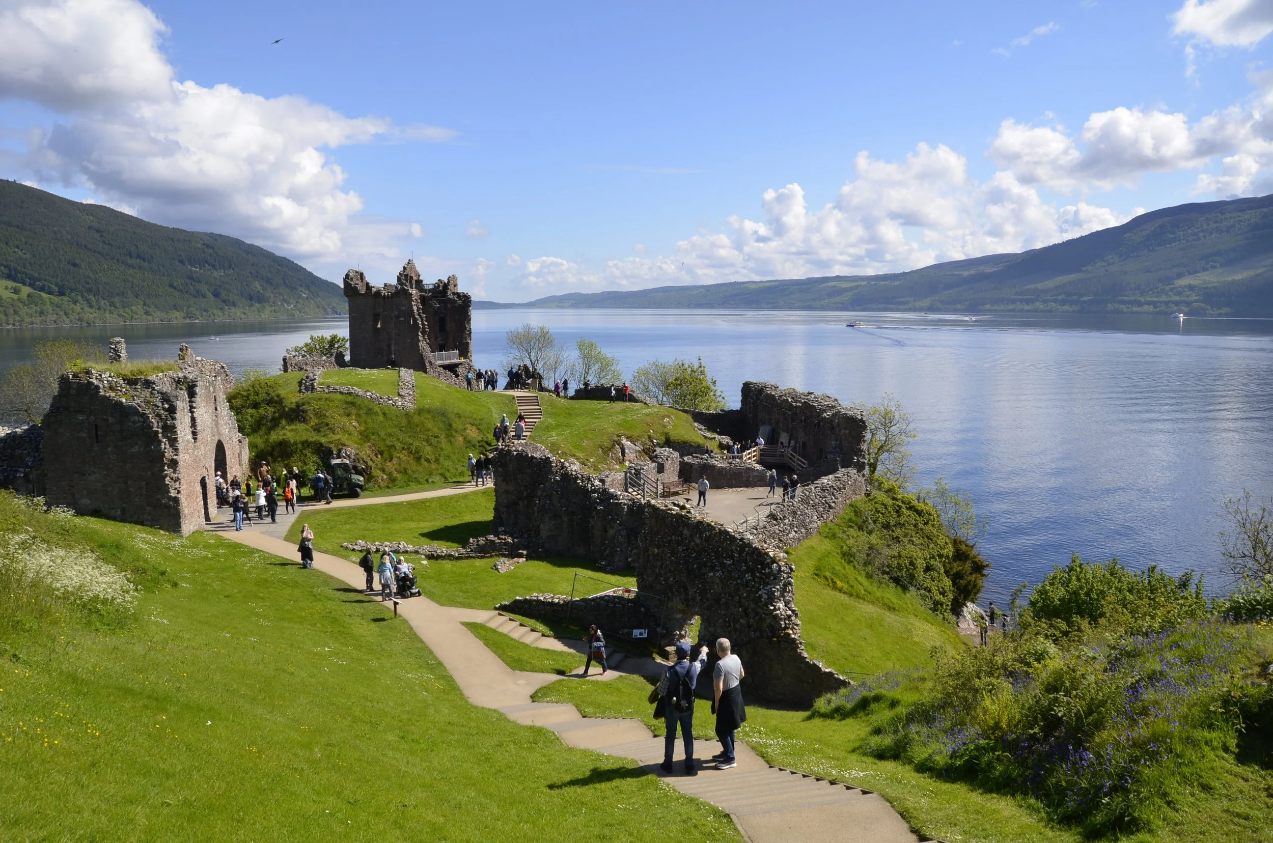
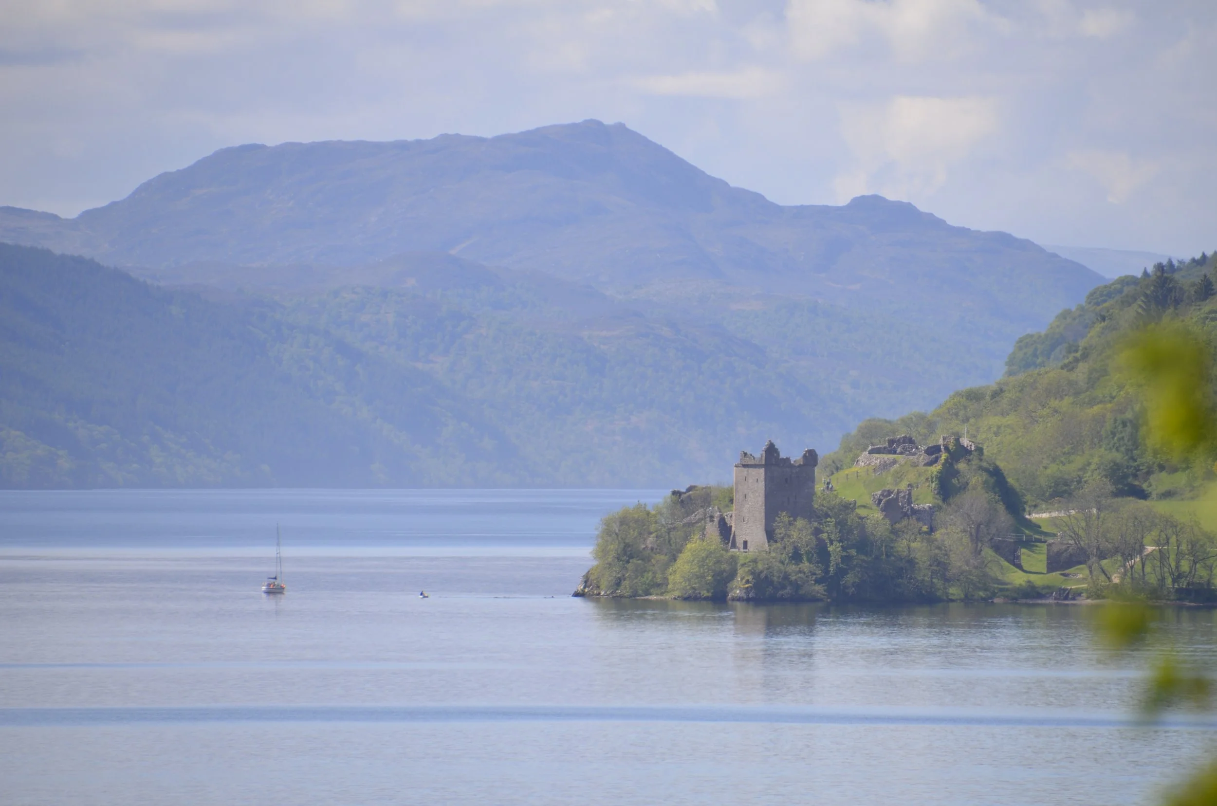
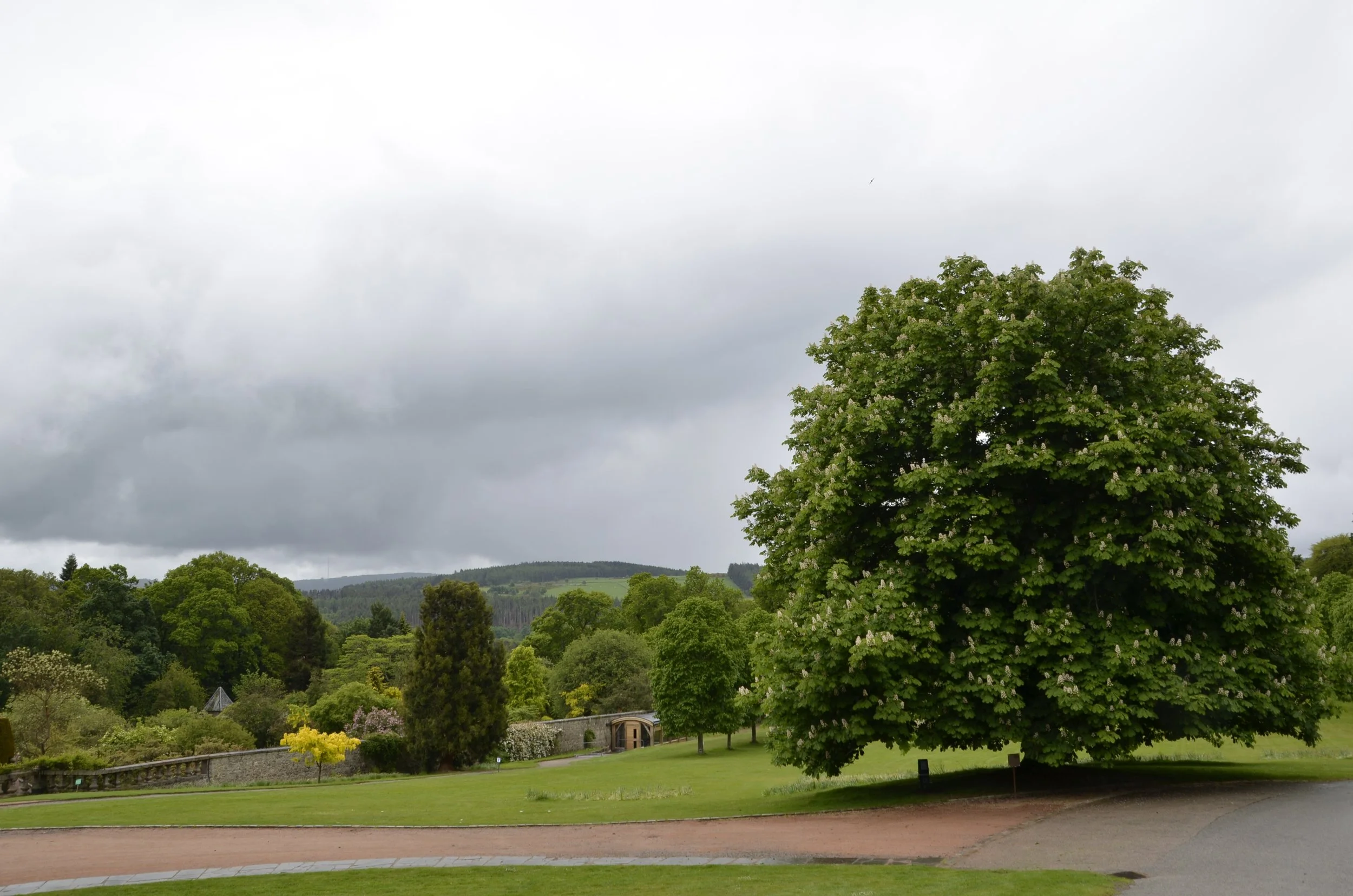
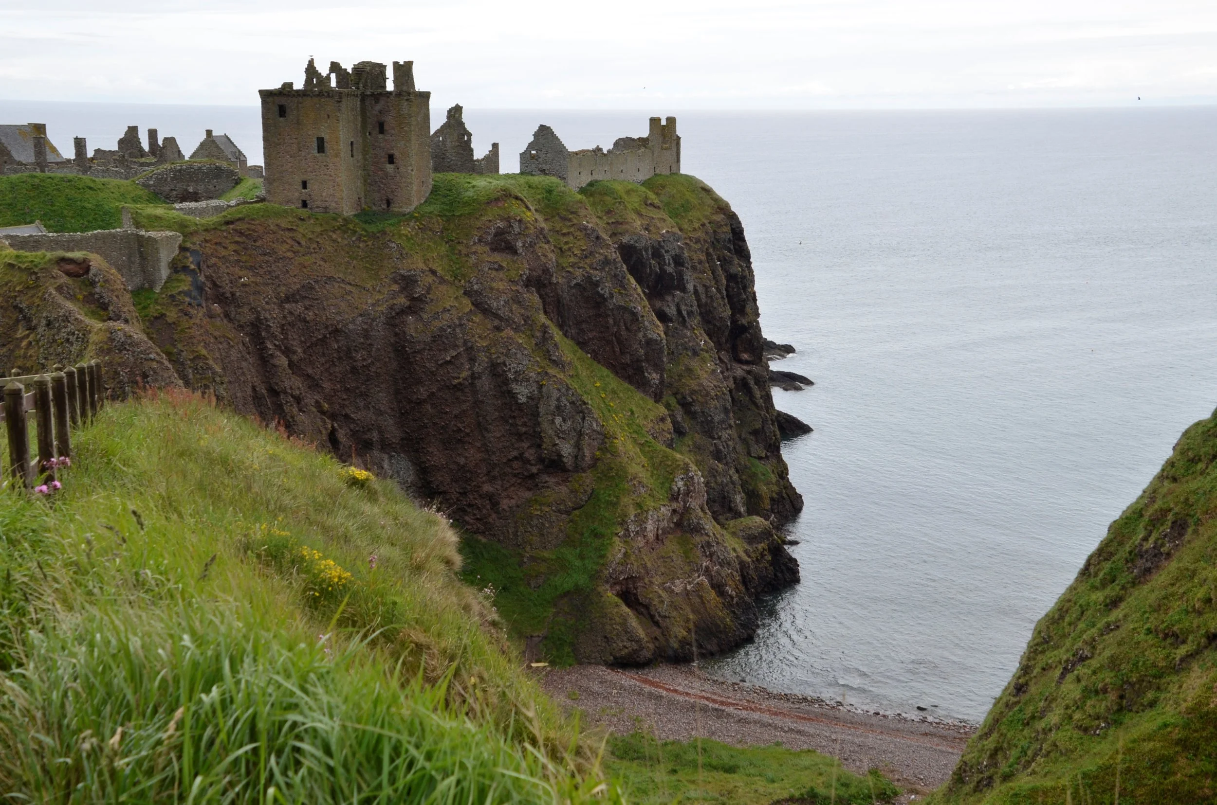
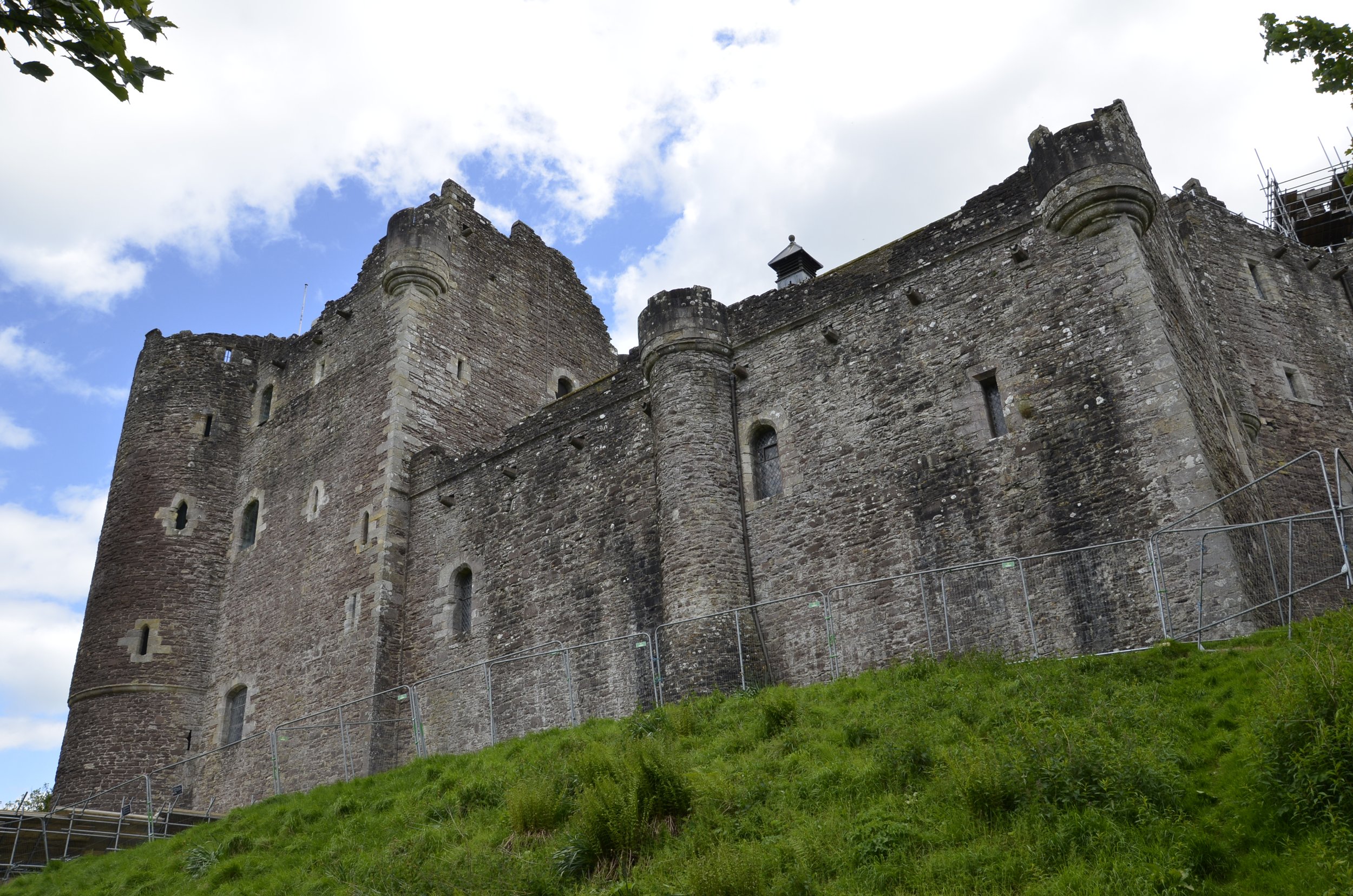
You can also see the variety of stone walls showing the various additions to fortifications. This was another castle built on the bedrock -

This next picture showed the great view commanded by the location, as well as the coats worn by the tourists in mid-June! (it was really windy there)

A better view of the city and surrounding hills -

The oldest building in all of Edinburgh is St. Margaret’s Chapel, which was built in the castle around 1130, and spared by Robert the Bruce when he destroyed the rest of the castle in 1314.

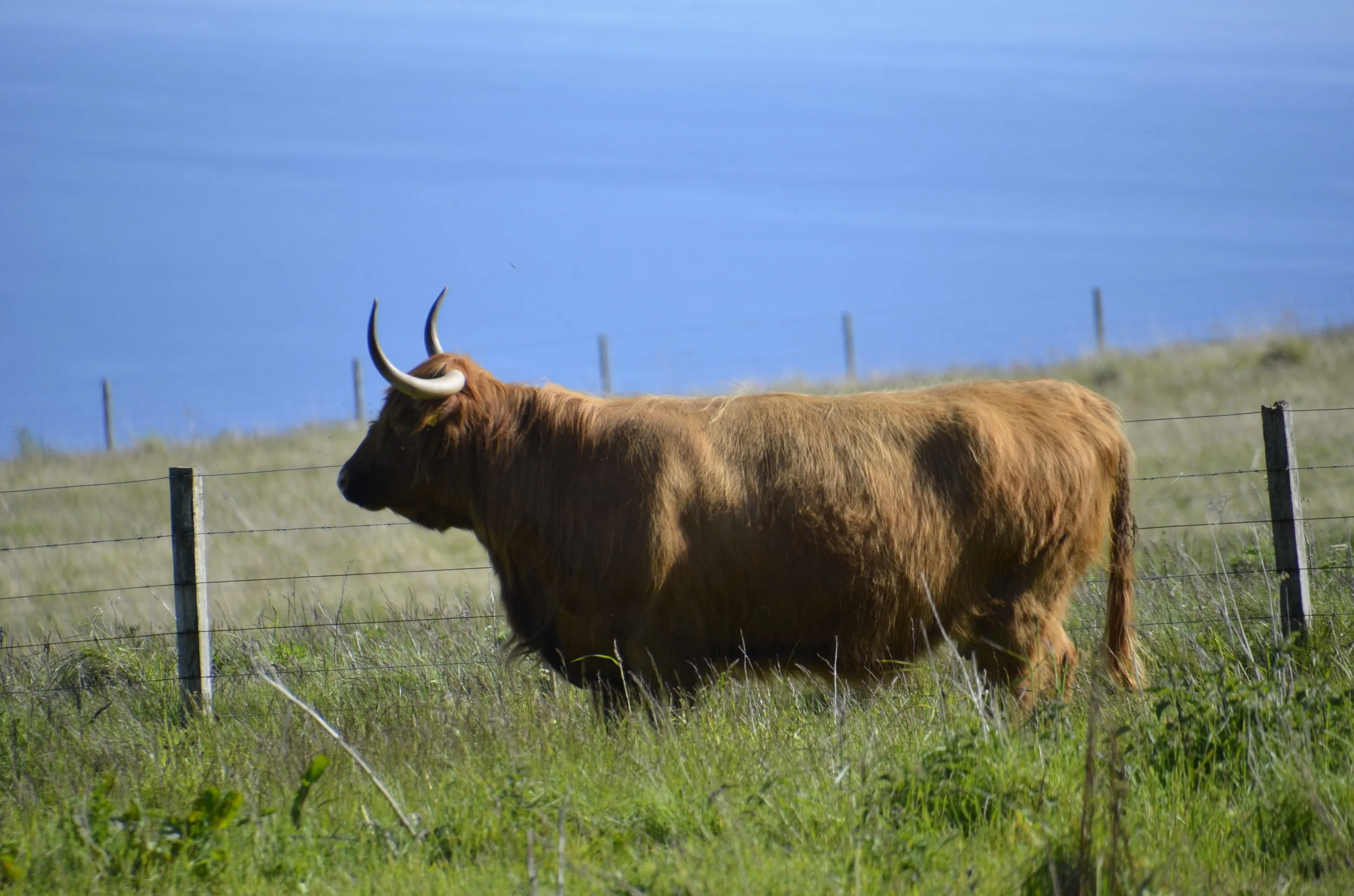
Another moment for asides and observations I saved — “high and tight” haircuts are a major thing for guys in both countries (shaved on the sides and left relatively long on top [a la Peaky Blinders]); speed limits in MPH on roads in Northern Ireland, while the cars have gauges in km; a pair of single temperature faucets in sinks everywhere - drove me nuts in bathrooms, as well as scalded my hands many times; G&T’s served in balloon glasses with the gin over ice in the glass, and a small bottle of tonic served on the side.

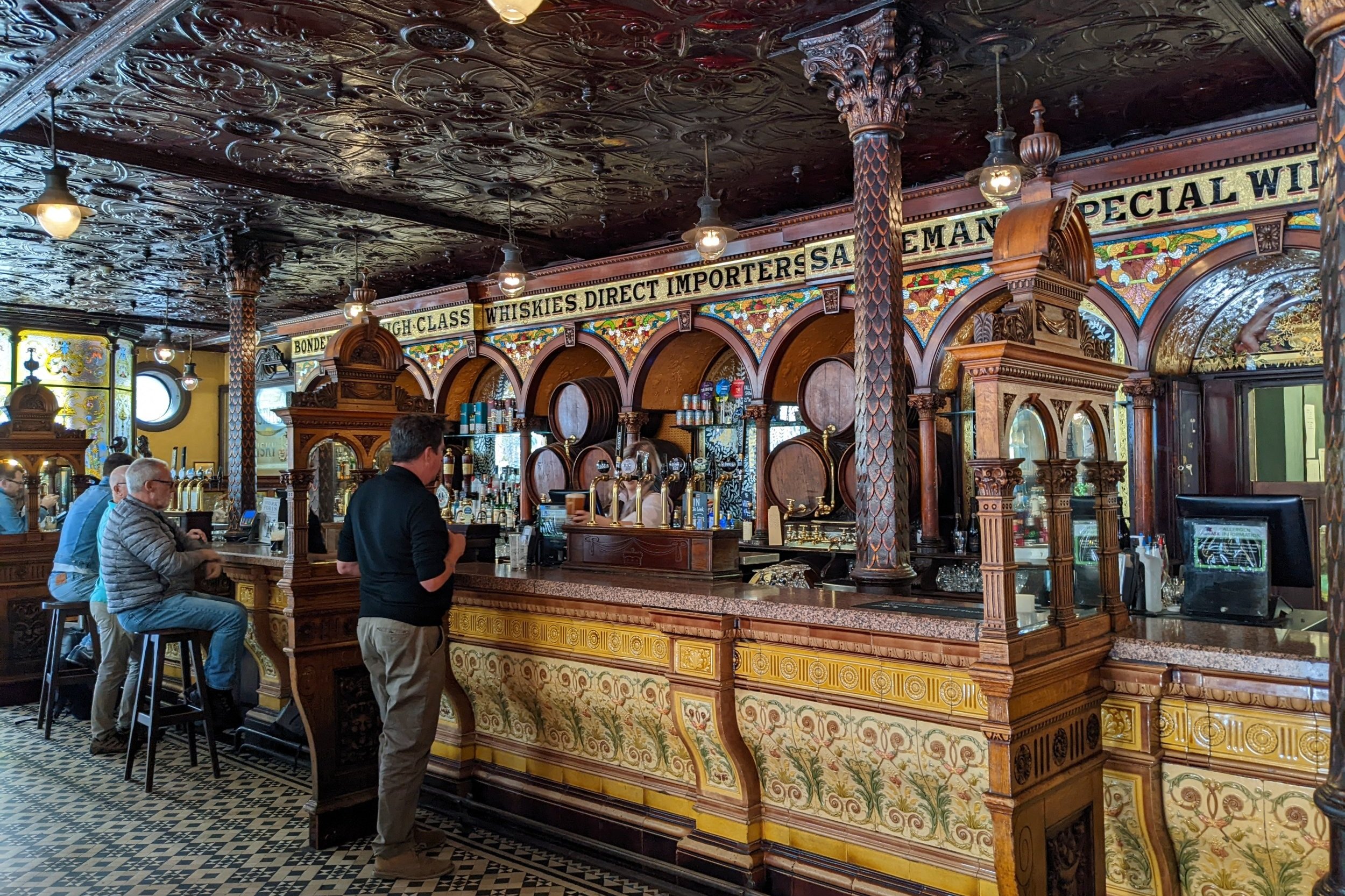
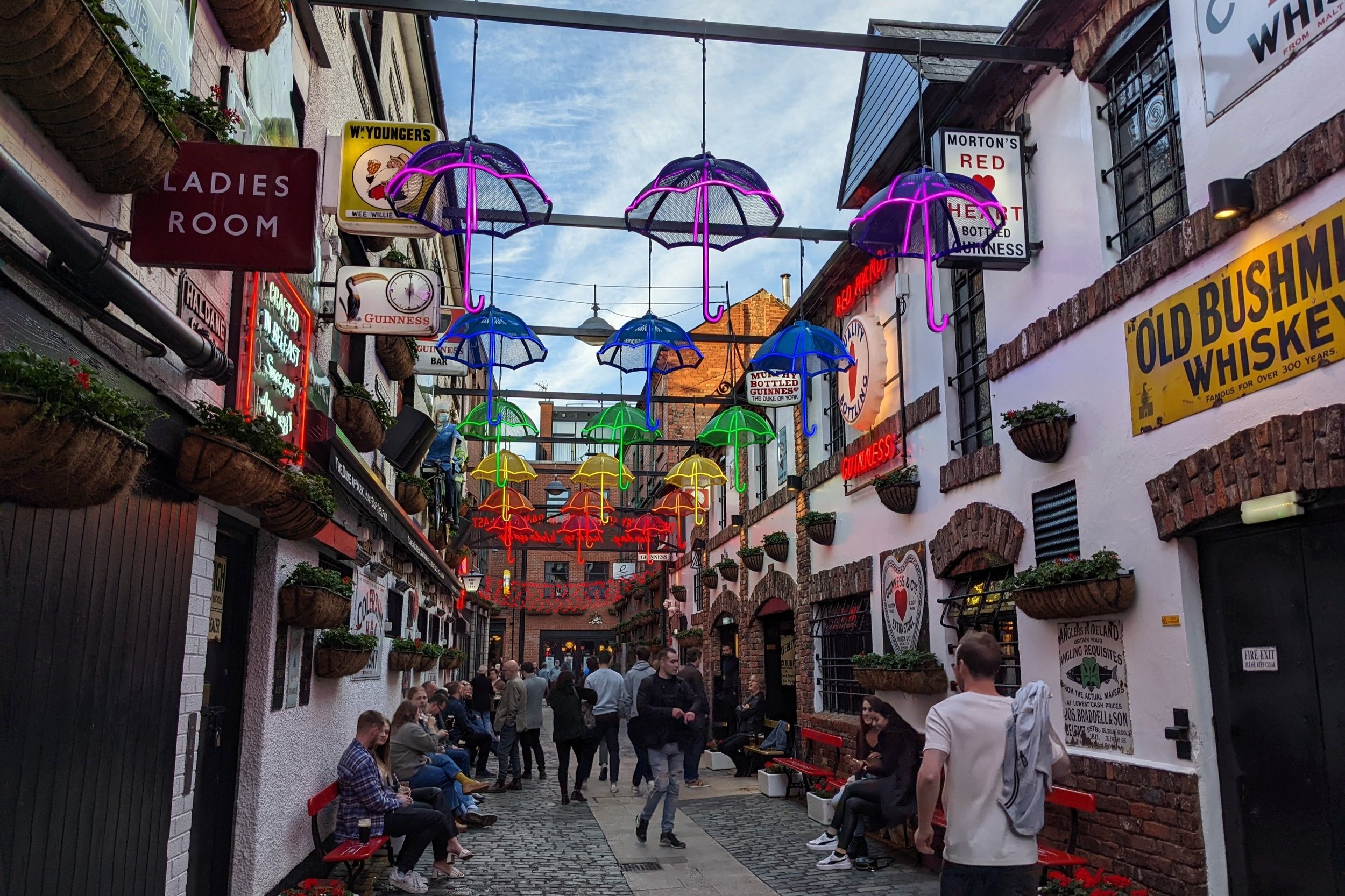
One of our favorite signs -

(sorry, the one good picture I had of this sign was missing the P)

The next day we had planned to hike up Arthur’s Seat, and nicely, we had glorious weather -

This is an ancient volcano that sits just east of the city center and rises to 822 ft. There’s no consensus on whether the name refers to King Arthur or is a derivation of “Archer”. It was a relatively easy walk…

… allowing great views of how compact the city is -

The green space and “palace” at the bottom of that photo is where the Queen stays when she’s visiting.

It was really windy up there, and I was almost blown sideways while trying to get this picture of Edinburgh Castle -

We then walked all over the Old Town…

… with its bits of whimsy…

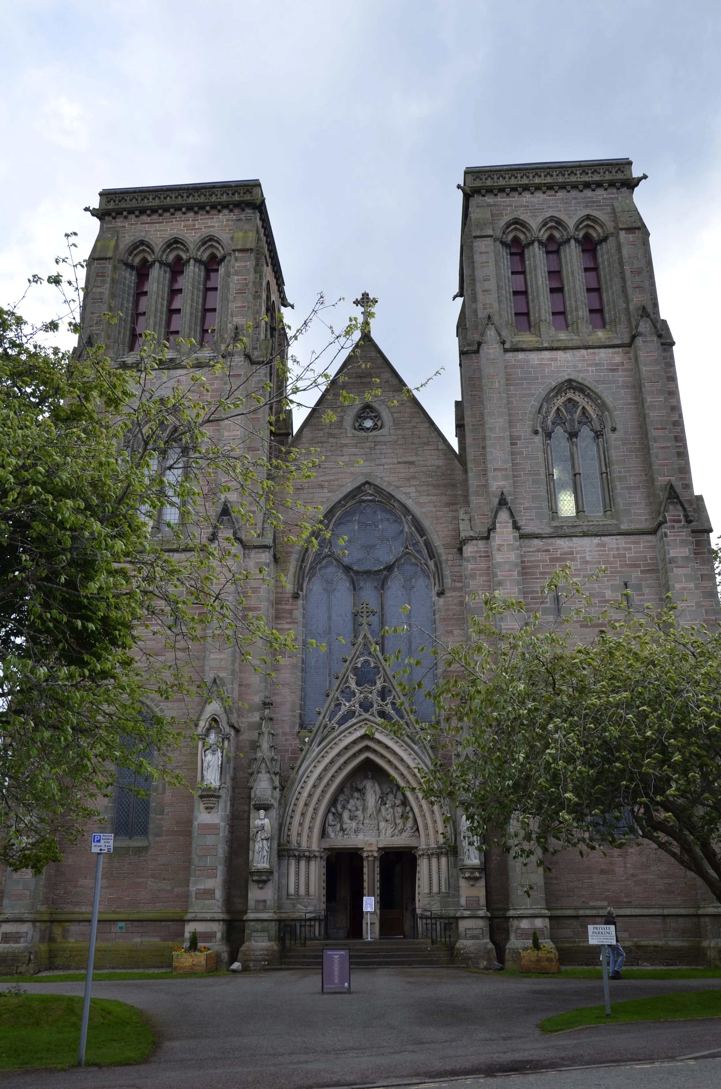
… and stately churches -

We then walked down the hill…

… for a different view of the castle…

… and to check out New Town. This area was built between 1767 and 1850 to attract the wealthy who were fleeing the crowded and decrepit Old Town for London.

I don’t have an awesome ending for this 7 week trip (maybe I should focus on that for future trips?), but I’ll leave you with this interesting picture of one of the fun, narrow places to explore in Old Town.

Oh — if you haven’t done so recently, check out the Images page on this blog, as I’ve added to and updated it a bit. Until next trip! Ta!

Loch Lomond and the end of the Highlands

I recently found that Loch Lomond is considered part of the boundary between the Highlands and the lowlands of central Scotland. We were continually amazed at how big the Highlands area was. Looking at this map (from Wikipedia), the vast majority of our time in Scotland was in the Highlands -

Before reaching Loch Lomond, we visited several castles, the first of which was Castle Stalker -

This was taken from the “official” viewpoint, but I directed Steve to get to a dead-end road that I could walk down a bit and get a better picture -

At the next castle, Dunstaffnage, we were able to visit and wander around inside -

I always admired those castles that were built right into the bedrock.

This one dates from the 13th century.

By now we were “castled” out, but hadn’t yet reached our limit on waterfalls. :)

The Falls of Falloch were an easy hike from the car, and had few people. It was a nice relaxing time.

I wanted to share some interesting observations from both Ireland and Scotland. In Ireland, we would hear “for yourself”, as in “Is everything ok here, for yourself?”, while in Scotland we heard “youse”. In both countries, time was described as “half ten” meaning 10:30. Two interesting phrases we heard in Irish pubs were “beer mats” (coasters) and a great descriptor of a rainy day - “a high stool day”.

Loch Lomond had wooded hills stretching right down to the water.

We spent only one night in Glasgow, but enjoyed our walk through town…

… by the Kellingrove Art Gallery & Museum -

… as well as our requisite stop at a pub, to sample yet some more Scotch whiskies.

G’bye from Glasgow.

Glen Coe

On our way to this picturesque corner of the Highlands in western Scotland, we had a series of fortuitous events. If you remember from the last post, we had lunch with some furry friends in this beautiful valley -

… and then headed out…

… making a brief stop at this church because it was photogenic…

… and found ourselves at the trailhead to the Glenfinnan Viaduct. We decided to hike because the rain had let up, but as we left the car, we were instantly surrounded by swarms of midges - tiny biting insects - so immediately returned to the safety of the car and drove on. As I was putting our accommodation’s address into the GPS, I saw that the parking lot for the viaduct was just up ahead, so we pulled in and got a spot right away. We figured this was a sign that we should get out and see what there was to see. Plenty, as it turned out!

The Glenfinnan Viaduct was completed in 1898. It spans over 1000 ft and sits 100 ft above the valley. It played an important role in the Harry Potter movie “Chamber of Secrets” where Ron and Harry were in the flying car and the Hogwarts Express arrives just behind them.

I couldn’t resist this pretty angle

So we wandered all over…

… getting some neat views, and avoiding the rain, mostly.

As we were about to leave, I saw a path leading up a hillside above the visitor’s center, and wanted to see what the view was like from up there.

Not bad, eh? Well, there were a bunch of people milling around in the rain, all facing the viaduct, and I asked what they were waiting for. As it turns out, we had happened upon the prime viewpoint for the Jacobite steam train crossing that happens a couple of times a day. Because of the rain, we only had our cellphones to capture the moment (to see the video, be sure to open the email in your browser, and have your sound on) -

Steve captured the entire crossing (so if you want to watch this, just send me an email and I’ll send it to you), but I wanted to get some stills, so that’s why I stopped when I did. :)

We felt lucky that we had just dropped into this, so we dropped our soggy bodies into the car and headed to our lodgings for the night. The skies cleared later and we enjoyed our surroundings -

The next day we drove to all the sites in the Glen Coe Valley that I had read about.

We sat out the rainy morning (and I got a little caught up on blogging), but as soon as I saw the clouds breaking, we headed out for a walk on the Glencoe Lochan Trail…

… that was crazy with ferns and pines -

… and led to a quiet little pond (lochen)…

… where I took advantage of the conditions to nab some reflection pictures…

… before the wind picked up and the clouds came back.

We then headed into the valley proper to visit The Three Sisters -

… the Glencoe waterfall -

… and Buachaille Etive Mòr, a pyramidal form that is one of the most recognizable mountains in Scotland.

As you can see in the pictures, the rain had come back, so we headed back to town…

… to again wait it out until dinner. This was our view from the restaurant -

… and our last peek before heading to bed -

Continuing Isle of Skye

I need to apologize to those of you who follow this blog by reading the emails as they are sent out. Unfortunately, I accidently published two posts on the same day, and I haven’t yet figured out how to take that back to ensure that only one is emailed per day. Of the last two posts, North Coast 500 follows the two on Orkney, and then the one on Western Scotland and Isle of Skye follows.

So now… continuing isle of Skye… on our way to The Fairy Pools…

… we pass through a large area of pines (which we hadn’t seen much of, further north). The Fairy Pools are a series of waterfalls and pools along a river…

… that some people enjoyed jumping into. (that water was really cold)

There were all sorts of falls…

… from small to big…

… and the pools were really clear.

This was a very popular destination, making it quite challenging at times to get relatively clear pictures of the water and rocks alone -

The waterfalls nearest the road were not on the main path and nicely (for me) ignored -

The weather started turning against us, so we didn’t end up doing a whole lot more that day. As we left Skye the next day, we had planned on visiting Eilean Donan Castle, noted to be “the most photographed fortress in Scotland”…

… but it didn’t present much to us in the rain -

We had intended on hiking to a waterfall, and even drove a number of miles down a one lane road…

… but just didn’t feel like slogging through mud and slippery terrain to the Upper Steall falls. On our way back out of the valley, we stopped at an area that had looked too crowded on our way in. It was gorgeous!

These were the Lower Steall falls -

I’ll end with our lunch buddies that day -

Western Scotland and Isle of Skye

As we headed down the western side of the country towards Skye, we passed through some more gorgeous areas…

…with mountains, lochs and rivers -

We visited Corrieshalloch Gorge…

… but the lighting made photographing the waterfall…

… tricky and frustrating.

We moved on to the Glen Docherty Viewpoint -

… before getting to the Isle of Skye.

It is 50 miles long, and is the largest of the Inner Hebrides islands. It has been connected to the mainland by a bridge since 1995. The dominant topography is mountainous -

On our first full day there, we hiked up to the Old Man of Storr -

It’s the thin pointy spire in the picture above. The trail was straightforward…

… but was a pretty constant ascent - 1300 feet over about a mile and a half. Looking back, the coast was nearly obscured by the encroaching fog…

… but our goal remained fairly clear -

We actually hiked on up past the pinnacle…

… to get the best shots -

From one beautiful sight to another…

And that above was just a sweet little waterfall on the way…

… to the main attraction -

Mealt Falls is a 55 meter sheer drop into the sea..

Looking to the right, there’s awesome coastline…

… and to the left is Kilt Rock, with its cool basalt columns -

We were blessed with a gorgeous day to keep exploring the beautiful sights of the Isle.

Next up was the mountain range named Quiraing…

… that I was wishing we had more time to go hiking within. Just after the road peaked, the terrain really flattened out…

… until we got to a pretty little bay.

We couldn’t tarry, as we still had a visit to the Fairy Glen on our itinerary.

This was named due to its interesting location and topography, and not to any “documented” links with fairies. ;)

You basically wander at will here…

… and explore whatever catches your fancy -

Pink foxglove caught my eye…

… along with bluebells -

Steve, of course, needed to play king of the mountain -

We headed back to our rental for a well deserved rest…

… and I’ll close with my artsy shot of Mealt Falls -

North Coast 500

After returning to the mainland from our Orkney exploration, we headed west across the northern coast of Scotland, to continue our counterclockwise jaunt on the NC 500.

The variety of terrain was amazing…

… and beautiful.

This is Scotland?!

This is Loch Eriboll - just a pretty stopping point along the way -

Green expanses kept popping up...

… as well as mountains and blue lochs -

We then came out to the coast again…

… with the beaches and water color resembling that in the Caribbean, but the air temps sure didn’t!

Our next stop was Smoo Cave - a large combined sea cave and freshwater cave.

This next shot was taken in the cave, looking back out at the bridge you can see in the above picture -

There is a waterfall inside…

… but the views we enjoyed more were outside -

And I found some more Marsh Orchids!

Always moving on, we found another beautiful beach with colorful rock walls…

… with obvious volcanic rock debris on it -

Coming away from the coast, we crossed a pretty barren area that reminded us of the altiplano in Peru…

… except for the gorgeous blue lochs -

We then passed through an area of yet another type of terrain…

… seeing the only Red Deer of the trip…

… and pausing at the Kylesku Bridge, just because.

Now for the end of the day, we drove 22 miles on a single track road…

… and enjoyed yet more variety -

I’m at a loss for more description…

… so I’ll just keep sharing more pretty pictures. ;)

More types of terrain just kept coming -

Ahhhh… finally the end! I’ll share Ardvreck Castle…

… before saying goodnight (this was taken about 11 pm).

Orkney Part 2

We had a gorgeous sunny day to spend exploring a number of the Neolithic sites on Orkney. We started with Skara Brae, which is an extremely well preserved Neolithic village on the west coast of Orkney.

A very strong storm in 1850 uncovered the village that had lain covered by a grassy sand dune for hundreds of years.

Archaeologists believe it was built and occupied about 5,000 yrs ago. There are 10 houses that were actually built underground and were connected by covered passages…

… and even had apparent indoor privies - small rooms with access to drains that led away from the village. Each house had a central hearth, stone beds and even cupboards -

Next on our agenda was the Ring of Brodgar -

This was built around the same time as Skara Brae, and is older than Stonehenge and the pyramids in Egypt. Thirty-six of the original 60 stones are still standing in an enormous circle (340 ft in diameter)…

… that is surrounded by a 10 ft deep trench that was dug out of bedrock. Some of the stones were quite tall -

We walked for several miles around the site…

… enjoying the peace and quiet, and birdlife ;) …

… and we walked to the nearby Stones of Steness -

These were erected around the same time frame as Skara Brae and the Ring of Brodgar.

There were originally 12 stones around a central hearth, but only 4 remain standing. This could be the oldest stone circle in the British Isles.

This was the swarm of bugs that accompanied us between the stone circles:

When we got back to our B&B for the evening, we found out that the local band was going to play to welcome the ferry into port, as part of the Queen’s Jubilee celebrations. As always, be sure to open this post in a browser, so you can watch the video -

In case you’re not a big fan of bagpipe music, I’ll close with a more serene version of Orkney -

Orkney

Before we headed north to the Orkney Islands, we wandered along the NE coast and first visited Castle Sinclair Girnigoe -

… which was first built between 1476 - 1496, and later added to in the 1600’s.

We really liked both the red stone highlights, as well as how it was built up/into the rocky headland.

Continuing along the coast, we passed some unknown (to us) castles…

… until we reached Duncansby Head …

… with its lighthouse…

… and imposing sea stacks -

Always moving on… we next visited Dunnet Head Lighthouse, where you can see the Orkney Islands in the distance -

The far northern coast area is pretty bleak, but it was amazing how many people were pulled off and wild camping there.

Then, just a little further on, there are gorgeous sand beaches…

… with towering sand dunes -

We headed to Scrabster to board the ferry to Orkney -

This was a new method of travel for us, a ferry ride both for us and our car.

As we left the mainland of Scotland behind…

… we quickly approached the Orkney Islands -

… and The Old Man of Hoy…

… a sea stack off of Hoy Island -

The colors along the cliffs of Hoy were stunning -

When we arrived to Stromness, on “Mainland” Island of Orkney, the weather wasn’t very welcoming -

We were amazed at the large expanses of farmland.

However, on reviewing info on the islands for writing this post, it was noted that the climate is generally mild and agriculture is the most important sector of the economy. We had headed here for the Neolithic sites all over the island, and the fact that it was situated north of the Scottish mainland.

Our first stop was to the Brough of Birsay, an uninhabited tidal island off the NW coast of Mainland. We happened to arrive during low tide, so we could cross over the rocks and causeway to explore the island -

The edges of the island were quite rugged…

… and the sense of space and isolation was really neat -

The cliffs had some awesome breaks -

… and interesting topography.

There was also the requisite puffin -

(but not nearly the great photo ops as on Iceland)

The 1,000 yr old Norse ruins were very interesting to explore -

As we headed to our B&B…

… we reveled in the sense of space and peacefulness here.

Exploring the Highlands

When we left Inverness, we first headed SW to Loch Ness…

… to visit Urquhart Castle -

It was a ruin, but it was beautifully situated -

Looking back -

We then drove deep into the countryside…

… to wander through a forest with tons of shades of green…

… to reach Plodda Falls (note the observation platform at the very top of the falls) -

This next picture was taken from the observation platform looking straight down -

I’m not sure what I expected for the “Highlands” of Scotland, but I don’t think I anticipated the lushness -

There were many lochs and inlets…

… and we crossed several Firths (Scottish term for narrow inlets of the sea) on long bridges -

The Highland council is the largest in the country and essentially encompasses the NW quarter of Scotland. The variety of the topography is stunning…

… and includes what’s referred to as the North Coast 500. This is a route of over 500 miles all along the coast of the Highlands -

That’s not the greatest map, but it gives you an idea of where we are in the world.

The coast was stunning…

… and we started seeing rock walls again (like throughout Ireland) that we hadn’t hardly seen at all in southern Scotland. Also, lots of sheep…

… and their more famous residents…

… Highland “coos”.

I found the variety of horn shapes and lengths to be interesting -

Every field we drove by that had large four legged beasts, we scanned them looking for these cuties. There actually weren’t that many.

Our final destination for this day was the Whaligoe Steps…

… which is a series of over 300 steps down to a very protected harbor (apparently a rarity along this coast) -

I’ll close with some neat pictures from the forest we wandered through earlier. This was one of the lookout points for the base of the waterfall -

Until next time…

More castles

Aberdeenshire is one of 32 council areas in Scotland and is located in the NE corner of the country. As we traveled through here, we found a number of neat castles with their gardens, as well as prehistoric stone circles.

Castle Fraser was our first stop. We just wandered in the gardens and on the grounds…

… admiring the Copper Beeches, like the one above. These offer great contrast to other trees, and we saw a lot of them in Scotland. I also liked the turrets that looked like they had faces -

We then moved on to my favorite castle grounds, at Crathes Castle -

I even made a note that when we return to Scotland, we need to devote at least a half day here, just wandering the grounds and gardens. There were topiary…

… as well as Giant Sequoia!

There was a very interesting and aptly named tree - a Handkerchief tree:

A Horse Chestnut…

… had some really beautiful and dainty flowers -

We visited some other castles, but they were rather boring, so I’ll advance on to Dunottar Castle, with its great siting -

We didn’t explore inside, but opted to walk down to the beach…

… as well as check out the coastline -

We spent the night in Aberdeen, and then wandered around stone circles…

… visiting several…

… and learning about recumbent stones. I’ll share this info board with you, as it was quite informative -

This was the nicest one we visited…

… and the stones were quite large -

The Speyside Cooperage was a fascinating place that we visited on our drive to Inverness. This is where whiskey barrels are made. Both new ones, and older ones that distilleries want resized or repaired, are made by hand.

An apprenticeship typically starts at age 16 and lasts 4 years…

… and you’d think it was a young man’s game, given all the pounding and rolling of barrels, but we heard of a guy who’d been there 51 years!

Rather than stopping along the whisky trail through the Speyside area (very reminiscent of Napa or Sonoma Valleys) at the numerous distilleries…

… we headed to picturesque Inverness…

… with its castle overlooking the River Ness -

There were some great old stone buildings here…

… and churches -

I’ve got a collection of pretty shots that I want to share. This was from the Hermitage, outside of Dundee (where the sunset on the clouds was taken) -

These were from the gardens…

(a hillside of rhododendrons above the ferns)

… at Glen Grant distillery.

This area of the Back Burn called “the gorge” was particularly lovely -

Ta ta for now!

Castles, lochs and mountains

The last post ended with the fields of bluebells. We were on our way through the Trossachs National Park, which is home to a large number of beautiful lochs, where the trees come right down to the water’s edge.

We were heading for that conical peak, Ben A’an -

A beautiful setting along the way -

As we started our hike, we climbed away from Loch Achray…

… and past ferns and a stream…

… towards our goal:

From the top (we climbed 1500 ft over a 2 1/2 mile trail), we reveled in views of Loch Katrine…

… and I captured the cloud reflection in the corner of Loch Achray -

Now for those of you who might be Monty Python fans, we stopped at Doune Castle…

… where the French guard taunted the knights (“your mother was a hamster, and your father smelt of elderberries”).

We then visited Glamis Castle, which sits on land that has been owned by the same family since 1372!

The most famous family member was HM Queen Elizabeth, the Queen Mother, who spent much of her childhood here, and also gave birth to her younger daughter, Princess Margaret, at the castle.

The grounds were extensive and gorgeous -

… and the tour of the interior was really interesting.

Construction was started in the 1400’s, with major additions in the 17th century. This was in the basement, where you can see how thick the walls were -

We then headed way up into the Highlands…

… to visit the Dalwhinnie Distillery.

We learned on the tour that those pretty copper chimney caps are no longer needed, as they don’t heat the stills with peat anymore. It was really cold there - about 45 with a biting wind - in contrast to the 60 degrees in the lower valleys -

We ended our day at Black Linn Falls -

… and spent the night on the coast at Dundee. G’night!

Scotland

We flew from Dublin to Edinburgh, and immediately got out of town due to an impending holiday weekend. We headed to Stirling…

… to visit the castle there.

Most of the construction was done in the 14th - 15th centuries, but a part of the outer wall dates to the 12th century. Atop these windows are the symbols of a thistle (no, not a pineapple) which for centuries has been linked with Scotland, and the rose, signifying England -

Another symbol of Scottish royalty, adopted in the 15th century, was the unicorn -

The picture above was taken in the Great Hall. Those chairs (er, thrones) would have been for the king and queen, as they had the best seats in front of the largest fireplace.

This is a recreation of carved wooden heads adorning the ceiling in James V’s Palace in the 1540’s -

The town of Stirling had some fine stone buildings…

… but we couldn’t stay to explore much, as we had to continue on. As we drove on the highway, we caught a glimpse of our next destination -

The Kelpies is the largest equine sculpture in the world.

These are 30 meter high steel sculptures of Clydesdale heads…

… and I was just mesmerized by them.

For those of you who might not be, I’ll move on. ;)

We also visited the Falkirk Wheel.

This replaced a staircase of 11 locks between the Union Canal and Forth & Clyde Canal. It was completed in 2002.

It is a rotating boat lift that raises boats 79 feet in 4 minutes. Passing through the locks used to take an entire day.

This part of the Scottish countryside is as green as Ireland…

… but with more trees and bigger hills.

And nicely, we weren’t finished with bluebells…

… not by a long shot!

Last Irish post

There are still old buildings to be shown…

… starting with Mellifont Abbey, the first Cistercian monastery in Ireland, founded in 1142.

I liked the entry gate -

A quick aside to show a remarkable tree we saw blooming all over Ireland - the Goldenchain tree -

We headed way out into the countryside to visit Loughcrew Cairns…

… and climbed up a hill to explore this one -

… finding a carved stone inside (but blocked by a gate).

There was no one around…

… and no signage to get us to the neater looking tomb on a neighboring hill. We had to settle for a long range shot with my camera:

On the way to our next stop, Google Maps took us some back roads (as it commonly does), and we met an “only in Ireland” roadblock: (as usual with a video, be sure and open this post in a browser window)

There are also old carvings to be seen. We stopped in Kells (from where The Book of Kells illuminated manuscript was taken, which resides in the library at Trinity College in Dublin) to see the High Crosses there. Irish High Crosses are free standing stone crosses that are richly decorated.

The round tower dates from before 1076, and the cross from the early 9th century.

Stories from the bible are commonly depicted in the carvings.

Well, our B&B host told us of a site where there were more and better crosses than at Kells. Monasterboice was a treasure trove -

(this was why we thought they were called “high” crosses)

The round tower here was built around 968 and three of the High Crosses in this cemetery were also erected in the 10th century.

This one was even taller!

Apparently, the chipping off at the base of the cross was done by emigrants for mementos before they left for America during the Great Famine of the late 1840’s -

We stayed in Drogheda, to easily access all the sites in the Boyne Valley, and the town itself had a couple of neat structures. The Magdalene Tower is the belfry and all that remains of a 14th century Dominican Friary -

I went back a second evening to get a different angle and light. ;)

Laurence’s Gate is a 13th century barbicon, which is a fore-work guarding the main gate in the walls into the city (of which nothing remains). This one is considered one of the finest in Europe.

Note the space where a gate could be lowered -

I just thought it was interesting because it’s sitting in the middle of the town with nothing else like it around.

Now, we’re off to Scotland, and because I don’t have a magnificent picture to finish this blog post with, I’ll give you a peek at coming attractions -

Counties Louth and Meath

We’re now back in the Republic of Ireland, heading south from Belfast, to take in some more forests -

This was Rostrevor Forest, and it was so cool to walk along a path where all you could see around you were trees, ranking up and down the hills -

We exited the forest to climb up to the top of a nearby hill for the views…

… and to ogle the large erratic left behind by a glacier. It’s appropriately named the Cloughmore Big Stone.

Moving on to Ravensdale Forest…

… we wandered along moss covered walls…

… reveled in more bluebells…

… and crossed old bridges.

The nearby town of Carlingford was quaint -

Over the next two days, we explored the Boyne Valley, which is rich in archaeologic sites. We started with Trim Castle -

This was built in 1172, and still has an impressive wall in place -

We had a tour of the tall castle keep, which gave us great views of the River Boyne and surrounding town -

We then crossed the Boyne River on foot…

… as we visited Knowth.

This is a Neolithic passage tomb, with one large mound and 18 smaller satellite tombs. Artifacts found in the area date this to 4000 BC. The large mound is ringed by 127 kerbstones…

… with many of them having art carved into them.

One third of all-known megalithic art in Western Europe is at this site.

I really liked the apparent sundial motif -

Newgrange was our next stop -

As you can see, restoration has recreated what was believed to be in place, given the stones found around the tomb.

This is from the Newgrange website:

“Newgrange is a Stone Age (Neolithic) monument in the Boyne Valley, County Meath; it is the jewel in the crown of Ireland's Ancient East. Newgrange was constructed about 5,200 years ago (3,200 B.C.) which makes it older than Stonehenge and the Great Pyramids of Giza. Newgrange is a large circular mound 85m (279ft) in diameter and 13m (43ft) high with a 19m (63ft) stone passageway and chambers inside. The mound is ringed by 97 large kerbstones, some of which are engraved with symbols…”

The opening above the entrance is a roof-box that allows sunlight to illuminate the interior of the chamber on the winter solstice. We were given a tour inside, but photography wasn’t allowed. If you’re interested in reading more or seeing photos from inside, you can check this out - https://www.newgrange.com/winter_solstice.htm

This stone was particularly decorated…

… as was this one -

On the grounds here was a recreation of a structure resembling the beehive huts…

… like those we became enamored with along Ireland’s West Coast. We were able to wander around inside -

Enough with old buildings for this post. I’ll close with my artsy pic of the day -

County Antrim and Belfast

Continuing through Northern Ireland, we visited Glenariff Forest Park. We started with a great walk in the woods…

… that descended down to a river…

… along walls covered in ferns…

… and on to a waterfall…

… or two.

We also walked through pine forests…

… and met a friend -

Red Squirrel (unusual to see)

Heading on down the coast, we stopped in the little seaside village of Whitehead…

… to walk along a path that hugged the coast…

… and ended at the Blackhead Lighthouse.

See the path at the bottom?

As we continued on to Belfast, we were reminded how rural Ireland is -

(be sure to open this post in a browser to be able to see the video)

… and they weren’t quite done. I had to turn my camera back on -

In Belfast, we did a tour of the city in a hop-on, hop-off bus. We learned a bit about the history of the city, and saw some neat architecture -

City Hall

Some ornate brickwork caught Steve’s attention -

We passed a beautiful college…

… and some churches…

… but then came to Shankill Road and the “Peace” Wall -

Twenty years after “the Troubles” ended, there’s still a 6 meter high wall between neighborhoods with gates that are locked at night. It’s not really Protestant vs Catholic — it’s about whether Northern Ireland should remain in the UK or (re)join the Republic of Ireland.

It was also interesting to see the older stone buildings up against new glass and steel ones -

And now for some photogenic pubs we enjoyed -

That first bar pictured had a series of “snugs” where you could settle in with friends, and I loved the coziness of it.

Cuddle with your loved ones, as I bid you adieu!

Northern Ireland

We spent our first nights in Derry (Londonderry) and enjoyed walking on top of the walls of the old city. This is Bishop’s Gate -

… and the view from atop the wall -

This was a very crowded city (outside the walls) and not very interesting, although they did have a gorgeous Guild Hall…

… and a neat Peace Bridge across the River Foyle -

Now, across the northern coast is their country’s claim to fame - The Giant’s Causeway -

There are 40,000 interlocking basalt columns…

… which I found fascinating, because some were flat, some concave and some convex -

It was actually quite fun to wander over the site -

Continuing along the coast…

… the Carrick-a Rede rope bridge was a must visit for us.

The first bridge was built in 1755 to facilitate salmon fishing off the tiny island of Carrick. Our excursion wasn’t nearly as harrowing as pictures make it out to be.

Dunseverick Castle was a brief, colorful stop -

Some sidebar notes on driving in Ireland — Not all roundabouts are fully built up circles…

… and not all 2 lane roads can actually fit 2 cars -

Even on a drizzly day, this area was breathtakingly beautiful -

On a ramble out to Torr Head…

… I captured a stoat…

… bringing his capture back to his lair -

The day started in mixed clouds and sun, turned rainy in the middle and cleared up just as we got to our B&B for the night -

Inishowen 100

This is a 100 mile route around the Inishowen Peninsula, the northernmost of Donegal.

We first stopped at the Grianan of Aileach, which is a reconstructed stone fort on the site of an 8-9th century fort.

The views here…

… were amazing.

Always moving on…

… we briefly stopped at Dunree Head Fort.

We then drove on through Mamore Gap…

… first checking out where we’d come from…

… before turning to the road ahead -

I just loved this vista -

Next up was Glenevin Waterfall…

… which is on private land. There was a plaque there that told the story of a woman who wanted to retire in this area, bought property, and then found this beautiful waterfall back about 1/2 mile into the acreage. She subsequently cleared and paved the path, put footbridges and picnic areas in, so that everyone could enjoy this beauty. There was no charge for parking or admittance, but a donation box was at the entrance.

Continuing to move north up the coast…

… brings us to Pollan Strand, a 3 km stretch of beautiful fine sand.

I also had Five Finger Strand on my list of things to see. Little did I know that we would need to head down a narrow road (sensing a theme here?)…

… past huge sand dunes that had gotten covered in grass and sheep over the years…

… before reaching this hidden gem.

The sand dunes were massive (note the person on the beach above for scale)…

… as were the cliffs ringing the bay. This next picture shows the beach and bay from above -

So this is looking back south or west along the coast where we’d been…

… while this view is looking north toward Malin Head, the northernmost point in Ireland -

And I’m still finding orchids!

And just to share a little peek into the process :-)

There was a short walk along the coast here to a site dubbed “Hell’s Hole” -

This next picture shows how the farms stretch right to the cliffs, and how narrow the roads are. See the road in the middle of the picture? Now picture yourself driving along it, unable to see anything except the 5 foot high stone walls on either side of the car, and coming up to a blind corner…

Steve had so much fun! (not)

Anyway, our last stop was to check out Kinnegoe Bay; yet another of the innumerable sand beaches on the Donegal coastline.

Well, we headed out of the rolling hills of Donegal to enter Northern Ireland, where we stayed in Derry, which is the subject of my next post.

County Donegal

This county is huge and comprises most of NW Ireland. We had never associated Ireland with beaches and sand, but Donegal is loaded with them. This was the first of many (and it wasn’t nearly as pretty as some I’ll share with you later) but as you can see, it was huge -

On our way to our first major destination…

… the Slieve League cliffs -

The day turned dreary soon after we arrived, but closer up shots still looked nice -

The highest point is almost 2,000 feet above the water (nearly 3 times the height of the Cliffs of Moher), so you know that we had to hike along them…

… of course!

Maybe it was the dreary weather, but we just didn’t find them as picturesque as Cliffs of Moher or the Kerry Cliffs, although this shot was nice -

Moving on, we found another waterfall (imagine that!). This is Assaranca Waterfall as we saw it…

… and then using a tripod and a special filter -

So that was our first day of driving north in Donegal. Our second day dawned beautifully clear, and we forged on, to tackle as much of the coast as we could cram into one day.

That was an unnamed tower that just happened to be perfectly sited, on our way to - Crohy Head Sea Arch -

We couldn’t get any closer or better views due to private property, but we did catch sight of what we initially thought was a dog running down a hill -

Yep. that’s the biggest rabbit/hare we’ve ever seen! I wish I had something other than those rocks to give it scale.

Moving away from the coast, we passed Mount Errigal and the Church of the Sacred Heart…

… near Dunlewey Lough…

… on our way to visit the fifth (out of 6) National Park - Glenveagh -

… where there is a castle, a lough, some hills and beautiful gardens.

Next up was Horn Head, but I thought the views leading there…

… were better than the actual point -

Are you still with me?? A few more stops… Fanad Head Lighthouse -

… and then some gorgeous beaches… Ballymastocker Bay -

… and my favorite - Tra Na Rossan -

No, we didn’t hop to the Caribbean. We’re still in Ireland ;)

County Sligo

For the next several days of our trip, we explored County Sligo, which is the next county north of Mayo, and is small in size, but has a fantastic variety of topography. I chose Lough Key Forest as our first stop…

… because I had read that you could find bluebells here. If you’ve read previous posts, you noticed there’s no lack of bluebells in spring in Ireland, but this forest had them in spades

And I loved when they mixed with ferns -

When we first drove into the park, and were trying to decide what trail to take (to maximize bluebell sightings), I found that I needn’t have worried. Just wandering down any one of the trails through the trees yielded great results -

Continuing on that trail we would suddenly come upon a grove of magnificent pines…

… or a secluded bridge -

Our next destination was a waterfall, but the route there sure had some beautiful vistas -

Glencar waterfall:

The waterfalls in Ireland aren’t as impressive in size as those in Iceland, but the variety of greens surrounding them was magnificent.

Because we had a gorgeous sunny day (and the next was forecast to be raining for most of it), we packed all of the sights I had planned on visiting over two days into the one. We ogled Benbulben as we drove by -

… on our way to Gleniff Horseshoe. My pictures just can’t do justice to this massive glacier-carved valley…

… but I’ll try.

Still moving on, we headed for a true hidden gem that I read about. There are no signs, it is not well-marked on Google maps, and not even all of the locals know about it. Luckily, however, someone had posted rough directions and pictures, so we could find the little trail off the side of a narrow road -

This is the way to The Fairy Glen -

Because there was no signage, I had no idea how far we had to walk or if we’d recognize it once we got there. No worries -

This huge, quiet space is completely hidden from any nearby roads…

… and is bordered on two sides by sheer rock walls, in some places probably 40-50 ft high.

Now the next day did have pouring rain for the entire morning, but once it cleared, we headed out for a short hike…

… up Knocknarea mountain…

… to Queen Maeve’s grave -

There wasn’t much to see at the cairn -

… but the views were phenomenal. In this next picture, check out the cloud reflection in the foreground and the lit up beach in the distance. :)

Thus, our travels through Sligo come to an end -

County Mayo

Continuing to head north up the west coast, the edges of County Mayo were our next destinations. Beautiful country was all around -

Muingelly Head was neatly flat…

(note the little white dots of sheep in about the middle of the picture)

… and beautifully cut in -

Our next stop was Downpatrick Head, but I couldn’t get a good picture of it, due to the curve of the road and the topography. This is when I used my long lens from Muingelly Head -

This was why we came out here -

Dun Briste sea stack.

In that shot I was really grateful for a person on the point, adding scale. An arch that led to the sea stack collapsed in 1393. Remains of walls and houses have been found on top.

A little further up, the coast continues to be quite rugged -

We had stopped in a small village for sandwiches that we enjoyed here -

… and were given a couple of fantastic tips on local sites. The first was a standing stone…

… which is reputed to be the tallest still standing in Ireland. It is 15 feet high…

… and besides the crosses near the base, there are ogham inscriptions. This was the earliest form of writing in Ireland, characterized by short strokes of lines in groups of between one to five. I only found out that last bit of information when I was writing this up, thus I didn’t take a picture of the marks, as I didn’t know what ogham writing was. (Remains of a nearby church date from the 7th century.)

Our next stop was Moyne Friary. What a hidden gem! Reviews online said not to worry about the sign, and just climb the stone stile and walk down to the field. Mm…ok?…

We never saw a bull, but there were cows and calves further down behind an electric fence.

This was built around 1460, and there was still a holy water font!

The cloister was still being kept well tended…

… and I loved exploring all over…

… including the second floor, seeing a two story fireplace…

… and beautiful views.

That’s all for today. No fancy ending, just timeless beauty -